background image


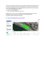
Two post processed files need to be input to the App: the RINEX post-processing file (.POS). 

and the event file (.POS). And the precalculated delay time in seconds for DJI Drone LEDs: 

0.3. The resulting geotagged file can be downloaded in CSV and TXT format, ready to input 

into any popular photogrammetry software: 


Exports a photo geotagging file 


Exports a file with the flight path of the drone 


Being an online service, you can use the App anywhere without the need for software 

installations or license activation. Developed by our technological partner 

SolucionesGeográficas (Geographic Solutions). 


Link: 

www.solucionesgeograficas.com/app-uav-ppk/


Summary of Contents for X5

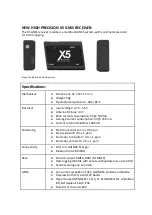
Page 1: ...p your Drone s original warranty The X5 PPK Module attaches and disattaches in seconds No Batteries required Ultra fast image triggering detector sensor Lightweight microelectronics 80 grams Trigger Sensor A sensor installed externally on the P4P drone detects the triggering of each photograph and records a time stamp in the log file of the MULTIBAND X5 GNSS module Timestamps are extracted from th...

Page 2: ...umption 5V 250 mA Current limit on USB OTG 1000 mA Positioning Static horizontal 4 mm 0 5 ppm Static vertical 8 mm 1 ppm Kinematic horizontal 7 mm 1 ppm Kinematic vertical 14 mm 1 ppm Connectivity Wi Fi 2 4 GHz 802 11b g n Bluetooth V4 2 BR EDR Data Position output NMEA RXM for RINEX Data logging UBX file with events with update rate up to 20 Hz External storage up to 32 GB GNSS Concurrent recepti...

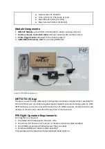
Page 3: ...endly software for configuration and data collection that is available for Android iOS version currently being developed Supports several coordinate systems With METTA X5 App you can control all the features of X5 GNSS receivers Our Beta Testers will receive via email a link to download the app that is in beta version PPK Flight Operation Requirements For integration is required 1 One GNSS X5 PPK ...

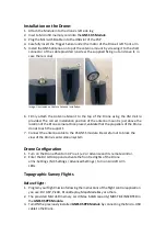
Page 4: ...ove the location of the Drone camera Once placed validate that the propellers of the Drone do not touch the support 7 Connect the antenna cable to the X5 GNSS module Be careful not to block the view of the Drone s anti collision system Drone Configuration 1 Turn on the Drone Phantom 4 Pro v 1 v 2 or Advance and its remote control 2 Enter the DJI GO 4 App and activate the front red lights of the Dro...

Page 5: ...erformed 3 RAW LOGS UBX or RINEX from a ground based GNSS receiver 4 List of Ground Control Point coordinates With this information you will be ready to process the data through different photogrammetric software options Post Process PPK The final PPK Post Processing Kinematic mapping workflow can be performed using the following software options Each of them has its own steps to follow at the user c...

Page 6: ...ownloaded in CSV and TXT format ready to input into any popular photogrammetry software Exports a photo geotagging file Exports a file with the flight path of the drone Being an online service you can use the App anywhere without the need for software installations or license activation Developed by our technological partner SolucionesGeográficas Geographic Solutions Link www solucionesgeograficas...

Reviews: