12.3 "Site" area at customer level
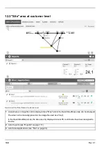
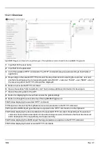
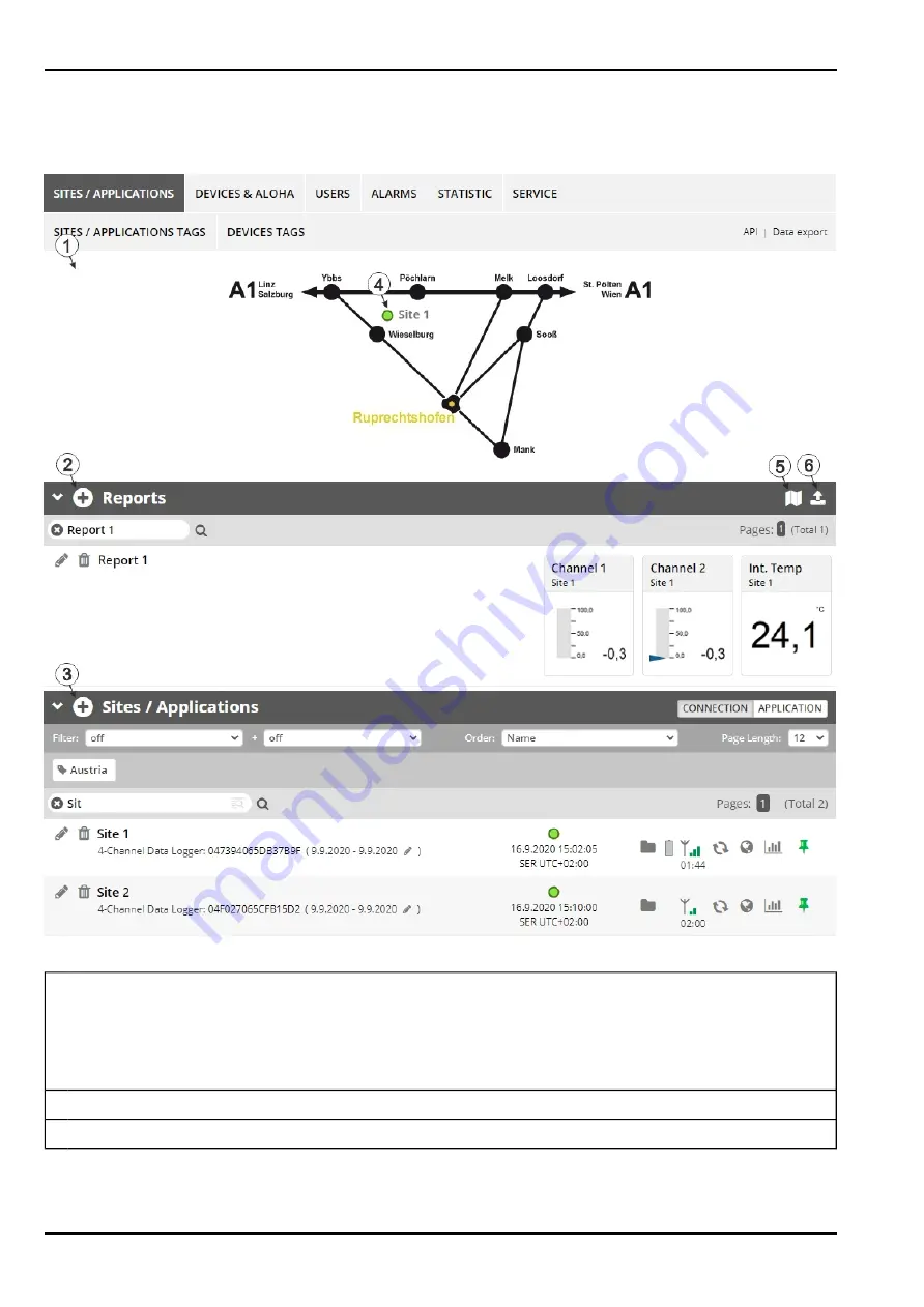
Overview of the "Sites" area at customer level
1
Area where an image file can be displayed as a "Map" and/or the OpenStreetMaps map can be displayed
The sites can be manually placed on the image file used as a "map".
In the OpenStreetMaps map, the sites are only displayed once GPS coordinates have been assigned to
the site.
2
List of reports (see "Reports" on page 131)
3
List of sites/applications (see "Site" on page 93)
130
Rev. 01
Summary of Contents for myDatalogGauge 3G
Page 2: ......
Page 10: ...2 2 BLE Gauge 10 Rev 01 ...
Page 11: ...Chapter 2 Declaration of conformity Rev 01 11 ...
Page 12: ......
Page 13: ...Chapter 3 Ex certification Chapter 3 Ex certification 3 1 BLE 3G Gateway ATEX Rev 01 13 ...
Page 14: ...14 Rev 01 ...
Page 15: ...Chapter 3 Ex certification Rev 01 15 ...
Page 16: ...16 Rev 01 ...
Page 17: ...Chapter 3 Ex certification 3 2 BLE Gauge Rev 01 17 ...
Page 18: ...18 Rev 01 ...
Page 19: ...Chapter 3 Ex certification Rev 01 19 ...
Page 20: ...20 Rev 01 ...
Page 134: ......
Page 140: ......
Page 152: ......
Page 154: ......


