

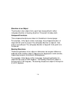
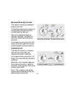
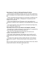
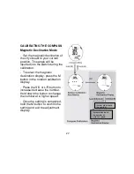
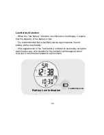


Checking your Position by Backward Bearing Directions
- Spot two distant identifiable landmarks such as mountains, lighthouses,
forts, or buildings for your current position (for example, mountains A and
B).
- Check the backward bearing directions of mountains A and B from your
current position. (For example, 135 degrees for mountain A and 270
degrees for mountain B).
- Use a ruler to draw the line 135 degrees on the map starting from
mountain A. Draw the line 270 degrees on the map starting from mountain
B.
- Your current position on the map will be the intersection point (point A)
of the 135 and 270 degree lines.
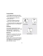
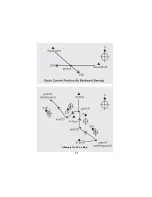
Checking the Trek Course (see map on next page for reference)
- During a trek, the watch can keep your correct course. For example, the
correct trail starts at point A and finishes at point E.
- Mark the points (identifiable landmarks) where the trail turns its
direction, such as points A, B, C, D, and E.
- Find out the bearing directions of point B from point A (315), point C
from point B (zero), point D from point C (225), and point E from point D
(315).
- During the trek, make sure that the heading direction is 315 degrees
from point A to point B. Perform similar checks in other sections of the
trail.
Note: If you are in doubt of the directions and positions of the trail, consult
the park administration office before starting the trek.
20
Summary of Contents for NG704 SERIES
Page 1: ...WATCH COLLECTION NG704 SERIES INSTRUCTION MANUAL...
Page 2: ......
Page 5: ...3...
Page 6: ...Timekeeping and Compass Modes 4...
Page 23: ...A Sample Trail on a Map 21...
Page 32: ......
Page 33: ......
Page 34: ......
Page 35: ......


