Chapter 5: Interactive Presentation Design & License Upgrade
Copyright © 2012 NEXCOM International Co., Ltd. All Rights Reserved.
49
PowerDigis V2 Player User Manual
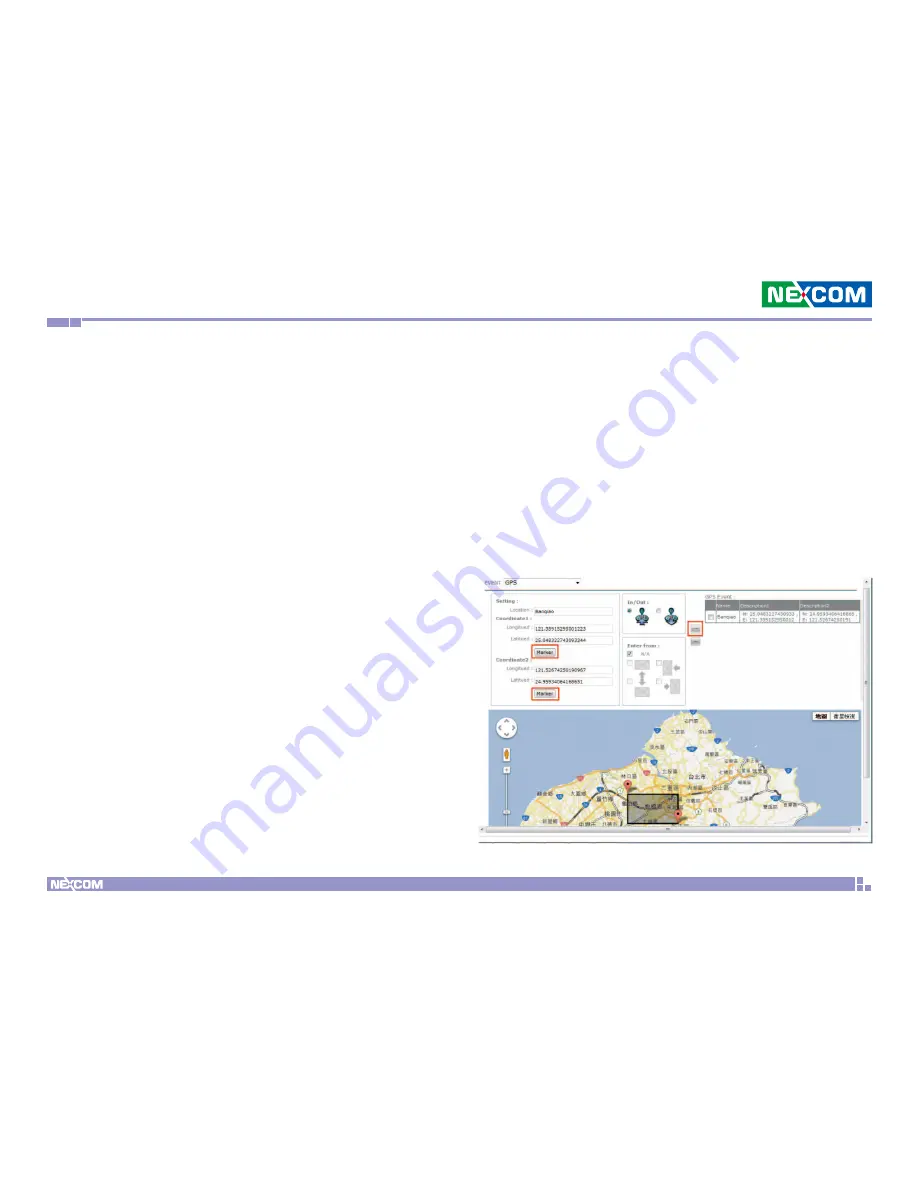
Create GPS Events
In addition to touch events, you can also create GPS events in the same
interactive presentation. GPS technology integration provides excellent
location-based digital signage. User can define playlists for each location on
the Google map to be displayed in moving vehicles. Follow below steps to
create GPS events.
Step 1. Click the default scene icon in the Root Layer to set a new event.
Step 2. From the Event Type dropdown menu, select GPS.
Step 3. Enter the GPS event name in the Event field.
Step 4. You can either manually enter the values of Longitude & Latitude
of this location or simply drag the Coordinate on Google Map to define
the area of the GPS event.
If you choose to manually enter the Longitude & Latitude values, make
sure to click “Marker” to fix Coordinate 1 & 2.
If you choose to drag the Coordinate on the map, click Coordinate1 first to
drag to specific spot and then click Coordinate 2 to define the GPS event
area.
Step 5. Next you can select “In or Out” of this GPS event. “In” means
the event will be triggered if the vehicle enters this area while “Out”
means the event will be trigger when the vehicle exit from this area.
Step 6. Then you can select which from which direction the vehicle
enters/exits from this area the event will be triggered. You can select
“N/A” if no specific direction is defined or North, South, East, West or
multiple directions if required.
Step 7. Click “Add” icon to add this event to the GPS Event list on the
right.


