Radar/Chart Radar User Guide
Charts
65900010 12-65
given below the list and the danger object is highlighted in the video circle.
When all dangerous objects have been acknowledged in the Dangers
window the red background is removed from the Dangers icon, although
the objects will remain listed. The system will remove objects from the
Dangers list if it has been 120 seconds or more since own ship's safety
region and a particular dangerous object last overlapped.
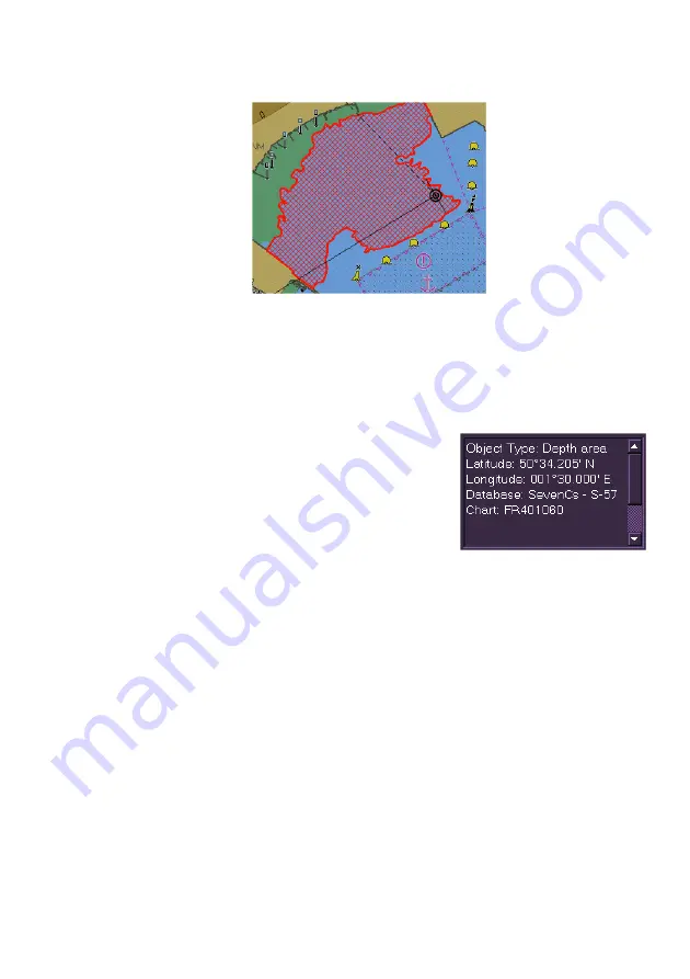
Chart Dangers Information
The chart dangers information area at the
bottom of the window gives detailed information
on each dangerous object selected. This
information will include the following:
Object Type - e.g. Depth Area, Caution
Area
Latitude/Longitude position of object
Database - the chart database, e.g. SevenCs S-57.
Chart - the reference number of the nearest chart to the dangerous
object.
Depth area information will additionally include the following data:
Depth Range Value 1:
Depth Range Value 2:
The figure shown with Value 1: usually represents the minimum depth in
metres of the Depth Area. This value may be 0 or a negative value if the
depth area represents height above water (e.g., land mass or a harbour
wall).
The figure shown with Value 2: usually represents the maximum depth in
metres of the Depth Area.
Summary of Contents for VisionMaster FT
Page 1: ...Radar Chart Radar User Guide Northrop Grumman Sperry Marine B V Part Number 65900010 ...
Page 2: ......
Page 4: ...Radar Chart Radar User Guide 65900010 ii Intentionally Blank ...
Page 24: ...Overview Radar Chart Radar User Guide 1 2 65900010 Single System ...
Page 42: ......
Page 114: ......
Page 212: ......
Page 304: ......
Page 370: ......
Page 450: ......
Page 462: ......
Page 502: ......
Page 516: ......
Page 532: ......
Page 533: ......


