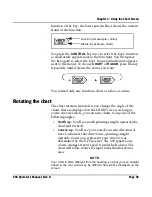
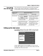
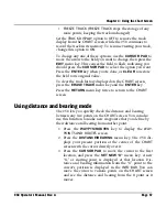
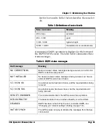
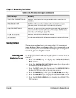
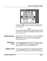
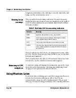
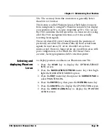
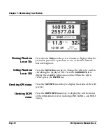

Chapter 4 - Using the Chart Screen
958 Operator’s Manual, Rev. A
Page 55
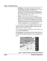
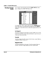
Chart edges
The
ON
setting shows the outlines of the charts that are on the
installed Navionics chart cartridge or the built-in maps. Chart
edges are shown as boxes with dotted lines.
Depth
The
ON
setting shows depth contour lines for low, mid, and
deep water areas, for any or all of the three depth levels.
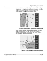
Track line
The
ON
setting shows your vessel’s track points (the course
you’ve already traveled). For more track display options, see
“Changing the track control” starting on page 56.
Waypoints
The
ON
setting shows your waypoints on the
CHART
screen,
and the
OFF
setting turns them off, with the exception of
waypoints on a route.
Nav aids
The
ON
setting shows nav aids from the Navionics chart
cartridge, and the
OFF
setting hides the nav aids.
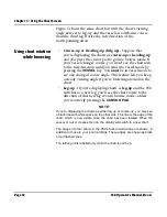
Land masses
The
ON
setting shows the coloring of land masses to contrast
between water and land. The
OFF
setting shows only coastline,
without the coloring.
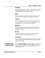
Turning the radar
overlay on and off
Press the
RADAR OVERLAY
menu key to place a radar overlay
on the
CHART
screen (
ON
) or remove it (
OFF
). For details
about the radar overlay, see ”Overlaying radar on the chart”
starting on page 128.
Summary of Contents for 958
Page 1: ...NORTHSTAR 958 Integrated Navigation System Operator s Manual P N GM958UM Revision A ...
Page 2: ......
Page 8: ...Page iv 958 Operator s Manual Rev A ...
Page 26: ...Page 18 958 Operator s Manual Rev A Chapter 1 Getting Started ...
Page 128: ...Page 120 958 Operator s Manual Rev A Chapter 8 Understanding Waypoint Route Navigation ...
Page 150: ...Page 142 958 Operator s Manual Rev A Chapter 10 Understanding Radar Functions ...
Page 198: ...Page 190 958 Operator s Manual Rev A ...
Page 204: ...Page 196 958 Operator s Manual Rev A ...
Page 212: ...Page 204 958 Operator s Manual Rev A ...