Page 60
958 Operator’s Manual, Rev. A
Chapter 5 - Determining Your Position
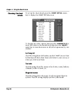
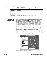
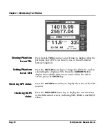
Displaying position, COG, and speed
The 958 uses a high-performance GPS receiver as its primary
source of position data, augmented by either the WAAS
satellite system, or radiobeacon differential, or both.
Depending on the type of antenna/receiver that’s connected,
the 958 can determine and display position coordinates in
several different ways:
•
as lat/lon coordinates
>
from GPS satellites alone
>
from GPS plus the radiobeacon differential system
>
from GPS plus WAAS satellites
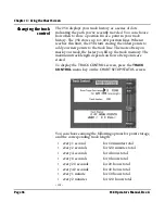
NOTE:
The 958 can display position as Loran TDs if the 958 is connected to a
loran receiver. Also, it can display “Phantom Loran” coordinates; that is, if
you don’t have a loran receiver, but want to see your position as loran
TDs, the 958 will convert GPS coordinates into Loran coordinates.
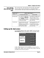
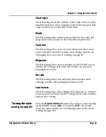
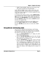
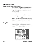
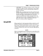
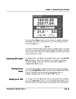
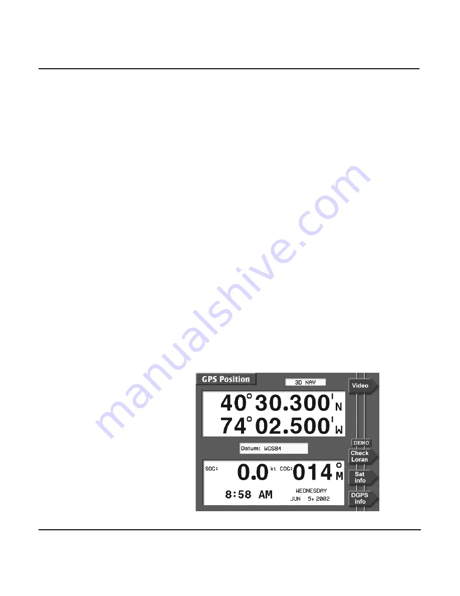
Using GPS
Position, COG, and SOG are calculated from the received
satellite data, as well as time, date, and an estimate of the 958’s
accuracy. To display this position information, press the
CHART
key to display the
GPS POSITION
screen.
Summary of Contents for 958
Page 1: ...NORTHSTAR 958 Integrated Navigation System Operator s Manual P N GM958UM Revision A ...
Page 2: ......
Page 8: ...Page iv 958 Operator s Manual Rev A ...
Page 26: ...Page 18 958 Operator s Manual Rev A Chapter 1 Getting Started ...
Page 128: ...Page 120 958 Operator s Manual Rev A Chapter 8 Understanding Waypoint Route Navigation ...
Page 150: ...Page 142 958 Operator s Manual Rev A Chapter 10 Understanding Radar Functions ...
Page 198: ...Page 190 958 Operator s Manual Rev A ...
Page 204: ...Page 196 958 Operator s Manual Rev A ...
Page 212: ...Page 204 958 Operator s Manual Rev A ...


