Chapter 5 - Understanding Position Coordinates
961/962 Operations and Reference Manual, Rev. A
Page 5-3
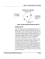
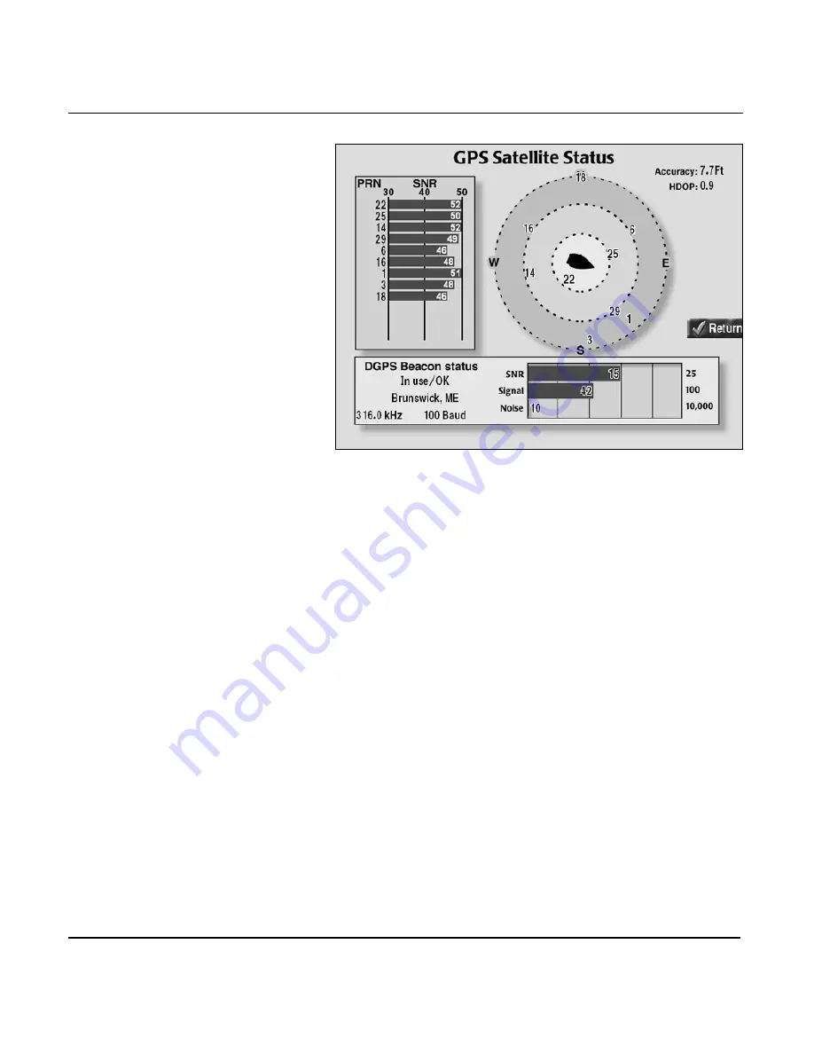
GPS satellite status screen
The
GPS SATELLITE STATUS
screen shows the received
Signal-to-Noise Ratio (SNR) for each satellite (up to 12), and a
map indicating where the satellites are now located in the sky.
Satellites are identified by their pseudorandom number (PRN),
a two-digit number assigned by the U.S. government. The
center of the satellite map represents the center of the sky, and
the outer ring is the horizon. The view is looking down from
above, with East to your right and West to your left.
Also displayed on the screen is the following GPS data:
• ACCURACY
•
HDOP
(horizontal dilution of precision)
Accuracy is the estimated accuracy of the GPS system to be
expected at the current time. Your position readings should be
more accurate than this estimate 95 percent of the time.
HDOP is a technical measure of how good the satellite pattern
is in the sky for fix-taking purposes. HDOP depends on how
many operational satellites are in view and where they’re
currently located. HDOP is calculated from the satellites’
current positions, not on actual received signals, and doesn’t
consider atmospheric conditions and signal interference, all of
Summary of Contents for 961
Page 6: ...Page viii 961 962 Operations and Reference Manual Rev A ...
Page 8: ...Page x 961 962 Operations and Reference Manual Rev A ...
Page 14: ...Page xvi 961 962 Operations and Reference Manual Rev A ...
Page 92: ...Chapter 3 Using the Controls Page 3 34 961 962 Operations and Reference Manual Rev A ...
Page 160: ...Chapter 6 Creating Waypoints Page 6 18 961 962 Operations and Reference Manual Rev A ...
Page 176: ...Chapter 7 Creating Avoidance Points Page 7 16 961 962 Operations and Reference Manual Rev A ...
Page 202: ...Chapter 8 Creating Routes Page 8 26 961 962 Operations and Reference Manual Rev A ...
Page 380: ...Glossary Page G 8 961 962 Operations and Reference Manual Rev A ...

