56
current settings will be saved in the measurement file;
9.1.4Measurement
1)
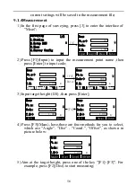
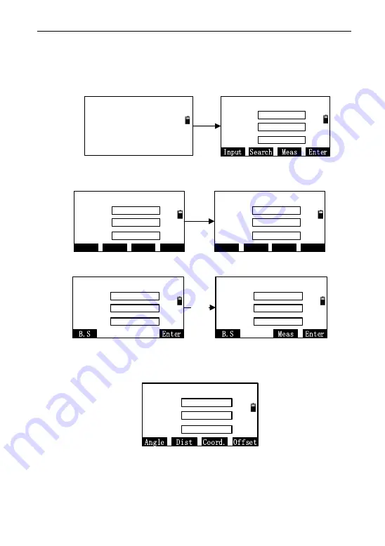
In the first page of surveying, press [3] to enter the interface of
―Meas‖;
Meas
Pt.n->
Code:
T.H:
PT1
1.000
m
Surveying
1.Station
1/2
2.Setup BSS
3.Meas
P1
[3]
4.Survey Config
2)
Press [F1](Input) to input the measurement point name ,then
press [Enter] to input code;
Meas
Pt.n->
Num.
Search
Input
Enter
Code:
T.H:
3
1.000
m
Meas
Pt.n:
Num.
B.S
Enter
Code->
T.H:
3
TREE
1.000
m
[F4]
[Enter]
List
3)
Input target height (I.H) ,then press [Enter];
Meas
Pt.n:
Code:
T.H->
3
TREE
1.000
m
Meas
Pt.n:
Code:
T.H->
3
TREE
1.000
m
[F4]
4)
Press [F3](Meas), here,there are four methods for you to select,
which are ―Angle‖, ―Dist‖ , ―Coord.‖, ―Offset‖, as shown in
picture below:
Meas
Pt.n:
Code:
T.H->
3
TREE
1.000
m
5)
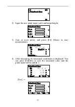
Aim at the target height, press one of the key ―[F1]~[F3]‖. For
example, press [F2](Dist) to start measuring;


