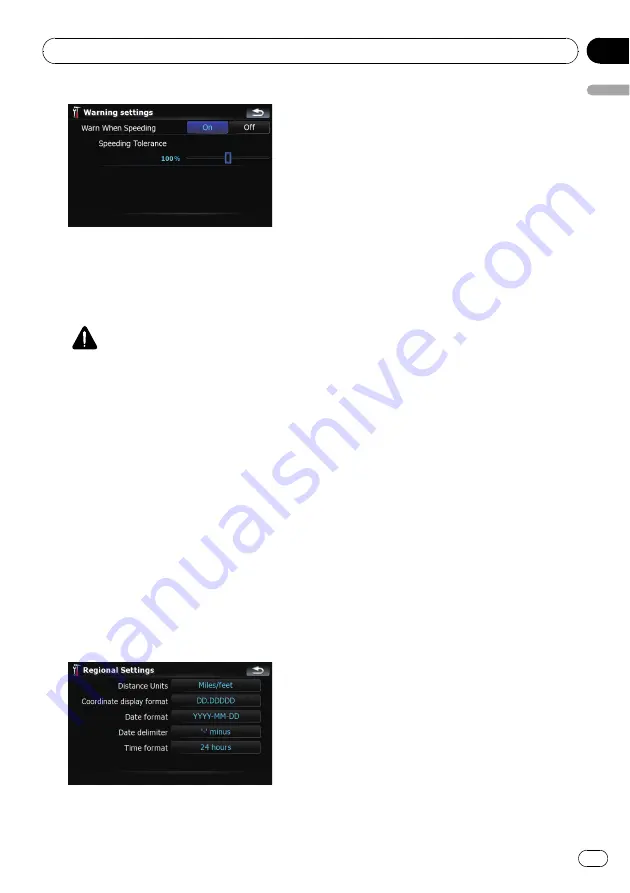
Available options;
!
“
Warn When Speeding
”
Establishes whether or not to enable the ex-
cessive speed warnings for when you ex-
ceed the speed limit.
CAUTION
The speed limit is based on the map data-
base. The speed limit in the database may
not match the actual speed limit of the cur-
rent road. This is not a definite value. Be
sure to drive according to the actual speed
limit.
!
“
Speeding Tolerance
”
Sets the tolerance for the speed limit
with a percentage.
Regional Settings
The display format for the distance unit, lati-
tude and longitude, and other settings related
to time and date can be customized.
%
Touch [Regional Settings] on the
“
Navi
Settings
”
menu.
The
“
Regional Settings
”
screen appears.
Available options;
!
“
Distance Units
”
Controls the unit of distance and speed
shown.
!
“
Coordinate display format
”
Controls the format of latitude and longi-
tude shown.
!
“
Date format
”
Controls the format of date shown.
!
“
Date delimiter
”
Controls the delimiter format for the date
shown.
!
“
Time format
”
Controls the time format shown.
Restore Factory Settings
Resets various settings registered to the navi-
gation system and restores them to the default
or factory settings.
p
Some data remains. Read
vigation system to the default or factory set-
tings
before you operate this function.
=
For more detailed information about the
items to be deleted, refer to
the navigation system to the default or
factory settings
1
Touch [Restore Factory Settings] on the
“
Navi Settings
”
menu.
2
Touch [Yes].
The navigation system will now restart.
Set Home
=
For more details concerning the operation,
refer to
Demo Mode
This is a demonstration function for retail
stores. After a route is set, touching this key to
start the simulation of the route guidance.
1
Touch [Demo Mode] on the
“
Navi Set-
tings
”
menu.
Customizing preferences
En
129
Chapter
25
Customizing
pr
eferences


