


v1.32
March 2014
44 of 90
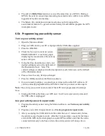
5.2b Export your data into Excel
Now that you have converted your data to your desired format you can open it in Excel.
To do this:
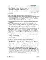
1.
Open Excel.
2.
Open the file you converted by going to File > Open.
You will need to navigate to where you saved your data file.
Change the file type to
all files
in order to see your data.
Press Open
3.
The text import wizard will open. Make certain Delimited is selected and press
next.
4.
On the next window make certain that only the Tab box is checked and press
Finished.
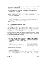
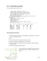
5.3 Output
Each data column has a heading indicating what it is. When viewing in notepad these
headings do not line up properly with the columns of data. By exporting the files and then
importing the file into Excel, the headings line up properly. This is a list and brief
explanation of each column in the output.
See
Appendix E
for more information on data
GPS data
Date
: Date that the GPS location was acquired.
Time
: Time that the GPS location acquisition began. This is local time according to the
time zone that you set in the edit unit text box.
TTF
: This is the amount of time required to acquire a position. For collars and pod
shipped after March 2, 2009 this column is the time required to acquire a position plus the
GPS additional time.
Latt
: Latitude
Long
: Longitude
Altitude
: Altitude. Please note that this will not be very precise; your maps will have
more precise altitude data
Maxsnr
: Maximum satellite signal strength
Summary of Contents for 4000 Enhanced
Page 90: ...v1 32 March 2014 90 of 90...


