GL100 @Track Air Interface Protocol
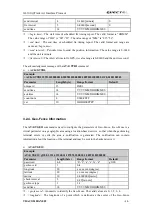
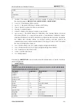
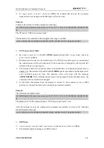
count num
4
ver 10
HHHHSSPPPP
<
active
>: 0: Geo-Fence mode is disabled; 1: Geo-Fence mode is enabled.
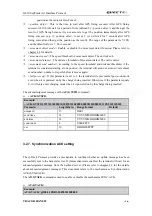
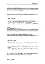
When
<function key mode>
is 2, i.e. Geo-Fence in current position, and Geo-Fence 0 is enabled
after press the function key for two times in 2 seconds, the terminal will start GPS to get the
current position and then report the message
+RESP:GTGCR
to the backend server.
¾
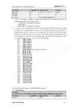
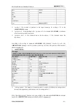
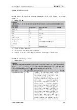
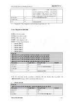
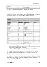
+RESP:GTGCR,
Example:
+RESP:GTGCR,359231030000010,1,1,121.387152,31.171803,100,2,3,20091022081314,046
0,0000,1806,2602,00,0014,0102080203
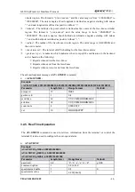
Parameter
Length(byte)
Range/format
Default
unique id
15
IMEI
gps fix
1
0|1
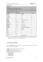
gps accuracy
2
0
-
50
longitude <=20
xxx.xxxxxx
latitude <=20
xx.xxxxxx
radius 10
0-6000000
(
meter
)
check interval
2
0-99
(
minute
)
geofence type
1
1-3
send time
14
YYYYMMDDHHMMSS
mcc 4
0XXX
mnc 4
0XXX
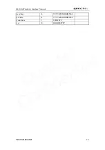
lac 4
cellid 4
ta 2
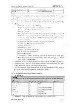
count num
4
ver 10
HHHHSSPPPP
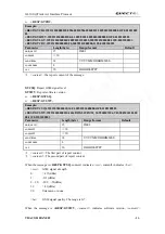
<
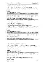
gps fix
>: A numeric to indicate whether GPS fixing is successful.
1: Successful GPS fixing. In the case, the following
<longitude>
and
<latitude>
in the
message specifies the current position and it will be the center of Geo-Fence 0. And the
terminal will start to check Geo-Fence 0 periodically.
0: Failure of GPS fixing. In the case, the following
<longitude>
and
<latitude>
in the
message is the old center of Geo-Fence 0. And the terminal won’t check Geo-Fence 0.
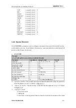
<
longitude
>: The longitude of a point which is the center of Geo-Fence 0 circular region.
<
latitude
>: The latitude of a point which is the centre of Geo-Fence 0 circular region.
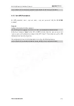
Note
:
<longitude>
and
<latitude>
are the longitude and latitude of the current position if GPS fixing
was successful. And
<longitude>
and
<latitude>
are the longitude and latitude of the old center
of Geo-Fence 0 if GPS fixing was failed. About the parameters
<radius>
,
<check interval>
and
<geofence type>
, please refer the 3.2.4.
TRACGL100AN002
- 26 -
Quectel
Confidential

