32
33
Turning Angle
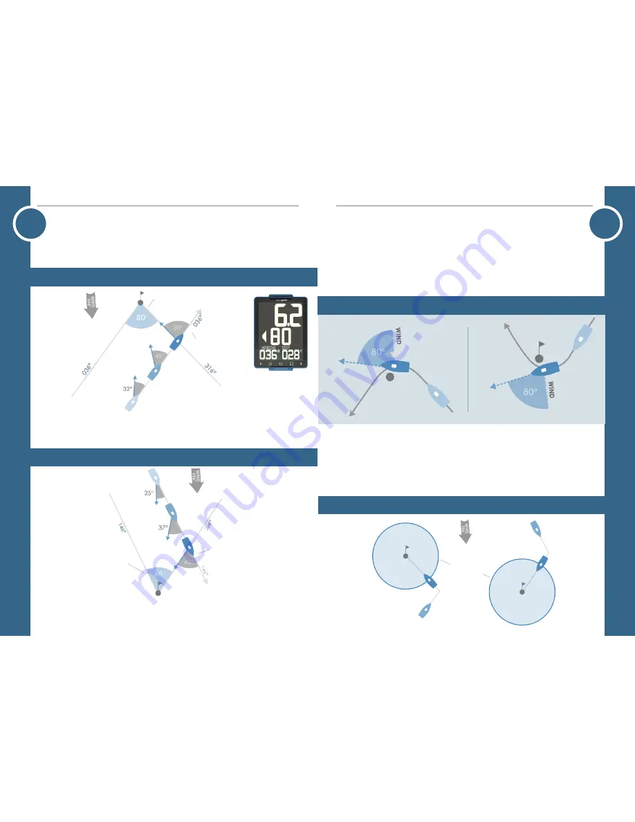
The middle digits in all Navigation modes shows the Turning Angle. The left
and right arrows show the direction of turn required to travel directly towards
upwind
Sailing upwind the turning angle shows the difference between the heading and
bearing to a waypoint or mark. When the Turning Angle equals your tacking angle
then you are on the layline.
upwind
Downwind
Sailing downwind the turning angle shows difference between the Course Over
Ground (COG) and bearing to the waypoint.
Downwind
Turning Angle
Tacking Angle
Turning Angle
Tacking Angle
o
peration -
n
avigation
Auto Acquire Marks
When Navigation Mode in settings is set to: Windward/Leeward, the d10
uses the current heading, mean wind direction and GPS position to acquire the
windward and leeward mark positions.
Once the heading passes 80° above or below the mean wind direction the GPS
grabs the boat’s current position and saves it.
Windward Mark
Leeward Mark
Windward Mark
Leeward Mark
Auto Progress course
When Navigation Mode in settings is set to: Course Mode, the d10 uses the current
GPS position, saved mark GPS position and the Waypoint Arrival Distance to auto
progress the course to the next saved mark. The Waypoint Arrival Distance can be
changed in the d10 settings.
Waypoint
Arrival
Distance
o
peration -
n
avigation


