Chapter 12: Weather (US only)
197
Tropical storm data
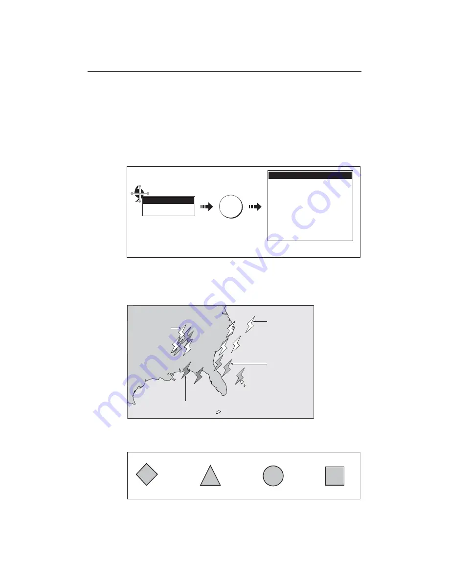
Tropical storm data can be displayed for a selected storm. This includes:
• The storm’s name, type, date and time.
• The position, direction and speed of travel of the storm.
• The pressure and maximum wind speed and gusts.
To display tropical storm data:
Lightning
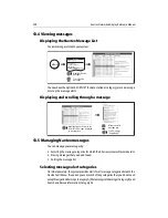
The system displays a lightning symbol at each cloud-to-ground strike recorded within
the last 5, 10 and 15 minutes:
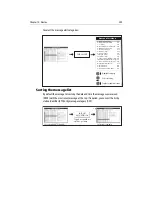
Surface observation stations
You can view current or historical weather data at surface observation stations.
Hurricane Category 2
OK for more info
OBJECT INFO
Storm name
Storm ID
Storm Type
Direction
Speed
Max Wind Speed
Max gust Speed
Pressure
Date
Time
Position
Tropical Storm Data
EPSILON
AL292005
Hurricane Category 2
075oT
9.9kt
64.9kt
80.1kt
987mb
12/03/2005
3:00PM
34
o
30'.000N/044
o
24'.000W
D8573_1
Move cursor over storm
graphic to display storm
type
Displays detailed information for
selected storm
OK
Strike recorded in
last 0 - 5 minutes
Strike recorded in
last 5 - 10 minutes
More recent strikes
overlay older ones
Strike recorded in
last 10 - 15 minutes
D8575_1
Lightning Strikes
Buoy Station
C - MAN
WSI
NWS
All surface observations stations are represented by a pink symbol:
D8975-1
Summary of Contents for E120W
Page 1: ...E Series Networked Display Reference Manual Document number 81244_2 Date March 2006...
Page 22: ...6 E Series Networked Display Reference Manual...
Page 48: ...32 E Series Networked Display Reference Manual...
Page 194: ...178 E Series Networked Display Reference Manual...
Page 200: ...184 E Series Networked Display Reference Manual...
Page 206: ...190 E Series Networked Display Reference Manual...
Page 226: ...210 E Series Networked Display Reference Manual...
Page 254: ...238 E Series Networked Display Reference Manual...
Page 272: ...256 E Series Networked Display Reference Manual...
Page 276: ...260 E Series Networked Display Reference Manual...


