G-Series Reference Manual
84
•
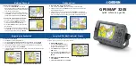
Pressing FIND SHIP from any synchronized application returns
the 3D chart to the default view and synchronizes the 2D chart to
the same view.
•
Changes made to heading, range or position in either 2D or 3D
charts are reflected in both windows.
•
If the 2D chart view for the current window is set to SYSTEM,
any changes made in a chart window will be reflected in all win-
dows on all displays.
•
If the 2D chart view for the current window is set to LOCAL, no
other windows will be affected.
•
You can synchronize the 2D chart with the 3D chart or the radar
but not both.
To synchronize the standard chart with the 3D chart
1. Make a 2D chart window active.
2. Press the
PRESENTATION
softkey.
3. Press
CHART MODE AND ORIENTATION
.
4. Toggle the
CHART SYNC
mode to
3D
.
5. Press
OK
.
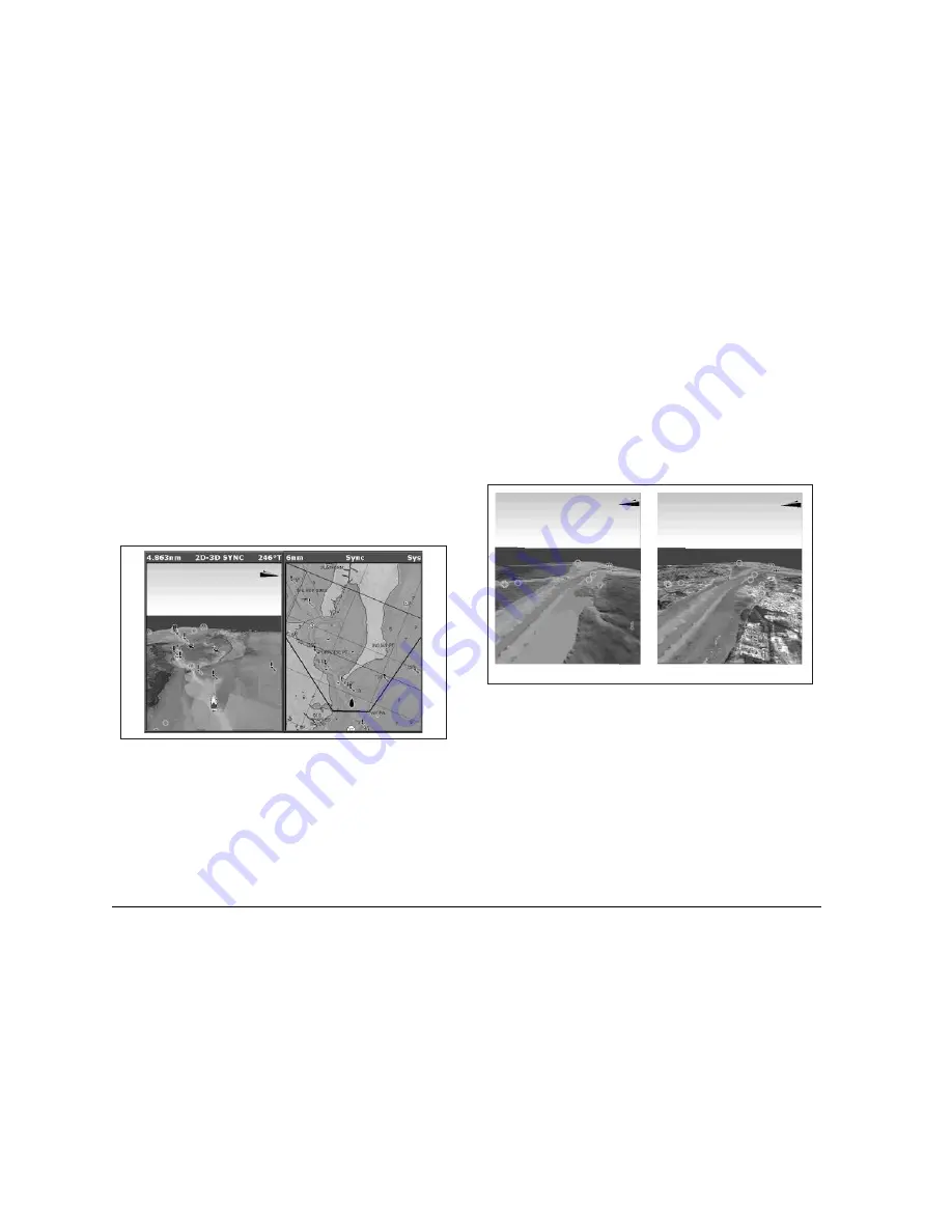
6.10 Aerial photography overlay
You can overlay aerial photography onto the 3D image. This can
help you interpret the chart view of your surroundings. Aerial pho-
tography is available for the navigable waters up to three miles
inside the coastline. Beyond these limits, land appears green (on
color charts) or grey (on black-and-white charts).
•
Aerial photo overlay is controlled from the 3D chart Setup
Menu.
D8257_1
Standard 3D image
3D image with aerial overlay
D8848_1
Summary of Contents for GPM400
Page 1: ...G Series Systems Reference Guide...
Page 2: ......
Page 3: ...G Series System Reference Guide Document Number 81276 1 Date June 2007...
Page 8: ...G Series Installation Commissioning 8...
Page 12: ...G Series Reference Manual 12...
Page 20: ...G Series Reference Manual 20...
Page 34: ...G Series Reference Manual 34...
Page 89: ...89 Chapter 7 Autopilot Integration...
Page 90: ...G Series Reference Manual 90...
Page 110: ...G Series Reference Manual 110...