background image

GPS-6020 Operating Manual


 Rikaline


Specifications subject to change without prior notice 


Rikaline

 International Corp.

      10

F, 64, Kang-Ding Road, Taipei 108, Taiwan 

Tel: ++886 2 2370 4688    Fax: ++886 2 2370 4686      E-Mail: 

info@rikaline.com.tw

  web: 

www.rikaline.com.tw


9

4.1.4 GNSS Satellites in View (GSV) 


Table 4-8 contains the values for the following example: 
 

$GPGSV,2,1,07,07,79,048,42,02,51,062,43,26,36,256,42,27,27,138,42*71 
$GPGSV,2,2,07,09,23,313,42,04,19,159,41,15,12,041,42*41


Table 4-8 GSV Data Format 

Name Example 

Units 

Description 

Message ID   

$GPGSV 


GSV protocol header 

Number of Messages


Range 1 to 3 

Message Number 


Range 1 to 3 

Satellites in View 

07 


Range 1 to 12 

Satellite ID 

07 


Channel 1 (Range 1 to 32) 

Elevation 

79 

degrees Channel 1 (Maximum 90) 

Azimuth 

048 

degrees Channel 1 (True, Range 0 to 359) 

SNR (C/No) 

42 

dBHz 

Range 0 to 99, null when not tracking 

.... .... 


Satellite ID 

27 


Channel 4 (Range 1 to 32) 

Elevation 

27 

degrees Channel 4 (Maximum 90) 

Azimuth 

138 

degrees Channel 4 (True, Range 0 to 359) 

SNR (C/No) 

42 

dBHz 

Range 0 to 99, null when not tracking 

Checksum *71 


<CR> <LF> 


End of message termination 


NOTE:

 Items <4>,<5>,<6> and <7> repeat for each satellite in view to a maximum of four (4) satellites per 

sentence. Additional satellites in view information must be sent in subsequent sentences. These fields will be 
null if unused. 
 

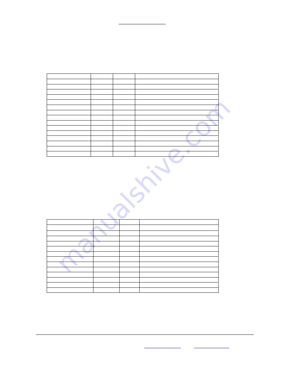
4.1.5 Recommended Minimum Specific GNSS Data (RMC) 
 

Table 4-9 contains the values for the following example: 
 

$GPRMC,161229.487,A,3723.2475,N,12158.3416,W,0.13,309.62,120598, ,*10 
 

     Table 4-9 RMC Data Format 

Name Example 

Units 

Description 

Message ID   

$GPRMC 


RMC protocol header 

UTC Time 

161229.487 


hhmmss.sss 

Status 


A=data valid or V=data not valid 

Latitude 3723.2475 


ddmm.mmmm 

N/S Indicator 


N=north or S=south 

Longitude 12158.3416 


dddmm.mmmm 

E/W Indicator 


E=east or W=west 

Speed Over Ground 

0.13 

Knots   

Course Over Ground 

309.62 

Degrees True 

Date 120598 


ddmmyy 

Magnetic Variation 


Degrees E=east or W=west 

Checksum *10 


<CR> <LF> 


End of message termination 


4.1.6 Course Over Ground and Ground Speed (VTG) 

 
Table 4-10 contains the values for the following example: 
 

Summary of Contents for CF GPS GPS-6020

Page 1: ...ad Taipei 108 Taiwan R O C Phone 886 2 2370 4688 Fax 886 2 2370 4686 E Mail info rikaline com tw Web www rikaline com tw All Right Reserved User s Guide High Accuracy 3 Meters 50 or 5 Meters 90 Low Po...

Page 2: ...TABLE OF CONTENTS 1 Introduction 3 1 1 Overview 3 1 2 Features 3 1 3 FirstGPSTM Architecture Highlights 3 1 4 Technical Specifications 3 2 Operational Characteristics 5 2 1 Initialization 5 2 2 Navig...

Page 3: ...y sustains internal clock and memory and is recharged during normal operation 6 Dual communication channels and user selectable baud rates allow maximum interface capability and flexibility 7 LED disp...

Page 4: ...ocity 0 05 meters second typical 5 Dynamic Conditions Altitude 18 000 meters 60 000 feet max Velocity 515 meters second 1000 knots max Acceleration 4 G max Jerk 20 meters second max 1 4 6 Important Ch...

Page 5: ...f significant inaccuracy exists in the initial data or the orbital data is obsolete it may take more time to achieve a navigation solution The FirstGPS feature is to provide fast and accurate position...

Page 6: ...370 4686 E Mail info rikaline com tw web www rikaline com tw 6 3 Hardware interface 3 1 Dimension Size 85 0 W x 42 0 D x 20 6 H mm 3 35 W x 1 65 D x 0 81 H 3 2 Hardware Interface The GPS 6020 includes...

Page 7: ...nce Description GPGGA Global positioning system fixed data GPGLL Geographic position latitude longitude GPGSA GNSS DOP and active satellites GPGSV GNSS satellites in view GPRMC Recommended minimum spe...

Page 8: ...r W west UTC Position 161229 487 hhmmss sss Status A A data valid or V data not valid Checksum 2C CR LF End of message termination 4 1 3 GNSS DOP and Active Satellites GSA Table 4 5 contains the value...

Page 9: ...um 90 Azimuth 138 degrees Channel 4 True Range 0 to 359 SNR C No 42 dBHz Range 0 to 99 null when not tracking Checksum 71 CR LF End of message termination NOTE Items 4 5 6 and 7 repeat for each satell...

Page 10: ...4 11 contains the values for the following example GPVTG 114523 62 12 04 2001 10 34 6E Table 4 11 zda Data Format Name Example Units Description Message ID GPZDA ZDA protocol header Hour Min Sec Sub...

Page 11: ...info rikaline com tw web www rikaline com tw 11 5 Ordering Information 5 1 Product Options GPS 6020 5 1 2 Color Option BK Black Standard Other Color by demand 6 Warranty The GPS 6020 is warranted to...

Reviews: