User Guide
56
on or off
Restricted Area: Turns the displaying of
Restricted area on or off
Fishing Area: Turns the displaying of
Fishing Area on or off
Sea Cable: Turns the displaying of Sea
Cable on or off
Name: Turns the displaying of area name on
or off
Mark Attribute: Turns the displaying of
Mark Attribute on or off
Sea Sector No: Turns the displaying of Sea
Sector No on or off
4-2-5
Map datum
This unit has a compatibility with most of
major chart system and this option allows
you to select a map datum. The default
datum is WGS84.
Map datum Selection
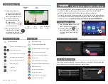
1 Press and hold
and select chart icon
2 Select general and Map datum
3 Select a desired map datum
4-2-6
NMEA datum offset
When you select other Map datum different
from WGS84, latitude and longitude will be
different from WGS84’S coordinates and this
might confuse other device such as VHF radio
if connected to the unit. If this option is
applied, latitude and longitude send on the
unit NMEA output will be the same as
coordinates in WGS84.
4-2-7
Map shift
Sometimes current position of own ship does
not match with the current location on the
chart. To correct this position error, you can
apply a map shift.
Applying a map shift
1 In the Chart setup menu, press and hold
and select Chart icon.
2 Select Map shift to ON.
3 Move cursor to the actual position on the
chart.
4 Press
and select Set.
Canceling a map shift
If you want to clear the map shift:
1 In the Chart setup menu, select Map shift.
2 Press
and select Clear.
4-2-8 Restore default
Returns every chat settings to default.
Summary of Contents for Nf100
Page 1: ...User Guide 1...
Page 2: ...User Guide 2...
Page 4: ...User Guide 4...
Page 16: ...User Guide 16 REM 350...
Page 64: ...User Guide 64 4 9 Other settings Press long then select Others...
Page 81: ...User Guide 81...
Page 83: ...User Guide 83...
Page 84: ...User Guide 84...
Page 85: ...User Guide 85...


