86,1*<285%2$7
6HDOLQH2ZQHUV0DQXDO3DJH
NAVIGATIONAL EQUIPMENT
The use of electronic navigational equipment should
not be used as a substitute for good seamanship.
Electronic equipment can fail, it is therefore
fundamental that the individual charged with the
craft's command be familiar with traditional navigation
methods.
Magnetic steering compass - Magnetic steering
compasses are fitted at the helm, however, a hand-
held compass should be carried as standard
equipment. All compasses are prone to variations
which deflect the indicated heading from the 'True
North' position.
a Variation is caused by earth's magnetism.
b Deviation is caused by the craft's magnetism.
Variation - The amount of variation changes with
time and geography. All navigational charts give
information on the amount of variation that exists.
To allow for the error it is only necessary to:
c
Look up the variation on the appropriate chart
and make the necessary allowances due to
the annual changes on the chart.
d Apply the correction due to the variation to the
compass reading.
Deviation - The amount of deviation experienced
will vary depending upon the heading of the craft
and can be as much as 30°.
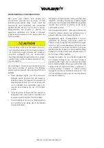
CAUTION
Never leave any metallic or electrical equipment
close to the compass as this will induce errors. A
small metal object in your pocket can be sufficient
to deflect the compass heading.
Boat speed indicator/log - The boat speed
indicator/log is used to determine the craft's speed
through the water and also the distance travelled.
Information can be accumulative or current and can
include additional data such as maximum speed,
average speed.
Depth sounder - The depth sounder is possibly the
most important single piece of instrumentation with
regards to safe navigation. This will give you accurate
depth information in all sea states and provides an
invaluable aid to anchoring.
Radar - A rotating antenna aboard the craft transmits
a beam of energy into the ether and if there are any
solid objects in the way the beam deflects back. The
antenna picks up these returning signals which are
then translated into picture form and displayed on a
screen as a map of the area around the craft.
Global positioning system (GPS) - The GPS
receiver converts signals given by the satellites into
position, velocity and time estimates. Four satellites
are required to compute the four dimensions of X, Y,
Z (position) and time.
Navigation and anchor lights - Navigation lights
MUST be on while underway from sunset to sunrise
or in conditions of reduced visibility. "Underway"
means the boat is not docked or at anchor. Drifting
with engine off is considered "underway" and
navigation lights must be used.
Summary of Contents for S450
Page 1: ... ...
Page 2: ... ...
Page 6: ... 6HDOLQH 2ZQHU V 0DQXDO 3DJH ...
Page 55: ... 75 6HDOLQH 2ZQHU V 0DQXDO 3DJH AC PANEL 10 10 16 10 16 16 16 16 16 10 16 10 ...
Page 81: ... 7 1 6HDOLQH 2ZQHU V 0DQXDO 3DJH ...
Page 82: ... 6HDOLQH 2ZQHU V 0DQXDO 3DJH DATA SHEETS DIAGRAMS PRINCIPAL DIMENSIONS ...
Page 84: ... 6HDOLQH 2ZQHU V 0DQXDO 3DJH DECK PLAN ...
Page 86: ... 6HDOLQH 2ZQHU V 0DQXDO 3DJH SYSTEM CONTROL POINTS ...
Page 88: ... 6HDOLQH 2ZQHU V 0DQXDO 3DJH EQUIPMENT LOCATION ACCOMMODATION SPACE ...
Page 90: ... 6HDOLQH 2ZQHU V 0DQXDO 3DJH GAS SYSTEM LAYOUT ...
Page 92: ... 6HDOLQH 2ZQHU V 0DQXDO 3DJH FIRE PROTECTION SYSTEM 3 4 1 5 6 8 1 2 7 8 8 1 ...
Page 94: ... 6HDOLQH 2ZQHU V 0DQXDO 3DJH BLACK WATER SYSTEM ...

