Advanced functionalities
•
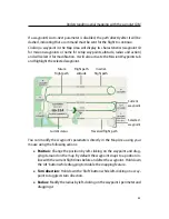
Altitude:
Hold down the ‘Ctrl’ button while left-clicking on the waypoint
and moving the mouse up or down to increase or decrease the altitude of
the waypoint, respectively.
•
Create new waypoint:
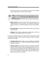
Right-click anywhere in the Map Area that does not
contain a symbol to bring up the context menu, then select ‘Add waypoint
here’ to add a new waypoint.
•
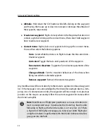
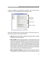
Context menu:
Right-click on a waypoint to bring up the context menu.
You can then select the following options:
–
Go to:
Select while the drone is in flight to make this the current des-
tination waypoint.
–
Auto-next:
Toggle the Auto-next parameter of the waypoint.
–
Reverse turn direction:
Toggle the Turn direction parameter of the
waypoint.
–
Change altitude:
Set the transition behaviour of the drone when
flying towards the selected waypoint.
–
Remove waypoint:
Remove the selected waypoint.
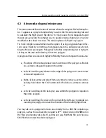
Any modification will be sent directly to the drone to update its onboard waypoint
list. If the message is not acknowledged by the drone (for example due to a tem-
porary loss of communication link), the waypoint will move back to its previous
position on the map to accurately reflect the current waypoint list status within
the drone’s autopilot.
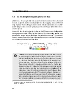
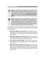
Note:
Modification of flight plan parameters can cause the drone to
react in unexpected ways. In particular, the drone may have trouble
following its flight path when the radius is set very low or if there
is high wind. We highly encourage you to test your entire flight plan
using the simulator to get familiar with the drone’s behaviours before
going out into the field.
54
Summary of Contents for swinglet
Page 1: ...Extended User Manual swinglet CAM Revision 12 September 2014 Copyright 2010 2014 senseFly Ltd...
Page 13: ...6 5 Charging the remote control 112...
Page 48: ......
Page 49: ...Part II Advanced functionalities...
Page 114: ......
Page 115: ...Part III Maintenance Repair and Troubleshooting...
Page 148: ......
Page 149: ...Part IV Speci cations...
Page 154: ......


