Paramount MX User Guide
54 |
P a g e
Altitude Scale
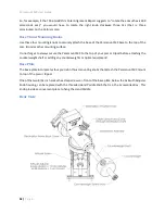
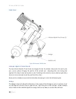
The Altitude Scale is a series of tic marks machined into the edge of both altitude wedge plates. The
longer tic marks represent 10 degree increments, the medium tics 5 degree increments and the shorter
tics 1 degree increments. When the mount’s base is close to level, this scale can be used to set the
altitude of the mount’s polar axis to an accuracy of plus or minus 15 arcminutes or so.
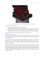
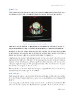
The current altitude of the mount’s polar axis can be read on the scale by looking at the intersection of
the bottom of the altitude reference block and the nearest tic mark on the Altitude Scale. The lowest
position on the Altitude Scale is 10 degrees, the highest position is 65 degrees. (The polar axis can
actually be adjusted to exceed the maximum scale by about one degree, so that the highest “reachable”
latitude is closer to 66 degrees.) Software Bisque manufactures the Paramount MX Latitude Adjustment
Wedge that allows the mounts polar axis to be adjusted for lower or higher latitudes.
Figure 25: The tic mark beneath the bottom of the Altitude Reference Block represents the current altitude.
Altitude Adjuster
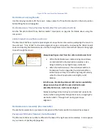
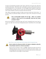
The calibrated Altitude Adjuster is used to make precise adjustments to the mount’s altitude axis for
polar alignment. The elevation of this axis should be positioned to match the latitude of your observing
site. The adjuster uses right-handed threads so that, when viewed from above, rotating the Altitude
Adjuster knob counterclockwise raises the elevation of the polar axis.


