Levelogger User Guide - Software Version 3.4.0 or Higher
Page 22
5 Levelogger Settings
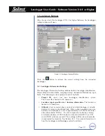
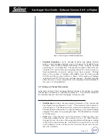
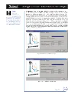
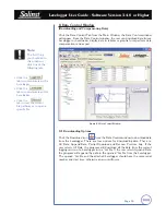
After the user starts the Levelogger V3.4.0 or higher Software, the Levelogger
settings window will open.
Figure 5-1 Levelogger Settings Window
Click the
button to retrieve the current settings from the connected
Levelogger.
5.1 Levelogger Information Settings
The Levelogger Information Settings window includes Levelogger identification,
Project ID and Location fields, sampling settings, altitude and fluid density input
fields. The following is a description of each of the fields:
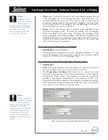
• Project ID
, input your own Levelogger identification system.
The Project ID is limited to 32 characters.
• Location, input specific site / location information
. The location is
limited to 32 characters.
• Altitude
in feet or meters above sea level, at which the logger is actually
deployed, is input in the altitude field. Water column equivalent pressure
decreases with altitude at a rate of approximately 1.2:1000 in the lower
atmosphere below 5000 m. You can compensate for this by entering
an elevation between -1000 ft below sea level and 16,400 ft (or -300
m and 5000 m) above sea level. The readings will then be automatically
compensated for elevation. See Section 11.1.3 for more information on
how the Levelogger and Barologger adjust for altitude


