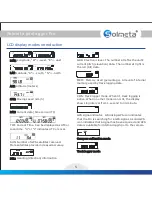
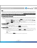
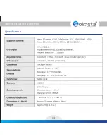
LCD display modes introduction
R
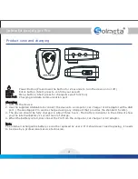
Solmeta geotagger
Pro
5
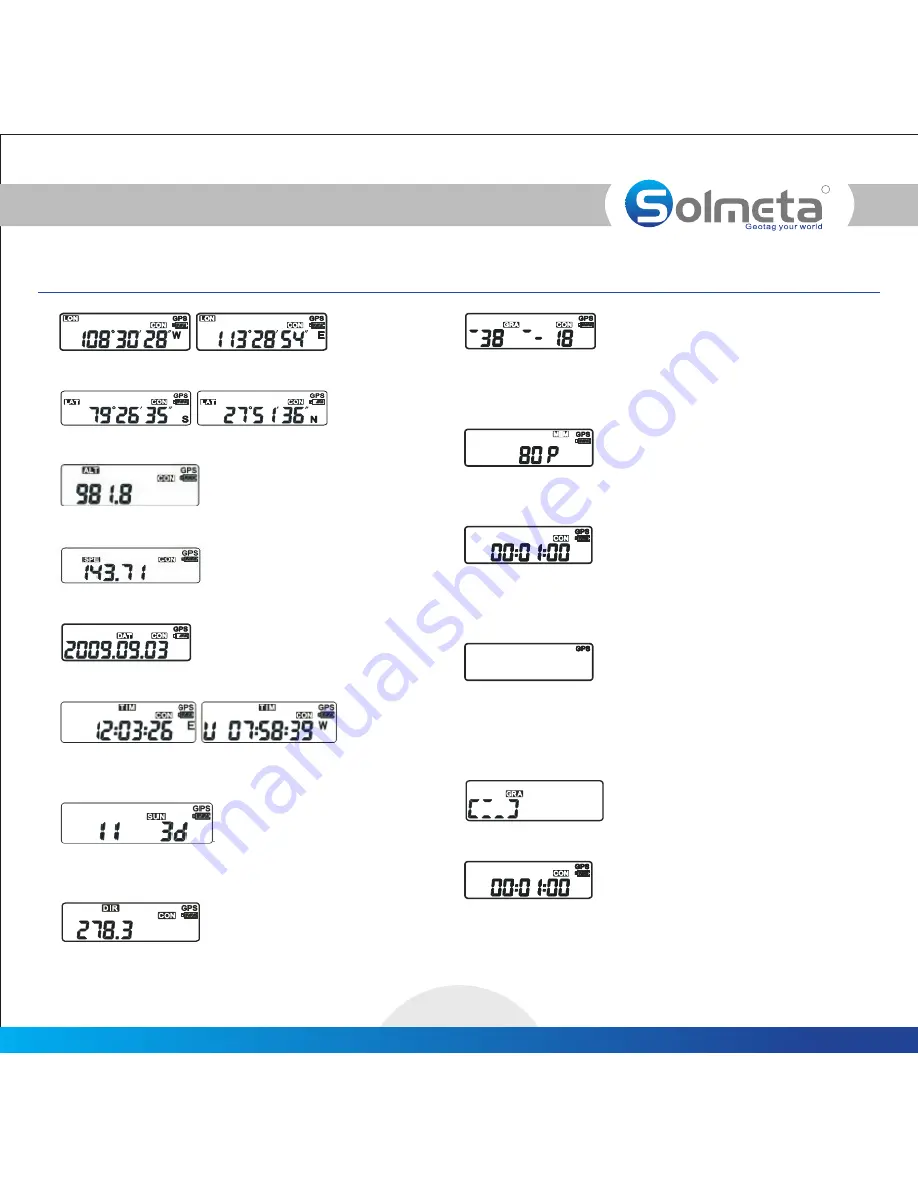
Longitude, “W”= -west, “E”= -east
LON:
LAT: Latitude, “S”= -south, “ N”= -north
ALT: Altitude (meters)
SPE: Moving speed (km/h)
DAT: Current date (time zone=UTC)
TIM:
Local time. “U” or “L” indicates UTC or Local.
Current Time. Can be displayed as UTC or
SUN:
More satellites provide increased accuracy.
Number of GPS satellites received.
GRA:
current pitch (elevation) data. The number at right is
the roll (tilt) data.
Electronic level. The number at left is the unit’s
DIR: Heading (direction) information
MEM:
memory used by track logging data.
Memory Used (percentage). Amount of internal
CON:
active. When no other mode icon is lit, the display
shows log interval from 1-second to 30-minute.
Track logger mode. When lit, track logging is
GPS signal indicator:
that the Pro is searching for a GPS signal. A solid GPS
icon indicates that a signal has been acquired and GPS
data is available for internal logging or to the camera.
A blinking GPS icon indicates
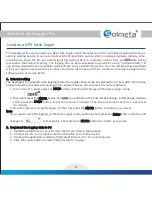
Compass calibration mode
Track logger mode