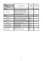
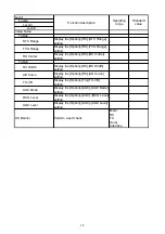
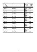


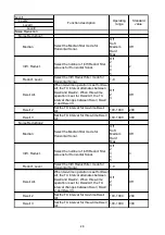

Level1
Level2
Level3
Level4
Initial Setting
IF Setting
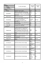
Depth
Select the Depth information interface
input.
Auto
GPIF
NMEA0
NMEA1
NMEA2
NMEA3
Auto
Water Temp.
Select the Water Temp. information
interface input.
Auto
GPIF
NMEA0
NMEA1
NMEA2
NMEA3
Auto
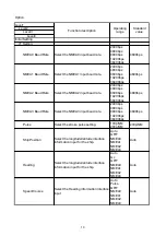
Current
Select the Current information interface
input.
Auto
GPIF
NMEA0
NMEA1
NMEA2
NMEA3
Auto
Wind
Select the Wind information interface
input.
Auto
NMEA0
NMEA1
NMEA2
NMEA3
Auto
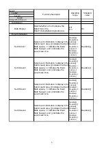
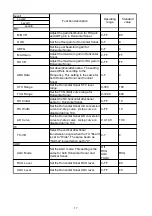
Wake Display
Select whether to display the Wake
Display method via latitude/longitude or
via Speed/Course.
Lat/Lon
Spd/Crs
Lat/Lon
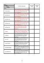
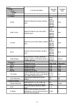
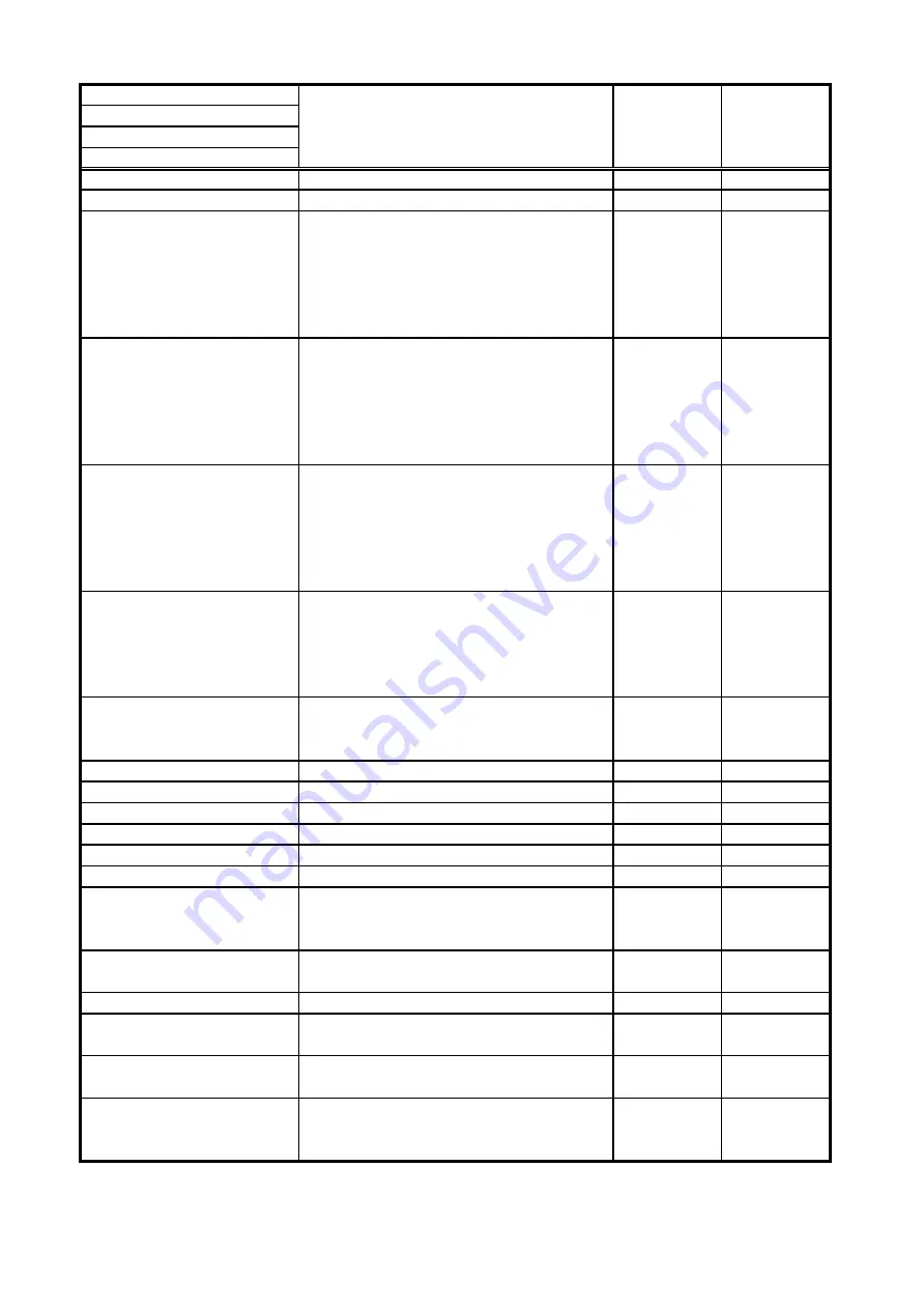
Date/Time
Year
Change the Year.
2000-2100
2000-2100
Month
Change the month.
1-12
1-12
Day
Change the date.
1-31
1-31
Hour
Change the Hour.
0-23
0-23
Minute
Change the minutes.
0-59
0-59
Time Zone
Correct the Date/Time according to the
difference between GPS world standard
time (GMT) and the time zone.
-12.0
~
+13.0
0.0
Auto Correction
Correct the GPS Date/Time when
started.
Off
On
Off
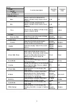
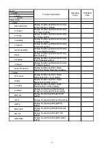
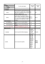
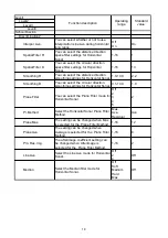
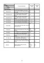
Image Correction
Image Correction
Select whether or not to match the
Wake Display on the sonar screen.
Off
Wake
Wake
Draft
Set the transducer protrusion draft
depth.
0-10
0
S Offset
Correct the horizontal sonar screen
heading when the transducer bow and
ship bow are misaligned.
0-359
0
Function description
Operating
range
Standard
value
14
Summary of Contents for KCS-5200
Page 1: ...Model KCS 5200 Color Scanning Sonar Operation Manual Ver 1 48 E Rev 0...
Page 2: ......
Page 14: ......
Page 22: ...2 4...
Page 28: ...3 6...
Page 50: ...5 16...
Page 78: ...6 28 Menu Screen Sub Screen Orthogonal Display Axis...
Page 80: ...6 30...
Page 84: ...7 4...
Page 90: ...8 6...
Page 106: ...9 16...
Page 116: ...10 10...