13
Horizon GPS Chart400 User Manual
This allows a larger proportion of the chart to be displayed. Press the key twice to remove remaining
borders and softkeys. The chart will occupy the entire screen. Press the hide key (not labeled) to
return to the previous display.
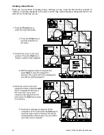
Lat/Lon Window
The latitude and longitude of the boat are displayed in a window at the bottom left of the display. A
boat symbol appears next to the lat/lon to indicate that it is the position of the boat. If the cursor has
been moved in the last ten seconds the latitude and longitude displayed is the position of the cursor
and the boat symbol is not displayed.
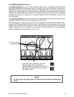
Scale
The chart scale is displayed on most screens, including the Underway and Waypoint screens. The
figure displayed (eg. scale=8nm) is the horizontal distance across the bottom of the currently visible
chart area. For example if the scale is 8 nm then a portion of chart eight nautical miles wide is
currently displayed.
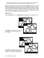
Autopan
Autopan changes the area of chart displayed to automatically maintain the boat position on the
screen. This function can only be enabled while the Underway screen is displayed. The Autopan
function is enabled by pressing the Ctr key twice to center the boat. A suitable chart scale can be
selected by pressing the Zoom In or Zoom Out keys. It is important to note that pressing any key,
other than the Zoom In and Zoom Out keys, will disable the autopan function.
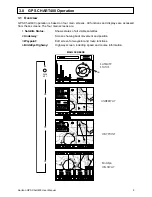
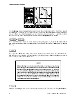
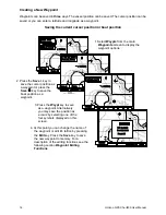
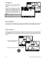
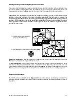
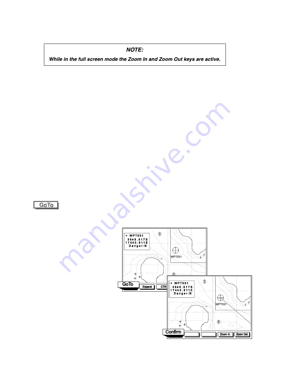
The GoTo function provides a simple method of navigating from the boat position to the current
cursor position, waypoint or mark.
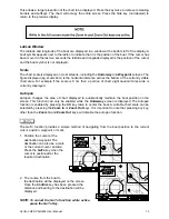
1. Position the cursor at the
destination waypoint. The
destination can also be a mark
or the current cursor position.
Press the GoTo key when the
cursor is positioned at the
required destination.
2. The course from the boat to
the destination will be displayed on the screen.
Once the Confirm key has been pressed the
distance and bearing to the destination will be
displayed.
NOTE: To cancel the GoTo function while active,
press the GoTo Key.