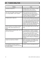
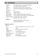
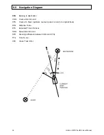


26
Horizon GPS Chart400 User Manual
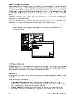
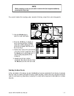
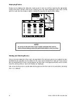
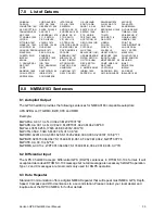
3.3 Auxiliary Screen
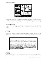
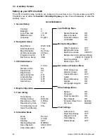
Setting up your GPS Chart400
The GPS Chart400 setup functions are located in the Auxiliary menu. To personalise your GPS
Chart400 move to either the Satellite or BirdsEye Highway screen. Press the Aux key to enter the
Auxiliary menu.
AUX SCREEN MENUS
1. General Setup
2. Navigation Setup
3. CDI/Units/Alarms
4. Map Configuration
5. Track History
6. Simulation Mode
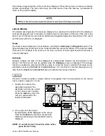
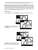
Contrast
6
Backlight
8
Local Time ofst
+13:00
NMEA Output
ON
Language
English
Map Datum
WGS 1984
North Reference
True
Map Orientation
North Up
Velocity Averaging
20 Secs
Projected Course
OFF
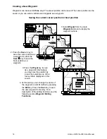
Nav Screen Setup
VMG
CDI Scale
0.5 Nm
Distance Units
Nm
Speed Units
Kts
Depth Units
Ft
Alarm Activated
ON
Arrival Radius
OFF
Anchor Alarm
OFF
Guard Zone
OFF
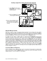
Track History
ON
Plotting Interval
Distance
Resolution by Dist.
0.05 Nm
Resolution by Time
10 sec
Track Memory Used
23%
Clear Track Memory
Mode
Normal
Speed
9.5 Kts
Heading
027 T
Starting Waypoint
MARINA
Dest. Waypoint
ANCH RCK
Active Simulation
OFF
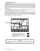
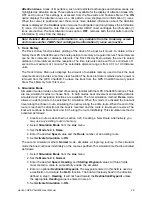
Land Settings Menu
Marine Settings Menu
Nav-Aids and Features Menu
Other Settings Menu
Chart Settings
Natural Features
ON
Rivers & Lakes
ON
Cultural Features
ON
Landmarks
ON
Water Turbulence
OFF
Bathymetric Lines
OFF
Depth Area Limits
00033 Ft
Bathymetrics & Soundings Range
00000 Ft - 00200 Ft
Spot Soundings
OFF
Bottom Type OFF
Ports & Services
ON
Attention Areas
ON
Tracks & Routes
OFF
Lights
OFF
Bouys & Beacons
ON
Signals
ON
Cartograph. Objects
ON
Names
ON
Compass
ON
Chart Generation
ON
New Objects
ON
Complex Object Icon
Multiple
Info Level
Detailed
Lat/Lon Grid
OFF
Chart Boundaries
OFF
Waypoint Icons
ON
Track Display
OFF
Plotter Mode
OFF