CP190i and CPF190i
Page 93
Tracks & Routes
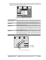
: Turns the underwater objects On or Off. Objects are obstructions, wrecks, cable etc.
12.0.8 Depth Settings
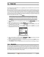
To control the display on the chart of the depth informations.
Depth Range Min
: Sets the minimum depth limit to show Depth Sounding, Bathymetric Lines and Depth Area.
Depth Range Max
: Sets the max depth limit to show Depth Sounding, Bathymetric Lines and Depth Area.
0
-
1000
F
t
50
-
100
F
t
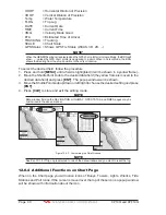
Figure 12.0.8 - Depth Settings
12.0.9 Land Settings
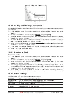
To control the display on the map of the terrestrial features.
Land Elevations
: Turns the Land Elevations On or Off.
Land Elevation Values
: Turns the Land Elevation Values On or Off.
Roads
: Turns the Roads On or Off.
Points Of Interest
: Turns the Points of Information On or Off.
ROAD
1
1
2
PO
I
N
T
O
F I
N
T
ERES
T
(L
I
BRARY)
2
Figure 12.0.9 - Example of Roads and Points Of Interest
12.0.10
Chart Settings
Settings that control how the chart features will be shown on the Chart Page of the GPS
Chart Plotter.
Summary of Contents for CP190i
Page 1: ......
Page 5: ...Page 6 CP190i and CPF190i ...
Page 11: ...Page 12 CP190i and CPF190i 21 APPENDIX TERMS 147 ANALYTICALINDEX 151 ...
Page 15: ...Page 16 CP190i and CPF190i ...
Page 49: ...Page 50 CP190i and CPF190i ...
Page 63: ...Page 64 CP190i and CPF190i ...
Page 71: ...Page 72 CP190i and CPF190i ...
Page 83: ...Page 84 CP190i and CPF190i ...
Page 103: ...Page 104 CP190i and CPF190i ...
Page 109: ...Page 110 CP190i and CPF190i ...
Page 137: ...Page 138 CP190i and CPF190i ...
Page 139: ...Page 140 CP190i and CPF190i ...
Page 145: ...Page 146 CP190i and CPF190i ...
Page 149: ...Page 150 CP190i and CPF190i ...
Page 160: ......

