P o s i t i o n i n g
64
Note: The Global Positioning System
The Global Positioning System (GPS) is operated by the United
States government, which is solely responsible for accuracy and
maintenance of the system.
The accuracy of location data can be affected by adjustments to
GPS satellites made by the United States government and is
subject to change with the United States Department of Defense
civil GPS policy and the Federal Radionavigation Plan. Accuracy
can also be affected by poor satellite geometry.
Availability and quality of GPS signals may be affected by buildings
and natural obstacles as well as weather conditions. The GPS
receiver should only be used outdoors to allow reception of GPS
signals.
Therefore, GPS should not be used for precise location
measurement and you should never rely solely on location data
from the GPS receiver.
Q
Positioning application
Note that establishing a GPS connection may take from a couple of
seconds to several minutes. The availability and quality of GPS
signals may be affected by buildings, natural obstacles, and weather
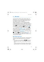
conditions. When the GPS receiver is on,
is displayed. If the
indicator blinks, the GPS receiver is calculating its location.
To activate the GPS receiver and to view available position
information, select
→
→
and
to scroll between the displays.
The first display contains the current geographical coordinates in
WGS-84 format (a geographical coordinate system) and an
estimate of the accuracy of the location. The correct coordinates are
shown only if the GPS receiver receives the needed positioning
information from the GPS satellites.
THR880i_Rel6_en_print.book Page 64 Jeudi, 20. novembre 2008 2:13 14

