7 Collar specifications
7.1 Globalstar Communication
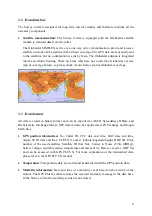
The Globalstar system provides remote data download. Each position data (maximum
2 positions per day) is sent by the collar. If a satellite is in range, data is directly transmitted to
the researcher. If no satellite is in range, data is not transmitted and can only be received from
the collar's non-volatile on-board-memory after the retrieval of the collar.
7.2 Functionality of sensors
7.2.1 GPS Receiver
All positionings are performed with the GPS receiver. Locations are stored with UTC date and
time, LMT date and time, three coordinates (Latitude, Longitude and Height), Dilution of
Precision (DOP) and Navigation status as quality information and number of satellites used
for positioning.
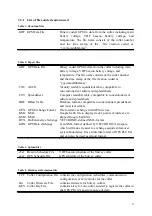
GPS data can be exported to ASCII, Spreadsheet, DBase, GPS Exchange, Google Earth and
BioTelemetry eXchange format (see Table 2 for details). You can easily import the data into
Google Earth to check the area your animal is using.
7.2.2 Mortality Sensor
The mortality sensor measures true acceleration of the animal. If no acceleration is detected
for a user-defined period (e.g. 24 hours), a mortality event is triggered. The mortality period is
user-definable and can set up to 140 hours. When a mortality event is detected an immediate
mortality message is sent. First, this message is sent as email but optionally also as immediate
text message to your mobile phone. In case of mortality, the collar records a GPS position
every 30 minutes for six hours. This way, you will be able to get the information that your
animal has died, even if the mortality message should have been lost.
18
Summary of Contents for Vertex Plus Survey
Page 1: ...VERTEX PLUS Survey Collar Globalstar User s Manual Version 1 6 Last Change 30 08 2016 1...
Page 21: ...21...
Page 22: ...22...
Page 23: ...23...
Page 24: ...24...

