


Copyright © 2019 Xflight Technologies LLC, Florida, USA
37
Q.
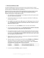
LOGFILE Access
Log files are available via the Mission Planner. This will give you access to many different flight
parameters as well as the ability to view your flight track on Google Earth.
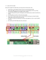
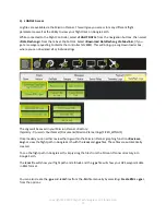
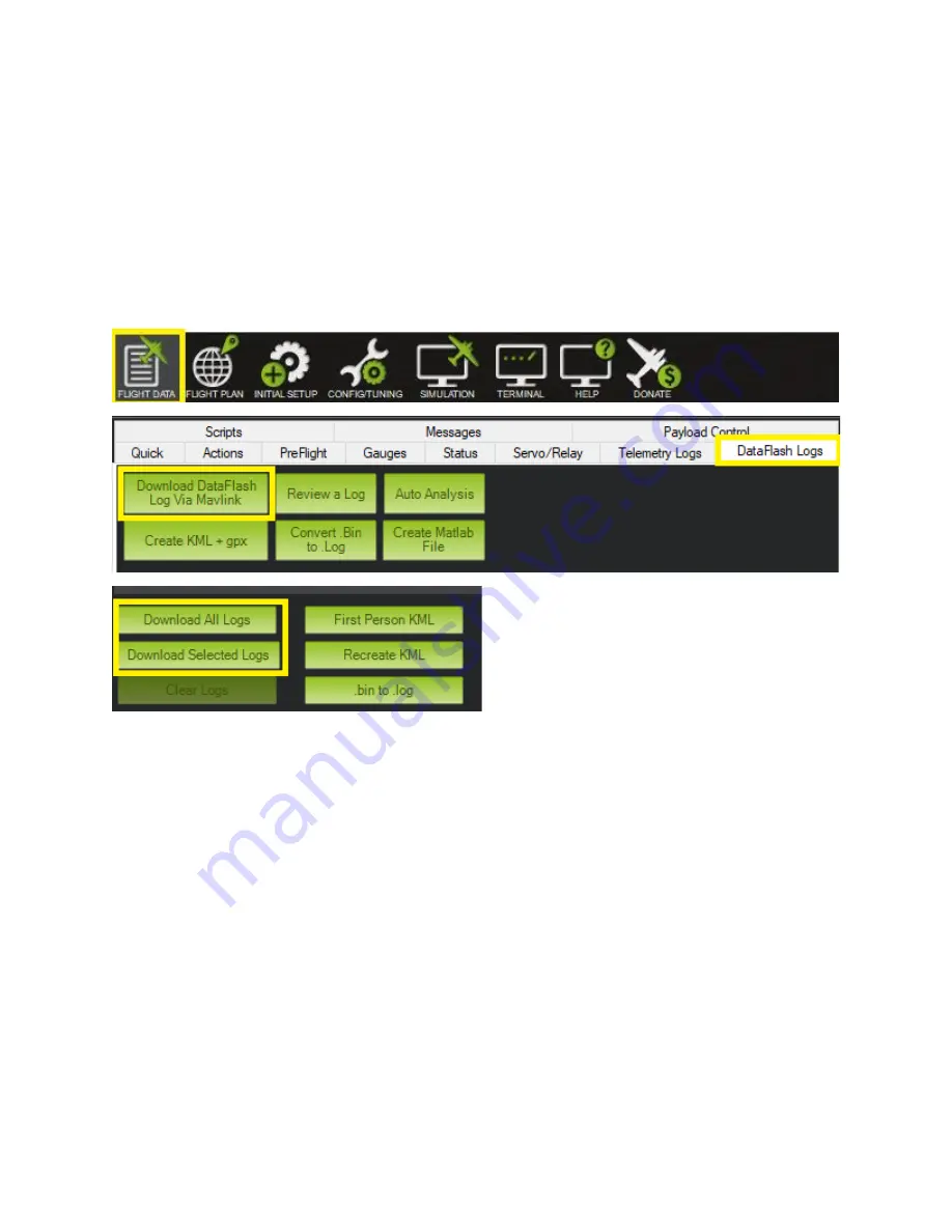
While connected to the Flight Controller, select
<FLIGHT DATA>
from the navigation buttons, then select
<DataFlash Logs>
from the tabs at the bottom. Select
<Download DataFlash Log Via Mavlink>
(if you
get a message requesting to disarm the controller hit
<OK>
). This will bring up a Log Downloader box,
where you can download all or individual logs.
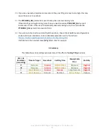
The Logs will be saved in your Mission Planner directory:
(typically - C:\users\<
Your Name
>\Documents\Mission Planner\logs\FIXED_WING\1)
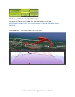
Once loaded you can either review the logs within the Mission Planner graphing function
<Review a
Log>
or view the flight path in Google Earth with the
.kmz
and
.gpx
files. These files are automatically
created.
To see the flight path in Google Earth, simply drag the files from the Mission Planner directory into
Google Earth.
The
.kmz
file will show your flight path and altitude and the
.gpx
file will show your GPS waypoint data
in KML format.
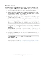
You can also create the
.gpx
and
.kmz
files from the
.bin
file manually by selecting <
Create KML + gpx>
from the options: