ECDIS User manual
22
2.2.10 List of waypoints
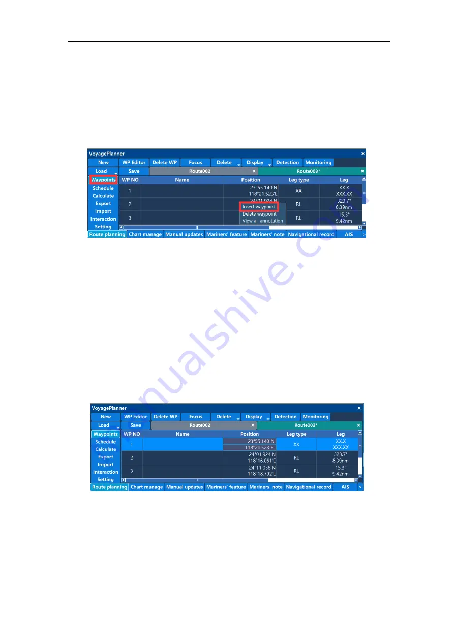
The route is loaded first, and the information of each waypoint of the route will be loaded
into the waypoint list. The waypoint list shows the waypoint name, latitude and longitude,
range type, range, safe distance, steering radius, and so on. Click the left mouse button
to select the entire row, click the right mouse button to pop up the operation menu as
shown:
Select “Insert Waypoint” to insert a new waypoint in the selected row. The default latitude
and longitude coordinates of the waypoint are the coordinates of the center point of the
route segment. Select to delete the waypoint and the waypoint will be deleted.
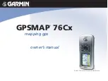
Double-click on a column in the list to enter the editing state. Cells with "XX" and gray
areas are un-editable.
Double-click the waypoint name unit to enter the waypoint name edit, enter the name of
the waypoint via the keyboard, and left click on the location outside the edit zone to exit
the waypoint name edit.
Edit the latitude and longitude coordinates, double click the latitude and longitude items as
shown:
The mouse moves up and down by 5, and the left and right movement changes by 1.
The value can also be adjusted via the up and down keys of the keyboard. After
modifying a value, click the left mouse button to enter the next item of modification. Right
click to enter the modification menu, select Apply Settings to save, or cancel than the
latitude and longitude values will not be changed.
Viewing the comment is that the user can view the navigation note information added by


