background image

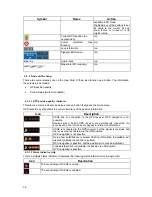
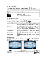
4.1.2.2 3D object types 

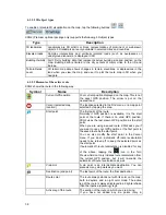
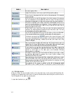
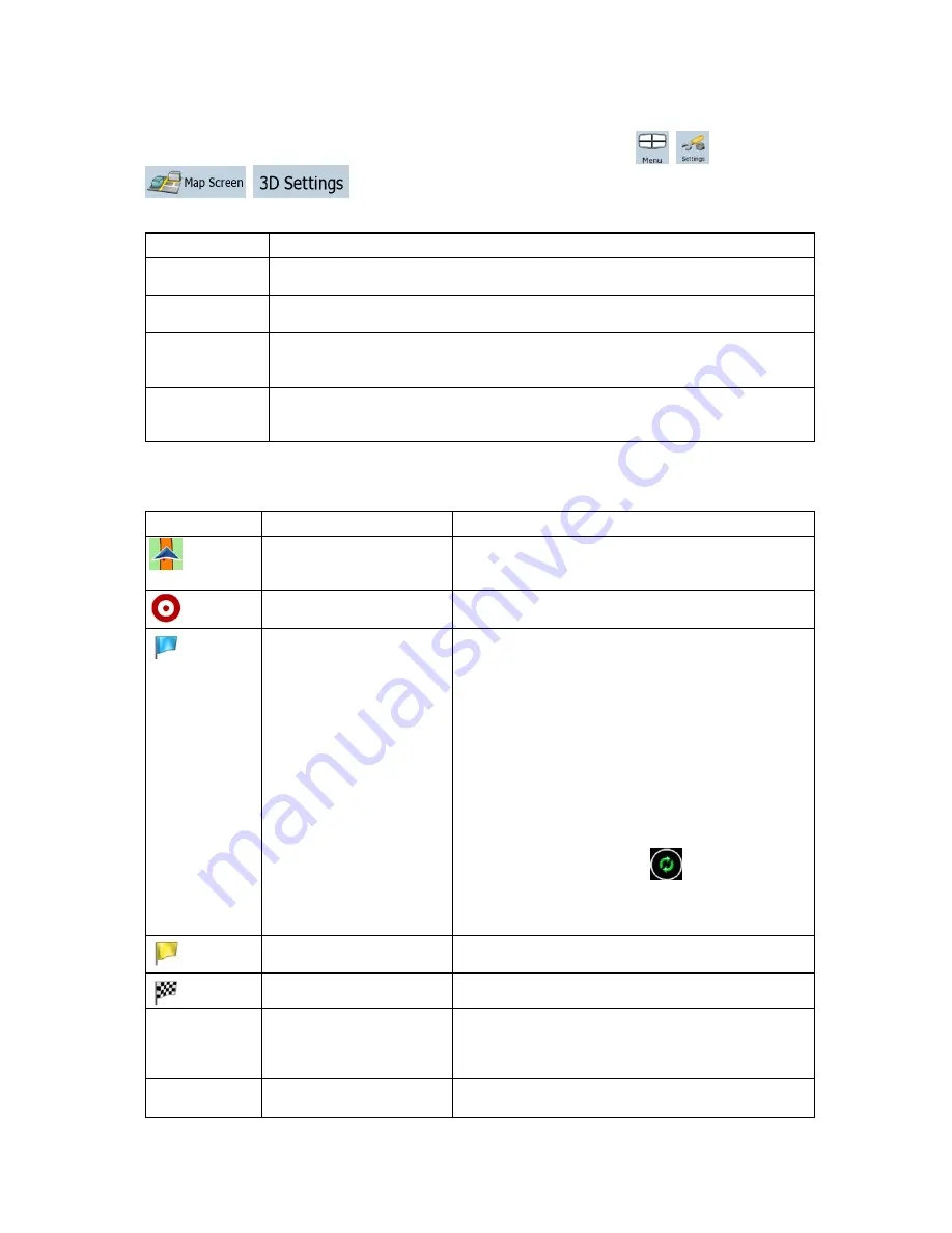
To enable or disable 3D visualization on the map, tap the following buttons: 

XSG2 (Premium optional package only) supports the following 3D object types: 

Type 

Description 

3D landmarks 

Landmarks are 3D artistic or block representations of prominent or well-known 
objects. 3D landmarks are only available in selected cities and countries. 

Elevated roads  Complex intersections and vertically isolated roads (such as overpasses or 

underground tunnels) are displayed in 3D. 

Building Visibility  Full 3D city building data that represents actual building size and position on the 

map. Building data is limited to the city centers of major cities in the US and 
Europe. 

Terrain Detail 
Level 

3D terrain map data shows changes in terrain, elevations or depressions in the 
land when you view the map, and use it to plot the route map in 3D when you 
navigate. 

 
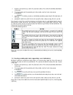
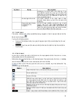
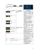
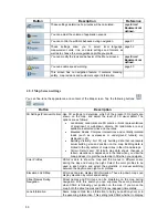
4.1.2.3 Elements of the active route 

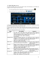
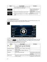
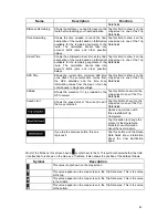
XSG2 shows the route in the following way: 

Symbol 

Name 

Description 


Current GPS position 

Your current position displayed on the map. This is not 
the exact GPS position. The arrow is put on the 
nearest road. 


Cursor (selected map 
location) 

The location selected in the Find menu, or a map point 
selected by tapping the map. 


Start point 

The first point of the route. 
Normally if GPS position is available, it is the start 
point of the route. If there is no valid GPS position, 
XSG2 uses the last known GPS position as the start 
point. 
When you are using a saved route, XSG2 asks you if 
you want to use your GPS position or the first point in 
the saved route as the start point. 
You can also modify the start point in the Cursor 
menu. If you do so, automatic off-route recalculation
needs to be turned off to keep the selected point as 
the start point. 
If automatic off-route recalculation is disabled for any 

of the above, tapping the 

 icon in the Turn 

Preview field not only initiates route recalculation from 
the current GPS position, but it will re-enable the 
automatic off-route recalculation as well. 


Via point 

A  via point is an intermediate destination. You can 
place as many via points as you want. 


Destination (end point) 

The last point of the route, the final destination. 


Route color 

The route always stands out with its color on the map, 
both in daytime and in night color mode. The active 
leg of the route is always displayed in a brighter shade 
than the inactive (upcoming) legs. 


Active leg of the route 

The section of the route on which you are driving. 
If you have not added any via points (only a 

38 


Summary of Contents for XSG2

Page 1: ...User Manual XSG2 Infotainment Center Navigation Software XSG2 English May 2010 ver 1 2 125G2NAVIMN01 1 ...

Page 2: ...otification This manual may not in whole or in part be reproduced or transmitted in any form either electronically or mechanically including photocopying and recording without the express written consent of XiteSolutions B V 2010 XiteSolutions B V Data Source 2006 Tele Atlas N V All rights reserved 2 ...

Page 3: ...escription of the software Please do not operate your navigation while driving or allow it to dstract you We recommend that you read this manual to understand the screens and the features of the XSG2 navigation For the latest in map updates please visit www naviextras com If you have questions or require assistance please contact River Park Inc at navi riverparkinc com 3 ...

Page 4: ...nels 18 2 3 5 Route calculation and recalculation 18 2 3 6 Itinerary 19 2 3 7 Route demonstration 20 2 3 8 POI Points of Interest 20 2 3 9 Speed limit warning 20 3 Navigating with XSG2 21 3 1 Selecting the destination of a route 21 3 1 1 Selecting the Cursor as the destination 21 3 1 2 Entering an address or part of an address 22 3 1 2 1 Entering an address 22 3 1 2 2 Entering an address if house ...

Page 5: ...r strip 36 4 1 1 3 Next two route events Turn Preview fields 37 4 1 2 Objects on the map 37 4 1 2 1 Streets and roads 37 4 1 2 2 3D object types 38 4 1 2 3 Elements of the active route 38 4 1 3 Avoid menu 39 4 1 4 Cursor menu 39 4 1 5 Position menu 40 4 1 6 Route Information screen 41 4 1 7 Trip Information screen 42 4 1 7 1 Trip Computer screen 44 4 1 8 Quick menu 44 4 1 9 GPS Data screen 45 4 2 ...

Page 6: ...4 5 5 Menu settings 53 4 5 7 Warning settings 53 5 Glossary 54 6 End User License Agreement 56 6 ...

Page 7: ...ay only when it is safe to do so If you are the driver of the vehicle we recommend that you operate XSG2 before you start your journey Plan the route before your departure and stop if you need to change something in the route You must obey the traffic signs and follow the road geometry If you deviate from the route that XSG2 recommended XSG2 changes the instructions accordingly For more informatio...

Page 8: ...s on the Map screen you can set or reset the zoom value of the button 2D map Tap and hold any of the buttons on the Map screen you can set or reset the tilt and zoom values of the button 3D map Tap and hold on list and menu screens the Navigation menu appears Tap and hold any of the and buttons on the Map screen you can rotate tilt or scale the map continuously Tap and hold on keyboard screens you...

Page 9: ... without a house number or the names of two intersecting streets page 22 Enter an address with ZIP code page Error Bookmark not defined This way you do not need to select the name of the city and the search for street names might be faster as well Use a coordinate page Error Bookmark not defined Use a saved location a Favorite page Error Bookmark not defined a POI page Error Bookmark not defined t...

Page 10: ...oard Alphabetic and alphanumeric keyboards to enter text and numbers Each key is a touch screen button 2 1 1 Using keyboards You only need to enter letters or numbers in the XSG2 when you cannot avoid it You can type with your fingertips on the full screen keyboards and you can switch between various keyboard layouts for example ABC QWERTY or numerical Task Details Tap and select from the list of ...

Page 11: ...dinate and the list of nearby POIs will be displayed You can check the details of any other location by selecting it on the map 1 Tap the map anywhere to open the map control buttons 2 Tap the desired location on the map The Cursor appears there The address of the location is displayed at the bottom of the map 3 For further details tap to open the Cursor menu 4 Tap The address the coordinate and t...

Page 12: ...r maps that let you see the map at various zoom levels always with optimized content It always displays street names and other text with the same font size never upside down and you only see the streets and objects that you need Map scaling has different limits in 2D and in 3D map view modes Tilting up and down Changes the vertical view angle of the map in 3D mode Rotating left and right Changes t...

Page 13: ...om levels to fixed predefined values Smart Zoom is disabled These buttons are available in 3D mode Tap hold any of the buttons to set its value to the current tilt and zoom levels or to reset it to its original value Map scale XSG2 shows the scale of the map in 2D mode 2 2 3 Lane information and Signposts When navigating on multilane roads it is important to take the appropriate lane in order to f...

Page 14: ... available and you navigate the recommended route This area gives you information about the type and distance of the next route event Tap this area to open the Route Information screen The following area appears next to the above described rounded area When tapping this area the result depends on the information currently shown Icon Information Details Action There is no valid GPS position If ther...

Page 15: ...ormation There are time values that can be shown Current GPS time Time remaining to reach the destination Time remaining to reach the next via point Estimated arrival time at the destination Estimated arrival time at the next via point Distance information There are distance type values that can be shown Distance remaining to reach the destination Distance remaining to reach the next via point Cur...

Page 16: ...address and coordinate information of the Cursor and the list of POIs near it 2 3 XSG2 concepts 2 3 1 Smart Zoom Smart Zoom provides much more than just a usual automatic zoom feature While following a route calculated by XSG2 when approaching a turn it will zoom in and raise the view angle to let you easily recognize your maneuver at the next junction If the next turn is at a distance it will zoo...

Page 17: ...you move the map while you are driving XSG2 continues navigating if there is an active route it plays the voice instructions and displays the turn preview icons according to your current GPS position 2 3 2 3 Selected location Cursor If you select a location in the Find menu or you tap the map when the map control buttons are visible the Cursor appears at the selected point on the map XSG2 displays...

Page 18: ...can also switch automatically between the daytime and the night scheme based on the current time and GPS position a few minutes before sunrise when the sky has already turned bright and a few minutes after sunset before it becomes dark 2 3 4 Color scheme in tunnels When entering a tunnel the colors of the map change All buildings disappear the large objects such as surface waters or forests and th...

Page 19: ...ns on the Itinerary screen Button Description Any of the list items Opens the map with the selected maneuver in the middle Changes the detail level of the Itinerary The levels are as follows Detailed Instructions all intersections are listed Itinerary only significant intersections the ones announced in voice guidance are listed Road list the list of the roads used while navigating the route Moves...

Page 20: ...ave your own POI you can select an icon for it independently of the POI category you have put it in Saving POIs To save a POI place the Cursor at the desired location then tap the following buttons Managing POIs You can select which POI groups to show and which ones to hide on the map and from which zoom levels POI icons are visible At the same place you can manage your saved POIs A saved POI can ...

Page 21: ...address with ZIP code page Error Bookmark not defined This way you do not need to select the name of the city and the search for street names might be faster as well Use a coordinate page Error Bookmark not defined Use a saved location a Favorite page Error Bookmark not defined a POI page Error Bookmark not defined the History of previously set destinations and waypoints page Error Bookmark not de...

Page 22: ... street any of the above starting the search with the ZIP code page Error Bookmark not defined 3 1 2 1 Entering an address The parts of the address are shown on buttons Start reading from the top and if you want to change any of them tap the button The procedure is explained starting from the Navigation menu 1 Tap the following buttons 2 By default the XSG2 proposes the country state and city wher...

Page 23: ...ng the address 6 The map appears with the selected point in the middle Tap from the Cursor menu The route is then automatically calculated and you can start navigating 3 1 2 2 Entering an address if house numbering is restarted There are long roads where house numbering is restarted at some point This way the same house number can appear twice or even more times on the same road If this is the cas...

Page 24: ...hen automatically calculated and you can start navigating 3 1 2 3 Entering an address without knowing the district suburb Long roads can run across several districts or suburbs You may not know what particular house number is located where In this case follow the instructions below The procedure is explained starting from the Navigation menu 1 Tap the following buttons 2 By default XSG2 proposes t...

Page 25: ...ing an intersection as the destination The procedure is explained starting from the Navigation menu 1 Tap the following buttons 2 By default XSG2 proposes the country state and city where you are If needed tap the button with the name of the country state and select a different one from the list 3 If needed change the city To select the city from the list of recently used ones tap the button To en...

Page 26: ... it is an important intersection The procedure is explained starting from the Navigation menu 1 Tap the following buttons 2 By default XSG2 proposes the country state and city where you are If needed tap the button with the name of the country state and select a different one from the list 3 If needed change the city To select the city from the list of recently used ones tap the button To enter a ...

Page 27: ... keyboard 3 Tap to finish entering the address 6 The map appears with the selected point in the middle Tap from the Cursor menu The route is then automatically calculated and you can start navigating 3 1 2 7 Tips on entering addresses quickly When you are entering the name of a city or a street XSG2 only displays those characters that appear in possible search results The other characters are gray...

Page 28: ...POI should be searched for The POI will be searched for around a given address The map appears with the Cursor in the middle Modify the location of the Cursor if necessary then tap The POI will be searched for around the given location The POI will be searched for around the current GPS position The POI will be searched for around the destination of the active route The POI will be searched for no...

Page 29: ...ier destinations 3 Tap the desired item 4 The map appears with the selected point in the middle Tap from the Cursor menu The route is then automatically calculated and you can start navigating 3 1 6 Selecting the destination by entering its coordinates The procedure is explained starting from the Navigation menu 1 Tap the following buttons 2 optional Tap to change the format of the displayed coord...

Page 30: ...omes the destination the destination becomes the start point and all via points are to be reached in the opposite order than before The route is optimized The start point and the destination remain at their position but the via points are reordered to make the shortest possible route The selected point is removed from the route The route remains as it was before adding the new point Every time a n...

Page 31: ...der than before The route is optimized The start point and the destination remain at their position but the via points are reordered to make the shortest possible route The selected point is removed from the route As soon as you leave this screen the route is recalculated automatically and you can start navigating right away 3 5 Watching the simulation of the route The procedure is explained start...

Page 32: ...s Note If via points exist in the active route you cannot delete the route immediately on the Route Information screen Tap repeatedly until all via points disappear and the button appears Tap it to cancel the whole route 3 10 Saving a route The procedure is explained starting from the Map screen 1 Tap the following buttons 2 Enter a name for the saved route and then tap When you save a route XSG2 ...

Page 33: ...ferent from the current GPS position you need to confirm whether you want to stop navigating from the current GPS position to use the start point of the loaded route If you choose this option automatic off route recalculation will be disabled If you choose to keep the current GPS position as the start point the route will be recalculated starting from your current position 4 The map appears and yo...

Page 34: ...ample the map layout during navigation the used languages or the warnings 4 1 Map screen XSG2 is primarily intended for land navigation That is why maps in XSG2 look similar to paper road maps However XSG2 provides much more than regular paper maps you can customize the look and the content of the map The most important and most often used screen of XSG2 is the Map screen During navigation the scr...

Page 35: ...right Tilt up tilt down Tilts the 3D map Zoom in zoom out Scales the map Return to GPS position appears when GPS position nt GPS position rotation is is available and you have moved the map Tap this button to move the map back to the curre If the map has been rotated in 3D mode automatic map also re enabled Enable Smart Zoom replaces there is no GPS position or the map has not been moved the previ...

Page 36: ...ccuracy of the position information Icon Description l circumstances XSG2 has no connection to the GPS receiver GPS navigation is not possible Devices with a built in GPS receiver are permanently connected On ppear in norma such devices the icon does not a XSG2 is connected to the GPS receiver but the signal is too weak and the receiver cannot determine the GPS position GPS navigation is not possi...

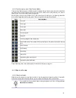
Page 37: ...n right Turn back Bear right Turn sharp left Keep left Continue straight in the intersection Enter traffic circle The number of the exit is shown in the circle but only for the next turn Enter freeway Exit freeway Board ferry Leave ferry Approaching the next via point Approaching the destination These fields may show other useful pieces of information Please see page 14 4 1 2 Objects on the map 4 ...

Page 38: ...on selected in the Find menu or a map point selected by tapping the map Start point The first point of the route Normally if GPS position is available it is the start point of the route If there is no valid GPS position XSG2 uses the last known GPS position as the start point When you are using a saved route XSG2 asks you if you want to use your GPS position or the first point in the saved route a...

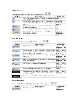
Page 39: ...he next intersection If you have used the above function before tap this button to clear the restrictions from the map 4 1 4 Cursor menu As soon as you select one point in the Find menu the map appears with the Cursor menu a menu with possible actions for the selected point Alternatively when you tap the map control buttons appear Tap again to place the Cursor a radiating red dot Now tap and the C...

Page 40: ... the results and choose one of the routes to navigate The Cursor becomes the start point of the route This means that the route is not started from the current GPS position and Automatic Off route Recalculation needs to be turned off to keep the selected point as the start point If the Cursor is at or near the selected start point this button replaces the previous one and deletes the start point f...

Page 41: ...o via point information Estimated Arrival Shows the estimated arrival time at the final destination of the route based on information available for the remaining segments of the route The calculation cannot take into account traffic jams and other possible delays Tap this field to change the content of all data fields to via point information Distance Left Shows the distance you need to travel on ...

Page 42: ...n the screen all route data fields contain information about reaching your final destination Tap and the fields concerning your route display data for the next via point Tap the button repeatedly to toggle between the two options You have the following data and functions on this screen Name Description Function or Shows whether the route data fields show information about the final destination che...

Page 43: ... Regional settings Tap this field to show it on the map screen in one of the Trip Data fields Altitude Shows the elevation if it is provided by the GPS receiver Tap this field to show it on the map screen in one of the Trip Data fields Speed Limit Shows the speed limit of the current road if the map contains it Tap this field to show it on the map screen in one of the Trip Data fields Opens a new ...

Page 44: ...ugh all trips 4 1 8 Quick menu The Quick menu is a selection of controls that are frequently needed during navigation It can be opened directly from the Map screen by tapping If you tap any of the switches in the Quick menu the Map screen immediately returns Name Main function single tap Function tap and hold If you only adjust the volume you need to use this button to return to the Map screen Ope...

Page 45: ...Since the device has a built in GPS receiver this status should not appear under normal circumstances Green blinking XSG2 is connected to the GPS receiver Yellow blinking XSG2 has no connection to the GPS receiver but it is still trying to establish a connection Red blinking GPS connection quality indicator XSG2 has no connection to the GPS receiver and is not trying to establish a connection Sky ...

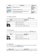
Page 46: ...a page Error Bookmark not defined You can browse the driving instructions that XSG2 follows during navigation You can exclude maneuvers or streets to adjust the route to your preferences page Error Bookmark not defined You can modify the route remove route points or change their order page Error Bookmark not defined Erase the active route with all its route points start point via points and destin...

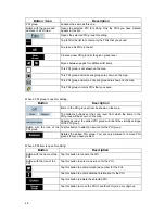
Page 47: ...oute for editing Deletes the selected route Clears the list of saved routes Moves between pages for additional list items 4 4 2 Manage History You can manage the list of locations you used lately Tap the following buttons Button Description Deletes the selected item in the History Deletes the entire History Moves between pages for additional list items 4 4 3 Manage POIs You can manage your POIs an...

Page 48: ...n Description Items in the POI group will not be shown on the map The distance buttons set the zoom level from which the items in the POI group will be shown on the map Subgroups under the edited POI group will inherit the visibility settings of the POI group Button with the icon of the POI group Tap this button to select a new icon for the POI group Deletes the edited POI group You are only allow...

Page 49: ...he current settings will be saved on the inserted memory card There is always one backup file If you perform a backup later the previous backup will be overwritten with the new information Restore User Data All user data and settings will be overwritten with the information stored in the backup file Data and settings created after the latest backup will be lost Delete User Data All user data will ...

Page 50: ...ed Roads Complex intersections and vertically isolated roads such as overpasses or underground tunnels are displayed in 3D Building Visibility Full 3D city building data that represents actual building size and position on the map Building data is limited to the city centers of major cities in the US and Europe Terrain Detail Level 3D terrain map data shows changes in terrain elevations or depress...

Page 51: ...distance Overview is a zoomed out 2D view to let you see the surrounding area You have the following controls for Automatic Overview Turn Distance for Overview The map view will be switched to Overview mode if the next route event is at least as far as this value Default Zoom Level Overview mode will appear with this zoom level You can scale the map in Overview mode but next time Overview appears ...

Page 52: ...as the smallest total distance of all possible routes between the route points Usually practical for slow vehicles Economical Combines the benefits of Fast and Short XSG2 calculates as if it were calculating the Fast route but it takes other roads as well to save fuel Easy Results in a route with fewer turns With this option you can make XSG2 to take for example the freeway instead of series of sm...

Page 53: ...lease note that the GPS clock is only available with GPS reception This allows you to check whether any correction is needed 4 5 5 Menu settings You can modify the look and behavior of the Menu screens Tap the following buttons Button Description Background You can choose the image to be used as the menu background image 4 5 7 Warning settings You can enable speed warning Tap the following buttons...

Page 54: ... the city but an arbitrary point the map creators have chosen In towns and villages it is usually the most important intersection in larger cities it is an important intersection GPS accuracy Several factors have impact on the deviation between your real position and the one given by the GPS device For example signal delay in the ionosphere or reflecting objects near the GPS device have a differen...

Page 55: ...oint is the final destination and the route is cut into different legs from one destination to the next Scheme XSG2 comes with different color schemes for the map for daytime or night use Schemes are custom graphic settings for the map and they can have different colors for streets blocks or surface waters in 2D and 3D modes and they display shades or shadows in different ways in 3D mode One dayti...

Page 56: ...2 The Software Product shall include the operating computer program its complete documentation the map database pertaining thereto and any third party content and XSG2 accessible through the Software Product hereinafter Database 4 3 Any form of display storage coding including printed electronic or graphic display storage source or object code or any other as yet undefined form of display storage ...

Page 57: ...t and at his her own risk It is strictly prohibited to store to transfer or to distribute these data or contents or to disclose them in full or in part to the public in any format or to download them from the product 8 No warranty or limitation of responsibility 8 1 The Licensor hereby informs the User that although the greatest care was taken in producing the Software Product given the nature of ...

Page 58: ...t and for any content or XSG2 provided by a third party by using the Database The Licensor does not warrant the quality suitability accuracy fitness for a specific purpose or territorial coverage of the product or XSG2 or the availability of the XSG2 and it specifically excludes any liability for the suspension of the XSG2 and any damage arising in relation to the XSG2 or for complete cancellation...

Reviews: