SonTek RS5 User Manual (August 2020) 68
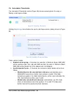
Figure 45. Site Information
7.5.4 Compass Calibration
When making a discharge measurement using the RS5, the system’s internal compass
is used to provide the instrument’s heading as it moves across the channel. The RS5
internal (magnetic) compass must be calibrated prior to data collection. Users familiar
with the M9/S5 compass calibration will recognize the steps outlined below, as the
procedure for calibrating the compass for those systems is the same as for the RS5.
A proper user-performed compass calibration at the field measurement site prior to
collecting data is a critical step for avoiding heading errors during the measurement, as
the compass calibration is used to compensate for localized magnetic interference in
the vicinity of the instrument. If heading errors are observed during the measurement,
then a review should be performed of the methodology used for the compass
calibration, and of the local surroundings where the calibration was performed for
potential sources of magnetic interference, in order to locate the cause(s) of the heading
errors.
A primary consideration is that the internal (magnetic) compass calibration is designed
to be representative of the conditions that will be experienced during the actual
measurement. When calibrating the compass, the RS5 should be rotated through two
complete circles while varying the pitch and roll smoothly through the greatest tilt angles
possible and practical. The keys to a proper compass calibration are slow rotations in a
relatively low magnetic field, using pitch and roll angles similar to what will be
experienced on the boat or floating platform during the actual data collection. For
example, if the measurement will be performed at a site with flat surface water
conditions, then a compass calibration using smaller pitch and roll angles may be
sufficient (but NOT totally flat). However, if the boat or floating platform will be
experiencing large pitch and roll angles during the measurement, then the calibration
needs to be performed using large pitch and roll angles during the rotations. If smaller
pitch and roll angles are used during the compass calibration procedure than what will
be experienced during the actual measurement, there will be the potential for significant
heading errors. Conversely, calibrating the compass using significantly large pitch and
roll angles and then making the actual measurement where very small pitch and roll
angles will be experienced could also lead to heading errors.
In addition, the pitch and roll angles applied during the calibration should be done at a
relatively slow rate (such as what one might use when operating/panning a video
camera). Varying the pitch and roll angles too quickly or erratically will cause the RS5’s
internal accelerometers to report unrealistic heading values for a given calibration point,
resulting in significant calibration errors.
Summary of Contents for Sontek River Surveyor RS5
Page 1: ...RS5 USER MANUAL XA00125...


