24
3.43 Tips for Navigation
Remember, once the vehicle begins its mission and is out of WiFi range, it is completely autonomous; the mission
cannot be stopped or altered unless the user can reestablish a WiFi connection.
• Begin and end the vehicle’s mission within WiFi range for simple retrieval.
• Remember that the vehicle will behave based on the programming of its next assigned waypoint. For
example, if ‘WP 32’ is programmed at 4 knots and 3 feet Depth from Surface and the vehicle is at the surface
at ‘WP 31,’ as soon as the AUV passes ‘WP 31’ it will dive and travel the line at 4 knots and 3 feet in order to
arrive at ‘WP 32’ at its programmed settings.
• Allocate extra waypoints and edit them accordingly at sharp turns where the vehicle will surface and then
submerge again. If you program a vehicle to travel a long line perpendicular to the shore, but you want it to
surface at the end of the line to reacquire a GPS fix, take these steps to ensure accurate arrival.
-At the end of a long line before a sharp turn, add an extra WP with the settings you wish to fly that line.
-Immediately after that WP, in the same straight line, program the vehicle to surface to make the turn.
-Add an extra WP in the turn for the vehicle to turn towards before it dives in the next line of the grid.
-Repeat this process in each sharp grid turn to optimize the vehicle’s flight pattern.
-The end result of this process should have three WPs in sharp turns.
*The first (receiving) WP at the average survey level.
*The second (middle) WP at the surface for a GPS fix.
*The third (sending) WP in line with the far WP at the average survey level.
• Try to check areas of potential obstructions such as bridges. A quick visual check of piling locations betters
your odds of missing them and similar obstructions.
• If you operate the AUV in a busy watercraft traffic area, try to conduct surveys when traffic will be lower.
• Although the AUV navigates very efficiently underwater, it is prudent to have the vehicle surface occasionally
to acquire a GPS fix for optimal performance. This should be considered especially when the survey is in an
area with any significant current.
• The AUV can only be successful in environments that fall within its performance range; do not program the
vehicle to travel upstream in a current faster than 4 knots.
3.44 Waypoint Information
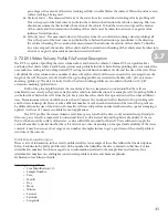
You may view statistical information on a specific WP at any time during mission planning and execution.
WP: Box displays which WP number’s information is being displayed (can be
changed by clicking the black arrow for a dropdown menu).
• Lat: Exact latitude of WP.
• Long: Exact longitude of WP.
• Time: Estimation of how long it will take the vehicle to reach the WP
(hours:mins:secs).
• Dist: How far the vehicle has traveled when it reaches the WP.
• Power: How much energy is expended to reach the WP from the previous
WP.
When the vehicle is on a mission, the information does not stream live but is an estimate of vehicle statistics.
The information will remain the same throughout mission execution even if the vehicle deviates from the planned
course.
NOTE
3.4


