32
3.64 Live Tracking
VectorMap allows users to track a vehicle on the surface by plotting GPS coordinates
from the vehicle throughout a mission. In order to live track a vehicle, the vehicle must
be on the surface and within WiFi range. If the vehicle dives or leaves WiFi range, the
connection will time out and disconnect. In order to enable and view live tracking,
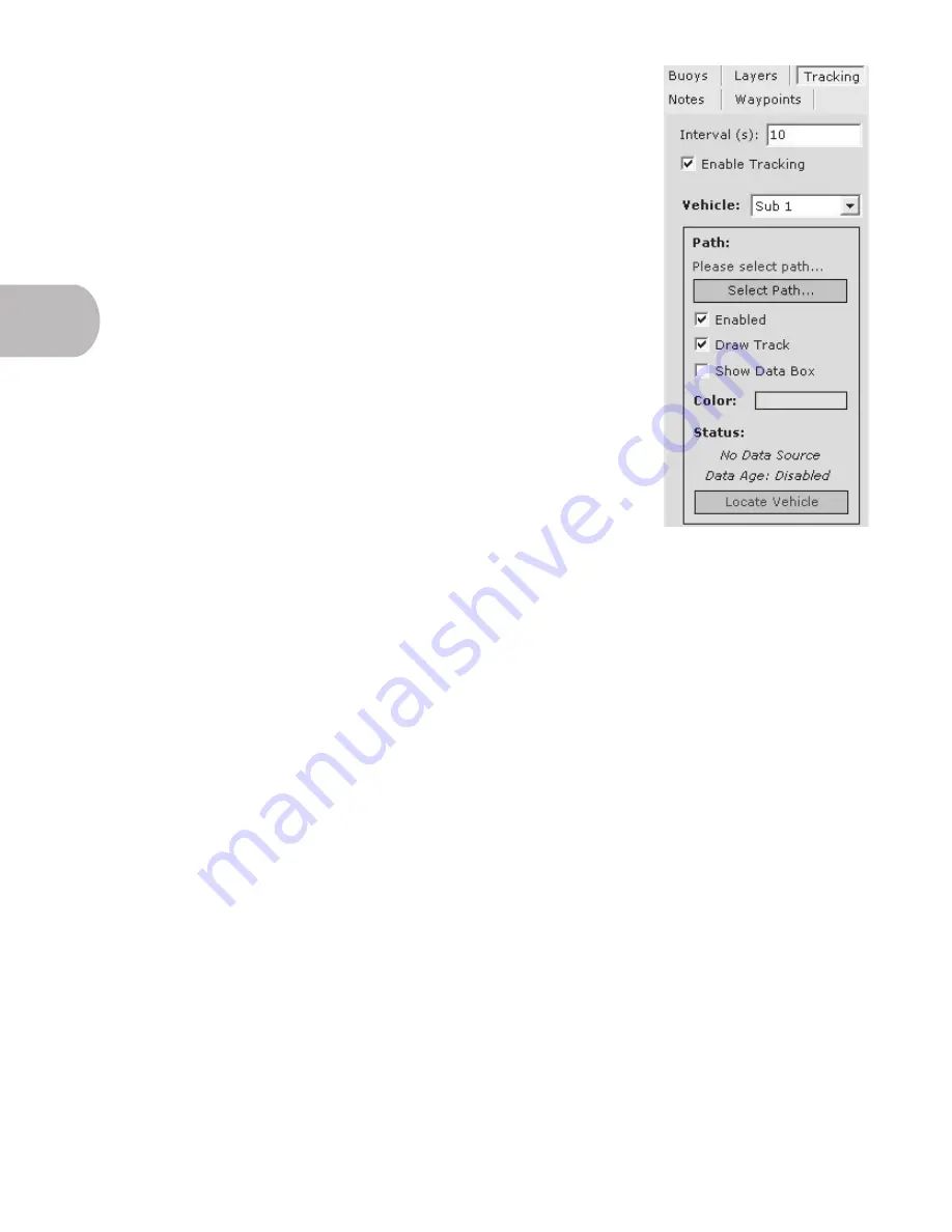
click the ‘Tracking’ tab in the Tools panel.
• Interval -
How often the vehicle receives updated information from the AUV
(in seconds).
• Enable Tracking
- Turns tracking on or off.
• Vehicle -
Allows the user to choose up to five vehicles and select which
vehicle’s path VectorMap should display.
• Path -
Allows the user to choose to enable this function, draw the track or
show the data box with information currently being processed by the vehicle.
• Select Path -
The user will click this button to browse to the
vehicle’s shared
log folder
and select the appropriate log for VectorMap to display. The vehicle
must be in WiFi range for these functions to work.
• Locate Vehicle -
Searches for the vehicle over WiFi to begin Tracking.
3.65 Video Cameras and Buoys
These options are currently not available on the EcoMapper AUV, but will be options
in the future. As a result, you will occasionally encounter icons, tabs, and instructions
that utilize these functions. The functions are, at this point in time, inoperable due to lack of hardware on the current
vehicle, but will come online as the EcoMapper evolves.
3.6


