background image

70 


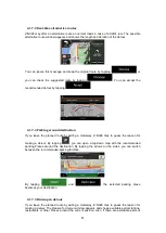
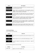
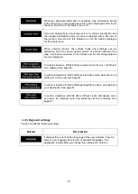
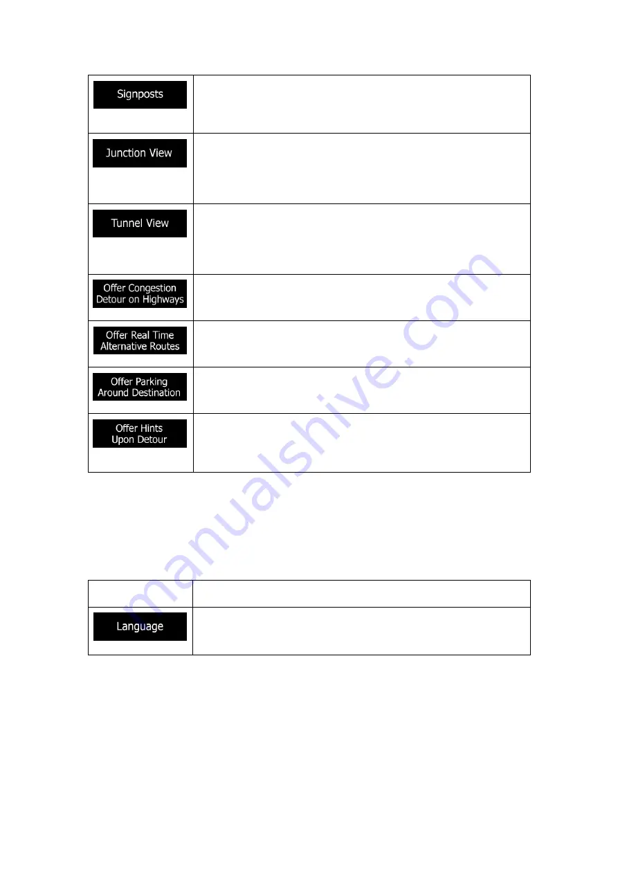
Whenever adequate information is available, lane information similar 

to the real ones on road signs above the road is displayed at the top of 

the map. Tap it to turn this feature on or off. 


If you are approaching a motorway exit or a complex intersection and 

the needed information exists, the map is replaced with a 3D view of 

the junction. Tap it to turn this feature on or let the map be displayed 

for the whole route. 


When entering tunnels, the surface roads and buildings can be 

disturbing. Tap it to show a generic picture of a tunnel instead of the 

map. A top-down overview of the tunnel and the remaining distance 

are also displayed. 


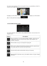
In certain situations, Z-N326 offers a detour when there is a traffic jam 

on a highway. See page 59.  


In certain situations, Z-N326 offers an alternative route when there is a 

traffic jam on the road. See page 61. 


In certain situations, Z-N326 offers parking Places when you approach 

your destination. See page 61. 


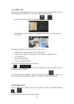
In certain situations, Z-N326 offers different route alternatives when 

you leave the planned route and suddenly exit the motorway. See 

page 61. 


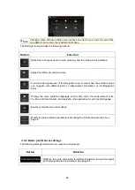
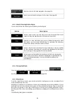
4.3.5 Regional settings  

You can modify the following settings: 
 

Button 

Description 


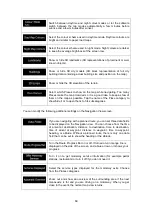
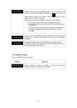
It displays the current written language of the user interface. Tap it to 

select a new language from the list of available languages. The 

application restarts after you change this setting and confirm it. 

Summary of Contents for Z-N326

Page 1: ...2 DIN NAVIGATION USER MANUAL EN Z N326 ...

Page 2: ...orway services 19 1 3 11 3D object types 19 1 4 Navigation menu 20 2 Warnings and safety information 23 3 Using the navigation 24 3 1 Selecting a destination 24 3 1 1 Using combined search 24 3 1 2 Selecting an address 27 3 1 2 1 Entering an address 27 3 1 2 2 Selecting a town centre 29 3 1 2 3 Selecting the midpoint of a street 30 3 1 2 4 Selecting an intersection in a town 31 3 1 2 5 Using the p...

Page 3: ...a saved location 54 3 5 Running a Simulation 55 3 6 Off road navigation 56 3 6 1 Switching to off road navigation 56 3 6 2 Selecting the destination in off road mode 56 3 6 3 Navigating in off road mode 56 4 Reference guide 58 4 1 Concepts 58 4 1 1 2D 3D GPS reception 58 4 1 2 Natural and TTS voices 58 4 1 3 Route calculation and recalculation 58 4 1 4 Smart Zoom 59 4 1 5 Speed limit warning 59 4 ...

Page 4: ...lay settings 71 5 Troubleshooting 72 5 1 GPS signal cannot be received 72 5 2 Address cannot be found 72 5 3 The calculated route is not optimal 72 5 4 Disabling the speed limit warning 73 5 5 Keyboard buttons are greyed out 73 5 6 The map is hidden behind an image of a junction 74 6 Copyright note 75 ...

Page 5: ...rge When you start using the product you can download new maps in the next 1 year 1 1 Initial set up When using the navigation software for the first time an initial set up process starts automatically 1 Select your preferred language then tap to confirm your selection Later you can change it in Regional settings page 70 2 Read the end user licence agreement and tap if you agree with the terms of ...

Page 6: ...o continue 5 If needed modify the time format and unit settings Later you can change them in Regional settings page 70 Tap to continue 6 If needed modify the default route planning options Later you can change them in Route Preferences page 64 Tap to continue 7 The initial set up is now complete tap to enter the Navigation view ...

Page 7: ... value can be changed After the change the new value is shown on the button Tap it once List Shows multiple options Grab the list anywhere and slide your finger up or down Depending on the speed of sliding the list scrolls fast or slow only a bit or till the end Switch Shows whether a feature is enabled when there are only two choices Tap it to turn the switch on or off Slider When a feature can b...

Page 8: ...use the controls 1 2 2 Using the cursor You can select a map location in the following ways By tapping the map when navigating By tapping the map when you are asked to confirm the destination at the end of a search When a map location is selected the cursor appears at the selected point on the map The location of the cursor can be used as the destination of the route you can search for Places arou...

Page 9: ...he keyboard Tap to remove the unnecessary character s Tap and hold the button to delete several characters or the entire input string Entering a space for example between a first name and a family name or in multi word street names Tap the button at the bottom centre of the screen Entering upper and lower case letters By default when entering a text the first character appears in upper case while ...

Page 10: ...ng button on keyboard screens to quickly delete several characters Dragging Drag the screen in the following cases To move the handle on a slider To scroll a list grab the list anywhere and slide your finger up or down Depending on the speed of the sliding the list scrolls faster or slower only a bit or till the end To move the map in map browsing mode grab the map and move it in the desired direc...

Page 11: ...to modify the view in a large step or tap and hold the button to modify it continuously and smoothly Tilting up and down Change the vertical view angle of the map in 3D mode Tap once to modify the view in a large step or tap and hold the button to modify it continuously and smoothly Rotating left and right Changes the horizontal view angle of the map Tap once to modify the view in a large step or ...

Page 12: ...326 works with digital maps which are not simply the computerised versions of traditional paper maps Similarly to paper road maps the 2D mode of digital maps shows you streets and roads Elevation is also illustrated in colour The navigation view displays the following screen buttons data fields and route information on the map during navigation Note Some buttons fields or icons may not be availabl...

Page 13: ...ows the type of the next manoeuvre and its distance See page 15 6 Second next turn preview It shows the type of the second next manoeuvre if it is near the first one See page 15 7 Next street It displays the name of the next street See page 15 If you have not selected a route destination you can see nearby house numbers if they are available 8 Parking around destination It appears near the destina...

Page 14: ...replaced with a generic tunnel image See page 18 1 3 1 Streets and roads Z N326 shows the streets similarly to paper road maps Their width and colours correspond to their importance you can easily tell a motorway from a small street 1 3 2 GPS position markers When your GPS position is available Z N326 marks your current position By default this marker is a blue arrow The dot near the arrow shows t...

Page 15: ...avigated route Whenever the destination is set the route is active until you delete it reach your destination or suspend navigation Z N326 displays the route in the following ways Symbol Name Description Current GPS position and starting point It is your current position displayed on the map If a vehicle is selected for route calculation and roads are near the arrow jumps to the nearest road Norma...

Page 16: ... Manoeuvre icons During navigation the next manoeuvre is displayed in the top left corner Most of the manoeuvre icons are intuitive The following table lists some of the frequently shown route events Icon Function Turn left Turn right Turn back Bear right Turn sharp left Keep left Continue straight in the intersection Enter the roundabout and take the first exit next manoeuvre Enter the roundabout...

Page 17: ...ignposts If necessary information is available Z N326 displays signposts at the top of the map The colour and style of the signposts are similar to the real ones you can see above roads or by roadsides They show the available destinations and the road numbers All signposts look similar when cruising when there is no planned route During navigation only the signpost that points to the lane s to be ...

Page 18: ...urrently displayed junction and return to the Navigation view tap the picture Junction view can be turned off in See page 68 1 3 9 Tunnel view When entering a tunnel the map is replaced with a generic tunnel image so that surface roads and buildings cannot distract you The top down overview of the tunnel displayed in a separate window helps you orientate yourself The remaining distance in the tunn...

Page 19: ...w service stations you can change the icons in See page 68 1 3 11 3D object types Z N326 supports the following 3D object types Type Description 3D terrain Z N326 displays 3D hills and mountains in the Navigation view and illustrates them by colouring and shading on the 2D map Elevated roads Elevated roads are complex intersections and vertically isolated roads such as overpasses or bridges displa...

Page 20: ...k up your recent destinations from the History Build your route from one or more route points You can also plan a route independently of your current GPS position by setting a new starting point Access additional options and check navigation related information Customise the way the navigation software works The About section provides you with product information Read the Software and Database End...

Page 21: ...point route In the navigation menu you have the following additional options Button Function Open the Saved Locations screen where you can save a location as a favourite destination or edit a saved location Set the volume or mute the navigation Switch to 2D 2D North up view or back to 3D mode Suspend navigation Resume navigation Access the User profiles menu where you can create new profiles or ed...

Page 22: ... menu The More button appears on the screen to display additional features Tap it to open the list of additional features on certain screens Tap the Back button to return to the previous screen You can also press and hold this button to quickly return to the Navigation view from any other screen ...

Page 23: ...t track you It is important to look at the display only when it is safe to do so If you are the driver of the vehicle we recommend that you plan and review your route before you start your journey Plan the route before your departure and stop if you need to change the route You must follow the traffic rules If you deviate from the planned route Z N326 changes the instructions accordingly ...

Page 24: ...n You can choose your destination by selecting one of the following options Using combined search to search among different destination types at once see page 24 Entering a full address or a part of an address for example a street name without a house number see page 27 Selecting a Place as your destination see page 33 Selecting a previously saved location as your destination see page 39 Selecting...

Page 25: ...rs a If the new search area is in a different country start entering the country and the town It is usually enough to type the first few letters of the country or town and conventional abbreviations can also be used b Tap to see the whole list of the matching results 5 With the proper search area displayed start entering the name address or category of the destination you are looking for 6 Tap to ...

Page 26: ...he results from one provider only Look for the provider logos Tap one of them to see Places from that provider Tip To search for an intersection in the combined search enter the names of the streets connected by the sign You do not need to use spaces before and after the separator character For example you can find the intersection of Collins Street and Douglas Avenue by entering strings like Coll...

Page 27: ...nt of a street see page 30 An intersection see page 31 Any of the above starting the search with the postal code see page 32 3 1 2 1 Entering an address To enter an address as the destination perform the following steps 1 Tap on the Navigation view to access the Navigation menu 2 Tap and 3 By default Z N326 proposes the country and town where you are or in case there is no valid GPS position the c...

Page 28: ...estions c Otherwise start entering the first few letters of the town The names that match the string appear in a list d To open the list tap and select the town 5 Enter the street name by performing the following steps a Tap the Street name field b optional On the Select Street screen you can immediately select a street from the list of suggestions c Otherwise start entering the street name on the...

Page 29: ...n also select a nearby point on the map or tap to select a different destination 9 The route is calculated and the map appears showing the entire route where you can check route information and route alternatives Tap to modify the route parameters or tap to start your journey 3 1 2 2 Selecting a town centre The town centre is not the geometric centre of the town but an arbitrary point the map crea...

Page 30: ...rs of the town The names that match the string appear in a list d To open the list tap and select the town 3 Tap This way the centre of the displayed town becomes the destination of the route 3 1 2 3 Selecting the midpoint of a street To navigate to the midpoint of a street without entering the house number perform the following steps 1 Go to and select the country and town as described earlier Th...

Page 31: ...ap The midpoint of the street is selected as the destination 3 1 2 4 Selecting an intersection in a town To navigate to an intersection perform the following steps 1 Go to and select the country and city as described earlier 2 Enter the street name by performing the following steps a Tap the Street name field b optional On the Select Street screen you can immediately select a street from the list ...

Page 32: ...an also select any kind of destination by entering the postal code instead of the city name To select the postal code perform the following steps 1 Go to and modify the country as described earlier page 27 if necessary 2 Tap the Town or Postcode field 3 Enter the postcode by performing the following steps a Tap to open the numeric keypad b Start entering the postal code c Tap to open the list of r...

Page 33: ...kly find the most frequently selected types of Places Perform the following steps 1 Tap on the Navigation view to access the Navigation menu 2 Tap and The following Quick search categories appear If a planned route exists petrol stations are searched along the route If a planned route exists accommodation is searched around the destination If a planned route exists restaurants are searched along t...

Page 34: ...and tap one of the list items A full screen map appears with the selected point in the middle The name and address of the Place is displayed at the top of the screen 7 Tap to see the details of the selected Place or to save the location If there is a telephone number saved for this Place you can make a call to that number by tapping the green button at the bottom 8 If necessary tap the map somewhe...

Page 35: ... the current position or if it is not available around the last known position In this case the following result list is ordered by the distance from this position Tap to search along the planned route and not around a given point This is useful when you search for a later stopover that results in a minimal detour only such as searching for upcoming petrol stations or restaurants The result list i...

Page 36: ...llowing criteria Name Their distance from the current or last known position Their distance from the selected town Their distance from the destination The length of the necessary detour Tap to reorder the list To filter the list of results by providers tap and then the provider logo on the right side of the screen 9 Browse the list and tap one of the list items A full screen map appears with the s...

Page 37: ...s ordered by the distance from this position Tap to select one of the following search areas Tap to search for a place within a selected town The result list is ordered by the distance from the centre of the selected town Tap to search for a place around the destination of the planned route The result list is ordered by the distance from the destination Tap to search along the planned route and no...

Page 38: ... list item A full screen map appears with the selected point in the middle The name and address of the Place is displayed at the top of the screen 4 The process continues the same way as in case of any other Places search See page 33 3 1 3 4 Finding help nearby To quickly search for nearby assistance perform the following steps 1 Tap on the Navigation view to access the Navigation menu 2 Tap and P...

Page 39: ...e list 5 Browse the list and tap one of the list items A full screen map appears with the selected point in the middle The name and address of the Place is displayed at the top of the screen 6 The process continues the same way as in case of any other Places search See page 33 3 1 4 Selecting a Saved Location To select a location that you have already saved page 53 perform the following steps 1 Ta...

Page 40: ...stination You can also select a nearby point on the map or tap to select a different destination 10 The route is calculated and the map appears showing the entire route where you can check route information and route alternatives Tap to modify the route parameters or tap to start your journey 3 1 5 Selecting a History item The destinations that you have used earlier appear in the History list Smar...

Page 41: ...croll the list to see earlier destinations 4 Select a destination from the list 5 A full screen map appears with the selected point in the middle If necessary tap the map somewhere else to modify the destination The cursor appears at the new location 6 Check the settings for road types and change them if necessary 7 Tap to confirm the destination You can also select a nearby point on the map or ta...

Page 42: ...odify the saved route Otherwise tap 5 The route is calculated and the map appears showing the entire route where you can check route information and route alternatives Tap to modify the route parameters or tap to start your journey 3 1 7 Entering coordinates To select a destination by entering its coordinates perform the following steps 1 Tap on the Navigation view to access the Navigation menu 2 ...

Page 43: ...e cursor appears at the new location 5 Check the settings for road types and change them if necessary 6 Tap to confirm the destination You can also select a nearby point on the map or tap to select a different destination 7 The route is calculated and the map appears showing the entire route where you can check route information and route alternatives Tap to modify the route parameters or tap to s...

Page 44: ...or to save this location Tip If you already have a planned route tap and to add the selected location to your route 4 Tap to select the cursor as the destination 5 The route is calculated and the map appears showing the entire route where you can check route information and route alternatives Tap to modify the route parameters or tap to start your journey 3 1 9 Planning a Multipoint Route To build...

Page 45: ...ected location appears on the map tap and the list returns If needed you can add further intermediate destinations 7 To add more route points tap or tap to change the final destination The Add to Route menu appears again where you can select the new route point the same way as you have set the destination before 8 optional Tap to optimise the whole route or the order of waypoints You can also dele...

Page 46: ...the map with the following additional information The total length of route The total time of route By tapping you can check detailed information about the route If you tap on the right side of the screen you can narrow the route information for example to show only motorway sections or toll roads By tapping your can see a list of route alternatives and select the most suitable route 3 Tap on the ...

Page 47: ... route alternative for an existing route see page 51 Pausing guidance see page 53 3 3 1 Setting a new starting point For normal navigation all routes are calculated from the current position You can pause navigation to check future routes simulate them or see their length in time and distance Then you can set the starting point of the route to a location other than the current GPS position 1 Tap o...

Page 48: ...location 7 To return to normal navigation tap 3 3 2 Adding an additional destination If you already have a planned route and you select a new destination as described in the above sections the route to the previous destination is deleted and a new route is calculated To add a new intermediate destination to the planned route perform one of the following actions Tap the map anywhere to browse it Af...

Page 49: ...mise the waypoints or the route Tap the name of the intermediate destination to move it up or down in the list to save the location or to delete it from the list If you have a route with at least one intermediate destination you can delete the waypoint from the list right from the Main menu Tap then confirm the deletion 3 3 4 Saving the planned route To save the planned route perform the following...

Page 50: ...tions the route to the previous destination is automatically deleted and a new route is calculated In the Navigation menu tap or If there are no waypoints the planned route is deleted after a confirmation If you have waypoints you can choose to delete the whole route or only the next waypoint 3 3 6 Selecting a route alternative when planning the route To select from different route alternatives or...

Page 51: ...screen Z N326 recalculates the route Tap to start your journey The orange line now shows the new planned route 3 3 7 Selecting a route alternative for an existing route To recalculate the planned route with a different route planning method and to compare different route alternatives perform the following steps 1 Tap on the Navigation view to access the Navigation menu 2 You can access the list of...

Page 52: ...e alternatives and tap to return to the previous screen Z N326 replaces the original route Tap to start your journey The orange line now shows the new planned route 3 3 8 Setting a detour 1 Tap on the Navigation view to access the Navigation menu 2 In the Navigation menu tap You can set up a detour for your route in the following ways Tap to open a list of special sections of the planned route suc...

Page 53: ... for a certain part of the route you can suspend it and continue when it is needed again In the Navigation menu tap to suspend guidance Tap to resume guidance 3 4 Saving a location To add any location to the saved locations the list of frequently used destinations perform the following steps 1 Select a destination as described before It can be an address a Place any location on the map a previousl...

Page 54: ... page 24 Planning a route to one of the saved locations is described on page 39 3 4 1 Editing a saved location To edit a location that you have already added as a Saved Location perform the following steps 1 On the Navigation view tap and 2 The list of Saved locations is displayed 3 Tap and 4 Tap the location you want to edit tap and enter the name of the location on the keyboard then tap Note In ...

Page 55: ... Navigation view to access the Navigation menu 2 In the Navigation menu tap 3 Tap 4 Tap The simulation starts from the starting point of the route and leads you through the whole planned route using a realistic speed optional You have the following controls during the simulation the control buttons disappear after a few seconds but you can open them again if you tap the map Jump to the next route ...

Page 56: ...avigation However there are some that are not available in this navigation mode For example You cannot open the itinerary as you have no manoeuvres just route points and straight lines between them There are no route alternatives and route planning method Vehicle settings are disabled 3 6 2 Selecting the destination in off road mode Selecting a destination waypoint or final destination is the same...

Page 57: ...on to reach The Turn Preview field in the top left corner shows a compass with your bearing and the distance of the next destination When you reach the final destination the navigation ends Note If you do not want to use off road navigation switch back to on road navigation by tapping and ...

Page 58: ...uctions Every phrase that occurs in voice guidance messages is recorded in a studio with a real person The advantage of pre recorded voice is that it sounds really natural but the range of instructions that can be given this way is limited Location specific information such as street names cannot be announced TTS technology provides a machine generated way to give voice instructions The advantage ...

Page 59: ... for all roads on the map Speed warning can be fine tuned in Warnings See page 68 You can also set the relative speed tolerance above which the application initiates the warning The following warning types are available Audio warning You receive a verbal warning when you exceed the speed limit with the given percentage Visual warning The current speed limit is shown on the map when you exceed it f...

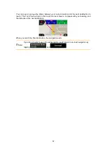
Page 60: ...and keep the original route by tapping or you can check the suggested route by tapping By tapping the plus minus signs you can increase or decrease the distance to avoid on the highway You can accept the recommended detour by tapping ...

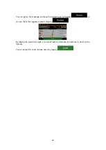
Page 61: ... route by exiting a motorway Z N326 tries to guess the reason for making a detour By tapping you can open a top down map with the recommended parking Places around the destination By tapping the arrows on the sides you can switch between the recommended parking facilities By tapping and the selected parking place becomes your destination 4 1 7 4 Hints upon detour If you leave the planned route by ...

Page 62: ...the Navigation menu Button Description Shows information on the current position latitude longitude nearest town next crossing street and so on or the last known position if GPS reception is not available See page 63 Offers assistance near your current position See page 38 Offers a list of countries with useful driving information about the selected country for example speed limits maximum blood a...

Page 63: ...e current position Latitude and Longitude coordinate of the current position in WGS84 format The nearest town Next crossing road street Previous crossing road street You can also perform some actions on this screen Tap and to add the current position to the saved locations and to check the country information You can also search for assistance near your current position Tap to open a new screen fo...

Page 64: ... helps you navigate with different kinds of route related information on the Navigation view Change the voice guidance language set the time zone the measurement units the time and date formats and customise the application for your local language Enable or disable menu animations Modify the basic software parameters set during the initial set up process See page 5 4 3 1 Route preferences settings...

Page 65: ...imal for normal vehicles Gives a quick but fuel efficient route based on the fuel consumption data Travel cost and CO2 emission calculations are estimations only They cannot take elevations curves and traffic conditions into consideration 4 3 1 2 Navigation Mode You can switch between on road and off road navigation by tapping and selecting or page 56 4 3 1 3 Road types To let the route fit your n...

Page 66: ...mporary ferries You might also need to pay a fare on ferries Car shuttle trains are used to transport vehicles for a relatively short distance and they usually connect places that are not easily accessible on a road for example in Switzerland Z N326 excludes unpaved roads by default Unpaved roads can be in a bad condition and you usually cannot reach the speed limit on them 4 3 2 Sound settings Yo...

Page 67: ...e announcement for the next manoeuvre after each turn or it is enough to receive the information when the turn is near Set the verbosity of the voice instructions that is how much they tell and how often they speak Minimal the voice instruction is given once right before the next manoeuvre Medium the voice instruction is given when approaching the next manoeuvre and it is repeated right before the...

Page 68: ...speed limit sign on the map all the time normally it is shown only if you exceed the limit you can set it here You can also set the relative speed above which the application initiates the warning by adjusting a slider The value can be different within and outside towns 4 3 4 Navigation View settings These settings allow you to fine tune the appearance of the Navigation view You can also adjust ho...

Page 69: ...t or to open the list of its subcategories You can modify the following additional settings on the Navigation View screen If you are navigating with a planned route you can set three data fields to be displayed on the Navigation view You can choose from the time of arrival at destination distance to destination time to destination time of arrival at waypoint distance to waypoint time to waypoint h...

Page 70: ... tunnel and the remaining distance are also displayed In certain situations Z N326 offers a detour when there is a traffic jam on a highway See page 59 In certain situations Z N326 offers an alternative route when there is a traffic jam on the road See page 61 In certain situations Z N326 offers parking Places when you approach your destination See page 61 In certain situations Z N326 offers diffe...

Page 71: ... distances TTS Voice street names announced These computed voices can read out complex instructions street names or system messages You can set the measurement units and time date format to be used Z N326 may not support all the listed units in some voice guidance languages By default the time zone is taken from the map information and adjusted by your current location Here you can manually set th...

Page 72: ...er away from your current position Solution 2 Wait a few minutes for the GPS signal 5 2 Address cannot be found Issue Z N326 cannot find the address you entered Cause The digital map data may not include every single address Solution 1 If the house number is not known or Z N326 cannot find it select only the street name This way Z N326 will navigate you to the midpoint of the street where you can ...

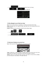
Page 73: ...ion Solution Disable the speed warning by performing the following steps 1 Tap and 2 Tap and 5 5 Keyboard buttons are greyed out Issue Some keyboard buttons are greyed out and cannot be used Cause Z N326 has a smart keyboard for address search which means that only those buttons are active that can be used to type a name that is available on the map Solution Check if you entered the name correctly...

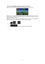
Page 74: ...a complex intersection and the needed information exists the map is replaced with a 3D view of the junction The lanes you need to take are displayed with arrows Solution If you want to hide the currently displayed junction and return to the Navigation view tap the picture To turn off this feature perform the following steps 1 Tap and 2 Tap Now the junction view will not appear again ...

Page 75: ...and recording without the express written consent of NNG 2017 NNG 2006 2017 TomTom All rights reserved This material is proprietary and the subject of copyright protection database right protection and other intellectual property rights owned by TomTom or its suppliers The use of this material is subject to the terms of a license agreement Any unauthorized copying or disclosure of this material wi...

Page 76: ... Copyright 2017 RevA copy deadline Q4 2017 ...

Reviews: