background image

© 2004 ... Directions Ltd

Navigator Manual

version 4.0

Summary of Contents for NAVIGATOR 4

Page 1: ...2004 Directions Ltd Navigator Manual version 4 0...

Page 2: ...e 16 Overview 18 Search 20 Postcode 21 Routing 24 Customise 30 4 The Output Pane 30 Search Results 33 Route Results 35 Highlights 36 5 GPS 36 GPS tracking 37 Replay 38 6 Navigation 38 Navigation 40 7...

Page 3: ...ng Navigator 76 76 1 Application 77 2 Bubble 78 3 GPS 80 4 Map 82 5 Navigation 84 6 Routing 87 7 Search 87 8 Selections Part V Navigator CE 90 90 1 Starting up and opening a map 92 2 Controlling the m...

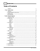
Page 4: ...Part I...

Page 5: ...S ActiveSync is installed and the PDA connected You can install Navigator CE at a later point by invoking it from the Windows start menu Start Programs Navigator Install Navigator CE The default langu...

Page 6: ...of the population Belfast and Major Road Network coverage for the rest of Northern Ireland Ireland Republic of Ireland 14 45 09 Tele Atlas Italy 1066 91 74 Tele Atlas Luxemburg 11 100 Tele Atlas Nethe...

Page 7: ...utton for more than 1 second a help bubble will pop up with a brief description of what the button does Note that if a button is greyed out it cannot be used 1 3 Opening a map To display a new map cli...

Page 8: ...w containing the map you selected To see it across the whole screen click the maximize button in the top right corner of the map window If you have previously saved any Position Marks then can select...

Page 9: ...Part II...

Page 10: ...he right The input pane is where you can search for locations postcodes routes as well as navigate and customise the map A third pane the results or output pane is not visible initially and will only...

Page 11: ...operation zoom move rotate etc Open another view Open another view of the current map Fullscreen Show the map across the whole screen To get out of full screen mode right click on the map and select...

Page 12: ...gle Elliptic Change the cursor to elliptic search mode Use to search the map for objects within a user defined circle ellipse Free shape Change the cursor to free shape search mode Use to search the m...

Page 13: ...and select Delete Calculate route Calculate a route based on the currently selected route points If the destination or departure has not been selected then routing will begin end the route at the home...

Page 14: ...and to the right to zoom out The scale bar will automatically adjust to give a correct reading This method zooms in out of the centre point of the map view Toolbar zoom buttons Clicking the first two...

Page 15: ...rea will shift to the left To move the map further you can click the square and slide it as far as necessary Panning If you move the mouse pointer near the edge of the map you will notice it change to...

Page 16: ...tangle to move the map to a new position Goto to coordinates If you know the coordinates of the location you want see on the map then you go there directly From the menu select Search Go to coordinate...

Page 17: ...re are four as can be seen at the top of the bubble entity 1 of 4 To see the other information on the other layers click the small arrows in the top right corner of the bubble To exit the bubble click...

Page 18: ...display the whole map If not selected you can choose the scale of the overview in relation to the current map view On the bottom right of the tab you can the current overview scale Show all views If...

Page 19: ...e tab By initial Search tab looks like this This allows you to search all databases for name of the location you are looking for To find Abbey Road type Abbey Road and click the Search button You do n...

Page 20: ...terest and Roads and Streets To exclude an entire category from the search make sure to uncheck it To speed up the search for Abbey Road uncheck Geographical features and Points of Interest in the lis...

Page 21: ...eck it to search for locations along it To set the width of the search corridor see Settings Search The list will also show a search area if you created one on the map To create a search area change t...

Page 22: ...nd button You can use the other search fields also To find all postcodes in Sevenoaks type Sevenoaks in the Post Town field Notice that as you type the nearest match is automatically found So for Seve...

Page 23: ...a search and add them from the output pane Simply select the entry you want to route to and right click on it From the menu go to routing and select a waypoint type Once a route point has been selecte...

Page 24: ...points click Select all and the Delete Note that deleting a route point will also remove it from the map If you have selected more than one waypoint you can get Navigator to automatically sort them to...

Page 25: ...ork Also it is not necessary to select a Departure for your journey as the route is calculated from your current GPS position Routing in restricted access roads If you select a routing point in a pede...

Page 26: ...lways and so on Each of these categories has several layers As you can see above the Streets category contains many different types of street If you expand a layer by clicking the next to it you will...

Page 27: ...ries defined above BLINKING shown as a highlight or HIDDEN not shown Line and Area attributes fill colour the colour of the line Click the value and a browse button will appear Click this to open the...

Page 28: ...Navigator 4 0 Help 27 2004 Directions Ltd Line only attributes end type defines the look of the end of a line square round trapezium...

Page 29: ...Using Navigator 28 2004 Directions Ltd flat join type when a road link is made of several points this setting affects the way the middle points are represented miter...

Page 30: ...resenting a street gets thinner Use this value to stop the line from shrinking beyond a certain pixel width size shrinking the rate at which the line shrinks with each zoom The larger the number the f...

Page 31: ...zoom out Width height ratio affects the spacing between letters In most cases you want to keep this set to proportional The lower the value the closer characters will be Pict attributes icon file Cli...

Page 32: ...into two lists On the left is a category list This list shows all the databases had records beginning with Abbey The number in brackets after shows the number of records found in that category If the...

Page 33: ...ecord they will all be highlighted on the screen and the map will automatically adjust to show them all Note that this performs the same function as clicking the following button in the top right corn...

Page 34: ...his point will automatically add as the opposite end of the journey So if you have selected a departure then the home point will be added as a destination and vice versa Once you have selected your ro...

Page 35: ...y major minor and unclassified See Routing settings for a further explanation of these types Comment other information about the maneuver e g roundabout slip road Length the distance you will travel b...

Page 36: ...the list will enable them in routing again The top right corner of the output pane shows several buttons highlights the current route on the map clears the current route from the map copy itinerary to...

Page 37: ...it Right click an item to bring up the following menu Zoom in show the selected item on the map and zoom in on it Change colour This option is only available if the Colour Icon column is not an icon...

Page 38: ...makes the map easier to read To enable disable this feature select Tools GPS Rotate map from the menu To reset the map to north up select Tools Reset map rotation to north up from the menu If you hav...

Page 39: ...have selected to display the Navigation tab in the Input pane Settings Application Input Dialogs Navigation only works if a GPS device is plugged in and receiving data Now you must set the navigation...

Page 40: ...to Navigation mode giving you a better overview of the map and the next maneuver There are two forms of guidance voice and visual Voice you will be verbally instructed ahead of your manoeuvre Remember...

Page 41: ...tor has is the ability to rotate the map as you drive This way your driving direction is always towards the top of the screen which makes the map easier to read To enable disable this feature select T...

Page 42: ...ptions let you export a route Exporting a map Select the type of region you want to cut out and export There are three choices rectangular cut out a rectangular square region of the map elliptic cut o...

Page 43: ...layers with a tick next to them will be exported Note that all the layers have sub layers which can be selected deselected individually To see these click the next to the layer you want Click Next to...

Page 44: ...ct an already existing folder click Browse Click Next to continue Navigator will now display the progress of the export You can cancel the process at any time by clicking Cancel If successful you shou...

Page 45: ...navigation data only for the route selected below Select one and click Next to continue If you are exporting a route and map then you will now be shown the layer selection dialog This dialog lets you...

Page 46: ...and a name for the navigation data Navigation name To select an already existing folder click Browse Please note that if you have selected to export a route only then the Map name will not be shown C...

Page 47: ...PDA should have been provided by the PDA manufacturer 2 7 2 Installing on PDA End the end of the Navigator installation you should have been offered the chance to install the Pocket PC program files...

Page 48: ...yer to the selected point on the map Goto coordinates Measure distance on the map Measure area on the map Measure bearing Display pointer co ordinates in status bar Pushpins Add a new pushpin on the m...

Page 49: ...Redo last Undo 2 8 2 Customising the toolbar Right click on the toolbar and the following menu will appear The top two entries toggle the visibility of the input and output windows The next set of ent...

Page 50: ...t You can add remove groups and tools using the buttons in the centre of the dialog If a group contains many buttons you can additional subdivide them using separators These are thin vertical lines be...

Page 51: ...double lines to the left of the group If the buttons in your toolbar are not neatly arranged you can click Line up and Navigator will stack them together 2 9 Pushpins 2 9 1 Adding a pushpin There are...

Page 52: ...he add pushpin button in the toolbar right click on the map and select Add Pushpin from the menu When you move your mouse pointer over the map it will change to a target symbol Centre the target on wh...

Page 53: ...re The pushpin name is the name that will appear in the list of user object and as label on the map You can also add a short Description with further details about the pushpin Although an icon is auto...

Page 54: ...jects categories Categories are only visible if there are user objects defined in them For example if you have yet not defined any route points then the Routing points category will not be shown Possi...

Page 55: ...e pushpin simply click the entry in the Icon file path column This will bring the standard Windows Open dialog where you can select an alternative icon The last three columns let you toggle visibility...

Page 56: ...e pushpin Label contains description show hide the description in a text label under the pushpin Type the route point type departure destination waypoint home point Closed roads If you have prohibited...

Page 57: ...et the current area as a point in a route or a home point The route point will be added to the street nearest the centre of the area The list has the following columns Name Name of the search area whi...

Page 58: ...Move the target over the pushpin you want to remove and click the left mouse button 2 10 Position marks Position marks are a tool to save your favorite views so that you can return to them quickly at...

Page 59: ...dialog In the textbox enter the name for the position mark and click OK It will now appear in the File menu under Position marks To go to the saved position simply click on it in the list To amend yo...

Page 60: ...aved position for the current map view Delete position delete the position mark from the list 2 11 Points of Interest Airline Access Airport Amusement Park Important Tourist Attraction Beach Cash Disp...

Page 61: ...pital Polyclinic Pharmacy Hotel or Motel Rest Area Tourist Information Office Music Centre Nightlife Parking Area Parking Garage Rent a Car Parking Mountain Pass Mountain Peak Concert Hall Opera Polic...

Page 62: ...or 4 0 Help 61 2004 Directions Ltd Car Repair Facility Shopping Centre Shop Sports Centre Stadium Tennis Court Railway Station Toll Veterinarian Scenic Panoramic View Winery Place of Worship Yacht Bas...

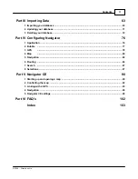
Page 63: ...Part III...

Page 64: ...ort wizard from the Navigator menu The first import wizard screen will now appear Select import You have two choices Create a new import select this option if you have never imported this database bef...

Page 65: ...f from most commonly used applications including Microsoft Access and Excel Once you have selected a driver click the New Driver button to select a database or ODBC Driver to connect to Once you have...

Page 66: ...elect the type you are using If you have address data from the United Kingdom you can choose to geocode data by postcode In this case your data must contain the full postcode Once you have selected a...

Page 67: ...drop down menu as single icon for all records Now select an icon by clicking the Browse icon button Many icons can be found in the Navigator installation folder typically C Program Files InfoMap picts...

Page 68: ...the next Under Icon file select an icon to represent that group Ideally each group should be represented be a different icon Whether you are importing one icon or many you can limit their visibility...

Page 69: ...to amend data in Navigator select the edit check box for the field in question If you do not select the edit check box then the column field will be read only Columns will appear in the user object l...

Page 70: ...n start Navigator will update from the source database every time it starts Every Navigator will update from the source database at regular intervals Do not schedule Navigator will not automatically u...

Page 71: ...outlines the import settings you have just selected If you are not happy with any of the values click Back and ammend them Select the Import database now checkbox to import you data immediately or de...

Page 72: ...ogress dialog Any unplaced records will be listed To terminate the import process click Cancel import 3 2 Updating your database If you have not set to update your database automatically and want to u...

Page 73: ...enu select which database you want to update and click Run import 3 3 Deleting your database There are two ways to remove imported data from Navigator To delete all data but leave the import settings...

Page 74: ...r 4 0 Help 73 2004 Directions Ltd Now select a database from the drop down menu and click Delete all imported data To delete all data and the import profile select Tools Import wizard from the Navigat...

Page 75: ...Importing Data 74 2004 Directions Ltd Now select Edit existing import and highlight the database you want to delete Click Delete...

Page 76: ...Part IV...

Page 77: ...to display other options On the right side of the dialog you can see the settings for that section 4 1 Application Here you can configure general application behaviour Language If you had chosen to i...

Page 78: ...cular interest when measuring map distances or areas and routing Toolbars select whether to show large or small buttons on the toolbar Input dialogs From this list you can control which tabs appear on...

Page 79: ...go to Control Panel System Hardware Device Manager Ports COM LPT to find out which port your device is using Set the speed etc at which your GPS unit communicates Make sure that Baud rate Byte size P...

Page 80: ...speed at which it was recorded Accelerate replay select this option to replay a file at a higher speed than that at which it was recorded Use the spinner on the right to set the replay acceleration Sk...

Page 81: ...t any option then no label will be shown GPS Trail If you want to see a snail trail of where you have been then select how long it will be The number represents historical positions if your GPS update...

Page 82: ...r of screen pixels that will represent one metre on the map Mouse sensitivity This feature to remove annoying mouse over sensitivity when operating on the map view For example if you find that clickin...

Page 83: ...a map will change its shape on screen Type of co ordinates shown in status bar Change the coordinates displayed in the status bar as you move the mouse pointer over the map 4 5 Navigation Here you can...

Page 84: ...ion sets the look of the enlarged view of the next maneuvre Arrow width in pixels your direction of travel through the next junction is represented by a large transparent arrow This setting adjust the...

Page 85: ...p look less cluttered You can choose which layers to display by ticking the check boxes next to them All layers with a next to them have sublayers which can also be selected and unselected To select d...

Page 86: ...for your car If you have set Navigator to imperial measurements then consumption is displayed in miles per gallon otherwise when set to metric units it is shown in litres per kilometre Fuel cost Enter...

Page 87: ...eferences for fastest route calculations From the drop down menu select a road type to amend Move the Preference slider to the right to increase preference and make Navigator favour that type of road...

Page 88: ...the record you are looking for Maximum nearest objects to find per category This sets how many records will be returned for each searchable map layer when you perform the find nearest Maximum distance...

Page 89: ...ight you wish to amend Number of colours Set the maximum number of colours for the selected highlight type If you display more highlighted objects than the number of colours selected the first colour...

Page 90: ...Part V...

Page 91: ...1 Starting up and opening a map After installation you can run Navigator CE from the Start menu on your device Navigator will now appear on your screen The first task is to open a map You should have...

Page 92: ...vigator 4 0 Help 91 2004 Directions Ltd the data to your device From the Tools menu select Open The following dialog will appear All your exported maps should appear in the list Select the one you wan...

Page 93: ...en it will look something like this 5 2 Controlling the map Once a map has been opened move around in the same way as you would with Navigator on a PC In the toolbar you will see a magnifying glass sy...

Page 94: ...sing the scroll bars You can also use the View menu to quickly zoom the map to overview or maximum detail If the use of hardware buttons is enabled in Settings then you can zoom using hardware buttons...

Page 95: ...e toggle between keeping your position always visible on the screen and free movement around the map Save Position Save your journey to file You can record your journey and replay it at a later date G...

Page 96: ...siness counter Start accumulating private mileage When you select this item mileage will begin to be added to the business counter Note that you can only enable one counter at a time Enabling the busi...

Page 97: ...e you want to take and click OK If your GPS device is connected then voice instructions will start guiding you when you start driving Navigation instructions are always given at predefined distances a...

Page 98: ...Navigator CE you will be warned when you deviate from your route but a new route will not be recalculated You can choose to display the itinerary showing you several maneuvers ahead by selecting Nav I...

Page 99: ...eans NMEA Port Select which COM port your device is attached to If you want to replay a file select file You will now be prompted to select a prerecorded NMEA file to replay Set the speed etc at which...

Page 100: ...acking This is useful for mileage allowances etc Hardware buttons select the use hardware buttons to enable control using the PDA buttons When this is enabled the buttons on you PDA will no longer sta...

Page 101: ...gs You are lost when you are X meters away from route after you stray more than the set distance in meters you will get a You are lost warning Voice Navigation set at which distances before the next m...

Page 102: ...Part VI...

Page 103: ...system Expand the Mice and other pointing devices item You should see at least two devices listed here one being Microsoft Serial Ballpoint Right click on it and select Disable This should prevent ano...

Page 104: ...Destination 21 Device communication 78 E Edit existing import 72 Elliptic 9 Exit 7 Export to PDA 40 Exporting a map 40 Exporting route 40 F Find nearest 9 Find Route 21 Free shape 9 Fuel consumption...

Page 105: ...ap 36 38 route itinerary 38 Route optimisation 82 Route Results 33 Route summary 33 Routing 9 21 Runtime 84 S Scale adjuster 80 Schedule import updates 63 Scroll bars 14 Search 18 Search Results 30 Se...

Page 106: ...Voice navigation 82 W Waypoint 21 Z Zoom bar 13 Zoom in out 9 Zooming 13 Navigator 4 0 Help 105 2004 Directions Ltd...

Reviews: