background image

600-00151-001 Rev 01

Summary of Contents for Envision EX5000

Page 1: ...600 00151 001 Rev 01 ...

Page 2: ......

Page 3: ...yne Corporation All rights reserved Date Revision Description November 12 2008 00 Released per ECO 08 426 Supports Release 8 including TWX Cell mode and Iridium Datalink MLX770 May 15 2019 01 8 2 2 Software release When contacting your dealer or Avidyne technical support and when logging onto MyAvidyne com for the first time please have your Envision EX5000 serial number and Subscriber Communicato...

Page 4: ...is guide may differ slightly from what you observe on your EX5000 If your system is configured with a partial set of the available sensors then some views may differ from this guide Note All images contained within this document including screenshots and other displays are for reference use only and are subject to change The images contained herein may differ slightly from your actual equipment or...

Page 5: ...ints and denote information that can prevent serious injury or death on the part of the user This manual assumes that the reader is an appropriately licensed pilot Avidyne strongly recommends that you use the EX5000 only under VFR conditions until you are very familiar with the EX5000 If you have questions please contact Avidyne at 800 284 3963 800 AVIDYNE before operating with the EX5000 under IF...

Page 6: ... is some delay from real time until the weather information is displayed on the EX5000 Therefore use datalink weather information only for strategic route planning Avoid severe weather areas with a safe margin of distance Do not use the EX5000 to penetrate severe weather thunderstorms cells or lines of cells By using Broadcast datalink you can access weather information made available from sources...

Page 7: ...s you are able to access information made available from a variety of sources Avidyne does not control edit or review the content of such information and is not responsible for such information or the actions or conduct of any company that provides sources of weather data procured by Avidyne Therefore although Avidyne uses diligent efforts to provide Services of high quality ALL SERVICES AND WEATH...

Page 8: ...Envision EX5000 vi 600 00151 001 Rev 01 This page intentionally left blank ...

Page 9: ...5 About CMax 27 About Geo Referenced Charts 28 CMax Chart Page 28 4 2 European VFR Charts33 CMax Views 35 Procedure Chart Views 35 Airport Chart Views 37 CMax Selection Page 39 Selecting an Airport 41 Chart NOTAMs Page 43 4 Traffic Mode and the Traffic Page 47 The Dedicated Traffic Page 47 Traffic Symbols 50 TIS Sensor Status 51 5 Trip Page 53 6 Nearest Page NRST 63 Nearest Page 63 Airport Info Pa...

Page 10: ... 87 Updating Your Databases 88 Loading NavData the Navigation Database 89 Loading CMax Chart Data 91 Activating Broadcast Datalink Accounts 93 Activating XM WX Satellite Weather 93 Cleaning the EX5000 Screen 96 Sensor Status Block Symbols 97 Map Symbols 99 Line Styles 101 Data Blocks 103 TAWS Messages 105 Nav Messages 107 Traffic Messages 109 PFD Messages 112 Broadcast Datalink Messages 113 Avioni...

Page 11: ...Views 37 Figure 3 6 Airport Departure Chart Night View 38 Figure 3 7 CMax Selection Page 39 Figure 3 8 Airport Selection Page 41 Figure 3 9 Chart NOTAMs Page 43 Figure 4 1 Map Page Traffic Mode 48 Figure 5 1 Trip Page Information 53 Figure 6 1 Nearest Page 63 Figure 6 2 Airport Information Page 65 Figure 7 1 Aux Main Page 67 Figure 7 2 Airport Filter Setup Page 69 Figure 7 3 Declutter Setup Page 7...

Page 12: ...nal 98 Table 9 3 Map Symbols Airports 99 Table 9 4 Map Symbols Navigational Fixes 100 Table 9 5 Map Symbols Traffic Symbols 100 Table 9 6 Map Symbols Other 100 Table 9 7 Airspace and Airways Lines 101 Table 9 8 SUA and TFR Status Lines 101 Table 9 9 AIRMET and SIGMET Boundary Lines 102 Table 9 10 Data Block Information 103 Table 9 11 TAWS Messages 105 Table 9 12 Nav Messages 107 Table 9 13 Traffic...

Page 13: ...ure turns and holding patterns from a compatible GPS navigator l Traffic information display from Avidyne TAS600 Series L 3 Skywatch Garmin TIS Garmin GTX345 or any compliant ADS B traffic system l Terminal procedure chart display using the CMax function l Display of weather and flight restriction information when interfaced with an external Broadcast Datalink receiver or internal Narrowcast Datal...

Page 14: ...low you quick and intuitive access to the information you need when you need it 1 PhotoCell Light Sensor Automatically compensates display brightness for varying lighting conditions 2 Brightness Control Allows you to override the default display brightness and adjust the brightness level Press the top button to brighten the display press the bottom button to dim it 3 5 6 2 1 7 4 4 ...

Page 15: ...nctions such as selecting items on the page or changing the view range The label on right knob changes as appropriate 7 Message Bar The message bar keeps you informed about critical as well as routine information from the EX5000 When information needs to be conveyed the message bar appears next to the bottom right button Note When removing the rubber cap from the data port pull the cap gently from...

Page 16: ...en the EX5000 is ready the Press any bezel key to continue message is displayed Figure 1 2 Envision EX5000 Initialization Page The EX5000 Startup page reports the valid dates for the currently loaded CMax chart data and NavData Check to ensure that you do not have any expired databases before continuing For CMax data l If the issue date for the next update has passed the Startup page displays Upda...

Page 17: ...o the charts is revoked until new CMax data is loaded For NavData the date range is displayed if the data is valid if it is not valid the word EXPIRED and the expiration data are displayed in yellow For more information about updating CMax and NavData see Section 9 1 Updating Your Databases on page 88 ...

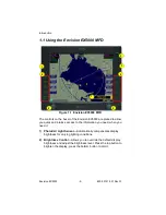
Page 18: ...Introduction Envision EX5000 6 600 00151 001 Rev 01 THIS PAGE INTENTIONALLY LEFT BLANK ...

Page 19: ...ows you to select the data you want to display on the Map page Turn the Select knob on the Page Bar to Map to display the Map page This section discusses the following topics l Map Page Controls page 8 l Map Symbols Terrain and Position page 16 l Map Symbols Runways and Flight Plan page 19 l Map Orientation Control page 20 l Errors Displayed on the Map Page page 21 ...

Page 20: ...ol overlay and modes of available sensors Buttons are only displayed for the sensors installed in your aircraft n Traffic Cycles through traffic sensor modes See Chapter 4 Traffic Mode and the Traffic Page for more information on traffic modes n Lightning Controls the display of lightning strikes or cells cells for WX 500 only on the map when interfaced with an Avidyne TWX670 an L3 WX 500 Stormsco...

Page 21: ...rikes are displayed as follows u WX 500 lightning strikes are displayed as yellow X s u TWX670 lightning strikes are displayed as X s Strike intensity is indicated using 5 colors from red to green yellow A strike displayed in red indicates an area of very high intensity while a strike displayed in green yellow indicates an area of low to moderate intensity Note The TWX670 can accurately display li...

Page 22: ...splays graphical SIGMETs only u DSPLY OFF Turns off display of all weather information For more information about Datalink functions see Section 8 Datalink Optional on page 79 2 Map Functions Controls basic look of the map in terms of orientation number of elements and base map n View Orients the map for either Track Heading Up or North Up FORWARD and CENTER views are oriented with Track Heading U...

Page 23: ...ot displayed The external Broadcast Datalink receiver receives a constant stream of weather data for the entire United States via a satellite radio system US RDR displays CONUS weather CAN RDR displays Canadian weather LOC RDR displays regional radar for ADS B configurations u US RDR If Broadcast Datalink is installed and available depending on your Datalink service level the single down arrow and...

Page 24: ...thunderstorm activity In this instance the aircraft must be flown away from the thunderstorm The TWX670 detects and measures lightning strike energy and generates cell data that the EX5000 displays in For Datalink RADAR small areas of high intensity datalink radar data might not be displayed on the EX5000 at high range settings Instead larger areas of surrounding lower intensity returns might obst...

Page 25: ...ice that the hexagon size changes abruptly This is normal as the MFD consistently uses the highest fidelity TWX lightning data available Note If cells appear in the same location as navaids obstacles or TFRs the cells will cover part or all of the navaids obstacles or TFRs To more clearly view the navaids obstacles or TFRs turn off the TWXCELL mode by pressing WxOvly and selecting DSPLY OFF or one...

Page 26: ...tivity Cell Colors Color Interpretation Red Intense thunderstorm activity presence of hazardous atmospheric conditions is certain Orange Weather conditions are approaching intense thunderstorm activity Orange Yellow Heavy thunderstorm activity high likelihood of hazardous atmospheric conditions Yellow Weather conditions are approaching heavy thunderstorm activity Green Yellow Moderate thunderstorm...

Page 27: ...uttered at 750NM and higher ranges Note The Map page monitors the health of the sensors traffic and lightning by means of a signal pulse Map looks for a signal every three seconds from each sensor If it doesn t see this signal it assumes the sensor has failed in some way When this happens the following occurs on the display Sensor data is removed from the overlay display The word FAIL displays in ...

Page 28: ...tion data in data blocks in the upper corners of the display For more information see Section 7 3 Data Block Edit Page on page 73 2 Sensor Status Box Displays the status of the available sensors including radar traffic lightning and both 2 Way Datalink and Broadcast Datalink The Datalink Radar display includes the Datalink Radar data age which is the elapsed time since the product was created by t...

Page 29: ...ock provides digital readout of the current heading or actual track Map orientation is indicated in the triangle to the right of the H T Block 5 Terrain Scale Shows highest and lowest limits of terrain in displayed area Legend colors in between these numerics represent terrain elevations Blue obstacle clearance number shows the top of the highest obstacle when greater than the Datalink Radar is th...

Page 30: ...the distance from the airplane symbol to the compass arc The displayed terrain and obstacle indicators are only advisory It is dangerous to rely on the EX5000 as the sole source of obstacle and terrain avoidance information Always refer to current aeronautical charts for appropriate terrain and obstacle information Note For example a 2000 foot tall TV tower located in Denver elevation 5300 feet MS...

Page 31: ...on to the moving map and the selected view 2 Flight Plan Displays the active flight plan from the GPS The current leg displays in magenta and all remaining legs are shown in white When you select an approach procedure on the Garmin 430 all approach segments including holds DME arcs procedure turns etc are shown when connected via the ARINC 429 bus Note For most GPS units the EX5000 does not displa...

Page 32: ... the EX5000 EX5000 traffic and lightning sensor symbols are positioned relative to the aircraft nose When the Map View is North Up you need to pay more attention to locate traffic outside the aircraft Set Map View to Center or Forward to display this data consistent with typical dedicated traffic and lightning sensor displays Note The Garmin GNS 430 GNC 420 does not differentiate curved flight pat...

Page 33: ...n If the primary GPS fails during flight and you have a second GPS connected to the EX5000 you may switch your GPS input to the backup source by pressing the Nav Src button on the Aux page 2 5 2 Loss of Heading Input The source for heading data on your aircraft is dependent upon the particular complement of equipment you have installed in your aircraft Loss of heading is typically associated with ...

Page 34: ...by a direction less symbol a white symbol l The compass labels N S E and W are removed from the display l The map and flight plan data will continue to be displayed l The map orientation annunciation is removed from the display l The heading track indicator will display a series of dashes l The map is oriented True North Up What to do l Have the avionics wiring inspected When heading track is rest...

Page 35: ...Errors Displayed on the Map Page 600 00151 001 Rev 01 23 Envision EX5000 THIS PAGE INTENTIONALLY LEFT BLANK ...

Page 36: ...Map Page Envision EX5000 24 600 00151 001 Rev 01 ...

Page 37: ...ge 39 3 1 Expired Charts CMaxTM charts are valid for a period of 56 days Charts will be displayed normally for 10 weeks after the chart expiration date After 10 weeks from the chart expiration date charts will display a NOT FOR NAVIGATION watermark The Ownship symbol and flight plan legs are removed from charts that cannot be used for navigation As pilot in command it is your duty to have alternat...

Page 38: ...CMax Chart Pages Optional Envision EX5000 26 600 00151 001 Rev 01 Figure 3 1 Not for Navigation Watermark on Chart display ...

Page 39: ...Update Guide or the Jeppesen website at www jeppesen com The Data Update Guide also contains instructions for loading the chart data to your Zip Drive or USB Flash Memory Drive See Section 9 1 Updating Your Databases on page 88 for information about loading CMax Data onto your EX5000 Note You can load new CMax Chart data into the MFD as soon as you receive each data cycle Any charts that have chan...

Page 40: ...re selected on the Chart Selection page described in Section 3 7 CMax Selection Page on page 39 The EX5000 Startup page reports the valid dates for the currently loaded chart data If the date for the next update has passed the Startup page will report this in yellow cautionary text If the chart data becomes more than 10 weeks out of date access to the charts shall be revoked until new chart data i...

Page 41: ...the current chart being displayed also in green 3 Geo referenced Symbol When the displayed chart is geo referenced a small globe displays If the chart is not geo referenced the globe symbol is crossed out 4 Flight Plan Symbol an FPL symbol indicates the option to display the current flight plan is turned on If the display of flight plan is turned off the FPL symbol is crossed out Note that if a ch...

Page 42: ...mains fixed and the ownship symbol moves across the chart with aircraft movement 10 Pan Buttons The right hand buttons allow you to manually move the chart on the screen The pan buttons are only active when the current view can be panned The Plan view of each chart can generally be panned many information pages such as header and departure views cannot Not shown Center When you use Pan the Center ...

Page 43: ... is magenta Non active legs are shown in green Note The Garmin 400W 500W can use the parallel track For Garmin 400W 500W software at Release 2 or earlier if a parallel track is active the current non offset leg will be displayed in white For Garmin 400W 500W software at Release 3 or later if a parallel track is active the parallel track leg will be displayed in white Note The ownship symbol on the...

Page 44: ...ven chart there must be a waypoint on that chart in the flight plan For example a direct flight plan from KBED to KLAX passes over KEMT If you bring up KEMT charts the KBED KLAX flight plan will not display To display the flight plan over KEMT a waypoint on an approach for KEMT must be included in the flight plan ...

Page 45: ...er must be used to download European VFR Charts 1 VFR Charts If loaded VFR charts will be listed first in the list of CMax charts for a given airport 2 IFR Charts If loaded standard CMax IFR charts will appear second on the CMax Selection Page below European VFR charts If a VFR chart is selected pressing Display Airport will display the VFR airport diagram Likewise if an IFR chart is selected pres...

Page 46: ...CMax Chart Pages Optional Envision EX5000 34 600 00151 001 Rev 01 ...

Page 47: ...or that chart 3 6 1 Procedure Chart Views For the Procedure chart the Header Profile and Minimums views also feature a small preview pane of the Plan View which although too small to read all chart details gives the user a general overview of the approach for situational awareness The flight plan and ownship symbol are also displayed on the preview pane Note If CMax detects non standard data for a...

Page 48: ...iews View Description 1 of 4 Plan Includes a flight plan overlay if available shown in Figure 3 3 2 of 4 Header Contains general chart information and appropriate communication frequencies 3 of 4 Profile Includes the profile view of the approach procedure 4 of 4 Minimums Shows the descent minimums for the approach Header View Profile View Minimums View ...

Page 49: ...able 3 2 Airport Chart Views Chart Description 1 of 4 Plan Includes a flight plan overlay if available shown in Figure 3 2 2 of 4 Header Includes general chart information and communications frequencies 3 of 4 Runways Shows runway information for the airport 4 of 4 Departure Displays specific departure procedure information Header View Runways View Departure View ...

Page 50: ...e runway or departure information For larger airports this information is often large enough to warrant a separate chart which can be selected from list on the Selection page Charts that cannot be split into smaller sections are shown as a complete chart with the View button not displayed since only one View type is available Figure 3 6 Airport Departure Chart Night View ...

Page 51: ...r types of charts such as airspace diagrams taxi diagrams special instructions and other miscellaneous charts 2 Chart NOTAMs The Chart NOTAMs button only displays if chart NOTAMs exist for the currently selected airport Press Chart NOTAMS to bring up a window that lists any associated chart NOTAMs for the airport currently entered in the Airport Entry Field See Section 3 8 1 Chart NOTAMs Page on p...

Page 52: ...Returns to the current active chart display screen Any inputs to the Airport Entry Field or Chart list are abandoned Changes to flight plan display status however are preserved 6 Change Airport Moves the cursor to the Airport Entry field described in Section 3 8 Selecting an Airport on page 41 7 Display Chart Loads the selected chart and displays it on the Chart page Remember that the associated A...

Page 53: ...ion codes such as KCAD etc The EX5000 will try to auto complete an airport entry as the first characters are entered Press the AutoFill button to immediately fill this field with the destination airport Only those airports within the coverage area are auto completed A list of all charts available for the identified airport appears in the chart list area The name of the airport in the Airport Entry...

Page 54: ...ifier The character selection scrolls through A to Z 0 to 9 and common punctuation marks and symbols before returning to A Note The AutoFill button automatically detects the destination airport if the final waypoint is an airport or a waypoint that is part of an instrument approach procedure However for some approaches AutoFill may detect another nearby airport rather than the intended destination...

Page 55: ...s window and return to the Selection page Press the Chart NOTAMs button from the Selection page to display the chart NOTAMs associated with that airport Chart NOTAMs specific to that airport are listed first followed by any general chart NOTAMs Note Chart NOTAMs address changes to information contained on the charts and do not include local or regional operational NOTAMs Always obtain local and re...

Page 56: ...le at all Chart page is not accessible Expected airports are not available for chart selection If you observe any of these reload the CMax chart data using the CMax Dataloader described in the Avidyne CMax Data Update Guide or in the Jeppesen JeppView for MFD Quick Start Guide If problems persist contact your dealer or Avidyne Technical Support As pilot in command it is your duty to have backup so...

Page 57: ...Selecting an Airport 600 00151 001 Rev 01 45 Envision EX5000 THIS PAGE INTENTIONALLY LEFT BLANK ...

Page 58: ...CMax Chart Pages Optional Envision EX5000 46 600 00151 001 Rev 01 ...

Page 59: ... depictions l Lightning Not displayed l Flight Plan Displayed It is dangerous to rely on the EX5000 as your sole source of data for collision avoidance Traffic information is provided as an aid to visually acquiring traffic Maneuver your aircraft based only on ATC guidance or positive acquisition of conflicting traffic It is your duty as pilot in command to see and avoid Notes The intruder track i...

Page 60: ...nger present Figure 4 1 Map Page Traffic Mode 1 Exit Traffic Restores the Map page to the previous settings If the Map page is restored prior to acknowledging a TA the message will remain displayed and acknowledging it will once again bring up the dedicated Traffic page The available Traffic button modes are listed below For more information on specific traffic sensor modes consult the user docume...

Page 61: ...900B Traffic modes are GROUND TERMINAL STANDARD ENROUTE UNLIMITED APPROACH and DSPLY OFF Note that some TCAD installations will support automatic mode switching by the TCAD unit The current mode is always reported on the EX5000 screen l All others ARINC 735 devices Traffic modes are ABOVE NORMAL UNLIMTD BELOW and DSPLY OFF ...

Page 62: ...displayed in the message bar as shown in the example above 1 Relative bearing of target 2 Range in nautical miles Table 4 1 Traffic Symbols Non TIS Symbol TIS Symbol Type Meaning Traffic Alert TA Traffic within the alert zone defined by the traffic sensor Proximate Traffic Traffic close to your position but not within an alert zone Other Traffic Traffic detected by the traffic sensor but determine...

Page 63: ...xample shown in Table 4 1 the intruder is 500 feet below and is climbing In addition this example with an intruder track shows the intruder is moving along a track approximately 45 degrees to the right of our current map alignment i e if the EX5000 map is set for North Up the intruder is flying a track somewhere between 023 and 067 This is the accuracy limit of the intruder track data 4 3 TIS Sens...

Page 64: ...Traffic Mode and the Traffic Page Envision EX5000 52 600 00151 001 Rev 01 l DATA FAIL The TIS sensor has reported an internal fault Traffic information will be removed from display ...

Page 65: ...X5000 from the GPS If the entire flight plan does not fit on the screen an ellipsis displays in the next to last line The destination line is always displayed All flight plans are from the GPS A No Flightplan Available message displays if there is no flight plan entered or if the GPS has failed Figure 5 1 Trip Page Information 1 Current ground speed and track As reported by your GPS Navigator 2 Co...

Page 66: ...e icon indicates that at least one ILS approach chart is available for the associated airport on the CMax Chart page Chart icons only display for those airports for which you have JeppView subscription coverage For more information see Section Figure 3 1 Not for Navigation Watermark on Chart display on page 26 n Intermediate waypoints are shown with the prefix Wx The Trip page includes distance NM...

Page 67: ...ton for the selected waypoint when available 7 Destination Airport Info Provides quick access to airport information for the destination airport when available 8 Display Controls the display shown in the lower portion of the screen The selections are n METAR Displays the decoded text METAR for the selected waypoint when available If METAR cannot be decoded raw text METAR will be displayed ...

Page 68: ...election Units Controls the units used for decoded METARs and Datalink Legend The selections are u ENGLISH Displays the decoded METAR text and Datalink Legend using statute miles SM feet ft and inches of mercury inHg u METRIC Displays the decoded METAR text and Datalink Legend using meters m kilometers km and hectopascals hPa Cloud altitudes are still in feet ft Unit selections apply to decoded ME...

Page 69: ...arious types of weather data If the time since reception for any particular weather product is greater than the limits defined by the system a cyan alert message will display in the message box on the Aux Main page and in the message bar For example if 91 minutes has elapsed since the last TAF data was received a Broadcast TAFs 90 min message will display in the message bar and in the message list...

Page 70: ...t determine your subscription level Unknown is displayed n Winds Aloft and Freezing Level Temperatures Aloft Depending on your XM WX service level displays Winds Aloft and Freezing Level data from Broadcast Datalink if available The Winds Aloft direction is measured from true not magnetic North Winds are interpolated for each Trip page waypoint and are based on a computer forecast model that is up...

Page 71: ... This page shows information about which stations are providing data and the completeness of that data White text in the CRL Current Report List Range columns indicates that additional data is expected u Unavail This page displays information about products that are being reported as temporarily unavailable 9 Chart If CMax approach charts are installed and available provides a quick jump to the Ch...

Page 72: ...00 series users When the EX5000 is interfaced to a Garmin GNS400 500 series GPS via RS 232 the GPS may send duplicate waypoints while in approach mode These duplicate waypoints may affect the distance and time readings on the Trip page Use the GPS as the primary source of navigation information for approach procedures Consult your avionics installation facility to determine if your EX5000 is inter...

Page 73: ...600 00151 001 Rev 01 61 Envision EX5000 THIS PAGE INTENTIONALLY LEFT BLANK ...

Page 74: ...Trip Page Envision EX5000 62 600 00151 001 Rev 01 ...

Page 75: ...ure 6 1 Nearest Page 1 Airport details By default displays the following details about the airports nearest to your current location n METAR and Chart Symbols Waypoints with METAR reporting stations display a color coded METAR flag when Datalink is active If CMax approach charts are installed a chart icon displays next to any METAR reporting station for which an Instrument Procedure chart is avail...

Page 76: ...osition frequency and airport name n DEST APT Airports Nearest Destination Graphical METARs airport identifier bearing distance from the aircraft present position frequency and airport name n VORs Identifier bearing distance frequency and name n NDBs Identifier bearing distance frequency and name n Intersections Identifier bearing and distance n Obstacles MSL and AGL height bearing and distance 5 ...

Page 77: ...elected Airport as shown Figure 6 2 Airport Information Page 1 Back to Nearest Returns to the Nearest page 2 Step and Jump knobs If the communications frequencies list is long enough so that it does not fit on a single page the Step and Jump labels appear on the left and right knobs n Step Scrolls the page one line n Jump Scrolls an entire page or to the end of the list 1 2 2 ...

Page 78: ...Nearest Page NRST Envision EX5000 66 600 00151 001 Rev 01 THIS PAGE INTENTIONALLY LEFT BLANK ...

Page 79: ...ge you can view informational messages and select the options you want to configure This section discusses the following topics l Aux Main Page page 67 l Airport Filter Setup Page page 69 l Declutter Setup Page page 71 l Data Block Edit Page page 73 l System Time Page page 75 l Datalink Configuration page l Aux Main Page Figure 7 1 Aux Main Page 6 3 2 4 1 7 5 ...

Page 80: ...ch traffic sensor is installed n Traffic Standby switches the sensor back into standby mode only while on the ground To view traffic data while on the ground press Traffic in Map page n Traffic Self Test replaces Traffic Standby after the Traffic sensor has entered Standby Initiates a 30 second self test of the SkyWatch traffic sensor only while on the ground 6 Nav Src If your aircraft is equipped...

Page 81: ...flying The values selected on this page also dictate the types of airports that get displayed on the map Figure 7 2 Airport Filter Setup Page 1 Airport Type Select Towered Non Towered or both 2 Surface Select between hard soft and or water surfaces 3 Minimum Runway Length select the minimum runway length from 2000ft 7000ft or show all lengths 4 Save Saves settings and returns to the Aux Main page ...

Page 82: ... Page Configuring the EX5000 Envision EX5000 70 600 00151 001 Rev 01 6 Change knob The left knob changes the value or status of the selected field 7 Select knob The right knob moves the blue field selector ...

Page 83: ...sing VFR or IFR defaults Figure 7 3 Declutter Setup Page 1 IFR VFR Defaults Sets the declutter settings to predefined factory settings based on typical usage 2 Display Each item has three possible display settings n On The item displays all the time n Auto The item displays automatically and declutters automatically based on pixel density of the display at a given range n Off The item is never dis...

Page 84: ...Aux Main page 7 Change knob The left knob changes the value or status of the selected field 8 Select knob The right knob moves the blue field selector Note The 1000NM and 1500NM columns are not displayed because this data is never displayed at these ranges Note If all display elements are forced on via the Declutter Setup page the quick declutter setting on Map page is set to maximum and the Map R...

Page 85: ...ay mode 2 Left Right Data Blocks The Upper Left and Upper Right Data Blocks are user configurable data blocks that appear in the upper left and upper right of the Map pages You can keep these data blocks at the default factory configuration or you can customize the data that appears in the data blocks The factory default uses the data blocks as follows n Upper left contains engine and fuel data n ...

Page 86: ... For information on the fields available in the data blocks see Section 9 7 Data Blocks on page 103 3 Save Saves settings and returns to the Aux Main page 4 Cancel Cancels any changes and returns to Aux Main page 5 Change knob The left knob changes the value or status of the selected field 6 Select knob The right knob moves the green field selector ...

Page 87: ...ected the EX5000 will first try to receive current time data from the attached GPS unit If the GPS signal is not available it will try to receive current time data from Narrowcast Datalink If neither are available the EX5000 will use the last known time data 2 Time and Date Setting If manual time source is selected it allows you to manually adjust the current UTC value Before conducting flight ope...

Page 88: ...e left knob changes the value or status of the selected field 8 Select knob The right knob moves the blue field selector Note The EX5000 maintains a constant offset from UTC and does not adjust local time for daylight savings Note If the EX5000 time has drifted noticeably from the current GPS time ensure the GPS unit s are receiving valid GPS information by re synching the EX5000 time as follows E...

Page 89: ... CMOS battery the system will report the current year to be 2000 If this is the case the system setting should be checked to make sure the manual mode of clock update is not enabled Follow the prescribed steps in the System Time Page section of the EX5000 Pilot Guide to set the system to either the Auto or GPS selection either selection will update the MFD with the appropriate time No other action...

Page 90: ...ev 01 7 5 3 CMOS Battery Replacement For customers whose batteries are no longer operational and are uncomfortable waiting for a GPS signal in order to facilitate the clock adjustment we suggest replacement of the CMOS battery Replacement of a CMOS battery is optional ...

Page 91: ...ional Datalink services allow you to view weather and other data on the Map and Trip pages Avidyne offers Broadcast Datalink and ADS B FIS B data For most operations the EX5000 weather data display is the same regardless of which Datalink system is in use ...

Page 92: ...t Datalink receiver receives weather data continuously It is not necessary to enable or disable the receipt of individual types of data You can control the display of received data on the Map Trip or NRST pages Note The boundary of the available datalink radar data is shown by an area with diagonal stripes In normal operation this boundary follows the outline of CONUS if US RDR is selected or the ...

Page 93: ...Broadcast Datalink 600 00151 001 Rev 01 81 Envision EX5000 radar returns in that region above FL100 the returns will be displayed as islands of precipitation surrounded by the hatched lines ...

Page 94: ...rike symbols Depending on your broadcast service level lightning information from the broadcast datalink weather is matched to grid coordinates with a resolution of approximately 2 NM Overlapping lightning symbols may be decluttered for clarity l METAR symbols Each METAR reporting station shown on the Map page will have a METAR condition flag displayed The color of the METAR flag indicates the cur...

Page 95: ...s is found on the Trip page l Storm Cells If storm cells are present the EX5000 displays the cells along with the cell s groundspeed in knots and direction of travel If there is a greater than 50 chance of hail the cell is displayed with a white background It also shows echo tops Note At longer range settings individual lightning strikes and storm cells are combined into single strikes or single s...

Page 96: ...vailable buttons and the WX Reports button is split into two buttons Air Sig and Metars as shown below Figure 8 3 Datalink Weather without Traffic Sensors 1 Metar Controls display of the graphical METAR symbols on the Map page Press Metar to toggle between ON and DSPLY OFF 2 Air Sig Controls the display of AIRMETs and SIGMETs Press Air Sig to cycle between ALL AIRMET SIGMET and DSPLY OFF 1 2 ...

Page 97: ...n a column next to the Nearest airports list for all airports that have weather reporting stations Airports that do not report METARs do not have a METAR symbol shown When Broadcast Datalink is enabled the text METAR for the currently selected airport is displayed on the lower half of the Nearest page Figure 8 4 Nearest Page with Broadcast Datalink For further information about Datalink weather on...

Page 98: ...e nearest METAR is used The general conditions are reported with the same METAR flags as used on the Map page here shown in a column for each waypoint If legs on the flight plan exceed 100 miles in length the EX5000 selects intermediate waypoints in between the waypoints of the leg to provide greater situational awareness of the weather conditions along the route Figure 8 5 Trip Page with Datalink...

Page 99: ...k Accounts page 93 l Cleaning the EX5000 Screen page 96 l Sensor Status Block Symbols page 97 l Map Symbols page 99 l Line Styles page 101 l Data Blocks page 103 l TAWS Messages page 105 l Nav Messages page 107 l Traffic Messages page 109 l Lightning Messages page 110 l PFD Messages page 112 l Broadcast Datalink Messages page 113 l Avionics Abbreviations page 117 ...

Page 100: ...ta An optional Avidyne feature that allows you to view JeppView chart data on your EX5000 You can use a Zip Drive or USB Flash Memory Drive to move data between your PC and the EX5000 For more information about the databases and about loading data from your PC to a Zip Drive or USB Flash Memory Drive see the Avidyne Data Update Guide USB Flash Memory Drives come in many sizes and configurations A ...

Page 101: ...displays on the MFD The disk may be damaged if it is already in the Zip Drive when power is applied After loading the CMax data into your MFD wait until the disk is ejected from the drive before unplugging the Drive or powering off the MFD Unplugging the Zip Drive with the disk still engaged may cause damage to the disk If using a USB Flash Memory Avidyne strongly suggests that to avoid confusion ...

Page 102: ... power up the EX5000 The Dataloader page displays 5 Press Proceed Do not turn off the EX5000 or disconnect the cable during a data load The data load is complete when the regular Startup page is displayed 6 At this point turn off power to the EX5000 remove your USB Flash Memory Drive or Zip Drive and then turn the EX5000 power back on This step ensures that all data has been checked in self test a...

Page 103: ...n the MFD in step 2 2 Turn on the MFD If you are using a Zip Drive insert the Zip disk into the Zip Drive when the initial Avidyne logo screen is displayed 3 The Dataloader page displays If this is the first ever update you may see a warning that you are about to load older data than the MFD already contains This is because the preloaded demo charts expire in the year 2020 so the warning message i...

Page 104: ... and then turn the EX5000 power back on This step ensures that all data has been checked in self test and the MFD is ready to use 7 Confirm the valid dates of the Chart data as reported on the Startup Screen 8 Go to the Chart page and select a chart from an airport known to be in your subscriptions coverage area Confirm that the chart is available 9 Store the Zip Drive and cable or USB Flash Memor...

Page 105: ...package See the appropriate website to select the subscription service For XM weather go to www xmwxweather com l The Broadcast Radio Serial Number ID Number To obtain the ID of the Broadcast receiver installed in your aircraft open the EX5000 Trip page Press the Display key until p Status Broadcast Datalink status is shown and carefully enter your Radio Serial Number l Credit Card Information Wha...

Page 106: ...eather including datalink radar data satellite provided lightning storm cells and METARs through the use of the METAR symbology n Nearest page will display METARS through the use of the METAR symbology For problems relating to your receiver contact Heads Up Technologies E mail service heads up com Phone 972 980 4890 Ext 142 Note If 24 hours pass before you can get to your aircraft contact XM Satel...

Page 107: ...Activating Broadcast Datalink Accounts 600 00151 001 Rev 01 95 Envision EX5000 ...

Page 108: ...ite Cloth 2011 or similar l A cleaning solution composed of de ionized water or isopropyl alcohol IPA Always apply the cleaning solution directly onto the cloth Never spray cleaner directly onto the screen The EX5000 screen is made of a plastic film that is vulnerable to scratches damage by a sharp articles or improper cleaners Use care when cleaning Note Use caution when using IPA as it is flamma...

Page 109: ... A hollow cyan symbol indicates that the function is reporting a healthy status but is turned off for display on the Map page Lightning Traffic A solid yellow symbol indicates that the EX5000 is unable to display data from that particular sensor This may be due to a communication error the sensor is not healthy or there is a configuration problem Lightning Traffic A hollow yellow symbol indicates ...

Page 110: ... signal quality is Good An empty hollow arrow indicates that Datalink Radar imagery is turned off for display on the Map page and the broadcast signal quality is Marginal Weak or None A solid yellow arrow indicates that Datalink Radar imagery is selected for display but is not shown because the Datalink Radar data is invalid The broadcast signal quality is Marginal Weak or None An animated black a...

Page 111: ... named fixes l Class B and Class C controlled airspace l Tower Zone Airspace l Obstacles 200 AGL l Certain classes of special use airspace Prohibited Restricted Warning Alert and Military Operating Areas Navigational symbols used by Map are shown in this section Table 9 3 Map Symbols Airports Airport Type Surface Hard Soft Water Towered Towered Non Towered Non Towered Notes The larger airport symb...

Page 112: ... by the traffic sensor Proximate Traffic Traffic close to your position but not within an alert zone Other Traffic Traffic detected by the traffic sensor but determined not to be a current threat Table 9 6 Map Symbols Other Symbol Item Symbol Item Flight Plan active leg Single Low Obstacle 200q AGL 1000q AGL Flight Plan inactive leg Low Obstacles within 1NM of each other 200q AGL 1000q AGL Map Ori...

Page 113: ...us Lines Region Type Status Inactive Unknown Pending Active Line Label Line Label Line Label Line Label Prohibited Restricted Dashed Inact Single Unk Single Pend Triple Act Warning Alert MOA Dashed Inact Single Unk Single Pend Triple Act TFR Dashed N A N A N A Single N A Triple N A N A Note For adjacent or overlaying types of Special Use Airspace e g Restricted Areas or Prohibited Areas within lar...

Page 114: ...1 Rev 01 Table 9 9 AIRMET and SIGMET Boundary Lines Line Color Type Label Bright blue Mountain AIRMET MTN Dark yellow IFR AIRMET IFR Orange Turbulence AIRMET TURB Blue Icing AIRMET ICE Dark Red SIGMET AIRMET SIG Blue grey Convective SIGMET CSIG ...

Page 115: ... parallel track all data is removed 5 characters Name 1 to 360 degrees 0 0 unlimited NM HH MM SS DEST WPT Name of and distance to the final destination waypoint in system distance units Distance is measured along planned route Note For parallel track all data is removed 5 characters 0 0 unlimited NM NRST ARPT Identifier of bearing and distance to the nearest airport 5 characters Name LAT LON Curre...

Page 116: ...o Altitude may be received from the FMS or GPS via 429 The FMS GPS calculates the altitude based on the barometric pressure entered into the FMS by the pilot This display verifies what has been put into the FMS GPS Do not rely on this display for terrain separation ...

Page 117: ...tializing During its startup phase this Message displays While TAWS display is initializing the TAWS page is painted with magenta dots overlaid by the large text annunciation TAWS DISPLAY INITIALIZING The message should clear spontaneously If the test fails or does not terminate refer to the EGPWS pilot s guide TAWS Sensor Self Test The EGPWS is performing a Self Test A distinctive color test patt...

Page 118: ...unreliable When the TAWS Display is unavailable due to this condition the TAWS Display page is painted with magenta dots overlaid by the large text annunciation TAWS DISPLAY UNAVAILABLE Check to see that EGPWS is powered up Have an Avidyne Entegra Authorized Service Center check configuration and installation TAWS Not Communicating Indicates that the EGPWS sensor is powered down or incorrectly att...

Page 119: ...lation Nav Source Can t Open Port The GPS FMS interface cannot open the assigned port Generally indicates a configuration error Have an Avidyne Entegra Authorized Service Center check configuration and installation Nav Source Reconnecting EX5000 is attempting to reconnect to the port that is connected to the GPS FMS Acknowledge Nav Source is Not Communicating EX5000 does not detect any data being ...

Page 120: ...nter check configuration and installation Heading Data is Valid GPS navigator is configured as the Map heading source and that data becomes valid following an acknowledgement of an invalid message Acknowledge Parallel Track Active 430W is operating in parallel track mode Certain flight plan information will not be available Acknowledge Table 9 12 Nav Messages Continued NAV Messages and Colors Mean...

Page 121: ... Traffic Bearing Distance Traffic Advisories with no relative altitude information Acknowledge to go to Dedicated Traffic page to look for traffic Traffic Distance Traffic Advisories with no bearing and no relative altitude information Acknowledge to go to Dedicated Traffic page and begin looking for traffic Traffic Sensor is in Stand By EX5000 receives a Stand By transmission from the traffic sen...

Page 122: ...ge Table 9 14 Lightning Messages Lightning Messages Colors Meaning RecommendedPilot Action Lightning Sensor is Operating Normally Lightning source is operating in a normal state from a recoverable fault that was previously acknowledged Acknowledge Lightning Sensor is in Noise Monitor Mode Lightning source is in Noise Monitor Mode Have an Avidyne Entegra Authorized Service Center check configuratio...

Page 123: ...aft nose and within 75nm Determine location of lightning and avoid Lightning Heading Source Failed Stormscope is configured as a heading source and a fatal heading fault is received Have an Avidyne Entegra Authorized Service Center check configuration and installation Lightning Heading Source OK Stormscope is configured with heading input Acknowledge Lightning Antenna Location Changed WX 500 only ...

Page 124: ...aft PTT switches If the problem persists have the aircraft checked at an Avidyne Authorized Entegra Service Center No Position Data TWX 670 only The position reporting source GPS or FMS connected to the TWX 670 is not sending position data Cycle position sensor power Have configuration checked at an Avidyne Authorized Entegra Service Center Table 9 15 PFD Messages PFD Messages Colors Meaning Recom...

Page 125: ...acknowledged Acknowledge Broadcast Data not yet received The EX5000 did not receive Broadcast weather data within the first 10 minutes after power on Monitor Broadcast system during flight have system inspected if performance does not improve Broadcast RADAR not received The EX5000 did not receive Datalink Radar data within the first 15 minutes after power on Monitor Broadcast system during flight...

Page 126: ...not yet received The EX5000 did not receive AIRMET data within the first 15 minutes after power on Monitor Broadcast system during flight have system inspected if performance does not improve Broadcast SIGMETs not yet received The EX5000 did not receive SIGMET data within the first 15 minutes after power on Monitor Broadcast system during flight have system inspected if performance does not improv...

Page 127: ...play Monitor Broadcast system during flight have system inspected if performance does not improve Broadcast AIRMETs 90 min Broadcast AIRMET data age since creation is greater than 90 minutes AIRMET data will not display Monitor Broadcast system during flight have system inspected if performance does not improve Broadcast SIGMETs 90 min Broadcast SIGMET data age since creation is greater than 90 mi...

Page 128: ...l data age since creation is greater than 20 minutes Storm Cells will not display Monitor Broadcast system during flight have system inspected if performance does not improve Broadcast Winds Aloft 90 min Broadcast Winds data age since creation is greater than 90 minutes Winds data can no longer be displayed Monitor Broadcast system during flight have system inspected if performance does not improv...

Page 129: ... Landing System METAR Meteorological Aerodrome Report MFD Multi Function Display MSL Mean Sea Level NDB Non Directional Beacon NM Nautical Mile NOTAM NOTices to AirMen Important information provided by the FAA or similar international organizations PFD Primary Flight Display SIGMET SIGnificant METeorological advisory SUA Special Use Airspace TA Traffic Advisory TACAN Tactical Air Navigation TAF Te...

Page 130: ...Reference Envision EX5000 118 600 00151 001 Rev 01 VFR Visual Flight Rules VOR VHF Omnidirectional Radio Beacon WX Weather Table 9 17 Avionics Abbreviations Continued Abbreviation Meaning ...

Page 131: ...l Information Manual l TFRs Temporary Flight Restrictions are displayed only within the United States when 2 Way Datalink is in use 10 2 Features Available in North America l XM WX Weather XM WX Satellite Weather Broadcast Datalink and therefore the EX5000 Datalink features are not currently available outside North America l ADS B Weather 10 3 Features Specific to International Flight l CMax Chart...

Page 132: ...here your current terrain data is not supported terrain will not display similar to the Base view on the Map page When purchasing an EX5000 you can specify which terrain data you want on your MFD An International Conversion Utility is available from Avidyne that changes the MFD terrain data between Americas and International The utility can be installed in the field at an Avidyne Authorized Entegr...

Page 133: ...are This manual has been provided pursuant to an agreement containing restrictions on its use This manual is also protected by United States and worldwide copyright laws No part of this manual may be reproduced or distributed transcribed stored in a retrieval system translated into any spoken or computer language or transmitted in any form or by any means whatsoever without the prior written conse...

Page 134: ...lightning or other electrical source or otherwise If warranty protection is applicable to the Product Avidyne will use reasonable efforts to repair or replace Product within ten 10 business days of its receipt of the Product Any Product that has been repaired by Avidyne or replaced by Avidyne under this warranty will be subject to remainder of the original warranty term applicable to the repaired ...

Page 135: ...F ANY SUCH PRODUCT FOR USE WITH ANY PRODUCT MANUFACTURED BY AVIDYNE AVIDYNE AND ITS AFFILIATES EXPRESSLY DISCLAIM ANY AND ALL REPRESENTATIONS AFFIRMATIONS AND OR WARRANTIES REGARDING OR RELATED TO ANY SUCH PRODUCTS IN NO EVENT WILL AVIDYNE OR ITS AFFILIATES BE RESPONSIBLE OR LIABLE FOR ANY DAMAGE OF ANY NATURE WHATSOEVER INCLUDING DIRECT INDIRECT INCIDENTAL CONSEQUENTIAL SPECIAL LOSS OF USE LOSS O...

Page 136: ... SOLE RESPONSIBILITY AND LIABILITY AND PURCHASER S SOLE AND EXCLUSIVE REMEDIES RELATED TO THE PRODUCT Some jurisdictions may not allow the exclusion or limitation of warranties or liabilities in which case the above limitations or exclusions or some of them may not apply in those jurisdictions ...

Page 137: ...licensors The Software is protected by the copyright laws of the United States and by international copyright treaties Title ownership rights and intellectual property rights in and to the content accessed through the Software is the property of Avidyne and where applicable to the licensor content owners and may be protected by applicable copyright or other law This Agreement gives you no rights t...

Page 138: ...hnical Data and Computer Software clause at DFARS 52 227 7013 and when applicable subparagraphs a through d of the Commercial Computer Restricted rights clause at FAR 52 227 19 and in similar clauses in the NASA FAR Supplement Avidyne Corporation 710 North Drive Melbourne Fl 32934 Export Law Assurances You acknowledge and agree that the Software is subject to restrictions and controls imposed by t...

Page 139: ... contact Avidyne for instructions on return of the unused product s for a refund Copyright 2008 2019 Avidyne Corporation All rights reserved Reproduction of this publication or any portion thereof by any means without the express written consent of Avidyne Corporation is prohibited For further information contact Avidyne Corporation 710 North Drive Melbourne Fl 32934 781 402 7400 Information in th...

Page 140: ...Envision EX5000 128 600 00151 001 Rev 01 This page intentionally left blank ...

Page 141: ......

Page 142: ...lightMax CMax and EMax are trademarks of Avidyne Corp SKYWATCH and STORMSCOPE are trademarks of L 3 Corp AVIDYNE CORPORATION 710 North Drive Melbourne FL 32934 P 321 751 8520 Toll Free 800 AVIDYNE 800 284 3963 www avidyne com P N 600 00151 001 Rev 01 May 15 2019 ...

Reviews: