
®
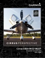
Cirrus SR20/SR22/SR22T
Integrated Avionics System
Pilot’s Guide
Cirrus Perspective
™
by Garmin
Cirrus SR20/SR22/SR22T
Garmin International, Inc.
1200 East 151st Street
Olathe, KS 66062, U.S.A.
p:913.397.8200
f:913.397.8282
www.garmin.com
Garmin AT, Inc.
2345 Turner Road SE
Salem, OR 97302, U.S.A.
p:503.391.3411
f:503.364.2138
Garmin (Europe) Ltd.
Liberty House, Bulls Copse Road
Houndsdown Business Park
Southampton, SO40 9RB, U.K.
p:44/0870.8501241
f:44/0870.8501251
Garmin Corporation
No. 68, Jangshu 2nd Road
Shijr, Taipei County, Taiwan
p:886/02.2642.9199
f:886/02.2642.9099
Summary of Contents for Cirrus Perspective SR20
Page 1: ... Cirrus SR20 SR22 SR22T Integrated Avionics System Pilot s Guide ...
Page 2: ......
Page 655: ......


