Summary of Contents for CS 1522
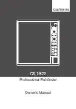
Page 1: ...CS 1522 Professional Fishfinder Owner s Manual...
Page 44: ...CHAPTER 2 GETTING STARTED 42...
Page 72: ...CHAPTER 5 APPENDICES 70...
Page 73: ......
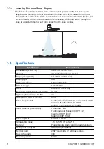
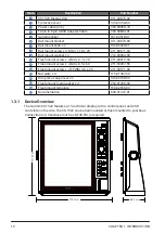
The Garmin CS 1522 Owner's Manual is a comprehensive guide to unlocking the full potential of your device. Easily download the manual for free from 88.208.23.73:8080 to learn how to use all the features and settings of the Garmin CS 1522 for optimal performance and user experience.
Page 1: ...CS 1522 Professional Fishfinder Owner s Manual...
Page 44: ...CHAPTER 2 GETTING STARTED 42...
Page 72: ...CHAPTER 5 APPENDICES 70...
Page 73: ......