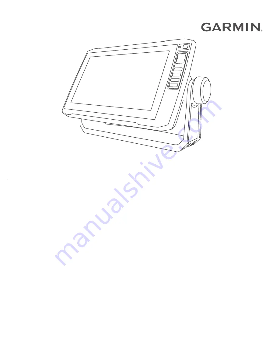
background image

ECHOMAP

 PLUS

Owner’s Manual

Summary of Contents for ECHOMAP PLUS

Page 1: ...ECHOMAP PLUS Owner sManual ...

Page 2: ...ECHOMAP Fusion Link Garmin ClearVü Garmin Connect Garmin Express Garmin Quickdraw GXM LiveScope OneChart and Panoptix are trademarks of Garmin Ltd or its subsidiaries These trademarks may not be used without the express permission of Garmin The BLUETOOTH word mark and logos are owned by the Bluetooth SIG Inc and any use of such marks by Garmin is under license NMEA NMEA 2000 and the NMEA 2000 logo...

Page 3: ...ng Charts with ActiveCaptain 14 Charts and 3D Chart Views 15 Navigation Chart and Fishing Chart 15 Zooming In and Out of the Chart 15 Panning the Chart with the Keys 16 Selecting an Item on the Map Using the Device Keys 16 Chart Symbols 16 Measuring a Distance on the Chart 16 Creating a Waypoint on the Chart 16 Navigating to a Point on the Chart 17 Viewing Location and Object Information on a Char...

Page 4: ...l Saved Routes 39 Auto Guidance 40 Setting and Following an Auto Guidance Path 40 Creating and Saving an Auto Guidance Path 40 Adjusting an Auto Guidance Path 40 Canceling an Auto Guidance Calculation in Progress 41 Setting a Timed Arrival 41 Auto Guidance Path Configurations 41 Tracks 42 Showing Tracks 42 Setting the Color of the Active Track 42 Saving the Active Track 43 Viewing a List of Saved ...

Page 5: ...n 67 Setting the Scroll Speed 67 Adjusting the Range 67 Sonar Appearance Settings 68 Sonar Alarms 68 Advanced Sonar Settings 69 Transducer Installation Settings 69 Sonar Frequencies 70 Turning On the A Scope 71 Panoptix Sonar Setup 71 Adjusting the RealVü Viewing Angle and Zoom Level 71 Adjusting the RealVü Sweep Speed 71 LiveVü Forward and FrontVü Sonar Settings 72 LiveVü and FrontVü Appearance S...

Page 6: ... Number of Engines Shown in Gauges 86 Customizing the Engines Shown in Gauges 86 Enabling Status Alarms for Engine Gauges 86 Enabling Some Engine Gauge Status Alarms 86 Setting the Fuel Alarm 86 Setting the Fuel Capacity of the Vessel 87 Synchronizing the Fuel Data with the Actual Vessel Fuel 87 Viewing the Wind Gauges 87 Configuring the Sailing Wind Gauge 87 Configuring the Speed Source 87 Config...

Page 7: ...ettings 100 NMEA 0183 100 NMEA 2000 Settings 100 Wi Fi Network 101 Setting Alarms 101 Navigation Alarms 101 System Alarms 102 Setting the Fuel Alarm 102 Units Settings 102 Navigation Settings 102 Other Vessel Settings 103 Restoring the Original Chartplotter Factory Settings 103 Sharing and Managing User Data 103 Connecting to a Garmin Device to Share User Data 104 User Data Sharing Cable Wiring Di...

Page 8: ...oes not display the correct time 112 Garmin Support Center 112 Specifications 113 All Models 113 4 Inch Models 113 6 Inch Models 114 7 Inch Models 114 9 Inch Models 115 Sonar Models Specifications 115 NMEA 0183 Information 116 NMEA 2000 PGN Information 118 vi Table of Contents ...

Page 9: ...device in the bracket you should make sure the device is firmly secured in the cradle the cables are fully pushed into the device and cradle and the locking bracket is snapped firmly closed There is an audible click when the device or locking bracket is installed correctly If the cables are not fully seated and the device is not firmly secured it can lose power or stop working The device can also ...

Page 10: ...out of a chart or view Zooms in to a chart or view Scrolls highlights options and moves the cursor SELECT Acknowledges messages and selects options BACK Returns to the previous screen MARK Saves the present location as a waypoint HOME Returns to the Home screen Takes a screenshot when held MENU Opens a menu of options for the page when applicable Closes a menu when applicable Takes a screenshot wh...

Page 11: ... the cradle the cables are fully pushed into the device and cradle and the locking bracket is snapped firmly closed There is an audible click when the locking bracket is installed correctly If the cables are not fully seated and the device is not firmly secured it can lose power or stop working The device can also fall out of the cradle and become damaged if it is not firmly secured Introduction 3...

Page 12: ...ns to the previous screen MARK Saves the present location as a waypoint HOME Returns to the Home screen Takes a screenshot when held MENU Opens a menu of options for the page when applicable Closes a menu when applicable Takes a screenshot when held ECHOMAP Plus 60 Connector View POWER Power and data sharing1 N2K NMEA 2000 network XDCR 4 pin transducer NOTICE To prevent corrosion of the metal cont...

Page 13: ...e Keys Turns on and off the device when held Opens a shortcut menu to backlight color mode and sonar transmission when quickly pressed and released Scrolls through the brightness levels when pressed repeatedly 1 2 3 4 Assigns a shortcut key to the active screen when held Opens the assigned screen when pressed Introduction 5 ...

Page 14: ...rts 1 Open a screen 2 Hold a shortcut key and select OK TIP The shortcut is also saved to the Frequently Used category with the shortcut key number Tips and Shortcuts Press to turn on the chartplotter From any screen press repeatedly to scroll through the brightness levels This can be helpful when the brightness is so low you cannot see the screen Hold a numbered key to create a shortcut to a scre...

Page 15: ...s 4 or higher Use of an 8 GB or larger memory card with speed class 10 is recommended 1 Open the access flap or door on the front of the chartplotter 2 Insert the memory card 3 Press the card in until it clicks 4 Clean and dry the gasket and door NOTICE To prevent corrosion be sure the memory card gasket and door are thoroughly dry before closing the door 5 Close the door Acquiring GPS Satellite S...

Page 16: ... and select the new item To remove an item you have added to the Home screen select Remove and select the item To change the Home screen background image select Background and select an image Customizing Pages Creating a New Combination Page with the ECHOMAP Plus 70 90 You can create a custom combination page to suit your needs 1 Select Combos Customize Add 2 Select a layout 3 Select an area 4 Sel...

Page 17: ... select Done 9 Use the arrow keys to resize the windows 10 Select to BACK to exit Creating a New Combination Page with the ECHOMAP Plus 40 You can create a custom combination page to suit your needs 1 Select Combos Customize Add 2 Select the first function 3 Select the second function 4 Select Split to choose the direction of the split screen optional 5 Select Next 6 Enter a name for the page TIP ...

Page 18: ... Bar and select the necessary options 3 Select Done Setting the Vessel Type You can select your boat type to configure the chartplotter settings and to use features customized for your boat type 1 Select Settings My Vessel Vessel Type 2 Select an option Adjusting the Backlight 1 Select Settings System Display Backlight 2 Adjust the backlight TIP From any screen press repeatedly to scroll through t...

Page 19: ...push smart notifications such as calls and texts to your chartplotter display when connected You can connect to the ActiveCaptain community for up to date feedback on marinas and other boating points of interest The ECHOMAP Plus 70 90 models are compatible with the ActiveCaptain community The ECHOMAP Plus 40 60 models are not compatible with the ActiveCaptain community ActiveCaptain Roles Your lev...

Page 20: ...05 3 From the ActiveCaptain page select Wi Fi Network Wi Fi On 4 Enter a name and password for this network 5 From the application store on your mobile device install and open the ActiveCaptain app 6 Bring the mobile device within 32 m 105 ft of the ECHOMAP Plus device 7 From your mobile device settings open the Wi Fi connections page and connect to the Garmin device using the name and password yo...

Page 21: ...e you can manage the notifications you must enable the Smart Notifications feature When the Smart Notifications feature is enabled and your mobile device receives a notification a pop up notification appears on the ECHOMAP Plus screen briefly You can access and manage the notifications from the ActiveCaptain screen 1 Select ActiveCaptain Smart Notifications Messages A list of notifications appear ...

Page 22: ... Now Updating Charts with ActiveCaptain NOTE Before you can update your charts you must register them Getting Started with the ActiveCaptain App page 12 You can use the ActiveCaptain app to download and transfer the latest chart updates for your device To shorten download time and conserve storage space you can download only the areas of the chart you need After you download a chart or area for th...

Page 23: ... and provides a visual navigation aid This view is helpful when navigating tricky shoals reefs bridges or channels and when trying to identify entry and exit routes in unfamiliar harbors or anchorages Fish Eye 3D Provides an underwater view that visually represents the sea floor according to the chart information When a sonar transducer is connected suspended targets such as fish are indicated by ...

Page 24: ...e Perspective photo available Other features common to most charts include depth contour lines intertidal zones spot soundings as depicted on the original paper chart navigational aids and symbols obstructions and cable areas Measuring a Distance on the Chart 1 From a chart select a location 2 Select Measure Distance A push pin appears on the screen at your present location The distance and angle ...

Page 25: ...ance cannot calculate part of the Auto Guidance line This is due to the settings for minimum safe water depth and minimum safe obstacle height 5 Follow the magenta line steering to avoid land shallow water and other obstacles Viewing Location and Object Information on a Chart You can view information about a location or an object on the Navigation chart or the Fishing chart NOTE The Fishing chart ...

Page 26: ...rom a chart select MENU Layers My Vessel Heading Line Angle Markers 2 If necessary select Source and select an option To automatically use the available source select Auto To use the GPS antenna heading for COG select GPS Heading COG To use data from a connected heading sensor select Heading To use data from both a connected heading sensor and the GPS antenna select COG and Heading This displays b...

Page 27: ...esolution satellite images for a realistic view of the land and water on the Navigation chart Showing Satellite Imagery on the Navigation Chart page 20 Aerial Photos Shows marinas and other navigationally significant aerial photos to help you visualize your surroundings Viewing Aerial Photos of Landmarks page 21 Detailed Roads and POI data Shows detailed road and point of interest POI data which i...

Page 28: ...ion appears above the direction indicator Color Current Speed Range Yellow 0 to 1 knot Orange 1 to 2 knots Red 2 or more knots Showing Tides and Current Indicators NOTE This feature is available with premium charts in some areas You can show static or animated tide and current station indicators on the Navigation chart or Fishing chart 1 From the Navigation or Fishing chart select MENU Layers Char...

Page 29: ...rection in which the triangle is pointing indicates the direction in which the AIS vessel is moving Target is selected Target is activated The target appears larger on the chart A green line attached to the target indicates the heading of the target The MMSI speed and direction of the vessel appear beneath the target if the details setting has been set to Show If the AIS transmission from the vess...

Page 30: ...d by the vessel can impact the calculation of the projected course line When course over ground heading and rate of turn information are provided by an activated AIS target the projected course of the target is calculated based on the course over ground and the rate of turn information The direction in which the target is turning which is also based on the rate of turn information is indicated by ...

Page 31: ... the safe zone radius around your vessel 4 Select Time To 5 Select a time at which the alarm will sound if a target is determined to intersect the safe zone For example to be notified of a pending intersection 10 minutes before it will likely occur set Time To to 10 and the alarm will sound 10 minutes before the vessel intersects the safe zone AIS Aids to Navigation An AIS aid to navigation ATON i...

Page 32: ...ed AIS distress signal devices transmit emergency position reports when activated The chartplotter can receive signals from Search and Rescue Transmitters SART Emergency Position Indicating Radio Beacons EPIRB and other man overboard signals Distress signal transmissions are different than standard AIS transmissions so they appear differently on the chartplotter Instead of tracking a distress sign...

Page 33: ...essels AIS Off All AIS functionality on all charts and 3D chart views is disabled This includes AIS vessel targeting and tracking collision alarms that result from AIS vessel targeting and tracking and the display of information about AIS vessels Chart Menu NOTE Not all settings apply to all chart views Some options require premium maps or connected accessories NOTE The menus may contain some sett...

Page 34: ...are used Showing Satellite Imagery on the Navigation Chart page 20 NOTE This setting must be enabled to view Standard Mapping charts Tides Currents Shows current station indicators and tide station indicators on the chart and enables the tides and current slider which sets the time for which tides and currents are reported on the map Land POIs Shows points of interest on land Navaid Shows navigati...

Page 35: ...er Time Constant Filters the layline data based on the time interval entered For a smoother layline that filters out some of the changes in the boat s heading or true wind angle enter a higher number For laylines that display a higher sensitivity to changes in the boat s heading or true wind angle enter a lower number User Data Layer Settings You can show user data such as waypoints boundaries and...

Page 36: ...ws the gradient of the bottom with shading This feature is available only with some premium maps Sonar Imagery Shows sonar imagery to help show the density of the bottom This feature is available only with some premium maps Lake Level Sets the present water level of the lake This feature is available only with some premium maps Depth Range Shading You can set color ranges on your map to show the w...

Page 37: ...e Garmin Quickdraw Contours mapping feature allows you to instantly create maps with contours and depth labels for any body of water When Garmin Quickdraw Contours records data a colored circle surrounds the vessel icon This circle represents the approximate area of the map that is scanned by each pass A green circle indicates good depth and GPS position and a speed under 16 km h 10 mph A yellow c...

Page 38: ...munity Connecting to the Garmin Quickdraw Community with Garmin Connect page 31 Connecting to the Garmin Quickdraw Community with ActiveCaptain 1 From your mobile device open the ActiveCaptain app and connect to the ECHOMAP Plus device Getting Started with the ActiveCaptain App page 12 2 From the app select Quickdraw Community You can download contours from others in the community Downloading Garm...

Page 39: ...ect account create one 4 Sign in to your Garmin Connect account 5 Select Dashboards Marine to open the Garmin Quickdraw widget TIP Make sure you have a memory card in your computer to share Garmin Quickdraw Contours maps Sharing Your Garmin Quickdraw Contours Maps with the Garmin Quickdraw Community Using Garmin Connect You can share Garmin Quickdraw Contours maps that you have created with others...

Page 40: ...utes to load the maps Garmin Quickdraw Contours Settings From a chart select MENU Quickdraw Contours Settings Recording Offset Sets the distance between the sonar depth and the contour recording depth If the water level has changed since your last recording adjust this setting so the recording depth is the same for both recordings For example if the last time you recorded had a sonar depth of 3 1 ...

Page 41: ...low the course or the route on the Navigation chart Fishing chart Perspective 3D chart view or Mariner s Eye 3D chart view You can set and follow a course to a destination using one of three methods Go To Route To or Auto Guidance Go To Takes you directly to the destination This is the standard option for navigating to a destination The chartplotter creates a straight line course or navigation lin...

Page 42: ... hazards that could result in vessel damage personal injury or death The Auto Guidance feature is based on electronic chart information That data does not ensure obstacle and bottom clearance Carefully compare the course to all visual sightings and avoid any land shallow water or other obstacles that may be in your path When using Go To a direct course and a corrected course may pass over land or ...

Page 43: ...ightings and steer to avoid land shallow water and other dangerous objects You can set and follow a direct course from your current location to a selected destination 1 Select a destination Destinations page 34 2 Select Navigate To Go To A magenta line appears In the center of the magenta line is a thinner purple line that represents the corrected course from your current location to the destinati...

Page 44: ...e a new waypoint by projecting the distance and bearing from a different location This can be helpful when creating sail racing start and finish lines 1 Select Nav Info Waypoints New Waypoint Enter Range Bearing 2 If necessary select a reference point on the chart 3 Select Enter Range Bearing 4 Enter the distance and select Done 5 Enter the bearing and select Done 6 Select Select Position Viewing ...

Page 45: ...ttom clearance Carefully compare the course to all visual sightings and avoid any land shallow water or other obstacles that may be in your path When using Go To a direct course and a corrected course may pass over land or shallow water Use visual sightings and steer to avoid land shallow water and other dangerous objects NOTE Auto Guidance is available with premium charts in some areas Before you...

Page 46: ...Route You can add up to 250 turns to one route 1 Select Nav Info Routes New Route Route Using Chart 2 Select the starting location of the route The starting point can be your present location or another location 3 Select Add Turn 4 Select the location of the next turn on the chart 5 Select Add Turn 6 If necessary repeat steps 4 and 5 to add more turns 7 Select Done Viewing a List of Routes Select ...

Page 47: ...igate parallel to the route offset from it by a specific distance 5 Indicate how to navigate the route To navigate the route from the starting point used when the route was created to the left of the original route select Forward Port To navigate the route from the starting point used when the route was created to the right of the original route select Forward Starboard To navigate the route from ...

Page 48: ...ew the path indicated by the magenta line 4 Select Start Navigation 5 Follow the magenta line steering to avoid land shallow water and other obstacles Route Color Coding page 34 NOTE When using Auto Guidance a gray segment within any part of the magenta line indicates that Auto Guidance cannot calculate part of the Auto Guidance line This is due to the settings for minimum safe water depth and min...

Page 49: ...ns When your boat enters one of those areas a warning message appears Route Color Coding page 34 NOTE Auto Guidance is available with premium charts in some areas NOTE Not all settings apply to all maps You can set the parameters the chartplotter uses when calculating an Auto Guidance path Select Settings Navigation Auto Guidance Preferred Depth Sets the minimum water depth based on chart depth da...

Page 50: ...the Shoreline Distance setting to Near or Nearest As a result the chartplotter may not reposition the Auto Guidance line unless the destination selected requires navigation through a narrow waterway 8 Select an option If the placement of the line is satisfactory select MENU Stop Navigation and proceed to step 10 If the line is too close to known obstacles select Settings Navigation Auto Guidance S...

Page 51: ...ect a track 3 Select Review Edit Track Save as Route Browsing for and Navigating a Recorded Track Before you can browse a list of tracks and navigate to them you must record and save at least one track 1 Select Nav Info Tracks Saved Tracks 2 Select a track 3 Select Follow Track 4 Select an option To navigate the track from the starting point used when the track was created select Forward To naviga...

Page 52: ...n To record the track based on a distance between points select Distance Change and enter the distance To record the track based on a time interval select Time Change and enter the time interval To record the track plot based on a variance from your course select Resolution Change and enter the maximum error allowed from the true course before recording a track point This is the recommended record...

Page 53: ...rm select Alarm Setting a Boundary Alarm Boundary alarms alert you when you are within a specified distance of a set boundary This can be helpful when attempting to avoid certain areas or when you should be very alert in certain areas 1 Select Nav Info Boundaries 2 Select a boundary 3 Select Review Alarm 4 Select an option To set an alarm for when your boat is a specified distance from the boundar...

Page 54: ...hite This indicates the boat must increase speed to reach the start line on time When the end point is past the start line the line is red This indicates the boat must reduce speed to avoid a penalty for reaching the start line before the timer expires When the end point is on the start line the line is white This indicates the boat is moving at an optimal speed to reach the start line when the ti...

Page 55: ... chart Length Sets the length of the laylines Display Sets how the laylines and vessel appear on the chart Setup Sailing Angle Allows you to select how the device calculates laylines The Actual option calculates the laylines using the measured wind angle from the wind sensor The Manual option calculates the laylines using manually entered windward and leeward angles Setup Windward Angle Allows you...

Page 56: ... the transducer is installed at the water line or anywhere above the end of the keel measure the distance from the transducer location to the keel of the boat Enter this value as a positive number If the transducer is installed at the bottom of the keel and you want to know the true depth of the water measure the distance from the transducer to the water line Enter this value in as a negative numb...

Page 57: ...structions included with your autopilot 1 From the autopilot screen select MENU Autopilot Setup Sailing Setup Wind Hold Type 2 Select Apparent or True Engaging Wind Hold Before you can enable the wind hold you must connect a wind sensor to the autopilot From the autopilot screen select MENU Engage Apparent Wind Hold or Engage True Wind Hold Engaging Wind Hold from Heading Hold Before you can engag...

Page 58: ... ground which are helpful for casting or finding reference points Setting the Heading Line and Angle Markers The heading line is an extension drawn on the map from the bow of the boat in the direction of travel Angle markers indicate relative position from the heading or course over ground which are helpful for casting or finding reference points You can show the heading line and the course over g...

Page 59: ...he type of transducer and sounder module connected to the chartplotter For example you can view certain Panoptix sonar screens only if you have a compatible Panoptix transducer connected There are four basic styles of sonar views available a full screen view a split screen view that combines two or more views a split zoom view and a split frequency view that displays two different frequencies You ...

Page 60: ...een scrolls from the right to the left Depth information Suspended targets or fish Bottom of the body of water Split Frequency Sonar View In the split frequency sonar view the two sides of the screen show a full view graph of sonar data of different frequencies NOTE The split frequency sonar view requires the use of a dual frequency transducer Split Zoom Sonar View The split zoom sonar view shows ...

Page 61: ...follows a traditional sonar color palette in which yellow indicates the strongest return orange indicates a strong return red indicates a weaker return blue indicates the weakest return and white indicates no return Select Sonar Flasher A scope zoomed in view of the right side view A scope with zoom area outlined 2 3 Depth scale Depth at your present location Angle and span of the transducer cone ...

Page 62: ...nd down to move the zoom area Select to adjust the range Select to adjust the frequency Select to adjust the gain Select to adjust the beam width Drag the zoom window to move the zoom area on the left A scope Spread two fingers apart to zoom in Pinch two fingers together to zoom out 54 Sonar Fishfinder ...

Page 63: ...requency sonar provides a detailed picture of the fishing environment around the boat in a detailed representation of structures the boat is passing over Traditional transducers emit a conical beam The Garmin ClearVü scanning sonar technology emits a beam similar to the shape of the beam in a copy machine This beam provides a clearer picture like image of what is beneath the boat Sonar Fishfinder ...

Page 64: ...el does provide built in SideVü sonar you need a compatible SideVü transducer SideVü scanning sonar technology shows you a picture of what lies to the sides of the boat You can use this as a search tool to find structures and fish Left side of the boat Right side of the boat The transducer on your vessel Logs Old tires Trees Water between the vessel and the bottom Distance from the side of the boa...

Page 65: ... Views To receive Panoptix sonar you need a compatible transducer The Panoptix sonar views allow you to see all around the boat in real time You can also watch your bait underwater and bait schools in front of or below your boat The LiveVü sonar views provide you a view of the live movement either in front of or below your boat The screen updates very quickly producing sonar views that look more l...

Page 66: ...his sonar view shows a two dimensional view of what is below the boat and can be used to see a bait ball and fish Panoptix down view history in a scrolling sonar view Boat Range Trails Drop shot rig Bottom 58 Sonar Fishfinder ...

Page 67: ...LiveVü Forward Sonar View This sonar view shows a two dimensional view of what is in front of the boat and can be used to see a bait ball and fish Boat Range Fish Trails Bottom Sonar Fishfinder 59 ...

Page 68: ...ows a three dimensional view of what is in front of the transducer This view can be used when you are stationary and you need to see the bottom and the fish approaching the boat Color legend Boat Ping indicator Fish Bottom Range 60 Sonar Fishfinder ...

Page 69: ... This sonar view shows a three dimensional view of what is below the transducer and can be used when you are stationary and want to see what is around your boat Color legend Boat Sonar beam Range Fish Bottom Sonar Fishfinder 61 ...

Page 70: ...des a three dimensional view of what is behind your boat as you are moving and shows the entire water column in 3D from the bottom to the top of the water This view is used for finding fish Color legend Boat Range Bottom Structure Fish 62 Sonar Fishfinder ...

Page 71: ...ü sonar decreases as your speed rises above 8 knots To see the FrontVü sonar view you must install and connect a compatible transducer such as a PS21 transducer You may need to update the transducer software LiveScope Sonar View This sonar view shows a live view of what is in front of or below the boat and can be used to see fish and structures Depth information Suspended targets or fish Bottom of...

Page 72: ...g the Compass Before you can calibrate the compass the transducer must be installed far enough away from the trolling motor to avoid magnetic interference and deployed in the water Calibration must be of sufficient quality to enable the internal compass NOTE The compass may not work if you mount the transducer on the motor NOTE For best results you should use a heading sensor such as the SteadyCas...

Page 73: ...ight 2 Select BACK to exit Sonar Sharing You can view the sonar data from all compatible sources on the Garmin Marine Network You can view sonar data from a compatible external sonar module such as a GCV sonar module In addition you can view the sonar data from other chartplotters that have a built in sonar module Each chartplotter on the network can display sonar data from every compatible sonar ...

Page 74: ...rns at the bottom If you want to reduce the intensity of the return you can reduce the color gain or contrast 1 From a sonar view select MENU 2 Select an option based on sonar view Select Contrast Select Sonar Setup Appearance Color Gain 3 Select an option To increase or decrease the color intensity manually select Up or Down To use the default setting select Default Traditional Garmin ClearVü and...

Page 75: ... using speed over ground or water speed data select Auto The Auto setting selects a scroll rate to match the boat speed so targets in the water are drawn with the correct aspect ratio and appear less distorted When viewing Garmin ClearVü SideVü sonar views or searching for structure it is recommend to use the Auto setting To scroll faster select Up To scroll more slowly select Down Adjusting the R...

Page 76: ... alarms feature is a tool for situational awareness only and may not prevent grounding in all circumstances It is your obligation to ensure safe operation of the vessel The shallow water alarm feature is a tool for situational awareness only and may not prevent groundings in all circumstances It is your obligation to ensure safe operation of the vessel CAUTION The Beeper setting must be turned on ...

Page 77: ... the bottom The device will not search for the bottom deeper than the selected depth Adjusts the appearance of returns to compensate for weakened sonar signals in deeper water and reduces the appearance of noise near the surface When the value of this setting is increased the colors associated with low level noise and fish targets appear more consistent through various water depths This setting al...

Page 78: ...r each transducer element which enables you to change the frequency quickly using the presets as the water and your goals change Viewing two frequencies concurrently using the split frequency view allows you to see deeper with the lower frequency return and at the same time see more detail from the higher frequency return NOTICE Always be aware of local regulations on sonar frequencies For example...

Page 79: ... the viewing angle of the RealVü sonar views You can also zoom in and out of the view From a RealVü sonar view select an option To zoom in and out select and To adjust the viewing angle on devices with keys use the arrow keys To adjust the viewing angle diagonally on touchscreen devices select To adjust the viewing angle horizontally on touchscreen devices select To adjust the viewing angle vertic...

Page 80: ...ion to the depth Manually adjusting the range enables you to view a specified range The bottom can appear on the screen as long as it appears within the range you have set Manually reducing this option can reduce the effectiveness of the FrontVü Alarm reducing your reaction time to low depth readings Transmit Angle Adjusts the focus of the transducer to the port or starboard side This feature is a...

Page 81: ...orward range gives you time to react 10 seconds It turns red and sounds an alarm when the system detects an obstruction or the depth is less than the entered value LiveVü and FrontVü Appearance Settings From a LiveVü or FrontVü Panoptix sonar view select MENU Sonar Setup Appearance Color Scheme Sets the color palette Color Gain Adjusts the intensity of colors shown on the screen You can select a h...

Page 82: ...nal attitude heading and reference system AHRS sensors to detect the installation angle of the Panoptix transducer automatically When this setting is turned off you can enter the specific installation angle for the transducer using the Pitch Angle setting Many forward view transducers are installed at a 45 degree angle and down view transducers are installed at a zero degree angle Flipped Sets the...

Page 83: ...e and prudent operation of your vessel The autopilot is a tool that enhances your capability to operate your boat It does not relieve you of the responsibility of safely operating your boat Avoid navigational hazards and never leave the helm unattended Always be prepared to promptly regain manual control of your boat Learn to operate the autopilot on calm and hazard free open water Use caution whe...

Page 84: ...he Step Steering Increment 1 From the autopilot screen select MENU Autopilot Setup Step Turn Size 2 Select an increment Setting the Power Saver You can adjust the level of rudder activity 1 From the autopilot screen select MENU Autopilot Setup Power Mode Setup Power Saver 2 Select a percentage Selecting a higher percentage reduces rudder activity and heading performance The higher the percentage t...

Page 85: ...sengage the autopilot system 1 From the autopilot screen select MENU Autopilot Setup Shadow Drive Setup 2 If Disabled is shown select Shadow Drive to enable the Shadow Drive feature The Shadow Drive feature is enabled You can repeat these steps to disable the feature again Engaging the Autopilot When you engage the autopilot the autopilot takes control of the helm and steers the boat to maintain y...

Page 86: ...d back over a specified time and angle across your present heading 1 From the autopilot screen select MENU Pattern Steering Zigzag 2 If necessary select Amplitude and select a degree 3 If necessary select Period and select a length of time 4 Select Engage Zigzag Following the Williamson Turn Pattern You can use the Williamson turn pattern to steer the boat around with the intent of running alongsi...

Page 87: ...d never leave the motor controls unattended Learn to operate the autopilot on calm and hazard free open water Use caution when operating the autopilot near hazards in the water such as docks pilings and other boats CAUTION When using the autopilot features be prepared for sudden stops acceleration and turns When stowing or deploying the motor be aware of slick surfaces around the motor Slipping wh...

Page 88: ...olling motor control bar allows you to control a Force trolling motor and see the status of the motor Select an item to engage it The button illuminates when selected Select the item again to disengage it Trolling motor battery status Turns the propeller on and off Reduces the speed Speed indicator Increases the speed Enables the cruise control at the current speed over ground SOG Engages the prop...

Page 89: ... safe operation of your boat When using the Manual setting for the Arrival Mode option you must be ready to take control of the boat Auto Power On Turns on the trolling motor when you apply power to the system Prop Stow Side Sets which side of the trolling motor the propellor rotates to when stowing the trolling motor This is helpful when you store other items near the stowed propellor Shortcut Ke...

Page 90: ...stress and position information from the radio The chartplotter can track the positions of vessels sending position reports Turning On DSC Select Settings Other Vessels DSC DSC List The DSC list is a log of the most recent DSC calls and other DSC contacts you have entered The DSC list can contain up to 100 entries The DSC list shows the most recent call from a boat If a second call is received fro...

Page 91: ...Route To Position Tracking You can connect a VHF radio to the same NMEA 2000 network as the chartplotter to send position reports and track vessels that send position reports The vessel must send the correct PGN data PGN 129808 DSC Call Information to use this feature Every position report call received is logged in the DSC list Viewing the DSC List page 82 Viewing a Position Report 1 Select Nav I...

Page 92: ...ar for all tracked vessels Individual Routine Calls When you connect the chartplotter to a Garmin VHF radio you can use the chartplotter interface to set up an individual routine call When setting up an individual routine call from your chartplotter you can select the DSC channel on which you want to communicate The radio transmits this request with your call Selecting a DSC Channel NOTE The selec...

Page 93: ...out your bearing heading and route using the compass Select Gauges Compass Viewing Trip Gauges Trip gauges show information for odometer speed time and fuel for your present trip Select Gauges Trip Resetting Trip Gauges 1 Select Gauges Trip MENU 2 Select an option To set all the readings for the present trip to zero select Reset Trip To set the maximum speed reading to zero select Reset Maximum Sp...

Page 94: ...e 4 Repeat for the remaining engine bars Enabling Status Alarms for Engine Gauges You can enable the chartplotter to display engine status alarms From the engine gauges screen select MENU Gauge Setup Status Alarms On When an engine alarms is triggered a gauge status alarm message appears and the gauge may become red depending on the type of alarm Enabling Some Engine Gauge Status Alarms 1 From the...

Page 95: ... or apparent wind speed and angle 1 From the wind gauge select MENU Sailing Wind Gauge 2 Select an option To show true or apparent wind angle select Needle and select an option To show true or apparent wind speed select Wind Speed and select an option Configuring the Speed Source You can specify whether the vessel speed data displayed on the gauge and used for wind calculations is based on water s...

Page 96: ... switching system contact your Garmin dealer Adding and Editing a Digital Switching Page You can add and customize digital switching pages on the chartplotter 1 Select Switching MENU 2 Select Add Page or select a page 3 Set up the page as needed To enter a name for the page select Name To set up the switches select Edit Switches To toggle the switch style between rocker style and push style select...

Page 97: ...on To view information for a different date select Change Date Manual and enter a date To view information for today select Change Date Use Current Date If available to view information for the day after the date shown select Next Day If available to view information for the day before the date shown select Previous Day Viewing Information for a Different Tide or Current Station 1 Select Nav Info ...

Page 98: ...vailable on all media devices and sources 1 From the media screen select Devices and select the stereo 2 From the media screen select Source and select the media source NOTE The Devices button only appears when more than one media device is connected to the network NOTE The Source button only appears for devices that support multiple media sources Playing Music Browsing for Music You can browse fo...

Page 99: ...le marine AM FM antenna properly connected to the stereo and be within range of a broadcasting station You cannot connect an AM FM antenna to the remote control You must connect an AM FM antenna to the stereo you are controlling with the remote control For instructions on connecting an AM FM antenna see the stereo installation instructions To listen to SiriusXM radio you must have the appropriate ...

Page 100: ...ect a preset from the list 3 Select Remove Current Channel DAB Playback When you connect a compatible Digital Audio Broadcasting DAB module and antenna such as the Fusion MS DAB100A to a compatible stereo you can tune in to and play DAB stations To use the DAB source you must be in a region in which DAB is available and select the tuner region Setting the DAB Tuner Region page 92 Setting the DAB T...

Page 101: ...eset 2 Select Browse Presets Save Current Selecting a DAB Preset from a List 1 From the DAB media screen select Browse Presets View Presets 2 Select a preset from the list Removing DAB Presets 1 From the DAB media screen select Browse Presets 2 Select an option To remove one preset select Remove Preset and select the preset To remove all presets select Remove All Presets SiriusXM Satellite Radio W...

Page 102: ...ect an option If the media device is a FUSION Link capable stereo select Media Browse Channel If the media device is a GXM antenna select Media MENU Category Saving a SiriusXM Channel to the Presets List You can save your favorite channels to the presets list 1 Select Media 2 Select the channel to save as a preset 3 Select an option If the media device is a FUSION Link capable stereo select Browse...

Page 103: ... be unlocked 1 From the media screen select Browse Parental Clear All Locked 2 Enter your passcode Setting the Device Name 1 From the media screen select MENU Installation Set Device Name 2 Enter a device name 3 Select SELECT or Done Updating the Media Player Software You can update the software on compatible connected stereos and accessories See the stereo Owner s Manual at support garmin com for...

Page 104: ... GPS Settings NOTE Not all options are available on all models Select Settings System Satellite Positioning Skyview Shows the relative position of GPS satellites in the sky GLONASS Turns on or off GLONASS data Russia satellite system When the system is used in situations with poor sky visibility GLONASS data can be used in combination with GPS to provide more accurate position information WAAS EGN...

Page 105: ...pacity Sets the combined fuel capacity of all the fuel tanks on your vessel Setting the Fuel Capacity of the Vessel page 87 Fill Up All Tanks Sets the tank levels to full Synchronizing the Fuel Data with the Actual Vessel Fuel page 87 Add Fuel to Boat Allows you to enter the quantity of fuel you added to your tank when you did not entirely fill up the tank Synchronizing the Fuel Data with the Actu...

Page 106: ...he transducer is installed at the water line or anywhere above the end of the keel measure the distance from the transducer location to the keel of the boat Enter this value as a positive number If the transducer is installed at the bottom of the keel and you want to know the true depth of the water measure the distance from the transducer to the water line Enter this value in as a negative number...

Page 107: ...city of the Vessel 1 Select Settings My Vessel Fuel Capacity 2 Enter the combined total capacity of the fuel tanks Synchronizing the Fuel Data with the Actual Vessel Fuel You can synchronize the fuel levels in the chartplotter with the actual fuel in the vessel when you add fuel to your vessel 1 Select Gauges Engine MENU 2 Select an option After you have filled up all the fuel tanks on the vessel ...

Page 108: ...ee the chartplotter installation instructions The approved NMEA 0183 sentences for the chartplotter are GPAPB GPBOD GPBWC GPGGA GPGLL GPGSA GPGSV GPRMB GPRMC GPRTE GPVTG GPWPL GPXTE and Garmin proprietary sentences PGRME PGRMM and PGRMZ This chartplotter also includes support for the WPL sentence DSC and sonar NMEA 0183 input with support for the DPT depth or DBT MTW water temperature and VHW wate...

Page 109: ...network Setting Up the Wi Fi Wireless Network page 101 You can connect multiple wireless devices to the chartplotter to share data 1 From the wireless device turn on the Wi Fi technology and search for wireless networks 2 Select the name of your chartplotter wireless network Setting Up the Wi Fi Wireless Network page 101 3 Enter the chartplotter password Changing the Wireless Channel You can chang...

Page 110: ...map or chart that specifies a different position format Map Datum Sets the coordinate system on which the map is structured Do not change this setting unless you are using a map or chart that specifies a different map datum Time Sets the time format time zone and daylight saving time Navigation Settings NOTE Some settings and options require additional charts or hardware Select Settings Navigation...

Page 111: ... software updates To clear saved data and reset device settings to the factory default values disconnect the chartplotter from the Garmin Marine Network and select Delete Data and Reset Settings This does not affect maps or software updates Sharing and Managing User Data WARNING This feature allows you to import data from other devices that may have been generated by third parties Garmin makes no ...

Page 112: ...cted to the same ground 2 Complete an action If the devices are mounted near each other connect the blue wire from the first device to the brown wire of the second and connect the brown wire from the first device to the blue wire of the second If the devices are not mounted near each other obtain a User Data Sharing Cable 010 12234 06 and connect the devices following the instructions included wit...

Page 113: ... Info Manage Data Data Transfer 3 If necessary select the memory card to copy data to 4 Select an option To transfer data from the memory card to the chartplotter and combine it with existing user data select Merge from Card To transfer data from the memory card to the chartplotter and overwrite existing user data select Replace from Card 5 Select the file name Copying User Data to a Memory Card Y...

Page 114: ... from Card Saving System Information to a Memory Card You can save system information to a memory card as a troubleshooting tool A product support representative may ask you to use this information to retrieve data about the network 1 Insert a memory card into the card slot 2 Select Settings System System Information Garmin Devices Save to Card 3 If necessary select the memory card to save system ...

Page 115: ...ossible data charges with some mobile devices Function ActiveCaptain mobile app4 Garmin Express desktop app Register your new Garmin Marine device Yes Yes Update your Garmin chartplotter software Yes Yes Update your Garmin charts Yes Yes Download new Garmin charts Yes Yes Access the Garmin Quickdraw Contours Community to download and share contours with other users Yes No Sync a mobile device with...

Page 116: ...Garmin folder on the memory card 4 Remove the memory card from your device 5 Open the Garmin Express app on your computer 6 Insert the memory card into your computer 7 If necessary select Get Started 8 If necessary while the application searches select Sign In next to Have marine charts or devices near the bottom of the screen 9 Create or sign in to your Garmin account 10 Follow the on screen inst...

Page 117: ...Software Yes 15 Wait several minutes while the update process completes 16 When prompted leave the memory card in place and restart the chartplotter 17 Remove the memory card NOTE If the memory card is removed before the device restarts fully the update is not complete Software Updates You may need to update the software when you install a new device or add an accessory You can use the ActiveCapta...

Page 118: ...ting the Device Software Using a Memory Card page 110 Updating the Device Software Using a Memory Card To update the software using a memory card you must obtain a software update memory card or load the latest software onto a memory card using the Garmin Express app Loading the New Software on a Memory Card Using Garmin Express page 110 1 Turn on the chartplotter 2 After the home screen appears i...

Page 119: ... If it is mounted inside of a cabin it should be close to a window so it can receive the GPS signal My device will not turn on or keeps turning off Devices erratically turning off or not turning on could indicate an issue with the power supplied to the device Check these items to attempt to troubleshoot the cause of the power issue Make sure the power source is generating power You can check this ...

Page 120: ...his is commonly displayed as latitude longitude in degrees and minutes with options for degrees minutes and second degrees only or one of several grid formats Map datum is a math model which depicts a part of the surface of the earth Latitude and longitude lines on a paper map are referenced to a specific map datum 1 Find out which map datum and position format was used when the original waypoint ...

Page 121: ...50 000 points 50 saved tracks 4 Inch Models Specification Measurement Dimensions on mount W x H x D 10 2 x 16 5 x 0 4 cm 4 0 x 6 5 x 3 1 in Display size W x H 5 4 x 9 5 cm 2 1 x 3 7 in 10 5 cm 4 3 in diagonal Display resolution WQVGA 480 x 272 pixels Weight 0 7 kg 1 6 lbs Compass safe distance 25 cm 9 8 in Input voltage From 9 to 18 Vdc Max power draw 5 W Typical current draw RMS 0 5 A Max current...

Page 122: ...rrent draw at 12 Vdc RMS 0 7 A Max current draw at 12 Vdc 1 25 A Wireless frequency 2 4 GHz 17 2 dBm maximum 7 Inch Models Specification Measurement Dimensions on cradle and bail mount W x H x D 25 9 x 15 4 x 6 3 cm 10 2 x 6 x 2 5 in Display size W x H 15 5 x 8 7 cm 6 1 x 3 4 in 17 8 cm 7 in diagonal Display resolution WVGA 400 x 800 pixels Weight 0 77 kg 1 7 lb Clearance to nearest obstruction 11...

Page 123: ...w 18 W Typical current draw at 12 Vdc RMS 1 A Max current draw at 12 Vdc 2 4 A Wireless frequency 2 4 GHz 18 5 dBm maximum Sonar Models Specifications Specification Measurement Sonar frequencies8 Traditional 50 77 83 or 200 kHz CHIRP Garmin ClearVü 260 455 or 800 kHz CHIRP SideVü 260 455 or 800 kHz Sonar transmit power RMS 9 500 W Sonar depth10 701 m 2 300 ft at 77 kHz 8 Dependent upon the transdu...

Page 124: ...ngitude GPGSA GSA GNSS DOP and active satellites GPGSV GSV GNSS satellites in view GPRMB RMB Recommended minimum navigation information GPRMC RMC Recommended minimum specific GNSS data GPRTE RTE Routes GPVTG VTG Course over ground and ground speed GPWPL WPL Waypoint location GPXTE XTE Cross track error PGRME E Estimated error PGRMM M Map datum PGRMZ Z Altitude SDDBT DBT Depth below transducer SDDP...

Page 125: ...ing information DSE Expanded digital selective calling HDG Heading deviation and variation HDM Heading magnetic MWD Wind direction and speed MDA Meteorological composite MWV Wind speed and angle VDM AIS VHF data link message You can purchase complete information about National Marine Electronics Association NMEA format and sentences from www nmea org Appendix 117 ...

Page 126: ...ed Water referenced 128267 Water depth 129539 GNSS DOPs 129799 Radio frequency mode and power 130306 Wind data 130312 Temperature Transmit PGN Description 126464 Transmit and receive PGN list group function 127258 Magnetic Variance 129025 Position Rapid update 129026 COG and SOG Rapid update 129029 GNSS position data 129283 Cross track error 129284 Navigation data 129285 Navigation route and waypo...

Page 127: ...S class B position report 129040 AIS class B extended position report 129794 AIS class A static and voyage related data 129798 AIS SAR aircraft position report 128000 Nautical leeway angle 129802 AIS safety related broadcast message 129808 DSC call information 130310 Environmental parameters 130311 Environmental parameters obsolete 130313 Humidity 130314 Actual pressure 130576 Small craft status T...

Page 128: ...support garmin com TA 2018 183 TA 2018 209 TA 2018 154 GUID 4B2EE31F 9CD8 4C0D 89A0 3107908C721B v9 May 2023 ...

Reviews: