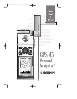
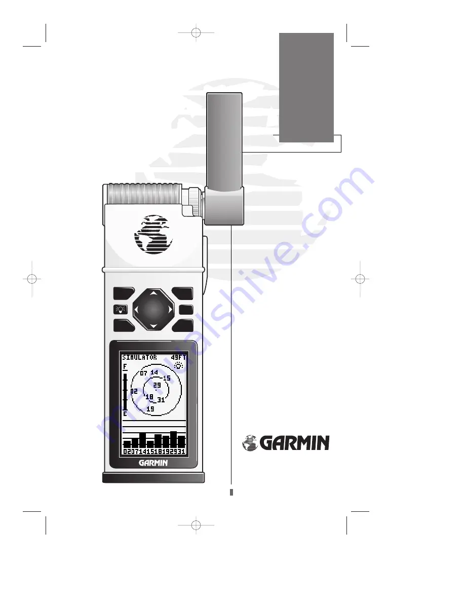
background image

GOTO

QUIT

PAGE

MARK

ENTER

G   P   S      4   5

GPS 45

Personal
Navigator

TM

Owner’s

Manual

&

Reference

45 manual Rev. B  8/4/98 10:17 AM  Page 1

Summary of Contents for GPS 45

Page 1: ...GOTO QUIT PAGE MARK ENTER G P S 4 5 GPS45 Personal NavigatorTM Owner s Manual Reference 45 manual Rev B 8 4 98 10 17 AM Page 1 ...

Page 2: ...45 manual Rev B 8 4 98 11 07 AM Page 2 ...

Page 3: ... electronic or manual including photocopying and recording for any purpose without the express written permission of GARMIN Information in this document is subject to change without notice GARMIN reserves the right to change or improve their products and to make changes in the content without obligation to notify any person or organization of such changes or improvements April 1994 Part 190 00070 ...

Page 4: ...rstand all aspects of this Owner s Manual and thor oughly practice operation using the simulator mode prior to actual use When in actual use carefully compare indications from the GPS 45 to all available navigation sources including the information from other NAVAIDs visual sightings charts etc For safety always resolve any discrepancies before con tinuing navigation NOTE This device complies with...

Page 5: ...des a quick start orientation to the GPS 45 It has been designed to acquaint you with the unit and provide a basic working knowledge necessary to use the unit in typical conditions Section Two provides a detailed reference to the advanced features and operations of the GPS 45 in a topical format This allows you to concentrate on a specific topic quickly without reading through entire sections of t...

Page 6: ...ll weather use Up to 20 hours of battery life on 4 AA alkaline cells in battery saver mode Advanced Navigating and Plotting 250 alphanumeric waypoints List of 9 nearest waypoints 20 reversible routes MOB mode with bearing and distance to mark Moving Map Plotting with scales to 1 5th statute mile Graphic pages for Satellite Status Position Plotting and CDI Navigation Active graphic display of cardi...

Page 7: ...PS 45 Receiver with Removable Antenna Carrying Case GPS 45 Owner s Manual 4 AA Batteries Quick Reference Card Warranty Registration Card Optional Accessories Swivel Mounting Bracket Power Data Cable Remote Mount Marine Antenna Low Profile Automobile Antenna Cigarette Lighter Adapter PC Kit See your local GARMIN dealer for optional accessories Introduction Packing List 45 manual Rev B 8 4 98 11 07 ...

Page 8: ...45 manual Rev B 8 4 98 11 07 AM Page vi ...

Page 9: ...Creating and Using Waypoints 18 24 GOTOs and MOB Mode 25 26 Creating and Using Routes 27 32 Moving Map Plotting 33 36 Menu Page and Auxiliary Functions 37 46 Battery and Antenna Installation 47 Appendix A Glossary 48 Appendix B Messages 49 50 Appendix C Time Offset 51 Appendix D Map Datums 52 53 Appendix E Maintenance and Specifications 54 Appendix F Electrical Wiring and Installation 55 Appendix ...

Page 10: ... any 3 or 4 of these satellites and calculating various time differences between the transmitted signals your GPS receiver can determine its present position anywhere on earth And once you re under way your GPS con tinuously updates your position and provides speed and track information What are the Advantages of GPS Navigation For centuries mariners have been searching for an accurate method of t...

Page 11: ...arth that pass through the north and south poles Longitude describes position in terms of how many degrees it is east or west of the Prime Meridian 0º longitude Parallels of latitude are another set of imaginary circles that are perpendicular to the earth s polar axis Latitude describes position in terms of how many degrees it is north or south of the equator 0º latitude A waypoint marks an exact ...

Page 12: ...tion 1 Rotate the antenna so it s pointing up perpendicular to the ground 2 Press the B key firmly to turn the unit on The Welcome Page will be displayed while the unit conducts a self test Once testing is complete the Welcome Page will be replaced by the Status Page and the unit will begin acquiring satellite data While the GPS 45 is acquiring satellite data relax and browse through the rest of t...

Page 13: ...zon north up the inner circle 45º above the horizon and the center point directly overhead Once sufficient signals have been acquired the Status Page will be replaced with the Position Page The Position Page shows you where you are what direction you re heading and how fast you are going The graphic display at the top of the page indicates your cardinal heading only while you re moving with the tr...

Page 14: ...t s change the default name to something that s a little more meaningful 1 Press theU key twice to move the field high light from the save field to the name field 2 Press the E key to begin entry of your way point name 3 Press and hold theU key to scroll through the alphabet until the letter H appears 4 Press the R key once to move the character highlight to the next character space 5 Repeat steps...

Page 15: ...display to the Moving Map Page and watch the track of our trip 1 Press the P key to change from the Position Page to the Map Page Your current position is shown as the diamond in the middle of the screen The dark circle below the diamond represents the position you created with the line between the two showing your track 1 Now turn 90º to your right and walk at a fast pace for another 2 3 minutes ...

Page 16: ...r the rate you are closing in on your destination at the bottom As you head towards your destination the mid dle section of the screen provides visual guidance to your waypoint on a moving graphic highway The moving arrow just below the course deviation scale always points to your selected waypoint HOME relative to the direction you are moving 8 The moving highway provides a visual per spective of...

Page 17: ...bot tom of the highway When the finish line reaches the CDI scale you ve arrived at your destination Whenever the GPS 45 has something it needs to tell you a message indicator box will flash on screen When you are less than one minute from reaching your HOME waypoint the message box will begin flashing 1 To view a message press the P key when the message indicator appears 2 Press P to return to th...

Page 18: ...ars Note the longitude of your cur rent position the bottom position value 2 Press the P or Qkey until the Menu Page is displayed 3 Press the U or D key until operation setup is highlighted 4 Press the E key 5 Press the Dkey until offset is highlighted 6 Press the E key Refer to the appendix C for the appropriate UTC offset for your longitude Remember to add 1 hour if you are in Daylight Savings T...

Page 19: ... gone through the basic operation of your new GPS and probably know a little more than you think about how it works We encourage you to experiment with the GPS 45 until it becomes an extension of your own marine navigation skills If you encounter any problems using the unit or want to take advantage of the GPS 45 s advanced features refer to the operation flowcharts and the reference section of th...

Page 20: ...d Pressing GOTO twice activates the MOB mode B The POWER key turns the unit on and off and activates screen backlighting To turn the unit off press and hold the POWER key for 3 seconds Q The QUIT key returns you to a previous page or clears data entry restoring a data field s previous value P The PAGE key scrolls through main data pages in sequence and returns the display from a submenu page to th...

Page 21: ... POWER OFF B Hold key for 3 seconds MAIN PAGE SEQUENCE Press the QUIT key to scroll through pages in reverse order Press the PAGE key to scroll through pages in sequence MARK POSITION M GO TO WAYPOINT G VIEW MESSAGES REVIEW WAYPOINT DEFINITION PAGE E E P P 45 manual Rev B 8 4 98 11 08 AM Page 13 ...

Page 22: ... only from the waypoint list submenu page SUN CALCULATION ROUTE PAGES SELECTING SUBMENUS FROM MENU PAGE E P WAYPOINT PAGE SUBMENU SETUP SUBMENU PAGES To return from a setup page to the Main Menu Page press the PAGE key E E E Once a route is activated the Active Route Page will appear in the main page sequence Clearing the contents of the Active Route Page cancels the active route 45 manual Rev B 8...

Page 23: ...entarily to reset the unit Receiver status is indicated at the top left of the screen with the current horizontal accuracy in feet or meters at the top right The status will show one of the following conditions Acquiring Satellites is the first status you ll see in normal operation The GPS 45 is looking for satellites to track based on its last known position 15 The satellite sky view shows a bird...

Page 24: ...t the receiver is no longer tracking enough satellites to provide a 2D or 3D position fix Simulating Navigation indicates that the receiver is in simulator mode Below the receiver status field and to the left of the satellite sky view is the battery level indicator The battery level indicator is calibrated for alka line batteries Ni Cad and lithium batteries will not show the battery level at full...

Page 25: ... your position 3 Use the L and Rarrow keys to select the character position you want to edit 4 Use the U and D arrow keys to select the value for each field All fields must have a value 5 Press the E key to confirm your changes When the GPS 45 is acquiring satellites or navi gating in the 2D mode the last known altitude will be used to compute your position If the alti tude shown is off by several...

Page 26: ...appears showing the captured position and a default 3 digit waypoint name To change the default position name 1 Press the U key twice to move the field high light from the save field to the name field 2 Press the E key to begin entry of your way point name 3 Use the U and D keys to enter a value in the appropriate character field using the Land R keys to move to each character position 4 Press Eto...

Page 27: ...ring and range noted for each waypoint During an emergency or foul weather the nearest waypoints page can give you a quick reference to the closest points of safety in your area The nearest waypoints page will also let you GO TO a selected waypoint or retrieve a waypoint definition page right from the list 1 Use the U and D keys to highlight a listed waypoint 2 To select a highlighted nearest wayp...

Page 28: ...int as your destination To review the waypoint definition page of a selected waypoint from the list 1 Press the E key To return to the waypoint list page when the done field highlighted 1 Press the E key To delete all user defined waypoints 1 Use the U or Dkeys to move the cursor high light to the delete all waypoints field 2 Press the E key A warning page will appear asking if you are sure you wa...

Page 29: ...ve to the next character position 4 Press E to confirm the waypoint name The position field will now become highlighted with the receiver s last known position shown 5 Press E to begin entry of the position 6 Use the U and Dkeys to enter your position using the Land R keys to move to each character field 7 Press the E key to confirm and save your coordinates The default waypoint comment UTC date a...

Page 30: ...ield 6 Press E to begin entry of reference waypoint 7 Use the U and D keys to enter the name of your reference waypoint using the L and R keys to move to each character field 8 Press the E key to confirm your entry 9 Enter the bearing and distance of your new way point from the reference waypoint Remember to use the E key to begin entry and confirm each field The coordinates will be calculated and...

Page 31: ...nt is the UTC date and time of the way point s creation To change or add a comment 1 Use the U and D keys to highlight the comment field 2 Press E to begin entry of your comment 3 Enter your new comment 4 Press the E key to confirm your changes The rename and delete function fields are located at the bottom of the screen to the left of the DONE prompt To select one of these functions you need to u...

Page 32: ...m your deletion 4 Press the L key to select the YES prompt 5 Press the E key to delete the waypoint and return to the waypoint page Waypoints that are part of an active or stored route cannot be deleted You must first go to the route page and remove the waypoint from all routes See pages 31 and 32 for complete instructions on editing routes 24 Reference Deleting Waypoints 45 manual Rev B 8 4 98 11...

Page 33: ... scanning feature As you enter waypoint characters the screen will automat ically display the first numerical or alphabetical match of the character you have entered This will save you from always entering an entire waypoint name To use the scan feature when the waypoint field is highlighted 1 Press the L key to clear the name field 2 Use the U and D keys to scroll through your waypoints 3 If you ...

Page 34: ...y the dia mond in the center of the course deviation scale The line down the middle of the highway is your desired track As you head toward a waypoint the highway will move indicating the direction and distance you are off course relative to the position diamond on the CDI scale To keep your vessel on course steer toward the center of the highway If you want to save the MOB waypoint be sure to ren...

Page 35: ... called the active to way point and the waypoint immediately behind you is called the active from waypoint The line between the active to and the active from way point is called the active leg When you activate a route with the GPS 45 it will automatically select the route leg closest to your position as the active leg As you pass a way point in your route the unit will select the next waypoint as...

Page 36: ...page func tion fields which let you copy clear invert or acti vate the displayed route Routes 1 19 are used as storage routes with route 0 always serving as the active route you are navigating If you want to save a route currently in route 0 be sure to copy it to another open route as it will be overwritten by the next route activation 28 If you re heading out on the water without a planned route ...

Page 37: ...atically scroll down as needed to enter up to 30 waypoints 9 After you have finished entering all your way points press P to return to the Menu Page The route definition page is also used to copy a route to another route number This feature is use ful when you make changes to the active route and want to save the new route and the original route To copy a route 1 Press E to begin route number sele...

Page 38: ...ger needed and will be retained in its original format under its existing route number This system allows you to have an active route that you may edit during navigation and save as an entirely new route from the original You will have to copy the active route to an unused storage route to save it since new route activation overwrites route 0 To activate a route 1 Select the route definition page ...

Page 39: ...ess the E key To invert a route from the Active Route Page 1 Press the U key once to move the field highlight to the invert field 2 Press the E key to invert the route To clear the active route from the Active Route Page and stop route navigation 1 Use the UandLkeys toselect the clear field 2 Press the E key to clear the active route Once a route has been created and stored in the GPS 45 it can be...

Page 40: ...y route to save it as the active route will be overwritten by a new route activation If you add delete or change the first or last way point of a route the default comment first and last waypoint will automatically be updated after your changes At the beginning of the route section we men tioned that the GPS 45 will automatically select the route leg closest to your position as the active leg This...

Page 41: ...listed You may select which of these features are shown through the map setup submenu page see page 43 for more information The last fields directly below the map show your bearing and distance to one of three selectable des tinations an active destination waypoint a high lighted on screen waypoint or to the panning tar get crosshair Your current track and speed are dis played just below the beari...

Page 42: ...o move the map with the four arrow keys to view areas outside the current map To activate the pan function 1 From the zoom field use the R key to highlight the pan field 2 Press the E key to activate the pan function 3 Use the arrow keys to move the map in any direction As you begin to move the map a crosshair will appear This crosshair will now serve as a target marker for the moving map The dist...

Page 43: ...reen waypoints To point at a displayed waypoint 1 Use the arrow keys to move the cursor highlight from the zoom field into the map field 2 Once you are in the map field use the four arrow keys to scroll through on screen waypoints The arrow key you use will determine the direction of your scroll Once you have scrolled through all the waypoints the cursor will move back to the zoom or pan function ...

Page 44: ...played at the bottom of the screen You can also use the target crosshair to mark a new waypoint position or as a GOTO destination right from the map field To mark the target crosshair position as a new waypoint 1 Press the M key to capture the position 2 Enter a new name and route number if you wish 3 Press the E key to return to the Map Page You can also use the target crosshair as an instant GOT...

Page 45: ...n 1 Highlight the from field and enter the desired waypoint Press E to move to the next field 2 Highlight the to field and enter the destination waypoint Press the E key to calculate the range and bearing to the destination waypoint 3 Highlight the date field and enter the date for your destination Press the E key to display the sun information The messages page displays all current messages in th...

Page 46: ... new set of satellites in situations where you have moved more than 300 miles from the unit s last known position To select an operating mode 1 Move the field highlight to the mode field and press the Ekey 2 Use the U and D keys to choose the desired mode and press E The date and time field is located directly below the mode field The date and time are calculated from satellites and cannot be edit...

Page 47: ... field and press the E key 2 Use the U and D keys to toggle through and select the desired setting Confirm the setting by pressing the E key 3 To turn backlighting on and off press B The last available field on the operation setup page is the tone field This field lets you specify an audible tone for message alerts and keystroke con firmation The tone may be set to sound for mes sages only message...

Page 48: ...are available for use see the map datum listing in appendix D you should only change the datum if you are using charts that specify a different datum than WGS 84 To enter a different map datum 1 Move the field highlight to the datum field and press the Ekey 2 Use the U and D keys to toggle through and select the desired setting Confirm the setting by pressing the E key 40 The GPS 45 comes with the...

Page 49: ...y 2 Use the U and D keys to select the desired unit of measure 3 Press the Ekey to confirm the selection The GPS 45 s heading information can be dis played referencing magnetic north automatic or user defined true north or calculated grid head ings The default setting is automatic magnetic north which is suitable for most applications To select a reference 1 Highlight the heading field and press E...

Page 50: ... in hours minutes and seconds in the field and press the Ekey The rest of the track log setup page displays the percentage of available memory currently used to store track log data and a function field to clear the track log memory To clear the track log 1 Highlight clear track log and press E 2 A warning page will appear asking you to con firm your actions Use the Lkey to move the field highligh...

Page 51: ...eys to select yes or no and press the Ekey The track log sets the number of points the unit will attempt to plot The maximum setting is 768 points Once you ve reached the maximum number of track points the older points will be lost as new points are added To enter a log setting 1 Highlight to the track log field and press E 2 Enter a value in the 3 digit field and press E If you do not want to dis...

Page 52: ...To choose an NMEA format 0180 0182 or 0183 version 1 5 or 2 0 1 Press E to begin a NMEA selection 2 Use the U and D keys to select the desired setting and press E 3 The baud rate will be selected automatically The last two format settings allow the GPS 45 to accept RTCM DGPS corrections in RTCM 104 version 2 0 format The RTCM NONE format will allow connection to any manually tuned beacon receiver ...

Page 53: ...atus message will display a receiving message If a beacon signal is tuned and no corrections are being received a no data message will be displayed If a beacon signal cannot be tuned a no status message will be displayed The GPS 45 will also display alert messages con cerning DGPS operation through the message page Three DGPS messages may appear No DGPS Position indicates that not enough data is a...

Page 54: ...nu Page Once the simulator mode has been activated use the Position or Navigation Page to set your speed and track You may also enter a new posi tion if you desire only from the Position Page To enter track speed and position 1 Highlight the track field and press the Ekey 2 Enter a track heading and press E 1 Highlight the speed field and press E 2 Enter a speed and press E 1 Highlight the positio...

Page 55: ...re your GPS 45 without batteries A built in capacitor will save almanac and waypoint data while you are changing the batteries but will only save data for a period of time a few hours If you re storing the unit for the season put in a fresh set of alkaline batteries to help prevent loss of stored data 47 Antenna Installation The GPS 45 s antenna may be removed to attach an optional external marine...

Page 56: ...tination Estimated Time Enroute ETE The time left to your destination at your present speed Grid A coordinate system that projects the earth on a flat surface using square zones for position measurements Ground Speed The velocity you are travelling relative to a ground position Latitude A north south measurement of position perpendicular to the earth s polar axis Longitude An east west measurement...

Page 57: ...y Approaching You are less than one minute away from reaching a destination waypoint Battery Power is Low The AA batteries are low and should be replaced Can t change Active WPT You have attempted to change the active to or active from waypoint Clear the active route or GOTO before making your changes No DGPS Position Not enough data is being received to compute a DGPS position No RTCM Input Beaco...

Page 58: ...fore striking it from memory Route Waypoint was Deleted A route waypoint entered does not exist in the database and has been deleted from the route RTCM Input has Failed DGPS data being received has been lost You are no longer receiving the beacon signal Searching the Sky The GPS 45 is in searching the sky for almanac data or the unit is in AutoLocateTM mode Stored Data was Lost All waypoints rout...

Page 59: ... to W097 5º 7 W097 5º to W082 5º 6 W082 5º to W067 5º 5 W067 5º to W052 5º 4 W052 5º to W037 5º 3 W037 5º to W022 5º 2 W022 5º to W007 5º 1 W007 5º to E007 5º 0 E007 5º to E022 5º 1 E022 5º to E037 5º 2 E037 5º to E052 5º 3 E052 5º to E067 5º 4 E067 5º to E082 5º 5 E082 5º to E097 5º 6 E097 5º to E112 5º 7 E112 5º to E127 5º 8 E127 5º to E142 5º 9 E142 5º to E157 5º 10 E157 5º to E172 5º 11 E172 5...

Page 60: ...onesia Dos 1968 Dos 1968 Gizo Island New Georgia Islands Easter Isld 67 Easter Island 1967 European 1950 European 1950 Austria Belgium Denmark Finland France Germany Gibraltar Greece Italy Luxembourg Netherlands Norway Portugal Spain Sweden Switzerland European 1979 European 1979 Austria Finland Netherlands Norway Spain Sweden Switzerland Finland Hayfrd Finland Hayford Finland Gandajika Base Ganda...

Page 61: ...awaiian Old Hawaiian Mean Value Oman Oman Oman Ord Srvy GB Old Survey Grt Britn England Isle of Man Scotland Shetland Isl Wales Pico De Las Nv Canary Islands Ptcairn Ast 67 Pitcairn Astro 67 Pitcairn Isl Prov S Am 56 Prov So Amricn 56 Bolivia Chile Colombia Ecuador Guyana Peru Venezuela Prov S Chln 63 Prov So Chilean 63 S Chile Puerto Rico Puerto Rico Virgin Islands Qatar National Qatar National Q...

Page 62: ...de w alk batt Up to 20 hours battery saver mode Specifications subject to change without notice With optional GARMIN GBR 21 Beacon Receiver Input Subject to accuracy degradation to 100m 2DRMS under the US DOD imposed Selective Availability Program 54 Appendix E Maintenance Specifications The GPS 45 is constructed of high quality materials and should not require user maintenance Should your unit ev...

Page 63: ... GPWPL Proprietary sentences PGRMM map datum PGRMZ altitude PSLIB beacon rec control NMEA 0183 version 2 0 Approved sentences GPGGA GPGLL GPGSA GPGSV GPRMB GPRMC GPRTE GPWPL Proprietary sentences PGRME estimated error PGRMM map datum PGRMZ altitude PSLIB beacon receiver control Complete information concerning NMEA formats and sentences is available from the NMEA at P O Box 50040 Mobile AL 36605 20...

Page 64: ...ith three 8 flathead screws not included Once the L bracket is installed the viewing angle may be adjusted by loosening the knob at the bottom right of the bracket For swivel base installation mount the swivel base directly to a flat surface with three 8 flathead screws Install the L bracket onto the swivel base using the knob provided see diagram below The swivel angle may also be adjusted by loo...

Page 65: ...cket see below 57 Appendix G Installation To insert the GPS 45 into the bracket snap the unit into place from the front of the bracket and press firmly If you are using the power data cable make sure you install the power data connector in the mounting bracket before inserting the unit in the bracket Using the mounting bracket without the swivel base 45 manual Rev B 8 4 98 11 11 AM Page 57 ...

Page 66: ...45 manual Rev B 8 4 98 11 11 AM Page 58 ...

Page 67: ...GOTO Function 25 GPS Overview 2 Ground Speed 48 H Heading Selection 41 I Installation wiring 55 Installation bracket 56 57 Interface Formats 55 I O Page 43 45 Interval track storage 42 K Keypad Usage 12 Keypad Tone 39 L Local Time Offset 38 51 Losing Satellite Coverage 15 M Magnetic Variation 41 Maintenance 54 MOB Function 26 Map Datum List 52 53 Map Datum Selection 40 Map Orientation 42 Map Page ...

Page 68: ...tellite Status 15 16 Satellite Status Page 15 16 Searching the Sky 16 Setup Pages 38 45 Simulator Mode 46 Sky View Display 5 15 Steering Guidance 8 9 25 Sun and Distance Calculation 37 T Time Setup 38 51 Tone Setup 39 Track 48 Track Log Setup 48 Track Recording 42 U Units of Measure 41 UTC time 38 51 UTM Coordinates 40 48 V Velocity Made Good VMG 48 W Waypoints 18 Waypoint Definition Page 21 Waypo...

Page 69: ...45 manual Rev B 8 4 98 11 11 AM Page 61 ...

Page 70: ... 1994 GARMIN INTERNATIONAL 9875 Widmer Road Lenexa KS 66215 USA Part Number 190 00070 00 Rev B 45 manual Rev B 8 4 98 11 11 AM Page 62 ...

Reviews: