


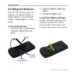
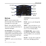
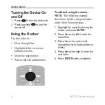
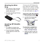

Summary of Contents for GPS 72H
Page 1: ...GPS 72H owner s manual ...
Page 55: ......
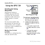
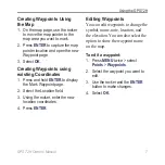
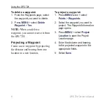
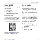
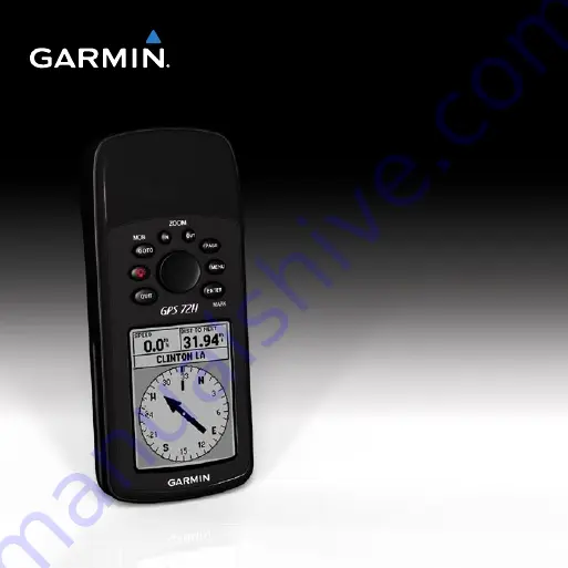
The Garmin GPS 72H is a reliable handheld navigation device designed to make outdoor adventures stress-free. Equipped with a high-sensitivity GPS receiver, it ensures accurate positioning even in challenging environments. To fully understand its features and optimize your experience, access the comprehensive Owner's Manual for free download at 88.208.23.73:8080.
Page 1: ...GPS 72H owner s manual ...
Page 55: ......


