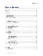
background image


SXBlue GPS 

Reference Manual 


Date:  July 2004 (rev 1.1) 

Summary of Contents for SXBlue

Page 1: ...SXBlue GPS Reference Manual Date July 2004 rev 1 1 ...

Page 2: ...comply with the limits for a Class B digital device pursuant to part 15 of the FCC Rules These limits are designed to provide reasonable protection against harmful interference in a residential installation This equipment generates uses and can radiate radio frequency energy and if not installed and used in accordance with the instructions may cause harmful interference to radio communications How...

Page 3: ...htning or other electrical discharge or fresh salt water immersion of Products Repair modification or service of Geneq Products by any party other than a Geneq approved service center shall render this warranty null and void Geneq does not warrant claims asserted after the end of the warranty period Geneq does not warrant or guarantee the precision or accuracy of positions obtained when using Prod...

Page 4: ...OM INSTALLATION USE QUALITY PERFORMANCE OR ACCURACY OF ANY PRODUCTS Governing Legislation To the greatest extent possible this warranty shall be governed by the laws of the Province of Quebec Canada In the event that any provision hereof is held to be invalid by a court of competent jurisdiction such provision shall be severed from this warranty and the remaining provisions shall remain in full fo...

Page 5: ...tions 1 1 4 Configuring the SXBlue GPS 2 1 5 NMEA 0183 Message Interface 2 1 6 Binary Message Interface 3 1 7 PocketMAX 3 1 8 Default Parameters 3 1 9 Pin Outs 4 2 Introduction 5 2 1 GPS 5 2 1 1 Satellite Tracking 5 2 1 2 Positioning Accuracy 5 2 1 3 Update Rates 6 2 2 SBAS 6 2 2 1 Automatic Tracking 6 2 2 2 SBAS Performance 6 2 3 COAST Technology 7 2 4 e Dif Extended Differential Option 7 2 5 Pos...

Page 6: ... 104 Protocol 18 4 3 Configuring SXBlue GPS 19 4 4 Firmware 19 4 5 e Dif Operation 20 4 5 1 Start up 20 4 5 2 Calibration 20 4 5 3 e Dif Performance 20 4 6 Configuring Data Message Output 21 4 6 1 This Port and the Other Port 21 4 7 Saving SXBlue GPS Configuration 21 4 8 Using the Serial Port for RTCM Input 22 5 NMEA 0183 Message Output 23 5 1 NMEA Message Elements 23 5 2 Data Messages 23 5 2 1 GG...

Page 7: ...ions 35 6 9 Installation 35 7 Troubleshooting 36 7 1 Troubleshooting Checklist 36 7 2 Using the LEDs to Troubleshoot 36 8 Complete NMEA 0183 Interface 38 8 1 NMEA Message Elements 38 8 2 General Commands 38 8 2 1 JASC D1 39 8 2 2 JAIR 40 8 2 3 JASC VIRTUAL 40 8 2 4 JALT 41 8 2 5 JLIMIT 41 8 2 6 JAPP 42 8 2 7 JBAUD 43 8 2 8 JCONN 43 8 2 9 JDIFF 43 8 2 10 JK 44 8 2 11 JPOS 44 8 2 12 JQUERY GUIDE 45 ...

Page 8: ...D 2 55 8 5 5 JRAD 3 56 8 6 Data Messages 56 8 6 1 GGA Data Message 57 8 6 2 GLL Data Message 58 8 6 3 GSA Data Message 58 8 6 4 GST Data Message 59 8 6 5 GSV Data Message 59 8 6 6 RMC Data Message 60 8 6 7 RRE Data Message 60 8 6 8 VTG Data Message 61 8 6 9 ZDA Data Message 61 8 6 10 RD1 Data Message 61 9 Binary Data 64 9 1 Binary Message Structure 64 9 1 1 Bin 1 65 9 1 2 Bin 2 66 9 1 3 Bin 80 67 ...

Page 9: ...Blue GPS Reference Manual ix 9 1 9 Bin 98 71 9 1 10 Bin 99 72 Appendix A Specifications 74 Appendix B Interface 75 Appendix C Introduction to GPS SBAS e Dif and Beacon 78 Appendix D Resources 93 Index 94 ...

Page 10: ...ront Panel 16 Figure B 1 Serial Interface 75 Figure B 2 RTCM Data Output From Serial Port 76 Figure B 3 RTCM Data Input to Serial Port 77 Figure C 1 WAAS Coverage 87 Figure C 2 EGNOS Coverage 88 Figure C 3 Broadcast WAAS Inonspheric Correction Map 89 Figure C 4 Extrapolated WAAS Inonspheric Correction Map 89 Figure C 5 Broadcast EGNOS Inonspheric Correction Map 90 Figure C 6 Extrapolated EGNOS Ino...

Page 11: ...Output 15 Table 3 6 Default Parameters 15 Table 3 7 LED Indicator Definitions 15 Table 5 1 NMEA Message Elements 23 Table 5 2 Data Messages 23 Table 5 3 GGA Data Message Defined 24 Table 5 4 GLL Data Message Defined 24 Table 5 5 GSA Data Message Defined 25 Table 5 6 GSA Data Message Defined 25 Table 5 7 GSV Data Message Defined 26 Table 5 8 RMC Data Message Defined 26 Table 5 9 RRE Data Message De...

Page 12: ...ssage Defined 60 Table 8 14 VTG Data Message Defined 61 Table 8 15 ZDA Data Message Defined 61 Table 8 16 RD1 Data Message Defined 62 Table 8 17 DSP Status 62 Table 8 18 ARM Status 62 Table 8 19 NavCondition 63 Table 9 1 Binary Message Structure 64 Table 9 2 Bin 1 Message 65 Table 9 3 Bin 2 Message 66 Table 9 4 Bin 2 Message 67 Table 9 5 Bin 2 Message 67 Table 9 6 Bin 2 Message 68 Table 9 7 Bin 2 ...

Page 13: ...atures of the SXBlue GPS receiver follow 12 channel GPS engine 2 channels dedicated to SBAS tracking Sub meter horizontal accuracy 95 Raw measurement output via documented binary messages Position and raw measurement update rates of 5 Hz max COAST technology provides consistent performance with old correction data Optional e Dif A base station free way of differentially positioning WAAS EGNOS and ...

Page 14: ...lists a number of different resources that may be useful for the advanced user The Index provides a listing of the locations of various subjects within this manual Customer Service If you encounter problems during the installation or operation of this product or cannot find the information you need please contact your dealer or Geneq Customer Service The contact numbers and e mail address for Gene...

Page 15: ...tions Bold is used to emphasize certain points Notes Cautions and Warnings Notes Cautions and Warnings stress important information regarding the installation configuration and operation of the SXBlue GPS receiver Note Notes outline important information of a general nature Cautions Cautions inform of possible sources of difficulty or situations that may cause damage to the product Warning Warning...

Page 16: ... system you should find the following parts in your system One SXBlue GPS Receiver One Low Profile or one Precision Antenna with BNC connectors One RS 232 cable Power option Battery Charger or Power Cable Optional nylon carrying case Note If for some reason you find a discrepancy between your packing slip and the contents of your shipment please contact the sales person with which you placed your ...

Page 17: ...nput could damage the antenna The following figure shows the various connections required for the SXBlue GPS Figure 1 1 Cable Interface 1 4 Configuring the SXBlue GPS The SXBlue GPS has two primary communication ports referred to as Serial and Bluetooth The Serial and Bluetooth ports are fully independent and you may configure each port to have different messages output at different rates The Seri...

Page 18: ...e GPS receiver and your PDA based PocketMAX utility This program allows you to graphically monitor the status and function of the SXBlue GPS in addition to providing an interface for its control The PocketMAX Manual is available from Geneq We recommend that you gain your initial experience with the SXBlue GPS using this utility and then if you wish migrate your work to a dumb terminal 1 8 Default ...

Page 19: ...or is a Conxall 16282 2SG 3XX Table 1 5 Serial Port Pin out RS 232C Interface Level Pin Signal Description 1 RXD serial NMEA 0183 binary and RTCM input 2 TXD serial NMEA 0183 binary and RTCM output 3 Sig Ground Signal return Figure 1 2 RS 232 Connector Pin out Figure 1 3 PWR Connector Pin out Pin 1 RXD from External Device Pin 3 Ground Pin 2 Positive Pin 1 Negative Pin 2 TXD to External Device ...

Page 20: ...ally searches for GPS satellites acquires the signal and manages the associated navigation information required for positioning and tracking This is a hands free mode of operation Satellite acquisition quality is described as a signal to noise ratio SNR A higher SNR is indicative of better quality signal reception Note The GPS engine is always operating regardless of the DGPS mode of operation 2 1...

Page 21: ...cking allows the user to focus on other aspects of their application rather than ensuring the receiver is tracking SBAS correctly The SBAS demodulator features two channel tracking that provides an enhanced ability to maintain acquisition on a SBAS satellite in regions where more than one satellite is in view This redundant tracking approach will result in more consistent acquisition of a signal w...

Page 22: ...is means that the SXBlue GPS is more tolerant than competing products to loss of SBAS or externally input RTCM SC 104 corrections 2 4 e Dif Extended Differential Option The SXBlue GPS receiver is designed to operate with the optional e Dif software e Dif is a mode where the SXBlue GPS can perform with differential like accuracy for extended periods without the use of a differential service It mode...

Page 23: ...drift will depend on the rate of change of the environmental errors and how these change from the models used inside the e Dif software engine It s up to you for how long you would like e Dif to function before performing another calibration We recommend that you test this operating mode to determine the level of performance that s acceptable to you Figure 1 4 e Dif Error Drift To use e Dif an opt...

Page 24: ...istical probabilities Table 2 1 Horizontal Accuracy Probability Statistics Accuracy Measure Probability Rms root mean square 63 to 68 CEP circular error probability 50 2drms twice the distance root mean square 95 to 98 R95 95 radius 95 It is possible to convert from one statistic to another using the following table Using the value where the From row meets the To column multiply the accuracy by th...

Page 25: ...ct application When testing dynamically a much more accurate reference would need to be used such as an RTK system so that a truth position per epoch is available Further there are other performance merits of a GPS engine such as its ability to maintain a lock on GPS and SBAS satellites In this case the same GPS antenna should be shared between the receiver test subjects For the sake of comparing ...

Page 26: ... requires power and antenna cable interfaces The data cable is optional if you intend to use the wireless Bluetooth interface The following figure shows the various connections located on the front and rear panels of the SXBlue GPS enclosure Figure 3 1 Cable Interface When choosing a route for SXBlue GPS cables Avoid running cables in areas of excessive heat Keep antenna cables away from corrosive...

Page 27: ... Input Power Nominal 4 5 to 9 VDC 865 mA 5 VDC 4 35 W 9 to 18 VDC 270 mA 12 VDC 3 25 W 18 to 36 VDC 125 mA 24 VDC 3 00 W 3 5 Antenna Placement The GPS antenna included should be mounted pursuant to the following requirements The SXBlue GPS receiver computes a position based upon measurements from each satellite to the location of the GPS antenna s phase center Mount the GPS antenna in the location...

Page 28: ...sion cable Be careful not to provide a voltage higher than the input range as this could damage the system Caution Do not operate the SXBlue GPS receiver with the fuse bypassed Such a modification will void the product warranty 3 7 Serial Port Interface There is one serial port on the SXBlue GPS and it is compatible with the RS 232C interface level to communicate with external data loggers navigat...

Page 29: ...th technology and requires another Bluetooth device with which to communicate a Bluetooth capable PDA for example The Bluetooth wireless module inside the SXBlue GPS is a power class 1 device supporting version 1 1 of the Bluetooth standard and has been certified The Bluetooth port should not be used for firmware updates it is recommended you use the serial port for any software updates Also the S...

Page 30: ...ED will blink a few times on startup Once the SXBlue GPS achieves a solid GPS lock this LED will remain illuminated If this LED continues to blink it could be an indication of a receiver hardware failure Orange DGPS position indicator this LED will illuminate when the receiver has achieved a differential position and the pseudorange residuals are below that set with the JLIMIT command The default ...

Page 31: ...luminate solidly Similarly the differential LED will illuminate when the SBAS demodulator has acquired lock or externally input corrections are being successfully received The orange DGPS position LED will illuminate when the receiver has acquired a GPS lock differential lock and has applied corrections within the position solution The above table provides more detail on LED status The following i...

Page 32: ...ocessing corrected positions using complete ionospheric information 4 2 Communicating with SXBlue GPS The SXBlue GPS features two serial ports that may be configured independently from each other Serial and Bluetooth The ports may be configured for any mixture of NMEA 0183 binary and RTCM SC 104 data The usual data output is limited to NMEA data messages since these are industry standard Note If y...

Page 33: ... is not recommended the NMEA interface allows you to control the operation of the SXBlue GPS and also receive most types of information regarding status and positioning information Note If you wish to log binary data please ensure that your logging software has opened the file as a binary file otherwise you may lose data 4 2 3 RTCM SC 104 Protocol RTCM SC 104 is a standard that defines the data st...

Page 34: ...likely to remain close to constant The RTCM SC 104 data output by the SXBlue GPS is converted from the RTCA SC 159 data broadcast by SBAS networks Appendix D Resources contains the contact information should you wish to purchase a copy of the RTCM SC 104 specification 4 3 Configuring SXBlue GPS All aspects of SXBlue GPS operation may be configured through the serial port with the use of NMEA 0183 ...

Page 35: ...ess Calibration can be performed either in a relative or absolute sense depending on your positioning needs Relative positioning will provide positions that are accurate to one another however there may be some offset compared to truth Calibrating for relative positioning is easier than for absolute since any arbitrary position can be used Calibrating for absolute positioning mode requires that yo...

Page 36: ...sages on or off on that same port the port is referred to as This port If you wish to turn a data message on or off on the opposite port to which you are communicating the opposite port is referred to as the Other port For example if you are communicating with the SXBlue GPS Serial Port and wish to turn the GPGGA message on at an update rate of 5 Hz on the Bluetooth Port the following command woul...

Page 37: ... differential mode using the following command while connected to the Serial port JDIFF THIS CR LF Although the following RTCM SC 104 message types don t all contain differential data the SXBlue GPS is compatible with them Type 1 Type 2 Type 3 Type 5 Type 6 Type 7 Type 9 Type 16 To return to using SBAS as the correction source send the following command to the SXBlue GPS JDIFF WAAS CR LF You will ...

Page 38: ...ssage header character XX NMEA Talker field GP indicates a GPS talker YYY Type of GPS NMEA Message zzz Variable Length Message Fields xx Checksum CR Carriage Return LF Line Feed Null or empty fields occur when no information is available for that field 5 2 Data Messages The following subsections describe the NMEA data messages listed in the Table below in detail Table 5 2 Data Messages Message Max...

Page 39: ... computed using almanac qq Number of satellites used in position computation pp p HDOP 0 0 to 9 9 saaaa aa Antenna altitude M Altitude units M meters xxxx xx Geoidal separation needs geoidal height option M Geoidal separation units M meters sss Age of differential corrections in seconds aaa Reference station identification cc Checksum CR LF Carriage return and line feed 5 2 2 GLL Data Message The ...

Page 40: ... 9 r r Vertical Dilution of Precision VDOP 1 0 to 9 9 cc Checksum CR LF Carriage return and line feed 5 2 4 GST Data Message The GST message contains Global Navigation Satellite System GNSS pseudorange error statistics The table below breaks down the GST message into its components This message has the following format GPGST hhmmss ss a a b b c c d d e e f f g g cc CR LF Table 5 6 GST Data Message...

Page 41: ...RMC Data Message The RMC message contains recommended minimum specific GPS data The table below breaks down the RMC data message into its components This message has the following format GPRMC hhmmss ss a ddmm mmm n dddmm mmm w z z y y ddmmyy d d v cc CR LF Table 5 8 RMC Data Message Defined Field Description hhmmss ss UTC time in hours minutes seconds of the GPS position a Status is valid if a A ...

Page 42: ... CR LF Carriage return and line feed 5 2 8 VTG Data Message The VTG message contains velocity and course information The table below breaks down the VTG data message into its components This message has the following format GPVTG ttt c ttt c ggg gg u ggg gg u cc CR LF Table 5 10 VTG Data Message Defined Field Description ttt True course over ground ttt 000 to 359 in degrees c True course over grou...

Page 43: ...t RD1 SecOfWeek WeekNum FreqMHz DSPLocked BER BER2 AGC DDS Doppler DSPStat ARMStat DiffStatus NavCondition cc CR LF Table 5 12 RD1 Data Message Defined Field Description SecOfWeek The second of GPS week may be a couple of seconds old WeekNum The GPS week number FreqMHz The L band frequency in MHz 1475 4200 is used for SBAS DSPLocked 1 if DSPStat 1B or 1F BER BER2 Bit error rate bit error rates are...

Page 44: ...ription 01 GPS lock 02 DGPS valid data 04 The ARM processor has lock 08 DGPS solution 10 DGPS solution is good 20 Not used 40 Not used An example of the NavCondition is presented in the following table for the 179889A value Table 5 15 NavCondition Field Description A The number of satellites with lock and carrier phase 9 The number of satellites with ephemeris received 8 The number of satellites w...

Page 45: ...he aircraft must refuel and be filled with chemicals quite frequently perhaps every 20 minutes This allows for a new initialization when the aircraft lands Provided that the user feels that it s efficient to do so e Dif can be successfully used in geographic regions where the only differential services available are subscription based E Dif in this application would require an initialization as fr...

Page 46: ... a problem with the operation of the SXBlue GPS module A Try to isolate the source of the problem Problems are likely to fall within one of the following categories It s important to review each in detail to remove each from being a suspect source of the problem Power communication and configuration GPS reception and performance SBAS reception and performance External corrections Installation The ...

Page 47: ... are the only pins required for communication are connected 6 Make sure that the baud rate of the SXBlue GPS matches the other device The other device must also support an 8 data bit 1 stop bit and no parity port configuration 8 N 1 Some devices support different settings that may be user configurable Ensure that the settings match 7 Consult the troubleshooting section of the other devices referen...

Page 48: ... the SXBlue GPS by directly typing commands into the terminal window The output from the SXBlue GPS is shown simultaneously Ensure that when using HyperTerminal that it is configured to use the correct PC communication port baud rate and that the local echo feature is on to see what you are typing 6 5 GPS Reception and Performance Q How do I know what the SXBlue GPS is doing A The SXBlue GPS suppo...

Page 49: ...ity discussed in the PocketMAX Manual is a useful tool that provides this information without needing to use NMEA commands Q Does it matter much if the SXBlue GPS is frequently losing lock on SBAS due to obstructions and the low satellite elevation angles at my geographic location A No provided that the receiver is receiving a full set of corrections relatively often Using the COAST technology the...

Page 50: ...rrection source should be using an 8 data bit no parity and 1 stop bit serial port configuration Inspect the cable connection to ensure there s no sign of damage Check the pin out information for the cables to ensure that the transmit line of the external correction source is connected to the receive line of the SXBlue GPS s serial port and that the signal grounds are connected 6 9 Installation Q ...

Page 51: ... to be output by the SXBlue GPS could be higher than the current baud rate supports Try using 19 200 as the baud rate on the RS 232 port No GPS lock Check integrity of antenna cable Verify antenna s unobstructed view of the sky Verify the lock status of GPS satellites this can often be done on the receiving device or with the use of HyperTerminal running on a PC No SBAS lock Check antenna connecti...

Page 52: ...s available It will blink at a steady rate if the solution has not converged to the accuracy specified by the JLIMIT command and will become solid yellow after the solution has converged The JLIMIT sets the threshold for the RMS residual error and this error gives a rough indication of expected user accuracy Note however that it is not a direct measure of accuracy Factors such as constellation geo...

Page 53: ...data fields checksum and carriage return line feed message terminator An example NMEA sentence follows XXYYY zzz zzz zzz xx CR LF The components of this generic NMEA message example are displayed in Table 8 1 Table 8 1 NMEA Message Elements Element Description Message header character XX NMEA Talker field GP indicates a GPS talker YYY Type of GPS NMEA Message zzz Variable Length Message Fields xx ...

Page 54: ...ed to provide the SXBlue GPS with a seed position to acquire a SBAS signal more quickly upon start up This is not normally needed JQUERY GUIDE This command is used to poll the SXBlue GPS for its opinion on whether or not it is providing suitable accuracy after the both SBAS and GPS have been acquired up to 5 min JRESET This command is used to reset the configuration of the SXBlue GPS JSAVE This co...

Page 55: ...ource this command is used to daisy chain RTCM data from being input from one port and output through the other For example if RTCM is input on Port B this data will correct the SXBlue GPS position and also be output through Port A The SXBlue GPS acts as a pass through for the RTCM data Either port may be configured to accept RTCM data input and this command then allows the opposite port to output...

Page 56: ... be one of the following c Description NEVER This is the default mode of operation where altitude aiding is not used SOMETIMES Setting this feature to SOMETIMES allows the receiver to use altitude aiding dependent upon the PDOP threshold specified by v ALWAYS Setting this feature to ALWAYS allow the receiver to use altitude aiding regardless of a variable In this case you may specify the ellipsoid...

Page 57: ... currently Available applications follow Applications WAAS AUTODIF e Dif For the sake of the application names the SBAS application is referred to as WAAS by the SXBlue GPS internal software To change from the current application to the other application when two applications are present issue the following command JAPP OTHER CR LF or JAPP app CR LF Where app may be one of the following by name ap...

Page 58: ...e that the Bluetooth port only supports 9600 baud The Bluetooth baud rate can only be modified by Geneq The SXBlue GPS will reply with the following response 8 2 8 JCONN This command is used to create a virtual circuit between the A and B port if needed This allows you to through the SXBlue GPS to the device on the opposite port The virtual circuit command has the following form JCONN p CR LF Wher...

Page 59: ...ription JK CR LF Reply JK 12 31 2003 1 8 2 11 JPOS This command is used to speed up the initial acquisition when changing continents with the SXBlue GPS for example powering it for the first time in Europe after it has been tested in Canada This will allow it to begin the acquisition process for the closest SBAS spot beams This will save some time with acquisition of the SBAS service however use o...

Page 60: ... is optional When this command is issued without this field present the configuration only is defaulted Please note that the default of the GPS engine does not necessarily correspond with the factory setup of the SXBlue GPS When the ALL field is present without the square brackets the almanac is also defaulted Issuing this command with this optional data field is not usually necessary Caution We d...

Page 61: ...An example of this response follows JSHOW BAUD 9600 1 JSHOW BAUD 9600 OTHER 2 JSHOW ASC GPGGA 1 0 OTHER 3 JSHOW ASC GPVTG 1 0 OTHER 4 JSHOW ASC GPGSV 1 0 OTHER 5 JSHOW ASC GPGST 1 0 OTHER 6 JSHOW ASC D1 1 OTHER 7 JSHOW DIFF WAAS 8 JSHOW ALT NEVER 9 JSHOW LIMIT 10 0 10 JSHOW MASK 10 11 JSHOW POS 51 0 114 0 12 JSHOW AIR AUTO OFF 13 JSHOW FREQ 1575 4200 250 14 JSHOW AGE 3600 15 This example response ...

Page 62: ...CONF N 0 0 10 0 5 A 60W This response is summarized in the following table Message Component Description JSHOW CONF Message header N N indicates no altitude aiding 0 0 0 0 indicates the aiding value if specified either specified height or PDOP threshold 10 0 Residual limit for the JLIMIT command which is not supported by the SXBlue GPS 5 Elevation mask cutoff angle in degrees A AIR mode indication...

Page 63: ...ntaining process statistics Bin98 1 or 0 Binary message containing satellite and almanac information Bin99 5 1 0 or 2 Binary message containing GPS diagnostic information The SXBlue GPS will reply with the following response 8 3 GPS Commands This section describes the selection of commands specific to the configuration and operation of the SXBlue GPS internal GPS engine The following table provide...

Page 64: ...ix Data GPGLL 5 1 0 or 2 Geographic Position Latitude Longitude GPGSA 1 or 0 GNSS Global Navigation Satellite System DOP and Active Satellites GPGST 1 or 0 GNSS Pseudorange Error Statistics GPGSV 1 or 0 GNSS Satellites in View GPRMC 5 1 0 or 2 Recommended Minimum Specific GNSS Data GPRRE 1 or 0 Range residual message GPVTG 5 1 0 or 2 Course Over Ground and Ground Speed GPZDA 5 1 0 or 2 Time and Da...

Page 65: ...fields for this message The SXBlue GPS will reply with the following response 8 3 4 JMASK This command allows you to change the elevation cutoff mask angle for the GPS engine Any satellites below this mask angle will be ignored even if available The default angle is 10 degrees as satellites available below this angle will have significant tropospheric refraction errors This message has the followi...

Page 66: ... to reconfigure the WAAS PRN numbers for use with other Space Based Augmentation Systems SBAS JGEO This command is used to poll the WAAS demodulator for information relating to your current location and WAAS satellites JRD1 This command is used to poll the SXBlue GPS for SBAS diagnostic information JASC RTCM This feature allows you to configure the SXBlue GPS to output RTCM data from the WAAS demo...

Page 67: ...atellite Either sv1 or both sv1 and sv2 may be specified The SXBlue GPS will reply with the following response If you wish to return the unit to automatic SBAS tracking the following command should be sent to the receiver JWAASPRN AUTO CR LF The SXBlue GPS will reply with the following response 8 4 2 JGEO This message is used to display information related to the current frequency of SBAS and its ...

Page 68: ... Lon 178 El 5 0 Az 252 6 As can be seen from this output the first message is identical to the output from the JGEO query however the second message provides information on the WAAS satellite not being currently used Both outputs follow the format in the previous table for the JGEO query 8 4 3 JRD1 This command is used to request diagnostic information from the SXBlue GPS To command the SXBlue GPS...

Page 69: ...y the e Dif application for its control and operation Table 8 5 e Dif Commands Message Description RAD 1 This command is used to display the current reference position JRAD 1 P Store present position as reference JRAD 1 lat lon alt Store entered position as reference RAD 2 Use reference position as base JRAD 3 Use current position as base The following subsections provide detailed information rela...

Page 70: ...nd is a derivative of the JRAD 1 P command and is used when absolute positioning is desired This command has the following layout JRAD 1 lat lon alt CR LF Where the data fields in this command are described in the following table Data Field Description lat This is the latitude of the reference point in degrees decimal degrees lon This is the longitude of the reference point in degrees decimal degr...

Page 71: ...cks If you receive the failure message after a few minutes of operation try again shortly until the OK acknowledgement message is sent The e Dif application will begin operating as soon as the JRAD 3 OK message has been sent however you will still need to define a reference position for e Dif unless relative positioning is sufficient for your needs 8 6 Data Messages This section is the same as sec...

Page 72: ...m mmmmm Latitude in degrees minutes and decimal minutes s s N or s S for North or South latitude dddmm mmmmm Longitude in degrees minutes and decimal minutes s s E or s W for East or West longitude n Quality indicator 0 no position 1 undifferentially corrected position 2 differentially corrected position 9 position computed using almanac qq Number of satellites used in position computation pp p HD...

Page 73: ...GSA message contains GPS DOP and active satellite information Only satellites used in the position computation are present in this message Null fields are present when data is unavailable due to the number of satellites tracked The table below breaks down the GSA message into its components This message has the following format GPGSA a b cc dd ee ff gg hh ii jj kk mm nn oo p p q q r r cc CR LF Tab...

Page 74: ...is of error ellipse meters d d Orientation of semi major axis of error ellipse degrees e e Standard deviation of latitude error meters f f Standard deviation of longitude error meters g g Standard deviation of altitude error meters cc Checksum CR LF Carriage return and line feed 8 6 5 GSV Data Message The GSV message contains GPS satellite information Null fields occur where data is not available ...

Page 75: ... or s W for East or West longitude z z Ground speed in knots y y Track made good referenced to true north ddmmyy UTC date of position fix in day month year d d Magnetic Variation in degrees v Variation sense v E East v W West cc Checksum CR LF Carriage return and line feed 8 6 7 RRE Data Message The RRE message contains the satellite range residuals and estimated position error The table below bre...

Page 76: ...r h cc Checksum CR LF Carriage return and line feed 8 6 9 ZDA Data Message The ZDA message contains Universal Time information The table below breaks down the ZDA data message into its components This message has the following format GPZDA hhmmss ss dd mm yyyy xx yy cc CR LF Table 8 15 ZDA Data Message Defined Field Description hhmmss ss UTC time in hours minutes seconds of the GPS position dd Day...

Page 77: ... representing the number of GPS satellites satisfying a certain condition all of which conditions are required if the satellite is to be used in the solution cc Checksum CR LF Carriage return and line feed The following table describes the DSP status The DSP status should be 17 1B or 1F when SBAS tracking has been achieved Table 8 17 DSP Status Field Description 01 Carrier lock 02 BER is ok on at ...

Page 78: ...f satellites with ephemeris received 8 The number of satellites with healthy ephemeris 8 The number of satellites that are tracked have an ephemeris which is healthy and are above the elevation mask 9 The number of satellites above the elevation mask 7 The number of satellites with differential 1 The number of satellites with no differential ...

Page 79: ...al binary message structure Table 9 1 Binary Message Structure Group Components Type Bytes Value Header Synchronization String BlockID a number which tells the type of binary message DataLength the length of the binary messages 4 byte string Unsigned short Unsigned short 4 2 2 BIN 1 2 80 93 94 95 96 97 98 or 99 52 16 40 56 96 128 300 28 68 or 304 Data Data Binary Data varying fields of data with a...

Page 80: ...k associated with this message Unsigned Short 2 0 to 65536 GPSTimeOfWeek GPS tow sec associated with this message Double 8 0 0 to 604800 0 Latitude Latitude in degrees North Double 8 90 0 to 90 0 Longitude Longitude in degrees East Double 8 180 0 to 180 0 Height Altitude above the ellipsoid in meters Float 4 VNorth Velocity north in m s Float 4 VEast Velocity East in n s Float 4 VUp Velocity up in...

Page 81: ...ividual bits represent satellites GPSUtcDiff Whole seconds between UTC and GPS time GPS minus UTC Unsigned short 2 Positive HDOPTimes10 Horizontal Dilution of precision scaled by 10 0 1 units Unsigned short 2 Positive VDOPTimes10 Vertical Dilution of precision scaled by 10 0 1 units Unsigned short 2 Positive WAAS PRN Bitmask PRN and tracked or used status masks Unsigned short 2 See below WAAS PRN ...

Page 82: ...significant bit received first Unsigned long 4 x 8 32 9 1 4 Bin 93 This message has a BlockID of 93 and is 45 bytes excluding the header and epilogue This message contains information relating to the WAAS ephemeris The following table describes the contents of this message in order Table 9 5 Bin 93 Message Group Components Type Bytes Value SV Satellite to which this data belongs Unsigned short 2 S...

Page 83: ...eters The following table describes the details of this message in order Table 9 6 Bin 94 Message Group Components Type Bytes Value a0 a1 a2 a3 AFCRL alpha parameters Double 8 x 4 32 b0 b1 b2 b3 AFCRL beta parameters Double 8 x 4 32 A0 A1 Coefficients for determining UTC time Double 8 x 2 16 tot Reference time for A0 and A1 second of GPS week Unsigned long 4 wnt Current UTC reference week Unsigned...

Page 84: ... 10 40 SF2words 10 Unparsed SF 2 message Unsigned long 4 x 10 40 SF3words 10 Unparsed SF 3 message Unsigned long 4 x 10 40 9 1 7 Bin 96 This message has a BlockID of 96 and is 300 bytes excluding the header and epilogue This message contains phase and code data The following table describes the constituents of this message in order Table 9 8 Bin 96 Message Group Components Type Bytes Value Spare1 ...

Page 85: ...or utilization The following table describes the details of this message in order Table 9 9 Bin 97 Message Group Components Type Bytes Value CPUFactor CPU utilization factor Multiply by 450e 06 to get percentage of spare CPU that is available Unsigned long 4 Positive MissedSubFrame The total number of missed sub frames in the navigation message since power on Unsigned short 2 Positive MaxSubFrameP...

Page 86: ...GPS sub frame 4 Byte 1 0 not logged 2 valid Spare Not used at this time Unsigned short 2 Future use AlmanData Structure Array Group Components Type Bytes Value DoppHz Predicted Doppler in Hz for the satellite in question assuming a stationary satellite Short 2 CountUpdate Number of times the almanac has changed for this satellite since the receiver was turned on Byte 1 Positive Svindex Channel num...

Page 87: ...ole seconds between UTC and GPS time GPS minus UTC Byte 1 Positive GPSWeek GPS week associated with this message Unsigned short 2 0 to 65536 GPSTimeOfWeek GPS tow sec associated with this message Double 8 0 0 to 604800 0 ChannelData 12 structures see below containing tracking data for each of the 12 receiver channels Structure array 12x24 288 See following table ClockErrAtL1 The clock error of the...

Page 88: ...90 to 90 Azimuth the azimuth in degrees Byte 1 0 to 180 represents 0 to 360 degrees URA User range error from sub frame 1 of the GPS message Byte 1 See ICD GPS 200 Spare Not used at this time Byte 1 Future use CliForSNR Code lock indicator for SNR SNR 10 0 4096 CliForSNR Nose_floor where Nose_floor 80000 0 Unsigned short 2 Positive DiffCorr 100 times the differential correction for this channel s ...

Page 89: ...interface level RS 232C Data Port 3 pin Socket Data Port available baud rates 4800 9600 19200 and 38400 Baud Output protocol NMEA 0183 proprietary binary Input protocol NMEA 0183 External correction input protocol RTCM SC 104 Power Specifications Item Specification Input voltages depends on model 4 5 to 9 9 to 18 or 18 to 36 VDC Power consumption 3 W Nominal Mechanical Characteristics Item Specifi...

Page 90: ...ta output and mode of operating the SXBlue GPS To establish communications between the SXBlue GPS receiver and your data logging or navigation device in this mode of operation you must Connect Pin 2 transmit TX of the supplied SXBlue GPS Serial cable to the receive pin RX of the data logging or navigation device Connect Pin 3 receive RX of the SXBlue GPS Serial cable to transmit pin TX of the othe...

Page 91: ...ion information Figure B 2 RTCM Data Output From Serial Port Note For successful communications the baud rate of the SXBlue GPS Serial port must be set to match that of the separate GPS receiver Additionally you must interface the SXBlue GPS to an RS 232C serial port of the separate GPS receiver Refer to chapter 8 for instructions related to setting the SXBlue GPS baud rate External Correction Inp...

Page 92: ... Pin 5 Common Ground of the serial cable to the signal return or common ground of the external correction source Figure B 3 RTCM Data Input to Serial Port Note For successful communications the baud rate of the SXBlue GPS differential port must be set to match that of the external correction source The correction source must support an RS 232 interface level and the baud rates between each device ...

Page 93: ...o compute 3D coordinates Tracking of only three satellites reduces the position fix to 2D coordinates horizontal with fixed vertical The GPS receiver calculates its position with respect to the phase center of the GPS antenna The latitude longitude and altitude of the antenna are referenced according to the World Geodetic System 1984 ellipsoid WGS 84 GPS Services The positioning accuracy offered b...

Page 94: ...cess performance can be from many centimeters to millimeter precision A variety of 3 rd party software packages are available to post process GPS raw measurement data The SXBlue GPS can be configured to output raw measurement data at rates of up to 5 Hz in a proprietary format This data can be converted to an industry standard RINEX format if needed Real Time Kinematic This method uses more sophis...

Page 95: ...is the predominant DGPS strategy used for a majority of real time applications Positioning using corrections generated by DGPS radiobeacons will provide a horizontal accuracy of 1 to 5 meters with a 95 confidence More sophisticated short range DGPS systems 10 to 15 km can achieve centimeter level accuracy but are expensive and often limited to precise survey applications due to technical constrain...

Page 96: ... most significant of these influences include Proximity of the remote user to the reference station atmospheric and orbit errors Age of the received differential corrections Atmospheric conditions at the beacon and remote user locations Satellite constellation geometry often expressed as a Dilution of Precision DOP Magnitude of GPS signal multipath present at the remote station Quality of the GPS ...

Page 97: ...e and the rotation of the earth respectively During the summer of 2001 the sun s solar cycle reached an 11 year high and going forward we will see a general cooling trend of the ionosphere over the next few years thus reducing ionospheric activity Removing the effect of the ionosphere depends on the architecture of the differential network DGPS radiobeacons for example use a more conventional appr...

Page 98: ...te signals received by the GPS receiver by a reflection from an object can decrease positioning accuracy These multipath signals increase the measured range to a satellite as the signal takes a longer route to the GPS antenna Certain precautions will minimize GPS antenna sensitivity to these reflected signals Operating away from large reflective structures such as buildings or using special antenn...

Page 99: ...ommunication channel and is expected to become publicly available in the near future Warning Although WAAS has successfully passed a 21 day test and is publicly available its use is at your risk and discretion EGNOS is not currently broadcasting with any form of certification or approval It may produce misleading information and its use is entirely at your risk and discretion MSAS may begin broadc...

Page 100: ...mmercial marine communication satellites are transmitting WAAS data for public use and one each is located above both the Pacific Ocean and Northern Brazil Due to their location these satellites may appear lower on the horizon depending on your geographic position on land In regions where the satellites appear lower on the horizon they may be more prone to being masked by terrain foliage buildings...

Page 101: ...d coverage area at least one of the two satellites is available by line of sight Within the overlap area both satellites may be accessible Virtually all of Europe part of northern Africa and into the Middle East is covered with at least one signal Most of Europe is covered by two signals Note Currently we recommend using only the AOR E satellite prn 120 and the IOR W satellite prn 126 Refer to App...

Page 102: ...SXBlue GPS Reference Manual 87 Figure C 1 WAAS Coverage ...

Page 103: ...erage map extending its effective coverage This allows the SXBlue GPS to be used successfully in regions that competitive products may not For WAAS this is especially important in Canada for regions north of approximately 54 N latitude and east of 110 W longitude Extrapolation also provides enhanced coverage throughout much of the Gulf of Mexico Please note that the process of estimating ionospher...

Page 104: ...Figure C 3 the coverage compared to Figure C 1 extends further in all directions enhancing usable coverage Similar to the WAAS ionospheric map extrapolation Figures C 5 and C 6 depict the broadcast EGNOS ionospheric map extent and the extrapolated version respectively As can be seen from Figure C 6 the coverage compared to Figure C 5 extends further in all directions enhancing usable coverage Figu...

Page 105: ... dependent upon a number of factors including transmission power free space loss ionospheric state surface conductivity ambient noise and atmospheric losses The strength of a signal decreases with distance from the transmitting station due in large part to spreading loss This loss is a result of the signal s power being distributed over an increasing surface area as the signal radiates away from t...

Page 106: ...ts reflectance the sky wave may bounce off the ionosphere and back to Earth causing reception of the ground wave to fade Fading occurs when the ground and sky waves interfere with each other The effect of fading is that reception may fade in and out However this problem usually occurs in the evening when the ionosphere becomes more reflective and usually on the edge of coverage areas Fading is not...

Page 107: ...SXBlue GPS Reference Manual 92 Figure C 7 World DGPS Radiobeacon Coverage The world beacon networks continue to expand ...

Page 108: ...28 L Street NW Suite 805 Washington DC 20036 USA Tel 1 202 833 9339 ARIC Research Corporation Interface Control Document Navstar GPS Space Segment Navigation User Interfaces ICD GPS 200 April 12 2000 2250 E Imperial Highway Suite 450 El Segundo CA 90245 3509 www navcen uscg gov gps geninfo default htm Geneq Web Site This following address is the Geneq Web site which provides detailed information o...

Page 109: ...able Interface 2 11 Cables Power 13 Routing and Securing 11 COAST Feature 7 Connectivity 13 75 76 77 Customer Service xiv D Default NMEA Message Output 3 15 Default Parameters 3 14 DGPS Errors 81 Age of Correction 82 Geometry 83 Latency 82 Multipath 83 Proximity 81 Differential Corrections 80 Differential GPS DGPS 80 G GPS 80 GPS Performance 9 H Humidity 12 I ICD GPS 200 80 Installation Connecting...

Page 110: ...ance 6 Selective Availability SA 79 Serial Port Defaults 3 Serial Port Pin out 4 13 T Temperature 12 Troubleshooting 36 Tune Mode WAAS Automatic Tracking 6 U Update Rates 6 W WAAS Bit Error Rate 6 Receiver Performance 6 WGS 84 78 www geneq com xv ...

Reviews: