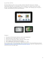
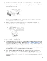
Summary of Contents for GO6

Page 1: ...figuration Live Map Vehicle Trips Zones Users Groups Messaging Routing Dispatch Exceptions Auxiliary Rules Drivers NFC Driver ID Reports Vehicle Maintenance System Options Engine Data Software Development Kit SDK Hardware Features Software Features What s New 1 ...

Page 2: ... connected to your team with real time GPS vehicle tracking Access your fleet from anywhere on the web Be notified instantly when important events occur Understand your entire fleet with accurate engine diagnostics Increase productivity with responsive route optimizations Keep everyone safe with driver feedback and alerts Our technology You ll be able to begin using Geotab in no time Installing th...

Page 3: ... advanced insights into your driver s on road performance Geotab stores your trips history information letting you re create any of your trips for any date specified The reports provide in depth views for various events such as time spent driving versus at customer locations helping you identify accurate work time allocations Features Real time GPS vehicle tracking Comprehensive trips and activity...

Page 4: ...actices as drivers take corrective actions when needed IOX Expandability Choosing how your company will grow in the future means picking a telematics platform that will grow with you Geotab s IOX is a plug in component that allows you to expand your Geotab GO device You can add on RFID technology for Driver ID satellite tracking for tracking in remote areas Garmin navigation and messaging for disp...

Page 5: ...cations Features Two way communication between drivers and dispatchers Send stops and routes directly to the vehicle Drivers can change their status using the touch screen All messages are verified and color coded Driver information and location is displayed on a map Note Geotab works with Garmin devices refer to this link for all recommended Garmin devices https geotab zendesk com entries 2338389...

Page 6: ...enters The company was able to adopt a conditions based preventative maintenance schedule by using the available data in this way Vehicle installed sensors provide data on components acting outside normal parameters After delivery trucks return to package centers if the provided data indicates vehicles have issues UPS service technicians will then diagnose the potential problems to determine wheth...

Page 7: ...ars ago Rollins which owns well known Orkin has saved as much as 40 million per year We have dramatically reduced our cost of risk Gibney says Back in 1996 7 of revenue was going to insurance Now we are only spending about 2 2 on claims and insurance What re more is the company and its employees are safer Accidents are down from about 33 of the fleet in 1996 to only 9 last year Workers compensatio...

Page 8: ...nagers down the road to profitability According to Dominique Bonte from ABI Research the problem is many fleet management vendors never moved beyond the dot on the map GPS provided It was very much pushing technology and then once it was sold it was up to the fleet manager to try and do something with it says Bonte But like most of today s executives fleet manager like O Connell are trying to do m...

Page 9: ...Geotab GO6 Device 1 Locate the vehicle s engine diagnostic port typically found in the driver s area at or below knee level Note Commercial vehicles with diesel engines use a different connection See Deutsch 6 9 for connection details Contact your authorized reseller to purchase an adapter If it is necessary to install your Geotab GO6 Device away from the engine diagnostic port you can use the ext...

Page 10: ...number which can be found at the bottom of the unit is required for this step Navigate to the web page http myinstall geotab com here ou will be asked to fill in your name email address and the device serial number the next step is to Click on Check to verify your installation Note This page is optimized for use on mobile devices and it may be easier to access the page from your smartphone to make...

Page 11: ...b select Maps on the left hand side options Choose your vehicle the map will now show its current location Select Trips History to see where the vehicle traveled today Where to learn more Attend one of Geotab s free online training events by contacting your authorized Geotab reseller to register Visit our online technical support community which is available 24 7 Visit the Geotab forum to post you...

Page 12: ...er after your first log in System requirements Windows Vista 7 8 or later Mac OS X 10 5 or later NET 2 0 already installed with Vista 40 GB hard disk that has 15GB space free 1 GB of RAM Additional hard disk space might be required for data storage iOS iPhone iPad and iPod Touch 5 0 or later Android 3 0 or later Android 2 1 or later when using Firefox for Android Touch screen displays are supporte...

Page 13: ...le name to pair them together We recommend a vehicle name such as Make Model Year or if you prefer the driver s name Editing a Vehicle In most cases the pre configured settings for new vehicle installations is well suited However in advanced usage circumstances such as custom logging behavior you will need to configure your vehicle more specifically From the left side menu select Vehicles the list...

Page 14: ...nse plate however you are able to make your own changes if necessary Driver feedback Making it easy for your drivers to immediately improve their on road driving behavior the in vehicle audible alerts notify drivers of unsafe or potentially risky driving events Once the driver has corrected their actions for example by reducing their speed or fastening their seat belt the interactive in vehicle al...

Page 15: ...et you can create groups to separate the vehicles into different areas When you have multiple user accounts accessing MyGeotab users can have access to all or individual groups this can be used for vehicle types regions managers or 15 ...

Page 16: ...s the data that was recorded when the installer tested the vehicle at http install geotab com Custom parameters Geotab supports using specially formatted XML coding to fully customize the behavior of the in vehicle tracking device Using custom parameters is used only in advanced usage situations If you require additional functionality from the device please contact your authorized reseller for det...

Page 17: ...ety of map providers which allows you to select the most detailed map for your area of interest You can change the map you use at any time by selecting Map Type then selecting one from the list of available providers Refer below for a feature comparison between our map providers For a more detailed list visit http en wikipedia org wiki Comparison_of_web_map_services Road and satellite maps Street ...

Page 18: ...e based on OpenLayers such as ArcGIS REST servers MapQuest CloudMade Tilemill Get started using your own maps by setting up your own tile or ArcGIS server When using MyGeotab all trips exceptions and zones will appear on your maps When everything is setup properly you can change your account preferences on MyGeotab to utilize your own map server by selecting Administration from the left side menu ...

Page 19: ... this View to save specific map views to return to areas of interest quickly In the example below Bay Area SF is added as a custom view When you return to the live map you can now select a preconfigured view from the top menu 19 ...

Page 20: ... steps to hide zones Note Zones are used to denote areas of interest such as customer areas workplaces or people s homes and can be used in exception reporting Refer to the chapter entitled Zones Displaying exceptions With the map displayed a smart legend which shows color coded exceptions to assist with identifying problems Individual exceptions can be toggled on and off on the map by selecting t...

Page 21: ...ection in view To find more information about the current location of a vehicle hover over its location and an information popup will appear with the device name and trip status Interacting with the map By selecting the current location of a vehicle several options are available Select Add Zone from the menu to quickly place a new zone at this vehicle s location 21 ...

Page 22: ...e will be an editable square centered on your selection You can then name the zone and change the size and shape Nearest Find the nearest vehicle to your selection Find address Displays the street address of your selection The latitude and longitude will be used if no street address is available Show street view Displays Google StreetView imagery for your selection 22 ...

Page 23: ... Use the filter box located in the top left corner of the screen to select which vehicles are shown Note The filter is only visible after vehicles have been added to one or more groups Additionally ensure that your user account has the proper permissions set by your account administrator to view the selected group using the filter 23 ...

Page 24: ...n MyGeotab will automatically create a trip This allows accurate recording of deliveries made when the vehicle is left idling Short stops lasting less than 200 seconds are not counted as stops if the ignition is not turned off If MyGeotab detects the engine is running and the vehicle is not changing position then this action is defined as idling Idling that occurs before a trip starts is included ...

Page 25: ...storic trips The list of trips also shows when the vehicle arrived how long it was stopped for the trip time and trip distance Selecting an individual trip will add the trip to the map Select additional trips from the list to show many trips at once Tip A shortcut for adding all the trips for the day is to select the date The numbers on the trips list correspond to the numbers on the map for that ...

Page 26: ... the vehicle is color coded with the exception type which occurred When multiple exceptions occur the color will alternate in a banding pattern In the case when the exception line is too short to be visible a warning triangle is used in its place The direction of travel along the trip is denoted with arrows A star with a number indicates a customer stop a zone was created at that location and a sq...

Page 27: ...om within the Trips History view selecting the Summary button will show you summarized trip information throughout your fleet The trip summary view allows you to compare essential driving data for your entire fleet This report will show the vehicle which was driven the furthest at the top of the list The pie chart in the upper right hand side corner shows the durations stopped inside customer offi...

Page 28: ...river is spending their time Hover your mouse over the green distance line of each driver to see the percentage of distance compared to the longest distance traveled You can examine the idle time compared to the overall drive time by hovering over the clock icon 28 ...

Page 29: ...es airports gas stations entire states and provinces or people s homes When combined with exception reporting zones become a critical component for analyzing the behavior of your fleet In the picture below a vehicle trip is shown where the driver stopped inside a zone When you hover your mouse over the stop the name of the zone is displayed Creating a new zone 29 ...

Page 30: ...select a starting point on the map Continue creating the boundary by selecting points along its perimeter A line will connect the points showing the perimeter in the order you add them To finish close the zone by re selecting the beginning point once again then select the Save button Tip While the zone is being created the round markers on the corners of the perimeter lines can be moved To remove ...

Page 31: ...nally you can provide any other details about the zone in the comments field disable the zone from being displayed on the map and change the color used to display the zone Another important aspect of zones is their type The zones which you create can belong to different classes such as Customers Offices or Homes By using zone types you can create very specific reports For example if you create zon...

Page 32: ... which zones they were inside or outside of or even nearby to This enables a number of possible scenarios such as Have an email sent out when drivers arrive at customer location Sound an in vehicle alert to a driver who has left work early Notify your shipping and receiving department when a truck is soon to arrive Geotab recognizes stops made within zones such as customer areas and can also indic...

Page 33: ...ct Change zone shape to modify the boundary by moving or removing individual points To add a new point to the boundary select along the zone boundary Remove an existing point by dragging it off the map When finished select Save changes or Cancel return to the previous screen Note Changing zone properties will affect future data You can reprocess data to affect data from the past 33 ...

Page 34: ...able and you will no longer be able to see the zone on the map Making changes to or removing multiple zones at a time is made easy by using the checkbox at the top right hand corner to select multiple zones Once your zones are selected select Remove or Edit Zones from the top menu to affect all the selected zones Note The zone list displays 500 zones at a time use Select Visible to select the enti...

Page 35: ...s for your zones are available use the following format to create a spreadsheet in Excel If you are creating zones in a remote area where street addresses are unavailable you can use the following format which utilizes geographical coordinates instead Note In both examples the reference column is an incremental number starting from 1 and is used to verify all zones have been successfully created 3...

Page 36: ...e route can optionally start and end at the same location and can be defined in any order you wish You can optionally allow Geotab to optimize the order in which a driver should visit each zone so that fuel consumption is kept to a minimum Navigate to Zones Messages from the left hand side options menu Select Routes from the sub menu your existing routes will be displayed Select Add Route from the...

Page 37: ...res defined route The route plan consists of your route timeframe for completion and a specific driver When used in combination with one another the route plan comparison is a powerful way to highlight where and when a driver unexpectedly spent time or has made unplanned stops Navigate to an existing route that has been created or follow the previous steps to create a new route Select Create plan ...

Page 38: ... each stop Note Geotab offers SDK samples to assist you with this process Your stop locations must be entered as unique zones in your Geotab account After the route has been completed a report can be generated using the Planned vs Actual Route Report to highlight stops made out of order missed stops travel time and extra time spent in zones along the route Plan vs actual route report In addition t...

Page 39: ...al time zone and language To change your own personal preferences select your account options from the top right hand corner of the screen Regional settings The most common preferences are located at the top of options page You can change which unit of measurement is used for speed and distances kilometers or miles the date format time zone and language 39 ...

Page 40: ...hoices include Google Maps and Bing Maps In some areas one map provider s imagery may be more recent than another For that reason you can change your default view using the options below Refer to the previous section on Views to learn about creating default map views to automatically center on an area when you open the live map Tip You can drag and drop the views blue to order them as you want The...

Page 41: ...s all the current hours of service regulations Depending on where your business operates select the rule set which applies to your drivers below Managing users So far all the options explained have been applied to the currently signed in user profile As an administrator of an account you have the ability to manage other user profiles by making changes on their behalf Navigate to Administration fro...

Page 42: ...Driver ID settings Options User preferences Modifying multiple users If you want to make the same changes to a number of user accounts rather than performing them all individually you can use the drop down list in the top right to select multiple users at a time to make account wide changes 42 ...

Page 43: ...ped into different access levels that you define and individual permissions can be applied to groups of users Geotab defines the following access levels and in most cases provides a suitable set of access levels Administrator Full access Supervisor Removes ability to change users databases engine data server status and global system options Default User Allows creating zones and groups and is able...

Page 44: ...44 ...

Page 45: ...ups from the left hand side options then select Groups from the sub menu Groups are managed using a graphical interface which shows the hierarchical organization of your organization including the base set of groups provided by Geotab Locations Used to separate assets into the areas they service For example East and West Reports Used to denote which users receive the available emailed reports Voca...

Page 46: ...ent of new jobs and tasks Note A Garmin device can be added to a Geotab GO6 or Geotab GO4v3 Device Not every Garmin model works with of all the features Geotab offers Contact your authorized reseller to purchase the necessary hardware Messaging hub You can access messaging by selecting Zones Messages from the left hand side options From there select Text Messages This screen allows you to review a...

Page 47: ...ients by either typing their name in the text box or by navigating your user list after selecting the blue arrow to the right 2 Compose message Compose a the text message to be sent You can use up to 256 characters 3 Reply options Select a canned response or input a custom response by typing each possible response by a comma For example Accept Decline Later 47 ...

Page 48: ...has been received is available from the messaging hub Status groups Drivers with Garmin equipped vehicles can notify their team of changes to their working status using common statuses For example when a has completed a task and requires new work they can set their status to available This status update can then be used by dispatch to select the most relevant driver for a task based on not only lo...

Page 49: ... can have up to four available statuses for the driver to select from Once you the statuses are saved the driver s in vehicle Garmin will be updated They can set their current status by selecting Geotab and then Quick Message When viewing the map driver status will be displayed in the information popup when hovering over their current location 49 ...

Page 50: ...all the features Geotab offers Contact your authorized reseller to purchase the necessary hardware Dispatching vehicles to zones To send a zone you ve created to a vehicle find that zone either by using the map or by searching for it Once the zone is displayed simply select it The zone options menu is now displayed select Dispatch vehicle here When creating a dispatch request you can select one or...

Page 51: ... should reach To send a route to a vehicle select Zones Messages from the left hand side menu Select Routes from the sub menu and then select the Routes button Find the desired route by searching those available and select it to continue Send the route to the vehicle by selecting Send To Vehicle from the top menu 51 ...

Page 52: ...ditions to suit your needs The types of built in exceptions available are available in three categories 1 Safety Changes to driver behavior which increases accident risk such as harsh braking seat belt use speed violations accident detection and more 2 Productivity Driver measurements related to time spent performing specific actions such as excessive idling late arrivals early departures and more...

Page 53: ...53 ...

Page 54: ...nteractively alert the responsible driver at the time of exception by using an audible alarm built in to your Geotab GO Device This feedback allows early detection and response to driver activity which greatly increases the road safety of your drivers and others on the road with them Listed below are all the built in safety related exceptions which Geotab offers 54 ...

Page 55: ...tivity tracking You can be notifications of exceptions such as late arrival early departure idling unauthorized home or customer stops excessive office time long lunch and even long stops during work hours Listed below are all the built in productivity related exceptions which Geotab offers 55 ...

Page 56: ... most extensive metrics available to help you reduce fuel consumption We help you be proactive in keeping your fuel costs down by managing driver behaviors such as excessive speeding idling and detecting engine issues as before they become costly problems Listed below are all the built in fleet related exceptions which Geotab offers 56 ...

Page 57: ...cesses It is possible to view broken auxiliary rules from the map trips history and exceptions report This change will not affect any device settings or rules that utilize auxiliaries these will continue to function as they have During the upgrade process from 5 6 to 5 7 any auxiliary groups that were assigned to one or more devices will be automatically converted to auxiliary rules Creating an au...

Page 58: ... More menu 6 Select True for the value from the opened Condition Value Selection then click Add to associate the new rule with this auxiliary input 7 Add any additional conditions you would require such as the ignition being on minimum duration or vehicle speed 8 Create the new rule by selecting Save Note Your new rule applies to future data If you would like to apply the auxiliary rule to histori...

Page 59: ...their reporting scope This will give them access to see the exception on the map and report on these exceptions If the users in question have Entire Organization data scope skip this step 1 Navigate to Users from the left hand side menu 2 Select the user s you want to see aux rule exceptions 3 Under Additionally allow reporting by these groups select the aux group you would like the user to report...

Page 60: ...ct Particular Rules 5 Select the auxiliary rules to report on and close the Select Exception Rules window 6 Select Apply to run your report using the filter you created Note To view a summarized version which includes duration totals and the total number of incidents select the Summarized button from the top menu Auxiliary rule notifications When auxiliary rules are broken you can have automatic n...

Page 61: ... when engine failure is detected Note there may be a minor delay between when data is sent from the vehicle to when the server sends a notification depending on the type of notification and exception being handled Advanced notifications You can further customize the conditions which need to be met to send a notification by using the advanced editor You can combine multiple conditions together to s...

Page 62: ...rner turns over acceleration and after hours vehicle use You will easily enhance your fleet s safety with real time risk and safety reporting Detecting speeding Compare your driver s speed with the posted road speed for local city driving or within specific zones such as schools or other low speed residential areas Easily watch changes in style depending on the environmental conditions Navigate to...

Page 63: ...rs changes On a monthly basis Geotab will send the latest posted road speeds to OpenStreetMaps where they will make them available to everyone else on the Internet Note Due to the possible inaccuracies caused by road construction or other hazards We recommend that posted speed limits be used as part of a larger safety strategy For the latest coverage maps from the above data sources see http goo g...

Page 64: ...e the vehicle will start Understanding drivers When using Geotab a Driver is special type of user account that is configured by your administrator A driver can be issued a physical driver key NFC or GO key which is then used to identify that specific driver when in a vehicle Driver keys When a driver enters a vehicle they use their Driver ID keyfob to associate their user account with that vehicle...

Page 65: ...r identifies themselves If a driver attempts to use their driver key before it is assigned to their user account an exception will be generated letting you know that an unassigned key has been used to identify a driver in a vehicle Note Your account must first have the driver identification feature enabled Configuring drivers To create a new driver navigate to Administration from the left hand sid...

Page 66: ...signment yourself of drivers to vehicles is useful when you are not using vehicles equipped with driver identification systems Additionally if there is a conflict between driver keys and vehicles you can easily make the manual correction Follow these steps assign your drivers to vehicles 1 Navigate to the Map from the left hand side menu 2 Select a vehicle then from the options that are displayed ...

Page 67: ...played select the driver by name from the drop down list 4 If this driver will be the default driver use the Yes No switch to automatically associate them with this vehicle in the future When finished select Apply changes 67 ...

Page 68: ...ports using Microsoft Excel Reports can be downloaded to your computer in Adobe PDF or Microsoft Excel to further examine and work with the data Schedule your reports to be emailed to you daily weekly monthly or on demand With proactive management you can create custom rules for your drivers and receive instant updates through email and more Running reports Navigate to Administration in the left h...

Page 69: ...cel Configure user level access to individual reports Set custom reports as a dashboard Control how often a dashboard is automatically refreshed Schedule reports to be emailed to users Dashboards Geotab has many different options for what you will initially see when signing in One of those options is the dashboard a graphical view of your reports all on one page The dashboard is meant to highlight...

Page 70: ...ail limitations In order to preserve the quality of service when using Geotab there are a number of limitations applied to the number of emails which can be sent at a time and the size of each individual message Attachments cannot not exceed 10 MB The total data usage of emails per hour cannot exceed 500 MB The total number of emails sent in an hour per rule cannot exceed 500 Note If an email limi...

Page 71: ...gement system can help you lower your insurance rates Insurance premiums can increase as a result of accidents speeding tickets and other unexpected incidents A growing number of insurance providers offer usage based discounts contact your insurance provider today to find out if you qualify Maintenance reminders Remembering when to perform oil changes rotate your tires and other minor automotive s...

Page 72: ... reminder rules When creating your new rule choose from the following criteria to notify you or others A duration of time has elapsed The vehicle has been driven a certain mileage The vehicle s engine has been operating for a certain period of time A specific date has been reached 72 ...

Page 73: ...icle s in the box on the right Click on the desired vehicle s reminder there may be several reminders The Event History screen is displayed Click on the maintenance event which was completed You will now see the event Click Edit Event Do not change the device or the reminder rule Just update with your known information For example the exact date and odometer reading when an oil change was performe...

Page 74: ...uch keys configured radio downloaders for legacy installation types using radio frequency passive tracking Engine Data Overview Your Geotab GO Device is designed to collect and respond to status information in your vehicle The port which it is installed in is traditionally used for on board diagnostics from the vehicle s manufacturer Your Geotab GO Device responds to changes in your vehicle to the...

Page 75: ...horized Geotab reseller Understanding your vehicle Authorized Geotab resellers have access to a proprietary tool which is used to automatically discover the available engine information for your vehicle This is done by providing Geotab your vehicle identification number which is usually located on your dashboard In order to determine whether a vehicle is driving stationary or turned off the system...

Page 76: ...cle odometer In most cases your Geotab GO Device automatically records your odometer value The IFTA report relies on the odometer history For some vehicles automatic recording of odometer reading may not be available because the manufacturer does not provide it or its not yet supported If not you can update the odometer in your Geotab account by manually entering your vehicle s current odometer re...

Page 77: ... and entry When permanently transferring your Geotab Go Device to a new vehicle set the previous vehicle to historic to preserve your location data and create a new vehicle Software Development Kit SDK Overview Geotab recognizes that when you ve invested significant time and money in your IT infrastructure you want to get the most out of it You can integrate your fleet telematics data into your ow...

Page 78: ...more Get involved ask questions and have them answered by dedicated support staff focused only on Geotab products Read the Geotab SDK documentation at http goo gl CFpUD which includes links to download the latest SDK and samples Get involved with the community by visiting our forums at http goo gl LdgWY1 78 ...

Page 79: ...key NF C ke y GO 4v 3 2000 miles GO 5 2000 miles GO 6 2000 miles Advanced Features De vic e System health diagnosis SDK for 3rd party devices Over the air updates Immobilizati on Device unplu gged timesta mp School bus GO 4v 3 GO 5 GO 6 Engine Data De vic e Most complete data G as en gin e J1708 J1939 diesel Hybrid EV and alt fuel Secondary Engine Protocol Remote Scan Tool GO 4 GO 5 GO 6 Communica...

Page 80: ...y the drivers feet Gets power from this port and because is self contained doesn t require any installation In some cases the positioning of the port can interfere with the driver and thus an extension harness must be used Optimal logging Patent pending algorithm to improve accuracy and reduce costs Most accurate mileage and track on a map Fast GPS latch by having the GPS always know where the sat...

Page 81: ...periodically and do a self diagnosis and communicate with the server to confirm that are fully functional SDK for 3rd party devices 3rd Parties with devices like weigh scales can integrate through a free SDK Geotab has an open protocol that any 3rd party can send serial data to the GO device That data is automatically sent to the Checkmate database and tagged with location and date and time Over t...

Page 82: ... Hybrid electric vehicle and alternate fuel vehicles Special support for analysing performance of the new hybrid and alternative fuel vehicles Partners of Geotab analyse and consult around this data Secondary Engine Protocol Newer devices can communicate using two protocol for engines that require it This is needed for some newer vehicles to get all the data that the engine computer has like seatb...

Page 83: ... detects that a possible accident has occurred it automatically sends this detail to the server for analysis Backup detect Sophisticated software can usually detect when the vehicle is being backed up or reversed and when it is moving forward This is communicated to Checkmate Driver rating The accelerometer is automatically calibrated to figure out the difference between hard braking aggressive ac...

Page 84: ...to some features in version 5 6 which add manual steps that you may need to perform if you have some more advanced configurations Please read the next few sub sections carefully to check whether you will need to perform additional configuration after upgrading Generic engine rules As of the July 2012 firmware update for Geotab GO Devices the vehicle will now use a generic engine ruleset for engine...

Page 85: ...2 Add a generic diagnostic by using the Add Engine button then add it to the conditions 3 Open the advanced rule conditions by selecting the script icon 85 ...

Page 86: ...content of the second term As an example you would keep the following IsValueLessThan value 50 FilterStatusDataByDiagnostic diagnostic DiagnosticFuelLevelId When finished you should have a rule which looks similar to the following 86 ...

Page 87: ... email alert in case of accident setup a procedure when accident happens Auto retrieve Reconstruction from data Detect distracted driving big issue Productivity Import customers using the built in wizard or use the SDK to sync customers in Checkmate from another system automatically Use groups for different customer types That way reports will group and categorize automatically Get minutes per cus...

Page 88: ...lly actionable but knowing this will tell you the best that can be obtained Miles per gallon and mpg compared against peers Mileage Reduction Email can be sent when the vehicle engine warning light is on vehicle needs maintenance Email can be sent when employee leaves their car lights on or the battery is going to fail Email can be sent when the alternator fails Use Checkmate to setup service inte...

Page 89: ...nted Provide mechanic with vehicle location Reduces vehicle obtain time Dispatch Find address or customer by customer name Find vehicles closest to the address or customer Click to send message to Garmin GPS in the vehicle to dispatch to that location and navigate the driver there Routes can be set up and driver dispatched to a route with automatic navigation to all destinations Statuses can be us...

Page 90: ...xample 3 24pm vs 15 24 Filter exceptions by time as well as date November 2013 Speed significantly improved for many operations including trips zones most reports click once and general map use Improved stability and thousands of small bug fixes Login New Login screen allows easy access for single user database as well as multiple database access for Resellers Dashboards Dashboards can easily be r...

Page 91: ...itor Simplified default user makes it easier for new users to be comfortable with the system Administrators can now enforce different password policies Translations improved for French and Spanish including new guides New improved API and great documentation for 3rd parties to use the MyGeotab data and to integrate to other systems New web based administration for security clearances New UI for re...

Page 92: ...n t appear in the legend or as a color on the trip This reduces clutter and makes important exceptions visible Improve the creating of new zone workflow Click to create and you directly go to Zone Editor ready to enter name and tweak other details Optimized the layout and information in trips info list including a new button to quickly toggle between common map sizes shown below is the new condens...

Page 93: ...mode Garmin Hours of Service BETA support Map context menu on vehicles Historic trips show star for customer stops Historic trips shows address in tooltip 93 ...

Page 94: ...r routes Click on Trip and go to the Accident and Log Details for that trip Auto scroll to the trip you select If you make a selection in a very long list of trips it will ensure that selected trip scrolls into view Added Radio Channel support to device editor Various smaller bug fixes Too many to mention 94 ...

Page 95: ...t to you based on a value in Excel The dashboards can now be created in different sizes Customer visits report allows selection by zone type Mapping Simple to use trips list view with clearly numbered stops visual indicator for customer stops and exceptions and speed graph Smart legend at the bottom of the map defines all of the data on the map Tooltip shows speed and exceptions against any part o...

Page 96: ...lgorithm for storing credentials Passwords can never be read back out of database Support staff working on customers databases are now tracked and audited and log in using their myadmin accounts Password reset feature where email will be sent to user to allow them to select a password Debug mode allows certain vehicles to have their data files duplicated to a different path for processing in more ...

Reviews: