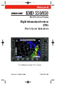
background image

N

Revision 2  November/2002

006-18237-0000

Multi-Function Display

KMD 550/850

Flight Information Services

(FIS)

Pilot’s Guide Addendum

B

For Software Version 01/11 or later

KMD 550/850 FIS Cover R2  11/21/02  5:33 PM  Page 1

Summary of Contents for KMD 550/850

Page 1: ...ion 2 November 2002 006 18237 0000 Multi Function Display KMD 550 850 FlightInformationServices FIS Pilot s Guide Addendum B For Software Version 01 11 or later KMD 550 850 FIS Cover R2 11 21 02 5 33 PM Page 1 ...

Page 2: ... Inc is prohibited For further information contact the Manager Technical Publications Honeywell One Technology Center 23500 West 105th Street Olathe Kansas 66061 Telephone 913 782 0400 The information contained in this manual is for reference use only If any information contained herein conflicts with similar information contained in the Airplane Flight Manual Supplement the information in the Air...

Page 3: ...ic planning It cannot be used to attempt pene tration of severe weather tactical maneuvering due to insuffi cient resolution and relative age of the data There are regions of precipitous terrain where coverage is not possible due to signal blockage by the terrain Always make note of the age of the data being displayed espe cially in areas of rapidly changing weather conditions Use good judgement w...

Page 4: ...UBSCRIPTION 17 CHECKING FIS SUBSCRIPTIONS 20 NORMAL OPERATION 21 NEXRAD PAGE 22 NEXRAD Page Operational Controls 23 Using The NEXRAD Page 23 GRAPHICAL METARS PAGE 27 Graphical METARs Page Operational Controls 28 Using The Graphical METARs Page 28 FIS TEXT PAGE 31 FIS Text Page Operational Controls 32 Using The FIS Text Page 33 Changing Modes Area 33 Selecting Identifiers Using the DATA SCAN Knob 3...

Page 5: ...CEIVED 46 FIS ALERT ONE OR MORE FIS SUBSCRIPTIONS ARE CLOSE TO EXPIRING PLEASE REVIEW YOUR SUBSCRIPTIONS 46 FIS ALERT ONE OR MORE FIS SUBSCRIPTIONS HAVE EXPIRED PLEASE REVIEW YOUR SUBSCRIPTIONS 47 FIS ALERT DATA CARD UPDATE REQUIRED FOR CONTINUED RECEPTION OF FIS DATA 47 FIS ALERT NEW DATA CARD NOT YET VALID UNABLE TO RECEIVE FIS DATA 47 FIS ALERT DATA CARD HAS EXPIRED UNABLE TO RECEIVE FIS DATA 4...

Page 6: ...ical information in accordance with FAA operating rules is still required The FIS system is operational 24 hours day 7 days week Data acquired from FAA approved weather sources is processed at the hub and then distributed to Ground Stations The Ground Stations broadcast the information over a VHF Data Link VDL to aircraft within line of sight utilizing VDL mode 2 transmitters at a bit rate up to 3...

Page 7: ...ally broadcast without the need to request informa tion nor acknowledge receipt Both basic no cost and value added fee based products are trans mitted Basic products are displayed using standard ICAO WMO textual format Most fee based products are displayed in a graphical form The following basic services are obtained through a no cost subscription service Aviation Routine Weather Reports METARs Av...

Page 8: ... Honeywell KDR 510 VDL Receiver This Pilot s Guide Addendum describes the operation of the KMD 550 850 display and discusses the proper use of the displayed data for strategic weather planning The detailed description of the general oper ation of the KMD 550 850 is contained in the other sections of the KMD 550 850 Pilot s Guide The Bendix King KMD 550 850 is shown below with the FIS Text Page sel...

Page 9: ...azardous meteo rological conditions b As a cue to the pilot to communicate with the ATC con troller AFSS specialist Operator Dispatch or Airline Operations Control Center AOCC to get further information about the current meteorological conditions In no case should the pilot take any eva sive action based solely upon the FIS display The FIS information is intended for assistance in strategic flight...

Page 10: ...rea will be displayed up to a maximum of 25 reports These reports are displayed in an encoded textual format METARs displayed graphically on the map are offered through a subscription service NOTE When a specific element of METAR data is not available it is omitted from the report The user must know the sequence of data to recognize omissions At the time of this printing METAR observations older t...

Page 11: ...ETAR report with the exception of the first element denoting report type SPECI will be seen in place of METAR NOTE When a specific element of SPECI data is not available it is omitted from the report The user must know the sequence of data to recognize omissions At the time of this printing SPECI observations older than 75 minutes are discarded Sometime in the first half of 2003 SPECI observations...

Page 12: ...Pilots are encouraged to promptly volunteer these reports A PIREP will contain elements in the following order 1 Type of message urgent or routine 2 Location in relation to an airport or VHF NAVAID 3 Time observed 4 Flight Level may not always be present 5 Type of aircraft may not always be present 6 Sky cover may not always be present 7 Weather conditions may not always be present 8 Temperature m...

Page 13: ...8 Revision 2 Nov 2002 KMD 550 850 FIS Addendum Basic Service Weather Products Intentionally left blank KMD 550 850 FIS PG R2 11 21 02 5 34 PM Page 8 ...

Page 14: ...ct content consists of reflec tivity measured at the minimum scan angle of 0 5 degree elevation CAUTION NEXRAD data must be used for strategic planning pur poses only Due to inherent delays and relative age of the data that can be experienced NEXRAD data cannot be used for tactical avoidance of weather NEXRAD Base Reflectivity images older than 75 minutes are discarded and no longer displayed Figu...

Page 15: ...e bodies of water Blocky and linear features are characteristics of strobes within the displayed data 4 Sun strobes occur when a radar antenna points directly at the sun This shows up as high reflectivity for one or two radials Since base reflectivity is scanned at the lowest antenna elevation angle 0 5 degrees typically sun strobes appear only when the sun is rising or set ting Sun strobes are sh...

Page 16: ...ermine information currency 3 Due to site location limi tations terrestrial blockages and outages NEXRAD cov erage gaps exist Coverage gaps are displayed as a cross hatched pattern as shown in Figure 2 Lack of reflectivity in a coverage gap area should not be construed as a lack of precipitation 4 NEXRAD base reflec tivity is sampled at the min imum antenna elevation angle An individual NEXRAD sit...

Page 17: ...o compare intensity levels between different sources of NEXRAD information since many internet weather providers will include a legend with dBz values indicated No Data as shown in the legend indicates the lack of coverage for reasons discussed previously GRAPHICAL METAR The graphical METAR is derived from the most cur rently received textual METAR or SPECI data from reporting sites This is dis pl...

Page 18: ...Graphical METARs are shown using two color coded boxes one indi cating ceiling upper box the other visibility lower box Next to the boxes is the ICAO station identifier for the airport to which the METAR pertains Color coding for the boxes is specified in the table below Moving the joystick pointer to an area that will not highlight a specific report then pressing the MORE INFO softkey will displa...

Page 19: ...tood that FIS informa tion is to be used as a strategic planning tool for pilot decisions on avoiding inclement weather areas which are beyond visual range or where poor visibility precludes visual acquisition of inclement weather Due to inherent delays areas of coverage and relative age and avail ability of the data that can be experienced FIS data cannot be viewed as an absolute depiction of con...

Page 20: ... with different passwords Once entered the display unit manages selection of the appropriate sub scription without any operator intervention A subscription code must be entered into the display unit whenever you add or renew a subscription When subscribing for a FIS service package you may specify the date when service shall commence and the duration If you subscribe to mul tiple packages the star...

Page 21: ...ersion of software to utilize new FIS products as they become available Note that data card updates are available every 28 days and also include the latest version of Jeppesen navigation data FIS Subscriptions Select the desired services Go to Bendixking com or call 1 800 247 0230 to subscribe to FIS Services Get Display ID from unit in airplane Receive Subscription Code s and print them out Take ...

Page 22: ...n four subscriptions will cause previous subscriptions to be overwritten To set up a subscription per form the following steps 1 Press the AUX Function Select Key to display the Auxiliary Mode Cover Page as shown in Figure 8 2 Press the WX SETUP softkey to display the WX Setup Cover Page as shown in Figure 9 3 Press the FIS softkey to display the FIS Setup Cover Page as shown in Figure 10 FIS Subs...

Page 23: ...1 800 247 0230 This ID will be used to obtain a Subscription Access Code NOTE For uninterrupted FIS services the data card must be updated by the date shown in Data card update required by field 5 After obtaining the Subscription Code press the ADD SUBSCR softkey to display Figure 12 6 The inner Control Knob selects the alphanumeric character and the outer Control Knob selects the character positi...

Page 24: ...in Figure 14 If an incorrect code has been entered a message like that shown in Figure 15 will be displayed 8 After the subscription has been accepted Figure 16 will be displayed showing the subscription validity period and status If the subscrip tion has been entered prior to the beginning of subscription service the entered subscrip tion will begin when subscrip tion services are turned on Figur...

Page 25: ...sub scription 1 has expired and subscription 2 is still valid The symbols that may appear in the Status column and their meanings are shown in Figure 18 Again subscriptions will only be valid when FIS subscription service is turned on NOTE Only the validity period for subscriptions is shown on the display To determine which products are available with each subscription access the account on Wingma...

Page 26: ...hin each weather function as shown in the following diagram KMD 850 Only Stormscope WX Radar FIS Graphical Products FIS Textual Products Only if Stormscope is installed WX Radar WX Mode WX Radar Ground Map Mode Stormscope Strike Mode Stormscope Cell Mode FIS Graphics NEXRAD Mode FIS Graphics Graphical METAR Mode FIS Text METAR Mode FIS Text TAF Mode FIS Text PIREP Mode KMD 850 Only NOTE Not all op...

Page 27: ...ter ring radius is selected range and inner ring radius is one half the selected range 5 MODE Indicates the weather product being displayed 6 Joystick Label Indicates joystick is active and can be used to pan map 7 No Coverage Area Crosshatch pattern indicates area of no coverage 8 Precipitation NEXRAD precipitation returns 9 Aircraft Symbol Indicates present aircraft position and heading if avail...

Page 28: ...reases range the lower button decreases it The selected range is displayed in the lower left corner of the display with the outer range ring the displayed range and the inner range ring is half the displayed range The RNG button labels will not be displayed when their respec tive range limits are reached OVLY Allows selection of flight plan and lightning data if Stormscope equipment is installed f...

Page 29: ...hese delays can range from one to seven minutes If no data update has been received for 75 minutes the NEXRAD image is discarded and no longer displayed 2 Press the RNG RNG Key to zoom in on the display The map is centered on the present position indicated by the symbolic aircraft 3 To view a specific area of weather move the joystick in the desired direction A pointer will appear on the display c...

Page 30: ...s are taken for a period of 30 seconds the display will return to the present posi tion 4 Press the OVLY Key to overlay flightplan or lightning data on the NEXRAD map see Figure 23 Lightning overlay capability will only be available if a Stormscope is installed with the system The FLIGHT PLAN and STORMSCOPE softkeys toggle the respective overlay on or off as in Figure 24 Normal Operation Figure 24...

Page 31: ...6 Revision 2 Nov 2002 KMD 550 850 FIS Addendum Press the SAVE EXIT softkey to retain the selec tions on the display see Figure 25 Normal Operation Figure 25 KMD 550 850 FIS PG R2 11 21 02 5 34 PM Page 26 ...

Page 32: ...R Icon Ceiling indicated in top box visibility in the bottom box and ICAO identifier of issuing airport Note that ICAO identifiers are not displayed on all range settings 4 North Pointer Indicates north 5 MODE Indicates the weather product being displayed 6 Joystick Label Indicates joystick is active and can be used to pan map 7 Range Rings Outer ring radius is selected range and inner ring radius...

Page 33: ...range The RNG button labels will not be displayed when their respective range limits are reached OVLY Allows selection of flight plan data for overlay on the FIS map USING THE GRAPHICAL METARS PAGE 1 Press the WX Function Select Key until the FIS Graphics Page is displayed If necessary press the MODE Key to obtain the Graphical METAR display as shown in Figure 26 Graphical METARs will be displayed...

Page 34: ...top moving the pointer When the pointer moves over a graph ical METAR icon a box will pop up containing the IDENT NAME and CITY STATE pertaining to the location and the AGE of the report see Figure 28 4 Press the RNG RNG keys to zoom in or out on the pointer position 5 Press the MORE INFO softkey to display the Text METAR Page for the dis played location as in Figure 29 6 Press the METAR MAP softk...

Page 35: ...yed as in Figure 30 Move the joystick to remove the legend from the display 9 Press the OVLY Key to overlay flightplan data on the Graphical METAR map see Figure 31 The FLIGHT PLAN softkey toggles the overlay on or off as in Figure 32 Press the SAVE EXIT softkey to retain the selection on the display Normal Operation Figure 30 Figure 32 Figure 31 KMD 550 850 FIS PG R2 11 21 02 5 34 PM Page 30 ...

Page 36: ...in the AVAILABLE REPORTS field 9 Available Reports Shows available reports based on the selection in the AREA field Special urgent or amended reports are highlighted in yellow 10 Scroll Bar Indicates there are more available reports than can be displayed on the screen Move the joystick to cycle through the reports 11 Change Area Soft Key Cycles the AREA field between Destination Flightplan Waypoin...

Page 37: ...his softkey is only available when viewing text METARs and graphical METARs are available When the METAR MAP softkey is pressed the Graphical METARs Page will be displayed with the map centered on the location of the selected METAR report SCAN DATA The SCAN feature is only available when FLPN WPT is the selected AREA The DATA feature is available when USER DEFINED is selected When the Control Knob...

Page 38: ...s TAFs or PIREPS The type of report viewed is displayed in the MODE field at the top of the display Figure 36 shows the relation ship between the selected AREA and the selected MODE The system filters and then displays reports for the selected MODE based on the distance from the selected AREA The AVAILABLE REPORTS field lists closest first furthest last For instance the display shown in Figure 33 ...

Page 39: ... waypoint in an active flightplan The softkey cycles through the AREAs as shown in Figure 37 These four selectable areas are used to make it easier to find all the reports near a specific location without having to know the exact identifier of the reporting station Again refer to Figure 36 to understand the rela tionship between the selected AREA and the selected MODE Normal Operation Destination ...

Page 40: ...points Turn the inner counter clockwise to sequence backward through the waypoints Finding User Defined Areas by Identifier If USER DEFINED has been selected as in Figure 39 use the Control Knob to enter data note cursor position in Figure 39 or scan through available location options The following is an example of using this feature 1 The cursor will be over the first character of the waypoint id...

Page 41: ...acter See Figure 42 4 Turn the outer knob one click clockwise to move the cursor to the next character field Turn the inner knob to select the desired character 5 Press the OK softkey when finished making selec tions The display will be as shown in Figure 43 6 Move the joystick right or left to view available reports NOTE Available reports highlighted in yellow like KMCW in Figure 43 indi cates th...

Page 42: ...be used to select it However if the identifier is not known the name of the location can be entered The system will also allow entry of just the first few characters of the location name to help find it in the database If neither the identifier nor the location name is known the city state can be scanned To Enter Location Name The following example shows entering EAGLE GROVE MUN as a location 1 Tu...

Page 43: ...e next character Turn the inner knob to select a A as in Figure 48 5 Turn the outer knob clock wise until the cursor is posi tioned for the next character entry Turn the inner knob to select a G as in Figure 49 6 Turn the outer knob clock wise until the cursor is posi tioned for the next desired character entry Figure 49 Figure 48 Figure 47 Normal Operation KMD 550 850 FIS PG R2 11 21 02 5 34 PM P...

Page 44: ...us procedure 2 Press the KNOB SCAN softkey The Control Knob label will now display SCAN The knob label will now show SCAN as in Figure 51 3 Turn the outer knob clock wise until the cursor is posi tioned as in Figure 51 4 Turn the inner knob to sequence through all the location names in the data base beginning with EAGLE stopping at the desired name as in Figure 52 NOTE This same method may be used...

Page 45: ...ing displayed 6 Joystick Label Indicates joystick is active and can be used to pan map 7 Softkey Label Pressing the PREV PAGE softkey will return to the previous display 8 Range Rings Outer ring radius is selected range and inner ring radius is one half the selected range 9 Aircraft Symbol Indicates present aircraft position and heading if available or track 10 Color Key Ground station status lege...

Page 46: ...liary Mode Cover Page as shown in Figure 53 2 Press the WX SETUP softkey to display the WX Setup Cover Page as shown in Figure 54 3 Press the FIS softkey to display the FIS Setup Cover Page as shown in Figure 55 Normal Operation Figure 53 Figure 54 Figure 55 KMD 550 850 FIS PG R2 11 21 02 5 34 PM Page 41 ...

Page 47: ...eceiving the closest transmit ting site This is not a problem since all stations transmit the same data 5 Ground station status and it s identifier number can be viewed by moving the joy stick to position the pointer over the desired ground sta tion as shown in Figure 57 NOTE Visit Wingman Services at www ben dixking com to view the latest information about network transmitter locations and to cro...

Page 48: ...ate with the KDR 510 VDL Receiver a message such as that shown in Figure 59 will be displayed If this message persists it may indicate a problem with the KDR 510 or the wiring between the KDR 510 and KMD 550 850 NEXRAD IMAGE NOT AVAILABLE DATA NOT RECEIVED If no valid Nexrad data is received a message such as that shown in Figure 60 will be displayed This message usually means that the system is n...

Page 49: ...hown in Figure 62 will be displayed if no METARs are available in the selected area This message means that the FIS system is working prop erly there are simply no reports of the selected mode within the area FIS ALERT FIS DATA NOT RECEIVED FOR 15 MINUTES This message will be dis played Figure 63 if FIS data has previously been received but it has been 15 minutes or more since the last reception T...

Page 50: ...on Code is entered This may be due to an error entering the Subscription Code Also it may be due to a Subscription Code being entered that is associated with a different Display ID ERROR PROCESSING SUBSCRIPTION CODE This message will be dis played Figure 66 when there is a problem pro cessing the Subscription Code Cycling power to the unit and re entering the code usually resolves the problem If t...

Page 51: ...ORK STATUS NOT AVAILABLE DATA NOT RECEIVED This message will be dis played Figure 68 if no valid network status data is avail able FIS ALERT ONE OR MORE FIS SUBSCRIP TIONS ARE CLOSE TO EXPIRING PLEASE REVIEW YOUR SUB SCRIPTIONS This message will be dis played Figure 69 if the system detects at least one subscription is within 7 days of it s displayed ending date Messages Figure 67 Figure 68 Figure...

Page 52: ... FOR CON TINUED RECEPTION OF FIS DATA If the system detects that the system date is within 30 days of the ending date of the data card a message such as that shown in Figure 71 will be dis played This is a reminder FIS services will continue to function until reaching the ending date of the data card FIS ALERT NEW DATA CARD NOT YET VALID UNABLE TO RECEIVE FIS DATA This message will be dis played F...

Page 53: ...ALERT FIS SUB SCRIPTION ERROR SWITCH OFF AND REPLACE DATA CARD A message such as that shown in Figure 74 will be displayed if there is a problem internal to the data card FIS ALERT FIS DECRYPTION ERROR UNABLE TO RECEIVE FIS DATA This message is similar in appearance to that shown in Figure 74 This message indicates that a decryption hardware failure has occurred after system startup and a successf...

Page 54: ...his element indicates a cor rected report 5 Wind 22015G25KT 220 is the 3 digit true direction to the nearest 10 Airport advisory service ATIS and ATC towers report wind direction as magnetic VRB in this place indicates variable winds less than or equal to 6 knots If wind direction is varying more than 60 with speeds over 6 knots an entry similar to 180V260 will be displayed in this place This exam...

Page 55: ...w PR Partial SH Showers The second two letter designator RA indicates moderate rain Moderate is indicated by the absence of a or VC preceding the designation These preceding designations represent the fol lowing Heavy Light VC In the vicinity Other possible designations could be as follows BR Mist DS Dust Storm DU Widespread Dust DZ Drizzle FC Funnel Cloud FC Tornado Water Spout FG Fog FU Smoke GR...

Page 56: ...ment PK WND denotes peak wind 200 indicates wind direction from 200 30 15 indicates a maximum instantaneous wind of 30 knots occurred at 15 minutes past the hour UNDERSTANDING TAFS TERMINAL AREA FORE CASTS Refer to the numbers on the following diagram to find the appropriate descriptions 1 Type of Report TAF TAF indicates a Terminal Area Forecast TAF AMD indicates an amended forecast 2 ICAO Statio...

Page 57: ...2200Z 22 Temporary indicates a tem porary fluctuation in conditions usually lasting less than one hour The described conditions follow this element 20 Low Level Windshear WS015 30045KT WS indicates windshear not associated with convective activity 015 indicates the windshear is expected at 1500 feet AGL Wind is expected from 300 300 at 45 knots 45KT 21 Change in Conditions PROB40 0407 PROB40 indic...

Page 58: ... Anticyclone ADJ Adjacent ADL Additional ADQT Adequate ADQTLY Adequately ADRNDCK Adirondack ADVCT Advect ADVCTD Advected ADVCTG Advecting ADVCTN Advection ADVCTS Advects ADVN Advance ADVNG Advancing ADVY Advisory ADVYS Advisories AFCT Affect AFCTD Affected AFCTG Affecting AFDK After dark AFOS Automated Field Operations System AFSS Automated Flight Service Station AFT After AFTN Afternoon AGL Above...

Page 59: ...es APLCN Appalachian APLCNS Appalachians APPR Appear APPRG Appearing APPRS Appears APRNT Apparent APRNTLY Apparently APRX Approximate APRXLY Approximately AR Arkansas ARL Air Resources Lab ARND Around ARPT Airport ASAP As soon as possible ASSOCD Associated ASSOCN Association ATCT Air Traffic Control Tower ATLC Atlantic ATTM At this time ATTN Attention AVBL Available AVG Average AVN Aviation model ...

Page 60: ...overcast BKN Broken BL Blowing BLD Build BLDG Building BLDUP Buildup BLKHLS Black Hills BLKT Blanket BLKTG Blanketing BLKTS Blankets BLO Below or below clouds BLW Below BLZD Blizzard BN Blowing sand BND Bound BNDRY Boundary BNDRYS Boundaries BNTH Beneath BOOTHEEL Bootheel BR Branch or mist METAR used only for visibility between 5 8 and 6 miles BRF Brief BRK Break BRKG Breaking BRKHIC Breaks in hig...

Page 61: ...gh X CDFNT Cold front CFP Cold front passage CG Cloud to ground lightning CHC Chance CHCS Chances CHG Change CHGD Changed CHGG Changing CHGS Changes CHI Cloud Height indicator CHINO Sky condition at secondary location not available CHOP Turbulence type characterized by rapid rhythmic jolts CHSPK Chesapeake CI Cirrus CIG Ceiling CIGS Ceilings CLD Cloud CLDNS Cloudiness CLDS Clouds CLKWS Clockwise C...

Page 62: ...rculation CRNR Corner CRNRS Corners CRS Course CS Cirrostratus CSDR Consider CSDRBL Considerable CST Coast CSTL Coastal CT Connecticut CTC Contact CTGY Category CTSKLS Catskills CU Cumulus CUFRA Cumulus fractus CVR Cover CVRD Covered CVRG Covering CVRS Covers CWSU Center Weather Service Units CYC Cyclonic CYCLGN Cyclogenesis DABRK Daybreak DALGT Daylight DBL Double DC District of Columbia DCR Decr...

Page 63: ...minishing DMSHS Diminishes DNS Dense DNSLP Downslope DNSTRM Downstream DNWND Downwind DP Deep DPND Deepened DPNG Deepening DPNS Deepens DPR Deeper DPTH Depth DR Low Drifting descriptor used with DU SA or SN DRDU Drifting dust DRFT Drift DRFTD Drifted DRFTG Drifting DRFTS Drifts DRSA Low drifting sand DRSN Low drifting snow DRZL Drizzle DS Duststorm DSCNT Descent DSIPT Dissipate DSIPTD Dissipated D...

Page 64: ...cal velocity DWNDFTS Downdrafts DWPNT Dew point DWPNTS Dew points DU Dust METAR DZ Drizzle METAR E East EBND Eastbound EFCT Effect ELNGT Elongate ELNGTD Elongated ELSW Elsewhere EMBD Embedded EMBDD Embedded EMERG Emergency ENCTR Encounter ENDG Ending ENE East northeast ENELY East northeasterly ENERN East northeastern ENEWD East northeastward ENHNC Enhance ENHNCD Enhanced ENHNCG Enhancing ENHNCS En...

Page 65: ...FC Funnel cloud FC Tornado or water spout FCST Forecast FCSTD Forecasted FCSTG Forecasting FCSTR Forecaster FCSTS Forecasts FEW Few used to describe cloud cover or weather phenomena 0 octas to 2 octas cloud amount FG Fog METAR only when visibility is less than 5 8 mile FIBI Filed but impracti cable to transmit FIG Figure FILG Filling FIR Flight information region FIRAV First available FIS Flight I...

Page 66: ...tal surface FRQ Frequent FRST Frost FRWF Forecast wind factor FRZ Freeze FRZLVL Freezing level FRZN Frozen FRZG Freezing FT Feet FTHR Further FU Smoke FV Flight visibility FVRBL Favorable FWD Forward FYI For your information FZ Freezing FZRANO Freezing rain sensor not available G Gust GA Georgia GEN General GENLY Generally GEO Geographic GEOREF Geographical refer ence GF Fog GICG Glaze icing GLFAL...

Page 67: ...Hurricane HUREP Hurricane report HV Have HVY Heavy HVYR Heavier HVYST Heaviest HWVR However HWY Highway HZ Haze IA Iowa IC Ice crystals or icing ICAO International Civil Aviation Organization ICG Icing ICGIC Icing in clouds ICGICIP Icing in clouds and in precipitation ICGIP Icing in precipitation ID Idaho IFR Instrument flight rules IL Illinois IMC Instrument meteo rolgical conditions IMDT Immedia...

Page 68: ...nsity INTVL Interval INVRN Inversion IOVC In overcast INVOF In vicinity of IP Ice pellets IPV Improve IPVG Improving ISOL Isolate ISOLD Isolated JCTN Junction JTSTR Jet stream KFRST Killing frost KLYR Smoke layer aloft KOCTY Smoke over city KS Kansas KT Knots KY Kentucky L Left LA Louisiana LABRDR Labrador LAST Last observation before a break in coverage at a manual station LAT Latitude LAWRS Limi...

Page 69: ...CA Lightning cloud to air LTGCC Lightning cloud to cloud LTGCG Lightning cloud to ground LTGCCCG Lightning cloud to cloud cloud to ground LTGCW Lightning cloud to water LTGIC Lightning in cloud LTL Little LTLCG Little change LTR Later LTST Latest LV Leaving LVL Level LVLS Levels LWR Lower LWRD Lowered LWRG Lowering LYR Layer LYRD Layered LYRS Layers M Minus or Less than lowest sensor value MA Mass...

Page 70: ...MOVD Moved MOVG Moving MOVMT Movement MOVS Moves MPH Miles per hour MRGL Marginal MRGLLY Marginally MRNG Morning MRTM Maritime MS Mississippi MSG Message MSL Mean sea level MST Most MSTLY Mostly MSTR Moisture MT Montana MTN Mountain MTNS Mountains MULT Multiple MULTILVL Multilevel MVFR Marginal visual flight rules MWO Meteorological Watch Office MX Mixed character ized as a combina tion of clear a...

Page 71: ...ew Jersey NL No layers NLT Not later than NLY Northerly NM New Mexico NMBR Number NMBRS Numbers NML Normal NMRS Numerous NNE North northeast NNELY North northeasterly NNERN North northeastern NNEWD North northeast ward NNW North northwest NNWLY North northwesterly NNWRN North northwestern NNWWD North northwest ward NNNN End of message NOAA National Oceanic and Atmospheric Administration NOPAC Nort...

Page 72: ...ally OCR Occur OCRD Occurred OCRG Occurring OCRS Occurs OFC Office OFCM Office of the Federal Coordinator for Meteorology OFP Occluded frontal passage OFSHR Offshore OH Ohio OHD Overhead OK Oklahoma OMTNS Over mountains ONSHR On shore OR Oregon ORGPHC Orographic ORIG Original OSV Ocean station vessel OTLK Outlook OTP On top OTR Other OTRW Otherwise OUTFLO Outflow OV Over OVC Overcast OVHD Overhead...

Page 73: ...PPINA Radar weather report not available PPINE Radar weather report no echoes observed PPSN Present position PR Partial PRBL Probable PRBLY Probably PRBLTY Probability PRECD Precede PRECDD Preceded PRECDG Preceding PRECDS Precedes PRES Pressure PRESFR Pressure falling rapidly PRESRR Pressure rising rapidly PRFG Partial fog PRIM Primary PRIN Principal PRIND Present indications are PRJMP Pressure ju...

Page 74: ...al PTNLY Potentially PTNS Portions PUGET Puget Sound PVA Positive vorticity advection PVL Prevail PVLD Prevailed PVLG Prevailing PVLS Prevails PVLT Prevalent PWB Pilot weather briefing PWINO Precipitation identi fier sensor not avail able PWR Power PY Spray QN Question OCNL Occasional QSTNRY Quasistationary QTR Quarter QUAD Quadrant QUE Quebec R Right with refer ence to runway des ignation RA Rain...

Page 75: ...EQSTD Requested RESP Response RESTR Restrict RGD Ragged RGL Regional model RGLR Regular RGN Region RGNS Regions RGT Right RH Relative humidity RI Rhode Island RIME Type of icing char acterized by a rough milky opaque appearance RIOGD Rio Grande RLBL Reliable RLTV Relative RLTVLY Relatively RM Remarks RMK Remark RMN Remain RMND Remained RMNDR Remainder RMNG Remaining RMNS Remains RNFL Rainfall RNG ...

Page 76: ...eturns RUF Rough RUFLY Roughly RVR Runway Visual Range RVRNO RVR system not available RVS Revise RVSD Revised RVSG Revising RVSS Revises RWY Runway RY Runway S South SA Sand METAR SAB Satellite Analysis Branch SCSL Stratocumulus Standing Lenticular cloud SCT Scattered describing cloud cover or weather phenomena 3 to 4 octas cloud amount SASK Saskatchewan SATFY Satisfactory SBND Southbound SBSD Sub...

Page 77: ...ET Significant meteoro logical information SIMUL Simultaneous SK Sky cover SKC Sky clear SKED Schedule SLD Solid SLGT Slight SLGTLY Slightly SLO Slow SLOLY Slowly SLOR Slower SLP Slope or sea level pressure SLPG Sloping SLPNO Sea level pressure not available SLW Slow SLY Southerly SM Statute mile SML Small SMLR Smaller SMRY Summary SMTH Smooth SMTHR Smoother SMTHST Smoothest SMTM Sometime SMWHT So...

Page 78: ...ward SSW South southwest SSWLY South southwest erly SSWRN South southwestern SSWWD South southwest ward ST Stratus STAGN Stagnation STBL Stable STBLTY Stability STD Standard STDY Steady STFR Stratus fractus STFRM Stratiform STG Strong STGLY Strongly STGR Stronger STGST Strongest STM Storm STMS Storms STN Station STNRY Stationary SUB Substitute SUBTRPCL Subtropical SUF Sufficient SUFLY Sufficiently...

Page 79: ...hicker THKST Thickest THN Thin THNG Thinning THNR Thinner THNST Thinnest THR Threshold THRFTR Thereafter THRU Through THRUT Throughout THSD Thousand THTN Threaten THTND Threatened THTNG Threatening THTNS Threatens TIL Until TKOF Takeoff TM Time TMPRY Temporary TMPRYLY Temporarily TMW Tomorrow TN Tennessee TNDCY Tendency TNDCYS Tendencies TNGT Tonight TNTV Tentative TNTVLY Tentatively TOC Top of Cl...

Page 80: ... Towering TX Texas UA Pilot weather reports UDDF Up and downdrafts UN Unable UNAVBL Unavailable UNEC Unnecessary UNKN Unknown UNL Unlimited UNRELBL Unreliable UNRSTD Unrestricted UNSATFY Unsatisfactory UNSBL Unseasonable UNSTBL Unstable UNSTDY Unsteady UNSTL Unsettle UNSTLD Unsettled UNUSBL Unusable UP Unknown precipita tion used only by automated sites that are incapable of discrimination UPDFTS ...

Page 81: ... ical conditions VOL Volume VOR VHF Omnidirectional Radio Range VORT Vorticity VORTAC VOR and TACAN combination VR Veer VRB Variable VRG Veering VRBL Variable VRISL Vancouver Island BC VRS Veers VRT MOTN Vertical motion VRY Very VSB Visible VSBY Visibility VSBYDR Visibility decreasing rapidly VSBYIR Visibility increasing rapidly VT Vermont VV Vertical velocity or vertical visibility W West WA Wash...

Page 82: ...ern WRMR Warmer WRMST Warmest WRMFNT Warm front WRMFNTL Warm frontal WRNG Warning WRS Worse WS Wind shear WSHFT Windshift WSFO Weather Service Forecast Office WSTCH Wasatch Range WSW West southwest WSWLY West southwesterly WSWRN West southwestern WSWWD West southwest ward WTR Water WTSPT Waterspout WUD Would WV West Virginia or wind WVS Waves WW Severe weather watch WWD Westward WX Weather WY Wyom...

Page 83: ...B 26 Revision 2 Nov 2002 KMD 550 850 FIS Addendum Appendix B YKN Yukon YLSTN Yellowstone Z Zulu time ZN Zone ZNS Zones Appendix B R2 11 21 02 5 32 PM Page 26 ...

Page 84: ...hnology Center 23500 West 105th Street Olathe KS 66061 Telephone 913 782 0400 FAX 913 712 1302 2001 2002 Honeywell International Inc 006 18237 0000 Printed in U S A Revision 2 November 2002 KMD 550 850 FIS Cover R2 11 21 02 5 33 PM Page 3 ...

Reviews: