background image

Pub. 988-0156-071

                      www.lowrance.com

LMS-332C &

LMS-337C DF

Fish-finding Sonar & Mapping GPS

Installation and Operation

Instructions

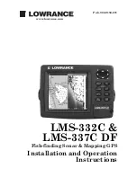
Summary of Contents for LMS-332C

Page 1: ...Pub 988 0156 071 www lowrance com LMS 332C LMS 337C DF Fish finding Sonar Mapping GPS Installation and Operation Instructions ...

Page 2: ...demark of Fishing Hot Spots Inc Navionics is a registered trademark of Navionics Inc eXitSource Database copyright 2001 2004 Zenrin Co Ltd Exit Authority and eXitSource are trademarks of Zenrin Co Ltd Lowrance Electronics may find it necessary to change or end our policies regulations and special offers at any time We reserve the right to do so without notice All features and specifications subjec...

Page 3: ...n and Fish Arches 23 Shoot Thru Hull Preparation 24 Speed Temperature Sensors 28 GPS Antenna Receiver Module 30 Power Connections 32 NMEA 2000 Cable Connections 35 Connecting to a NMEA 2000 Network 35 NMEA 0183 Wiring Data cable 35 Mounting the Unit Bracket In Dash or Portable 37 MMC or SD Card Memory Card Installation 41 Other Accessories 42 Face Cover 43 Section 3 Basic Sonar Operation 45 Keyboa...

Page 4: ...rScroll 80 Reset Options 82 Reset Water Distance 82 Set Keel Offset 83 Sensitivity Auto Sensitivity 84 Sonar Chart Mode 86 Sonar Page Sonar Chart Display Options 86 Full Sonar Chart 86 Split Zoom Sonar Chart 87 Split Frequency Sonar Chart LMS 337CDF only 87 Digital Data Chart 88 Customize Page Displays 89 FlashGraf 90 Map With Sonar Split Screen 91 Sonar Simulator 91 Stop Chart 94 Surface Clarity ...

Page 5: ... Creating and Saving a Trail 126 Displaying a Saved Trail 128 Navigating Trails 128 Visual Trailing 129 Navigate a Trail forward 129 Navigate a Back Trail backtrack or reverse 131 Transfer Custom Maps and GPS Data Files 132 Cancel Navigation 134 Section 7 Advanced GPS Operations 135 Find Distance From Current Position To Another Location 135 Find Distance From Point to Point 135 Icons 136 Create I...

Page 6: ...tup Options 149 Alarms 149 Auto Satellite Search 150 Check MMC Files and Storage Space 151 Communications Port Configuration 151 Configure NMEA 152 Coordinate System Selection 152 Map Fix 153 Customize Page Displays 155 GPS Simulator 156 Simulating Trail or Route Navigation 157 Hide GPS Features 157 Initialize GPS 158 Map Auto Zoom 158 Map Data 158 Show Map Data 159 Pop up Map Information 159 Map ...

Page 7: ...othing 176 Trail Options 177 Delete All Trails 178 Flash Trails on Screen Option 178 Update Trail Option 178 Delete Trail 179 New Trail 179 Trail Visible Invisible and Other Trail Options 180 Transparency 180 Units of Measure 181 Section 9 Searching 183 Find Streets 183 Find Any Item Selected by Map Cursor 185 Find Interstate Highway Exits 185 Find Map Places or Points of Interest POI 188 Find Str...

Page 8: ...ng to a way point but will also visually check to make sure a clear safe path to the waypoint is always available WARNING When a GPS unit is used in a vehicle the vehicle operator is solely re sponsible for operating the vehicle in a safe manner Vehicle operators must maintain full surveillance of all pertinent driving boating or fly ing conditions at all times An accident or collision resulting i...

Page 9: ...l So we designed our book so that you don t have to read the whole thing from front to back for the information you want At the start or end of each segment we ll tell you what content is coming up next If it s a concept you re already familiar with we ll show you how and where to skip ahead for the next important topic We ve also made it easy to look up any tips you may need from time to time Her...

Page 10: ...our unit s GPS command func tions organized in alphabetical order When you come to a GPS menu command on the screen you can look it up in the manual by skimming over the table of contents just flipping through Section 6 or scanning through the command portion of Section 7 Your unit is ready to use right out of the box but you can fine tune and customize it s operation with dozens of options Since ...

Page 11: ...30 400 total pixels Backlighting Incandescent backlit screen with multiple lighting levels backlit keypad Input power 10 to 15 volts DC Current drain Sonar only 500 ma lights off 600 ma lights on With GPS and lights on 700 ma Case size 5 4 H x 6 9 W x 3 4 D 13 8 x 17 6 x 8 6 cm sealed and waterproof suitable for saltwater use MMC slots One with waterproof door SD card compati ble Recording GPS use...

Page 12: ...salt water Depth display Continuous display Graph recording Up to 1 GB on one MMC or SD card Audible alarms Deep shallow fish zone Automatic ranging Yes with instant screen updates Auto bottom track Yes Zoom bottom track Yes Split screen zoom Yes Surface water temp Yes built into transducer Speed distance log Yes with optional speed sensor sensor in cluded with LMS 337CDF GPS Receiver antenna Exte...

Page 13: ...nd save for recall later is only limited by the number of MMC cards you have NOTICE The storage temperature range for your unit is from 4 degrees to 167 degrees Fahrenheit 20 degrees to 75 degrees Celsius Extended stor age in temperatures higher or lower than specified will damage the liq uid crystal display in your unit This type of damage is not covered by the warranty For more information conta...

Page 14: ...rance web site www lowrance com You can save several different sonar log files erase em and record new ones over and over again The size of your sonar recordings is only limited by the free space available on your MMC How Lowrance GPS Works You ll navigate faster and easier if you understand how your unit scans the sky to tell you where you are on the earth and where you re go ing But if you alrea...

Page 15: ... you look back the way you came Think of this data storage like the hard drive memory in a computer or a tape in a cassette tape recorder You can save several different GPS data files erase em and record new ones over and over again These GPS Data Files file format usr can be shared between not only the LMS 332 and LMS 337CDF but other Lowrance GPS units and even personal computers Your unit has o...

Page 16: ...xt formatting makes the manual tutorials easy to skim If that s the case move on to How to Use This Manual on page 10 But if you want to understand the current state of satellite navigation look over this segment describing how GPS and its new companion WAAS work together to get you where you re going The Global Positioning System GPS was launched July 17 1995 by the United States Department of De...

Page 17: ... These signals can be easily blocked by trees buildings an automobile roof even your body Like most GPS receivers the unit doesn t have a compass or any other navigation aid built inside It relies solely on the signals from the sat ellites to calculate a position Speed direction of travel and distance are all calculated from position information Therefore in order it to determine direction of trav...

Page 18: ...blic today Remember however that this receiver is only a tool Always have another method of navigation avail able such as a map or chart and a compass Also remember that this unit will always show navigation information in the shortest line from your present position to a waypoint regardless of terrain It only calculates position it can t know what s between you and your destination for example It...

Page 19: ... and selecting menu commands We ve written them in a condensed manner for quick and easy reading For example instructions for navigating a trail would look like this 1 From the Map Page press MENU MENU to MY TRAILS ENT 2 Press to Trail 1 ENT to NAVIGATE ENT 3 You are asked to wait while it converts the trail into a route 4 The wait message disappears and the unit begins showing navigation informat...

Page 20: ...12 Notes ...

Page 21: ...r and route the transducer cable to the so nar GPS unit 6 Install the GPS antenna and route the antenna cable to the so nar GPS unit 7 Install the power cable and route it to the sonar GPS unit 8 Mount the sonar GPS unit to the bracket Transducer Installation These instructions will help you install your Skimmer transducer on a transom on a trolling motor or inside a hull These instructions cover ...

Page 22: ...flat head screwdriver Supplies plastic cable ties Shoot through hull installations Tools these will vary depending on your hull s composition Consult your boat dealer or manufacturer Other tools are a wooden craft stick or similar tool for stirring and applying epoxy and a paper plate or piece of cardboard to mix the epoxy on Supplies rubbing alcohol 100 grit sandpaper specially formulated epoxy a...

Page 23: ... don t mount it closer than approximately one foot from the engine s lower unit This will prevent cavitation bubble interference with propeller operation 5 If possible route the transducer cable away from other wiring on the boat Electrical noise from engine wiring bilge pumps and aerators can be displayed on the sonar s screen Use caution when routing the transducer cable around these wires Good ...

Page 24: ... of the hull Shoot thru hull vs Transom Mounting In a shoot thru hull installation the transducer is bonded to the inside of the hull with epoxy The sonar ping signal actually passes through the hull and into the water This differs from a bolt thru hull installa tion often called simply thru hull In that case a hole is cut in the hull and a specially designed transducer is mounted through the hull...

Page 25: ...he transducer so that it s parallel with the ground The following instructions sometimes vary depending on the mounting bracket that came with your transducer Single frequency Skimmers come with a one piece stainless steel bracket while dual frequency Skimmers come with a two piece plastic mounting bracket Use the set of instructions that fits your model 1 Assembling the bracket A One piece bracke...

Page 26: ... 14 angle Insert and align ratchets Add ratchets to bracket and transducer 2 Aligning the transducer on the transom A One piece bracket Slide the transducer between the two ratch ets Temporarily slide the bolt though the transducer assembly and hold it against the transom Looking at the transducer from the side check to see if it will adjust so that its face is parallel to the ground If it does th...

Page 27: ...he transducer assembly but don t tighten the nut at this time Hold the assembled transducer and bracket against the transom Looking at the transducer from the side check to see if it will adjust so that its face is parallel to the ground If it does then the A positions are correct for your hull If the transducer s face isn t parallel with the ground remove and disassemble the transducer and ratche...

Page 28: ...ock nut at this time 4 Drilling mounting holes Hold the transducer and bracket assembly against the transom The transducer should be roughly parallel to the ground The trans ducer s centerline should be in line with the bottom of the hull Don t let the bracket extend below the hull Mark the center of each slot for the mounting screw pilot holes You will drill one hole in the center of each slot Dr...

Page 29: ...ough bracket Side view shown left and seen from above at right Both bracket types Attach the transducer to the transom Slide the transducer up or down until it s aligned properly with the bottom of the hull as shown in the preceding and following figures Tighten the bracket s mounting screws sealing them with the sealant Adjust the transducer so that it s parallel to the ground and tighten the nut...

Page 30: ...r This can prevent the transducer from enter ing the boat if it is knocked off at high speed If you need to drill a hole in the transom to pass the connector through the required hole size be 1 Caution If you drill a hole in the transom for the cable make sure it is lo cated above the waterline After installation be sure to seal the hole with the same marine grade above or below waterline seal ant...

Page 31: ...hen the motor is in the water Tighten the strap securely 3 Route the transducer cable alongside the trolling motor shaft Use plastic ties not included to attach the transducer cable to the troll ing motor shaft Make sure there is enough slack in the cable for the motor to turn freely Route the cable to the sonar unit and the trans ducer is ready for use Transducer mounted on trolling motor side vi...

Page 32: ...or may even prevent operation Shoot Thru Hull Preparation Hulls With Floatation Materials The transducer installation inside a fiberglass hull must be in an area that does not have air bubbles in the resin or separated fiberglass lay ers The sonar signal must pass through solid fiberglass A successful transducer installation can be made on hulls with flotation materials such as plywood balsa wood ...

Page 33: ...rectly to the outer layer of fiberglass After the epoxy cures for 24 hours fill the remaining space with polyester resin When the job is finished the hull is watertight and structurally sound Remember the sonar signal must pass through solid fiberglass Any air bubbles in the fiberglass or the epoxy will reduce or eliminate the sonar signals Testing Determines Best Location Ideally the shoot thru t...

Page 34: ...ent 2 Next take the transducer out of the water and place it in the water in the sump of the boat face down The transducer face is shown in the figure on the following page Notice how the signal strength de creases The second bottom signal will probably disappear and the bot tom signal intensity will likely decrease 3 Now move the transducer around to find the best location with the strongest poss...

Page 35: ...Hulls With Flotation Ma terials beginning on page 24 1 Make sure the area is clean dry and free of oil or grease then sand both the inside surface of the hull and the face of the transducer with 100 grit sandpaper The sanded hull area should be about 1 1 2 times the diameter of the transducer The surface of the hull must be flat so the entire transducer face is in contact with the hull prior to bo...

Page 36: ...ep oxy is wet Leave the weight in place for a minimum of three hours Allow the epoxy to cure for 24 hours before moving the boat 5 After the epoxy has cured route the cable to the sonar unit and it s ready to use Speed Temperature Sensors Optional Speed Sensor Installation All the units in this series can display speed and distance traveled but only the LMS 337CDF comes packed with a speed sensor ...

Page 37: ...r mounting configuration side view left and rear view right If the base of the transom has a radius fill the gap between the tran som and the sensor with the sealant This will help ensure a smooth water flow Route the sensor s cable through or over the transom to the sonar unit If you need to drill a hole in the transom to pass the connector through the required hole size is 7 8 CAUTION If you dri...

Page 38: ... directly using the supplied extension cable or through a NMEA 2000 network NOTE See the module s instruction sheet publication part number 988 0147 981 for complete installation instructions In an automobile you may achieve good results by simply placing the external antenna on the top of the dash at the base of the windshield A piece of the rubber non skid shelf liner material available in recre...

Page 39: ... Y adapter to connect both the antenna and the unit to the same network port To do this simply remove the 60 ohm terminator shown in the previous image and attach the NMEA 2000 buss adapter cable to the shorter branch of the extension cable s Y adapter Connect the NMEA 2000 buss adapter cable s other end to an available network port LGC 2000 and GPS unit connection to NMEA 2000 buss You can also a...

Page 40: ... is a power cable that connects to a NMEA 2000 buss The thicker three wire cable red black and white is the Power Supply for your unit and optional external speaker connection for some units The Power Data cable for this unit Depending on your configuration you may not use all of these wires The following segments include instructions for installing all the wires that you will use with this unit C...

Page 41: ...fe but if this small draw is a concern you can in stall a switch between the NMEA 2000 buss and the battery Powering Your Unit Power Supply cable red and black wires The unit works from a 12 volt battery system For the best results at tach the power cable directly to the battery You can attach the power cable to an accessory or power buss however you may have problems with electrical interference ...

Page 42: ...der directly to the battery or power buss This will protect both the unit and the power cable in the event of a short It uses a 3 amp fuse Power connections for LMS 332 and LMS 337CDF sonar GPS units NOTE If you re powering a NMEA 2000 buss you will attach both the NMEA 2000 Power cable and the unit s Power Supply cable to the boat s battery To attach the NMEA 2000 Power cable connect the red wire...

Page 43: ...MEA 2000 network as soon as it becomes available Connecting to a NMEA 2000 Network Your unit can be connected to a NMEA 2000 buss receiving sensor infor mation from any Lowrance units attached to the buss Contact LEI Extras look inside back cover for accessory ordering information for a NMEA 2000 buss adapter cable if you would like to do this You can connect both the unit and antenna module throu...

Page 44: ...e shown earlier Com 1 uses the yellow wire to transmit the orange wire to re ceive and the shield wire for signal ground Your unit does not use the blue wire Com 1 wiring to receive NMEA position information from some other GPS receiver Com 1 wiring to transmit NMEA position information to another NMEA compatible device Ground To Other Device Com 1 To unit Yellow Transmit NMEA Receive Shield Groun...

Page 45: ...pplied bracket you may be interested in the optional R A M bracket mounting system This converts the unit s gimbal bracket to a swivel mount which can be used on the dash or overhead mounting positions LMS 337CDF rear view GPS antenna module Network socket Power Data socket Power Supply cable NMEA 0183 Data cable four wires Sonar socket Transducer NMEA 2000 Power cable 60 ohm terminator LGC 2000 2...

Page 46: ...ere is enough room behind it to attach the power transducer and GPS antenna receiver module cables Holes in the bracket s base allow wood screw or through bolt mounting You may need to place a piece of plywood on the back side of thin fiber glass panels to reinforce the panel and secure the mounting hardware Install the gimbal bracket Orient the bracket so the arms slope toward the front of your u...

Page 47: ...s bare wire end down though the hole from the top If you wish you can fill in the hole around the cables with a good ma rine caulking compound Some marine dealers stock cable hole covers to conceal the opening No matter what type of installation you prefer be sure to leave enough slack in the cables to allow tilting or swiveling the unit If you choose to fill in the hole be sure to position the ca...

Page 48: ...nit is capable of portable operation by using an optional portable power pack The power pack a magnet equipped antenna module and an optional portable transducer expands the uses for your sonar GPS unit It makes it easy to transfer your unit from a boat to a car recreational vehicle airplane or other vehicle without mounting a second bracket You can use it in your own car or boat then take it alon...

Page 49: ...ory devices are about the size of a postage stamp An SD card is slightly thicker than an MMC As this manual went to press MMCs were available in storage capacities of 8 MB 16 MB 32 MB 64 MB and 128 MB SD cards were available with capacities of 8 MB 16 MB 32 MB 64 MB 128 MB 256 MB and 1 GB Additional MMC cards are available from LEI Extras see ordering in formation inside the back cover of this man...

Page 50: ... the way to the left until it is firmly seated in the slot 3 Close the compartment door and fasten the thumb screw finger tight Other Accessories LMS 332 and LMS 337CDF accessories include MMC cards MMC card readers and MapCreate 6 mapping software for your computer MMC card readers are available in USB and parallel port versions Two switch boxes are available for this unit The SB 7X transducer sw...

Page 51: ...d rather start learning about GPS operation first turn over to Sec tion 6 Basic GPS Operations Face Cover Your unit comes with a white protective cover that snaps on and off the front of the unit This cover is intended for use when the vehicle is idle WARNING When the unit is mounted in an unprotected area such as an open boat cockpit the protective face cover must be removed when the vehicle is m...

Page 52: ...44 Notes ...

Page 53: ... the one page Quick Reference on page 54 Keyboard LMS 337CDF sonar GPS unit front view showing map with sonar split screen keyboard and access door for the MMC slot 1 PWR LIGHT Power Light The PWR key turns the unit on and off and activates the backlight 2 PAGES Pressing this and the arrow keys switches the unit between the four different page screens Satellite Status Page Naviga tion Page Map Pag...

Page 54: ... and bottom detail On the Map Page zooming in lets you see greater detail in a smaller geographic area on the map Power lights on and off To turn on the unit press PWR As the unit powers up the Map Page is displayed first To switch to the Sonar Page press PAGES EXIT To turn on the backlight press PWR again The unit has three backlight levels to select from Repeatedly pressing PWR will cycle throug...

Page 55: ... Route Planning command used to plan view or navigate a route My Trails command shows creates and deletes plot trails Also used to navigate or backtrack a trail Cancel Navigation command turns off the various navigation com mands Used to stop navigating after you have reached your destina tion waypoint Point of Interest or map cursor location or after you reach the end of a route or trail Sonar Se...

Page 56: ... Status Page The Satellite Status Page provides detailed information on the status of the unit s satellite lock on and position acquisition To get to the Satel lite Status Page Press the PAGES key then use or to select STATUS Clear the Pages Menu by pressing EXIT This page represents a GPS function so it is discussed in much greater detail in Sec 6 No matter what Page you are on a flashing current...

Page 57: ...ge represents a GPS function but also has a navigation with sonar option which will keep you updated on what is under your boat as well as where you re going Left Navigation page with Sonar Right Navigation Page with digital data recording a trail traveling southwest Map Page The Map Page screens show your course and track from a bird s eye view on a moving map By default this unit shows the map w...

Page 58: ...ge The Sonar Page displays the sonar chart This is a cross section view of the water column beneath the boat The chart moves across the screen displaying sonar signal echoes that represent fish structure and the bottom To get to the Sonar Page Press the PAGES key then use or to se lect SONAR Clear the Pages Menu by pressing EXIT The Pages Menu also offers five chart display options under the Sonar...

Page 59: ...wing sonar chart display option commands Right Sonar Page in full sonar chart display mode Sonar chart display options from left split zoom and split frequency Sonar chart display options from left digital data and FlashGraf ...

Page 60: ...easy this unit is to operate the following page contains a simpli fied 10 step quick reference that will cover most fish finding situations The quick reference describes how your unit will operate with all the sonar features in their automatic modes which are set at the factory Surface clutter Structure Bottom signal Fish arches In FasTrack fish arches show as horizontal bars Depth scale Digital d...

Page 61: ...53 Notes ...

Page 62: ...e auto settings will track the bottom displaying it in the lower por tion of the screen The full sonar chart will scroll from right to left showing you what s under the boat as you cruise across the water You can change the display by Zoom in to enlarge the chart for more detail press ZIN Zoom out to return to full chart mode press ZOUT 7 Watch the display for the appearance of fish symbols or arc...

Page 63: ...o see more detail try increasing the sensitivity a little at a time There are situa tions when too much clutter appears on the screen Decreasing the sensitivity can reduce the clutter and show the strongest fish echoes if fish are present As you change the sensitivity setting you can see the difference on the chart as it scrolls These figures show results of different sensitivity levels on the sam...

Page 64: ...to turned on the unit will continue to track the bottom and make minor adjustments to the sensitivity level with a bias toward the setting you selected Adjusting sensitivity in Manual Sensitivity Mode is similar to driving a car without cruise control you have complete manual control of the car s speed In the unit manual mode allows you to set sensitivity at 100 percent maximum or zero percent min...

Page 65: ...for our example and not the popular Fish I D fish symbol feature Here s why Fish I D is an easier way for a sonar novice to recognize a fishy signal return when he sees it However locating fish by symbol only has some limitations Your sonar unit s microprocessor is remarkably powerful but it can be fooled Some of the echoes calculated to be fish could be tree limbs or tur tles To see what s under ...

Page 66: ... line noise rejection surface clarity etc of the recorded file Color interpretation of sonar signals can be user defined Operates like a Windows Multimedia Player with forward re verse pause fast forward fast reverse and scroll buttons Adjustments update the entire record displayed Can print in full color Window can dynamically be sized on your monitor Mouse cursor shows GPS position depth and sou...

Page 67: ...actly like your real sonar GPS unit Using the Sonar Simulator and GPS Simulator features it allows you to play back sonar logs run GPS routes and trails and create real waypoints you can use in the field You can even take snapshots of the Sonar Chart and print them or e mail them to friends ...

Page 68: ...60 Notes ...

Page 69: ...ion from the engine In all cases noise can produce unwanted marks on the display The ASP feature has four settings Off Low Medium and High If you have high noise levels try using the High ASP setting However if you are having trouble with noise we suggest that you take steps to find the interference source and fix it rather than continually using the unit with the high ASP setting There are times ...

Page 70: ...an anchor watch a shallow water alert or for navigation Depth Alarms The depth alarms sound a tone when the bottom signal goes shallower than the shallow alarm s setting or deeper than the deep alarm s set ting For example if you set the shallow alarm to 10 feet the alarm will sound a tone if the bottom signal is less than 10 feet It will continue to sound until the bottom goes deeper than 10 feet...

Page 71: ...ENU MENU to ALARMS ENT to SONAR ALARMS ENT 2 Press to DEEP ALARM ENABLED to DEEP ALARM DEPTH ENT 3 Press or to change the first number then press to move the cursor to the next number and repeat until the depth is correct then press ENT 4 Press to DEEP ALARM ENABLED ENT EXIT EXIT EXIT 5 To turn off the alarm press MENU MENU to ALARMS ENT to SONAR ALARMS ENT to DEEP ALARM ENABLED ENT EXIT EXIT EXIT...

Page 72: ...ABLED ENT EXIT EXIT EXIT Now any echo fish bottom structure within the zone alarm s depth range will trigger the zone alarm 6 To turn off the alarm press MENU MENU to ALARMS ENT to SONAR ALARMS ENT to ZONE ALARM ENABLED ENT EXIT EXIT EXIT To switch to a different depth setting open the Sonar Alarms menu and repeat the instructions in steps 3 and 4 above Fish Alarm Use the fish alarm for a distinct...

Page 73: ...ed you will enter 10 in the calibration window If the sen sor is reading 5 percent slower than true speed you will enter 5 in the window A good way to gauge your speed sensor s performance is to compare its reading with the ground speed measured by your unit s GPS functions When you make a run to compare GPS ground speed to speed sensor speed perform your test in relatively calm water free of curr...

Page 74: ...ound 75 percent When you are stationary and a fish swims through the sonar signal cone the image appears on the screen as a long line instead of a fish arch Reducing the chart speed may result in a shorter line that more closely resembles a regular fish return Left Sonar Page menu with Chart Speed command selected Right Chart Speed Control Bar If you do experiment with chart speed remember to rese...

Page 75: ...d line reddish yellow to bright yellow If you have two signals of equal size one with red to yellow color and the other without then the target with brighter color yellow is the stronger signal This helps distinguish weeds from trees on the bottom or fish from structure ColorLine is adjustable Experiment with your unit to find the Color Line setting that s best for you At left Sonar Page menu with...

Page 76: ...the cursor Left Sonar Page menu with Depth Cursor selected Right sonar chart with active depth cursor The cursor is set at 34 64 feet deep The cursor can be moved to any location on the screen letting you pin point the depth of a target 1 From the Sonar Page press MENU to DEPTH CURSOR ENT 2 The depth cursor appears Press to lower the cursor line press to raise the cursor line 3 To clear the depth ...

Page 77: ...le appears Press or to select a dif ferent depth range A blue bar highlights the selected range The light numbers cannot be selected 3 When the new range is selected press EXIT to clear the menu Depth Range Manual You have complete control over the range when the unit is in the man ual mode There are 16 depth ranges from 5 feet to 4 000 feet To switch to Manual Depth Range 1 First turn off automat...

Page 78: ...rol over the depth range This feature lets you zoom in the display in almost unlimited combinations Nearly any segment of the water column from the surface to the bottom can be shown Left Sonar Page Menu with Upper and Lower Limits command se lected Right Sonar Chart Limits menu with Upper Limit selected To change the upper and lower limits 1 From the Sonar Page press MENU to UPPER AND LOWER LIMIT...

Page 79: ...MENU to AUTO DEPTH RANGE ENT EXIT FasTrack This feature automatically converts all echoes to short horizontal lines on the display s far right side The graph on the rest of the screen con tinues to operate normally FasTrack gives you a rapid update of condi tions directly under the boat This makes it useful for ice fishing or when you re fishing at anchor When the boat is not moving fish sig nals ...

Page 80: ...ats air bubbles etc Individual tree limbs ex tending outwards from a group of limbs is the hardest object for the Fish I D feature to distinguish from fish You may see fish symbols on the screen when actually there are no fish The reverse is also true The illustrations on the next page show how Fish I D can actually miss fish that are present Does that mean Fish I D is broken No the feature is sim...

Page 81: ...re is on At left figures 1A and 2A show Sonar Page in normal chart mode At right figures 1B and 2B show the same underwater scene with Fish I D turned on Note how arches are replaced with symbols Fish arches above structure No fish shown FasTrack graph confirms fish above structure Fig 1 A Fig 1 B Fig 2 A Fig 2 B Many fish arches visible Fewer fish symbols visible ...

Page 82: ...Press then press to FISH DEPTHS ENT EXIT EXIT To turn off FishTrack repeat the instructions in step 1 Turning off FishTrack in this manner will not turn off Fish I D symbols Sonar Features menu with Fish I D Depths selected at left dual frequency menu center single frequency menu When the check box to the left is checked the feature is on At right Sonar Page showing Fish I D symbols and FishTrack ...

Page 83: ...f thumb Some fishermen on freshwater lakes or the ocean using downriggers like to see them on the sonar In many of those cases you ll see a 50 kHz transducer frequency in use because the wider cone angle lets them watch the bait Sonar Features menu with a frequency of 200 kHz selected To change the frequency setting to 50 kHz 1 From the Sonar Page press MENU to SONAR FEATURES ENT 2 Press then pres...

Page 84: ...ging command selected The menu says the MMC has 5 42 MB of free space which will record the scrolling chart for 28 minutes and 44 seconds To record or log chart data 1 Press MENU to LOG SONAR CHART DATA ENT 2 To record data using the default settings press ENT The menu clears and the Sonar Page title bar shows the name of the file you are record ing Warning messages will appear as recording time b...

Page 85: ...ombination the category divisions are there only to help you sort through the information Overlay Data with Navigation and Sonar Data categories expanded To overlay information on your screen 1 Press MENU to OVERLAY DATA ENT 2 If you currently have any overlay data on your screen it will be listed here Select ENTER TO ADD and press ENT The data viewer shows information categories with or symbols n...

Page 86: ... and press ENT to check it and turn it on right At left Map Page showing boat cruising Puget Sound Washington with Overlay Data turned on This example shows Depth Ground Speed and the Steering Arrow Note that the Steering Arrow always points directly to the destination you are navigating toward In this case the boater is headed on a northwesterly course of 275º Since the helmsman is on course the ...

Page 87: ...you would like to remove Overlay Data Shown with Date option selected left Press ENT to ac cess REMOVE option center Press ENT again to remove item and return to Overlay Data Shown right To move overlaid data You may find it useful to rearrange data that is floating in your display window 1 From one of the Map Pages press MENU to OVERLAY DATA ENT 2 You ll see a list of the overlay data currently d...

Page 88: ...size Press ENT EXIT The selected data type will be displayed in the new size To change the font size for another Data Type repeat these steps beginning with step two above 3 To return to the previous page press EXIT NOTE Some data types can be displayed in only one font size If that is the case the Data Size box will not be displayed for that data type Ping Speed HyperScroll Ping Speed controls th...

Page 89: ...appearing on the screen If this occurs just decrease the sensitivity to a level that eliminates the clutter When you turn HyperScroll off you can return to your original sensitivity level At left Sonar Menu with Ping Speed command selected Ping Speed Control Bar right at default setting To change Ping Speed 1 From the Sonar Page press MENU to PING SPEED ENT 2 The Ping Speed Control Bar appears Pre...

Page 90: ...defaults This is useful when you have changed several settings and want to return the unit to basic automatic operation 1 Press MENU MENU to SYSTEM SETUP ENT to RESET OPTIONS ENT 2 Press to YES ENT 3 All the menus are cleared and the unit reverts to the Map Page at the 4000 mile zoom range just as if you had turned it on for the first time All options have been returned to the factory settings At ...

Page 91: ...e digital depth chart depth scale chart cursor depth and fish symbol depth displayed on the screen To calibrate the depth indicators first measure the distance from the face of the transducer to the lowest part of the boat In this example we will use 3 5 feet This will entered as a negative 3 5 feet which makes the depth indi cators perform as if the transducer s lower in the water than it really ...

Page 92: ...ty level on water depth and conditions When the unit is in the auto matic mode sensitivity is automatically adjusted to keep a solid bottom signal displayed plus a little more power This gives it the capability to show fish and other detail However situations occur when it becomes necessary to increase or de crease the sensitivity This typically happens when you wish to see more detail so an incre...

Page 93: ...or to pick a different sensitivity setting When it s set at the desired level press EXIT To turn Auto Sensitivity back on From the Sonar Page press MENU to AUTO SENSITIVITY ENT EXIT NOTE To return to the original factory setting for Auto Sensitivity see the entry in this section on Reset Options If sensitivity is in manual mode the Reset Options command will switch back to Auto and re set the fact...

Page 94: ...e Pages Menu offers five chart display options for dual frequency models and four options for single frequency models To access them press PAGES or to SONAR to Option Name EXIT Pages Menu showing sonar chart display options Full Sonar Chart This is the default mode used when the unit is turned on for the first time or when it s reset to the factory defaults The bottom signal scrolls across the scr...

Page 95: ... A split chart shows the underwater world from the surface to the bot tom on the right side of the screen The left side shows an enlarged ver sion of the right side The zoom range shows in the bottom left corner Split Zoom Sonar Chart Image at left shows the left window zoomed to 2X The right image shows the left window zoomed to 4X Split Frequency Sonar Chart LMS 337CDF only This page shows sonar...

Page 96: ...crease sensitivity press to increase sensitivity When it s set at the desired level press EXIT When you reach the maximum or minimum limit a tone sounds The Split Frequency Sonar Chart page allows you to adjust sensitivity separately for each window Digital Data Chart This mode shows the chart on the right side of the screen The left side has five digital data boxes containing Water Depth Water Sp...

Page 97: ...llaneous Data You can select items from any of these categories for display in any data box the category divisions are only there to help you sort through the informa tion To change the information displayed in a data box On the Page display you wish to change press MENU to CUSTOM IZE ENT A data box name flashes indicating it is selected Press ENT to change the box or hit or to select another box ...

Page 98: ...hen press EXIT You can now select another box to change When you are finished with the settings press EXIT again to end the Custom ize command and the box name stops flashing A Page display can show a limited number of data boxes You can not turn them off or add more data boxes FlashGraf The FlashGraf sonar page option represents a flasher style sonar com bined with a scrolling chart A circular di...

Page 99: ...ctive menu To do this press PAGES PAGES The window with the blue title bar at the top of the screen is the active window To switch back just press PAGES PAGES again Sonar Simulator This unit has a built in simulator that lets you run it as if you were on the water All sonar features and functions are useable When in simulator mode you will see the chart file name in the Sonar Page title bar and a ...

Page 100: ...t press ENT EXIT The recorded chart begins scrolling across the screen just as if you were on the water 3 Turn off Sonar Simulator by pressing MENU MENU to SONAR SETUP ENT to SONAR SIMULATOR ENT ENT EXIT Sonar Page playing a recorded sonar chart in Sonar Simulator mode Tip The Sonar Simulator can use sonar charts that you or a friend have recorded logged on a MMC card To see how read the entry in ...

Page 101: ...and using the in structions in step 2 to select a different chart Tip There s more than one way to play a recorded sonar chart You can also turn on the simulator from the MMC files list Here s how 1 Press MENU MENU to BROWSE MMC FILES ENT ENT 2 Press or to file name ENT to PLAY ENT EXIT Select Browse MMC Files from the Main Menu NOTE For some great practice try running the Sonar Simulator and the ...

Page 102: ...ove step Sonar Menu with Stop Chart command selected The box is unchecked indicating that the chart is scrolling across the screen Surface Clarity The markings extending downward from the zero line on the chart are called surface clutter These markings are caused by wave action boat wakes temperature inversion and more The surface clarity control reduces or eliminates surface clutter signals from ...

Page 103: ...e Clarity set at High Transparency Use the transparency menu to adjust the transparency of menu win dows A high transparency allows you to continue monitoring the screen s display while adjusting feature settings though the text of the menus may fade until it is unreadable A low transparency will usually make menu text easier to read at the cost of watching your display Experiment with this featur...

Page 104: ...ssociated struc ture This unit lets you zoom the display quickly and easily by pressing the Zoom In key ZIN Pressing ZIN once doubles the size 2X of all echoes on the screen Pressing it again quadruples the size of the echoes 4X The zoom bar on the far right side of the screen shows which echoes will be displayed on the screen when the ZIN key is pressed For example pressing the ZIN key once will ...

Page 105: ...he touch of an arrow key The Zoom Pan feature lets you rapidly move the zoomed area up and down to different depths By pointing your zoom at different portions of the chart as it scrolls you can get a good close up look at structure or cover below you To use Zoom Pan switch to a manual depth Range setting see page 69 and turn on 2X or 4X Zoom Then simply press or to pan up and down the water colum...

Page 106: ...98 Notes ...

Page 107: ... wiring on the boat may help Route the sonar unit s power cable directly to the battery instead of through a fuse block or ignition switch 2 Inspect the transducer cable for breaks cuts or pinched wires 3 Check the transducer and power connector Make sure it s securely plugged in to the unit Weak bottom echo digital readings erratic or no fish signals 1 Make sure the transducer is pointing straigh...

Page 108: ... unit to eliminate weaker signals such as fish or even structure from the display Try using resis tor spark plugs or routing the sonar unit s power and transducer cables away from other electrical wiring on the boat No fish arches when the Fish I D feature is off 1 Make sure the transducer is pointing straight down This is the most common problem if a partial arch is displayed 2 The sensitivity ma...

Page 109: ...nar s wires away from it You may need to route the sonar unit s power cable directly to the battery to isolate it from other wiring on the boat If no noise displays on the sonar unit from electrical equipment then make sure everything except the sonar unit is turned off then start the engine Increase the RPM with the gearshift in neutral If noise ap pears on the display the problem could be one of...

Page 110: ...102 Notes ...

Page 111: ...e screens and how they all work together BUT if you just can t wait to get outside turn to the one page Quick Reference on page 116 Keyboard LMS 337CDF sonar GPS unit front view showing map with sonar split screen keyboard and access door for the MMC slot 1 PWR LIGHT Power Light The PWR key turns the unit on and off and activates the backlight 2 PAGES Pressing this and the arrow keys 4 switches th...

Page 112: ... to bottom On the Map Page this lets you see a larger geographic area on the map Less detail is seen as you zoom out 9 ZIN Zoom In This key lets you zoom the screen in On the Sonar Page this key enlarges fish signals and bottom detail On the Map Page zooming in lets you see greater detail in a smaller geographic area on the map Power lights on and off To turn on the unit press PWR As the unit powe...

Page 113: ...nd used to plan view or navigate a route My Trails command shows hides creates and deletes plot trails Also used to navigate or backtrack a trail Cancel Navigation command turns off the various navigation com mands Used to stop navigating after you have reached your destina tion waypoint Point of Interest or map cursor location or after you reach the end of a route or trail Sonar Setup command set...

Page 114: ...he bottom The Sonar Page is discussed in detail in Sec 3 To get to the Sonar Page Press the PAGES key then use or to select SONAR Clear the Pages Menu by pressing EXIT Satellite Status Page The Satellite Status Page shown provides detailed information on the status of the unit s satellite lock on and position acquisition To get to the Satellite Status Page Press the PAGES key then use or to select...

Page 115: ... is grayed out there fore it isn t being used to solve the position Beneath the circular graph are the bar graphs one for each satellite in view Since the unit has twelve channels it can dedicate one channel per visible satellite The taller the bar on the graph the better the unit is receiving the signals from the satellite NOTE One of the data display options for the Satellite Status page is Po s...

Page 116: ...on screen looks like the one below when you re not navi gating to a waypoint or following a route or trail Your position is shown by an arrow in the center of the screen Your trail history or path you ve just taken is depicted by the line extending from the arrow The arrow pointing down at the top of the compass rose indicates the cur rent track direction of travel you are taking The Navigation wi...

Page 117: ...re making toward the waypoint For instructions see the Customize Page Displays entry in Sec 8 Track is the heading or the current direction you are actually travel ing Bearing is the direction of a line of sight from your present position to the destination No matter what direction you are steering the Bearing window shows the compass direction straight to the destina tion from your location at th...

Page 118: ...gure Travel Time is the time that it will take to reach your destination at your present closing speed You can also customize the time data box to show Arrival Time instead Arrival Time is the local time it will be when you arrive at the destination based upon your present closing speed and track In the preceding example the driver is headed west a 265º track to ward a waypoint 265º bearing away T...

Page 119: ... screen similar to the fol lowing figures appears The arrow in the center of the screen is your present position It points in the direction you re traveling The solid line extending from the back of the arrow is your plot trail or path you ve taken The map zoom range is the distance across the screen This number shows in the lower right corner of the screen In the first of the follow ing example f...

Page 120: ...s MapCreate map content The background map includes low detail maps of the whole world con taining cities major lakes major rivers political boundaries and me dium detail maps of the United States The medium detail U S maps contain all incorporated cities shaded metropolitan areas county boundaries shaded public lands such as national forests and parks some major city streets Interstate U S and st...

Page 121: ...iggers a pop up box with the POI name This pop up box works on POIs at any zoom range Tip In some urban areas businesses are so close to one another that their POI icons crowd each other on the screen You can reduce screen clutter and make streets and other map features easier to see by simply turning off the display of POIs you re not watching for To see how check the text on Map Detail Category ...

Page 122: ...r moves on and which map the menu operates on A blue title bar de notes the active window when the unit is in simulator mode otherwise the map will have Active Map displayed at the top Pages Menu with Two Map option selected left Map Page with two map windows right With Active Map shown in the top left hand corner the left map is active Resize Window is another extremely handy feature for pages th...

Page 123: ...ur arrows Press to modify the windows to your preference They can either be side by side or stacked one on top of the other You can switch between maps by pressing PAGES PAGES The map that is active will have an Active Map indicator listed in a blue bar at the top of the screen After selecting the Two Maps option from Map menu you can modify the windows to be side by side or stacked one on top of ...

Page 124: ...ser to see greater detail press ZIN zoom in key Zoom out to see more area less detail press ZOUT zoom out key Scroll map north south east or west using arrow keys To stop scrolling and return to current position on map press EXIT key 6 Set a waypoint Wpt 001 at your current position so you can navigate back here press WPT WPT Waypoint symbol and 001 appears 7 Zoom scroll map to find a nearby objec...

Page 125: ...oom in to move in closer and see greater detail in a smaller geographic area 2 Press the ZOUT key zoom out to move farther away and see less map detail but a larger geographic area When you are traveling the map will automatically move as you move This keeps your current location roughly centered on the screen You can manually pan or scroll the map northward southward east ward or westward by usin...

Page 126: ... back to your current position on the map When you want to take another peek at that distant place just press EXIT again You can use this trick to toggle between your cur rent position and your destination without a lot of scrolling Searching Now that you ve seen how the unit can find where you are let s search for something somewhere else Searching is one of the most powerful features in the Lowr...

Page 127: ...ou wish you could scroll or here to select another restaurant but for now we will just accept the nearest one Press ENT 5 The POI information screen appears This is how you can use this unit as a business phone directory If you wanted to navigate there you could press Enter since the Go To Waypoint command is high lighted But we just want to see it on the map so press to FIND ON MAP ENT POI inform...

Page 128: ...f you do not have a high detailed custom map containing POI data for the area you are searching loaded on the MMC you may not find anything Set a Waypoint A waypoint is simply an electronic address based on the latitude and longitude of a position on the earth A waypoint represents a location or destination that can be stored in memory then be recalled later for navigational use You can create a w...

Page 129: ...bol and number appear on the map Sequence for setting a waypoint Step 1 while traveling press WPT twice to call up the Find Waypoint screen seen in Step 2 and set a waypoint Step 3 a message says the waypoint has been saved Step 4 vehicle continues on its way waypoint number and symbol are visible on map NOTE The Quick Save method uses the default waypoint symbol until you edit an existing waypoin...

Page 130: ...o return to the previous page display The waypoint is saved and automatically given a name with a sequential number such as waypoint 001 The waypoint symbol and number appear on the map and in the waypoint list Navigate To a Waypoint You can select any waypoint visible on the Map Page with the cursor then use the Navigate to Cursor command we ll describe how later in this section However you can a...

Page 131: ...OUT and ZIN keys at the same time Your position at the time these keys are pressed is used as the man overboard position Caution Saving a new Man Overboard waypoint will overwrite the pre vious Man Overboard waypoint Navigate Back to MOB Waypoint Find your way back to the accident position with the Navigation Page or Map Page When MOB is activated the Navigation Page automati cally shows the compa...

Page 132: ...ation information Navigate to Cursor Position on Map The GO TO CURSOR command navigates to the current cursor position on the map It s a quick and handy way to navigate to anything you can see on the map display 1 Use the cursor controlled by the arrow keys with the zoom in and zoom out keys to maneuver around the map until you find a location you want to go to 2 Center the cursor over the locatio...

Page 133: ...15 mile zoom figure clearly shows the dotted course line con necting your current position to your destination The 40 mile zoom center shows both current position and destination on screen The Navigation Page right will also show navigation information To stop navigating to the cursor use the Cancel Navigation command press MENU MENU to CANCEL NAVIGATION ENT to YES ENT The unit stops showing navig...

Page 134: ...ame On the screen trails are represented by a solid line extending from the back of the current position arrow The unit is set at the factory to automatically create and record a trail while the unit is turned on The unit will continue recording the trail until the length reaches the maximum trail point setting default is 2 000 but the unit can record trails 9 999 points long When the point limit ...

Page 135: ...age press EXIT EXIT EXIT EXIT As you leave the Edit Trail menu you will notice that a new trail starts with a new sequential number In the example figure below the new trail is number 2 showing zero points Note that Trail 1 is inactive but it is still visible on the map New trail named Trail 2 is created when Trail 1 is made inactive Any new travel will be recorded in this trail which is active an...

Page 136: ... Press to enter the Saved Trail list then use or to select the desired Trail Name ENT 3 Press to ACTIVE to VISIBLE ENT To return to the previous page press EXIT EXIT EXIT EXIT To turn on trail display 1 Press MENU MENU to MY TRAILS ENT 2 Press to enter the Saved Trail list then use or to select the desired Trail Name ENT 3 Press to ACTIVE to VISIBLE ENT To return to the previous page press EXIT EX...

Page 137: ... your current position arrow traces along the trail you have just made Tip Generally when using this method the smaller the zoom range the more accurately you will be able to steer along the trail Navigate a Trail forward The following figures illustrate the menu sequence for navigating a trail 1 Press MENU MENU to MY TRAILS ENT 2 Press to enter the Saved Trail list then use or to select the desir...

Page 138: ...ow the navigated trail as a dotted line The bearing arrow on the compass rose points to the next waypoint on the trail As you travel the arrival alarm will go off when you near a trail way point and the bearing arrow on the compass rose will swing around and point to the next trail waypoint Press EXIT to clear the alarm Navigate trail map views Left driver is northbound heading straight toward tra...

Page 139: ... Trail list then use or to select the desired Trail Name ENT 3 Press to DELETE TRAIL to NAVIGATE ENT 4 Press to NAVIGATE to REVERSE ENT to NAVIGATE ENT The unit begins showing navigation information along the trail in reverse NOTE If you are already located at or near the end of your trail the arri val alarm will go off as soon as you hit Enter Just press EXIT to clear the alarm and proceed 5 Now ...

Page 140: ...les GPS Data Files contain waypoints routes trails and event marker icons Instructions for copying GPS Data Files between your computer and an MMC are contained in the instruction manual for your MMC card reader and MapCreate 6 software GPS data automatically recorded in the unit s internal memory must be saved to the MMC as a GPS Data File in order to store it on your per sonal computer GPS Data ...

Page 141: ...er then press to the next character and repeat until the name is correct Then press ENT to SAVE DATA ENT The unit will display first a progress message followed by a completion message when the data transfer is finished To return to the Page view repeatedly press EXIT From left to right these figures show the menu sequence for naming and saving a GPS Data File from the unit s memory to an MMC 4 Lo...

Page 142: ...n MMC into the unit s memory Cancel Navigation You can turn off any of the navigation commands after you reach your destination or at any other time by using the Cancel Navigation com mand Press MENU MENU to CANCEL NAVIGATION ENT to YES ENT Figure 3 Figure 2 Figure 1 Figure 4 ...

Page 143: ...es At right the distance from the boat s current position to the boat ramp is 0 52 miles Find Distance From Point to Point You can also measure distance between two other points on the map 1 While on the Map Page press MENU to FIND DISTANCE ENT 2 Center your cursor over the first position A rubber band line ap pears connecting your current position to the cursor s location Press ENT to set the fir...

Page 144: ... at your current position while you are navigating Create Icon on Map 1 Use the arrow keys to move the cursor to the place where you want to make an icon 2 Press ENT and the screen shows a Select Icon Symbol menu 3 Press or or or to select your icon symbol then press ENT The icon appears on the map Cursor selects icon location left Select Icon Symbol menu center Boat Ramp icon on map right Cursor ...

Page 145: ...u to move the cursor over an icon to select it After selecting the icon press ENT and it disap pears from the map Navigate to an Icon Use the Navigate to Cursor command and use the cursor to select the desired icon on the map 1 Use arrow keys to center cursor cross hair over the icon 2 To navigate to the selected icon location press MENU ENT EXIT Follow course line on the Map Page or the compass b...

Page 146: ... the easiest method for preparing a route simply because your PC s larger screen keyboard and mouse are easier to manipulate than the unit To load a MapCreate route into the unit follow instructions in MapCre ate s manual for creating a route and saving it as part of a GPS Data File file format usr Copy the GPS Data File to an MMC and insert the MMC in the unit See Sec 2 for instructions on instal...

Page 147: ... and arrow keys to move the map and cursor until the cursor is centered on the spot where you want your route to begin If you are starting at your current position or the current cursor posi tion you are already at the starting spot 4 Set the first route waypoint press ENT In this example we started our route at the intersection of 11th Street and 145th E Ave The route ends at a public hunting are...

Page 148: ...turn Fig 5 Waypoint 4 set at highway exit to frontage road leading to river Waypoint 5 ends the route at a tree stand in the hunting area Fig 6 Press EXIT to save the route and you return to this screen 5 Move the cursor to the next point in the route a spot where you need to turn or change direction and press ENT to set the next waypoint 6 Repeat step five until the route reaches your destination...

Page 149: ... 2 Press to DELETE ALL ENT to YES ENT Edit a Route Name You can edit the route name if you wish 1 From the NAVIGATION PAGE press MENU ENT or from the MAP PAGE press MENU MENU to ROUTE PLANNING ENT 2 Press to route name ENT ENT 3 Press or to change the first character then press to move the cursor to the next character and repeat until the name is correct then press ENT Return to the previous page ...

Page 150: ...ow you where the selected waypoint is on the map NOTE When adding waypoints to a route the inserted waypoints will ap pear in the route in front of the waypoint you have selected To in sert waypoints at the end of the route make sure to select End of route before adding them Navigate a Route 1 From the NAVIGATION PAGE press MENU ENT or from the MAP PAGE press MENU MENU to ROUTE PLANNING ENT Route ...

Page 151: ...NT 3 Upon arrival at your destination cancel navigation press MENU MENU to CANCEL NAVIGATION ENT to YES ENT Navigating along a route Fig 1 shows the Navigation Page at the start of a route heading straight for the first waypoint Wpt 1 In Fig 2 the traveler has arrived at Wpt 1 the arrival alarm has been triggered and the bearing arrow on the compass rose has turned to point toward Wpt 2 off to the...

Page 152: ...is correct Press ENT then EXIT EXIT EXIT EXIT to return to the previous page display Tip You can quickly call up the Edit Trail menu by selecting a trail on the map with the cursor Simply move the cursor over a trail and a pop up box appears Press WPT and the Edit Trail menu opens Left trail selected with map cursor The pop up box shows distance and bearing from current position to the selected po...

Page 153: ...ited trail with dotted line pattern Utilities Utilities are useful tools for traveling or for outdoor activities Alarm Clock To get to the alarm clock menu press MENU MENU to TIMERS ENT to ALARM CLOCK ENT Sun Moon Rise Set Calculator To get to the Sun Moon menu press MENU MENU to SUN MOON CALCULATIONS ENT Trip Calculator To get to the Calculator menu press MENU MENU to TRIP CALCU LATOR ENT Trip Do...

Page 154: ... Name To edit waypoint name 1 Press WPT ENT ENT ENT to waypoint name ENT to EDIT WAYPOINT ENT ENT 2 Press or to change the first character then press to the next character and repeat until the name is correct Press ENT then EXIT EXIT EXIT EXIT to return to the previous page display Waypoint Symbol To edit waypoint symbol 1 Press WPT ENT ENT ENT to waypoint name ENT to EDIT WAYPOINT ENT to CHOOSE S...

Page 155: ... for the position The greater the number of points the greater the accuracy When the desired number of points accumulates press ENT to create and save the waypoint 4 The Edit Waypoint menu appears You can simply save the waypoint by pressing EXIT EXIT or you can edit the waypoint Set a Waypoint by Projecting a Position This feature sets a waypoint at a point located a specific distance and bearing...

Page 156: ...haracter and repeat until the bearing is cor rect Press ENT 6 Press to PROJECT ENT The Edit Waypoint menu appears You can simply save the new projected waypoint by pressing EXIT EXIT or you can edit the waypoint Press EXIT ENT if you want to immediately be gin navigating to the new waypoint ...

Page 157: ...m warns you when your track drifts too far to the right or left of the course line to the waypoint For example if the alarm is set to 1 mile then the alarm flashes a message if you drift 1 of a mile or more to the right or left of the line to the waypoint The anchor alarm is triggered when you drift outside of a preset radius Again using the 1 mile as an example if you re anchored and your boat mo...

Page 158: ... determine a position It needs this data so that it can calculate which satellites should be in view It then searches for only those satellites When your GPS receiver is turned on for the first time it doesn t know what your position or elevation altitude is It does know the current UTC time and date since these were programmed into it at the factory and an internal clock keeps the time while the ...

Page 159: ...m the System Setup Menu allows you to configure the communications port to send or receive data from another electronic device such as an autopilot The com port can be used for either NMEA or SiRF Binary data transfer Menus for changing Com Port settings For connectors and wiring information for another device see page 35 For assistance in configuring the unit to communicate with another device co...

Page 160: ...dinate System Menu lets you select the coordinate system to use when displaying and entering position coordinates Menus for changing coordinate system used to display positions To get to Coordinate System Selection 1 Press MENU MENU to GPS SETUP ENT 2 Press to COORDINATE SYSTEM ENT This unit can show a position in degrees 36 14952 degrees minutes and thousandths of a minute 36 28 700 or degrees mi...

Page 161: ...tion is off significantly then try the alternate NOTE When the position format is changed it affects the way all posi tions are shown on all screens This includes waypoints To change the coordinate system press ENT while COORDINATE SYSTEM is highlighted Press the or arrow keys to highlight the desired for mat Press ENT to select it Press EXIT to close the menus To setup Loran TD NOTE If the Loran ...

Page 162: ... scale maps such as 1 24000 The reference position can be anywhere on the map but the closer it is to your location the smaller the numbers will be that you ll have to deal with Once you ve decided on a reference position you can save it as a waypoint See the waypoint section for information on saving a waypoint Save the reference position as a waypoint Exit from the waypoint screens 1 Press MENU ...

Page 163: ...u These categories include GPS Data Navigation Trip Calculator Time Sonar and Miscellaneous You can select items from any of these categories for display in any data box the category divi sions are only there to help you sort through the information To change the information displayed in a data box On the Page display you wish to change press MENU to CUSTOMIZE ENT A data box name flashes indicatin...

Page 164: ...at way to practice using your unit You can set the starting location by entering latitude longitude Starting Posi tion or from a stored waypoint map place or POI You can steer your position and change speed on the map by using the arrow keys STEER WITH ARROWS command or by setting the track and speed in the dialog boxes provided on the simulator menu screen To get to the GPS Simulator 1 Press MENU...

Page 165: ...e If you are close enough to the first waypoint the arrival alarm will usually go off as soon as naviga tion begins Press EXIT to clear the alarm When navigation starts press to increase speed to the desired setting 4 Press EXIT to turn off the steering and speed boxes The unit will now automatically steer along the trail or route When you arrive at your destination cancel navigation as you normal...

Page 166: ...r brands of GPS receivers force you to make It works in conjunction with the navigation features First start navigation to a waypoint See the waypoint section for more information on navigating to a waypoint Then with the auto zoom mode on the unit zooms out until the entire course shows from the present position to the destination waypoint As you travel toward the destination the unit automatical...

Page 167: ...check it turn off After the option is set press EXIT EXIT to return to the page display Fill Water With White From the Map Page press MENU to MAP DATA ENT Press to FILL WATER WITH WHITE With the option highlighted press ENT to check it turn on or uncheck it turn off After the option is set press EXIT EXIT to return to the page display Map Overlays Range Rings Lat Long Grid The map screen can be cu...

Page 168: ...n highlighted press ENT to check it turn on and un check it turn off After the option is set press EXIT EXIT to return to the page display Map Datum Selection Maps and charts are based on a survey of an area covered by the map or chart These surveys are called Datums Maps using different da tums will show the same latitude longitude in different locations All datums are named The GPS system is bas...

Page 169: ...RIES DRAWN ENT 2 Press or to select a category or press then press or to select a subcategory Press ENT to turn it off no check or on checked 3 To return to the last page displayed press EXIT EXIT The Map Categories Drawn Menu Map Orientation By default this receiver shows the map with north always at the top of the screen This is the way most maps and charts are printed on paper Map orientation l...

Page 170: ... initial bearing to the waypoint When either the track up or course up mode is on a N shows on the map screen to help you see which direction is north To change map orientation from the Map Page press MENU to MAP ORIENTATION ENT Use or to select the desired mode then press ENT Press EXIT EXIT to return to the page display Map Menu left Map Orientation menu with the North Up map orientation option ...

Page 171: ...nently erase the chart from the card 2 From the Map Page press MENU to MAP DATA ENT to NAVIONICS MAP CHOICE ENT Use or to select the Map Name then press ENT EXIT EXIT Left Map Data menu with Navionics Map Choice selected Right the South Chesapeake Navionics chart is chosen from the map choice list 3 To turn off a Navionics chart From the Map Page press MENU to MAP DATA ENT to NAVIONICS MAP CHOICE ...

Page 172: ...h the Service Categories window press ENT then use or to see the types of services available As you highlight a different category the list in the lower window changes To return to the Map Page press EXIT EXIT 4 Depending on the location the Detailed Services window may have a long list of services under the General Services category To scroll through the Detailed Services window from SERVICE CATE...

Page 173: ...larger zoom ranges you can select the boxed C icon and it becomes an animated arrow with a pop up name box To view Tidal Current information 1 Use the arrow keys to move the cursor over a Tidal Current Station icon When selected a pop up name box appears 2 Press WPT to display the Tidal Current Information screen Navionics chart showing Tidal Current Station icon selected by cursor In this example...

Page 174: ...en press ENT To clear the information screen press EXIT Tide Information Navionics charts contain Tidal Information repre sented at large zoom ranges by a box icon with the letter T The icon stands for a Tidal Station location The figure on the right is an example When you zoom in to a sufficiently small zoom range the icon itself be comes an animated gauge showing a rising or falling tidal height...

Page 175: ...oximate view of the tidal range pattern for the day from midnight MN to noon NN to mid night MN The dotted line across the graph is the Mean Lower Low Water line MLLW The height scale on the top right side of the graph changes based upon the maximum range of the tide for that day The MLLW line also ad justs its position as the height scale changes You can look up tidal data for other dates by chan...

Page 176: ...e divided into categories in the Overlay Data menu These categories include GPS Data Naviga tion Trip Calculator Time Sonar Data and Miscellaneous Data You can select items from any of these categories for display in any combination the category divisions are there only to help you sort through the information Overlay Data with Navigation and Sonar Data categories expanded To overlay information o...

Page 177: ...the Overlay Data command 5 After the desired changes are made press EXIT EXIT to return to the page display From Overlay Data Shown left press ENT to see Data Viewer center Select a category and press ENT Next select information to show on screen and press ENT to check it and turn it on right At left Map Page showing boat cruising Puget Sound Washington with Overlay Data turned on This example sho...

Page 178: ...e items you want from the screen press EXIT to return to the page display NOTE You can also remove data directly from the Data Viewer menu by un checking the data option you would like to remove Overlay Data Shown with Date option selected left Press ENT to ac cess REMOVE option center Press ENT again to remove item and return to Overlay Data Shown right To move overlaid data You may find it usefu...

Page 179: ...ap or Sonar page press MENU to OVERLAY DATA ENT 2 Press or to select Data Type press ENT then use or to scroll to overlay size press ENT Press or to select the desired data size Press ENT EXIT The selected data type will be displayed in the new size To change the font size for another Data Type repeat these steps beginning with step two above 3 To return to the previous page press EXIT NOTE Some d...

Page 180: ...ge display System Setup menu left with Pop up Help command highlighted At right this example shows the Pop up Help message for the Go To Cur sor command located on the Map Menu Reset Options To reset all features to their factory defaults 1 Press MENU MENU to SYSTEM SETUP ENT to RESET OPTIONS ENT to YES ENT NOTE Reset Options does not erase any waypoints routes icons plot trails or sonar logs The ...

Page 181: ...u with Contrast bar selected To adjust the display s brightness Press to BRIGHTNESS Press or to move the bar The left end of the scale is the minimum contrast the right end is the maximum To adjust the screen s display mode Press to DISPLAY MODE ENT press or to select mode EXIT Display Mode menu Set Language This unit s menus are available in 10 languages English French Ger man Spanish Italian Dan...

Page 182: ...or to select the day then press ENT To set the Year Press to YEAR ENT Press or to select the year then press ENT The last field in this menu is CONFIG DST This feature allows your unit to automatically adjust to Daylight Saving Time you should only have to set it once You may select which set of rules matches DST in your region or simply accept the default Once you have each field set the way you ...

Page 183: ... are usually offered to customers as free downloads from our web site www lowrance com These upgrades make the unit perform better or introduce a new fea ture or function You can find out what software version is running in your unit by using the Software Information command The Software Information screen 1 Press MENU MENU to SYSTEM SETUP ENT to SOFTWARE INFO ENT 2 Read the information displayed ...

Page 184: ...me Press to VOLUME Press or to move the bar The left end of the scale is low volume the right end is high volume After the option is set press EXIT EXIT to return to the page display To set Alarm Style Press to ALARM STYLE ENT Press or to change the style then press ENT After the option is set press EXIT EXIT to return to the page display Track Smoothing This is a factory setting on the GPS Setup ...

Page 185: ...ect all trails other options can be applied to a particular trail You can change the way trails are updated display or hide trails make them flash on the screen or not flash create a new trail delete a trail etc General Trail Options To access the Trails Menu 1 Press MENU MENU to MY TRAILS ENT The Trails Menu ...

Page 186: ...tic mode the unit doesn t update the plot trail while you re traveling in a straight line Once you deviate from a straight line the unit drops a plot point trail waypoint onto the trail This conserves plot trail points If a plot trail uses all of the available points allotted to it the beginning points are taken away and placed at the end of the trail From the Trails Menu press to TRAIL OPTIONS EN...

Page 187: ...ail To delete a specific trail From the Trails Menu press to Trail Name ENT The Edit Trail menu appears as seen in the following fig ure Press to DELETE TRAIL ENT to YES ENT Edit Trail menu New Trail To manually start a new trail in the Trails Menu make sure NEW TRAIL is highlighted and press ENT ...

Page 188: ... Operations Transparency Use the transparency menu to adjust the transparency of menu win dows A high transparency allows you to continue monitoring the screen s display while adjusting feature settings though the text of the menus may fade until it is unreadable A low transparency will usually make menu text easier to read at the cost of watching your display Experiment with this feature until yo...

Page 189: ...its To change the units Press MENU MENU to SYSTEM SETUP ENT ENT The Units of Measure Menu To set Speed Distance Unit of Measure Press or to change the Speed Distance then press ENT After the option is set press EXIT EXIT EXIT to return to the page display To set Heading Press or to change the heading type then press ENT After the option is set press EXIT EXIT EXIT to return to the page display ...

Page 190: ...182 Notes ...

Page 191: ...de MapCreate maps This unit s varied search functions all begin with either the Find Way point menu or the Map Page menu Press WPT and the Find Waypoint menu appears for waypoints and Points of Interest POI From the Map Page press MENU and the Map Page menu appears for streets and highway exits Find Waypoint menu left Map Page menu right NOTE You can search for items after the unit has acquired a ...

Page 192: ...T You will be asked if you want to find streets only within a particular city This option is de signed so you can limit an address search to a single city if necessary see the following note If you select yes there are two options A You can spell out the city name in the top selection box Press or to change the first letter then press to move the cursor to the next letter and repeat until the name...

Page 193: ...revious page press EXIT A POI selected by the cursor left POI information screen right NOTE Since the Go To Waypoint command is highlighted you can navi gate to the selected POI by pressing ENT EXIT while in the POI Waypoint Information screen Find Interstate Highway Exits 1 From the Map Page press MENU to HIGHWAY EXITS ENT which calls up the Find Exit menu ...

Page 194: ...change the first letter then press to move the cursor to the next let ter and repeat until the name is correct then press ENT ENT B Jump down to the lower selection list by pressing ENT then press or to select a highway from the list then press ENT Find By Name menu 3 Once you have selected a highway name you can then select an exit Press to switch to the Exit List then press or until you highligh...

Page 195: ... or go to the exit B Press ENT to find the exit on the map Go To Exit option left Find On Map option right Tip You can also look up some additional information on the Exit Serv ices located near this exit Press to SERVICES press or to select Service Name ENT Exit Information screen left general location and amenities information right ...

Page 196: ...a calculating screen then a list of the nearest POI s will appear Press or to the selected POI and press ENT to call up the POI s Waypoint Information screen Find by Nearest option left Calculating screen center POI list right 3 To search by the name of a POI press ENT There are two options A You can spell out the POI in the top selection box Press or to change the first letter then press to move ...

Page 197: ...s Find a Street 1 From the Map Page press MENU to FIND STREETS ENT and the Find Streets Menu appears 2 2 You must first fill in a street name in the First Street dialog box Press ENT to display the Find By Name menu There are two op tions A You can spell out the street in the top selection box Press or to change the first letter then press to move the cursor to the next letter and repeat until the...

Page 198: ...rom the list in the lower box 3 The Find Streets menu reappears with the street you re searching for in the First Street box In this example it s 80th Street To search for that street press to FIND FIRST STREET ENT A message appears asking you to wait while the unit finds the street When the Streets Found list appears press or to select the street you are searching for and press ENT ...

Page 199: ... cursor points to the located street If you want to navigate to the found street at the cursor location just press MENU ENT EXIT Find an Intersection You must enter one street in the First Street dialog box and enter the next street in the Second Street dialog box 1 From the Map Page press MENU to FIND STREETS ENT and the Find Streets Menu appears 2 You must fill in a street name in the First Stre...

Page 200: ...e is correct then press ENT ENT B You can also jump down to the lower box and pick the sec ond street from the selection list Press ENT then press or to select a street from the list and press ENT 5 The Find Streets menu reappears with the first and second street dialog boxes filled in In this example we selected 71st Avenue as our second street You could now use similar techniques to select a cit...

Page 201: ...press ENT If searching for the Nearest waypoint press to NEAREST ENT To search by name jump to step 5 Find Waypoint menu left Find By Nearest command center Find by Name command right 3 If you re looking for nearest the unit says it is calculating then a list of waypoints appears The closest waypoint is highlighted at the top of the list The waypoint furthest from you is at the bottom of the list ...

Page 202: ...me in the top selection box Press or to change the first letter then press to move the cursor to the next letter and repeat until the name is correct then press ENT ENT B Or you can jump down to the lower selection list by pressing ENT then press or to select a way point from the list then press ENT The waypoint screen appears Find By Name menu left Waypoint Information screen center Right the fou...

Page 203: ...50 Zambia Arc 1950 Zimbabwe Arc 1960 Mean for Kenya Tanzania Ascension Island 1958 Ascension Island Astro Beacon E 1945 Iwo Jima Astro DOS 71 4 St Helena Island Astro Tern Island FRIG 1961 Tern Island Astronomical Station 1952 Marcus Island Australian Geodetic 1966 Australia Tasmania Australian Geodetic 1984 Australia Tasmania Ayabelle Lighthouse Djibouti Bellevue IGN Efate Erromango Islands Bermu...

Page 204: ...ean 1950 Finland Norway European 1950 Greece European 1950 Iran European 1950 Italy Sardinia European 1950 Sicily European 1950 Malta Ireland 1965 Ireland ISTS 061 Astro 1968 South Georgia Is lands ISTS 073 Astro 1969 Diego Garcia Johnston Island 1961 Johnston Island Kandawala Sri Lanka Kerguelen Island 1949 Kerguelen Island Kertau 1948 West Malaysia Singapore Kusaie Astro 1951 Caroline Islands L ...

Page 205: ...n 1927 Canada New Brunswick New foundland Nova Scotia Quebec North American 1927 Canada Northwest Territories Sas katchewan North American 1927 Canada Yukon North American 1927 Canal Zone North American 1927 Cuba North American 1927 Greenland Hayes Peninsula North American 1927 Mexico North American 1983 Alaska Canada CONUS North American 1983 Central America Mexico Observaorio Metereo 1939 Azores...

Page 206: ...can 1969 Chile South American 1969 Colombia South American 1969 Ecuador South American 1969 Ecuador Baltra Ga lapagos South American 1969 Guyana South American 1969 Paraguay South American 1969 Peru South American 1969 Trinidad Tobago South American 1969 Venezuela South Asia Singapore Tananarive Obser vatory 1925 Mada gascar Timbalai 1948 Brunei East Malay sia Sabah Sarawak Tokyo Mean for Japan Ko...

Page 207: ...ion against harmful interference in a residential installation This equipment generates uses and can radiate radio frequency energy and if not installed and used in accordance with the in structions may cause harmful interference to radio communica tions However there is no guarantee that interference will not occur in a particular installation If this equipment does cause harmful interference to ...

Page 208: ...200 Notes ...

Page 209: ...onexclusive nonassignable right to use these Databases for supplemental navigation reference purposes but only as long as you comply with the terms and conditions of this License Agreement We reserve the right to terminate this license if you violate any aspect of this License Agreement You are responsible for using official government charts and prudent navigation for safe travel 3 The Databases ...

Page 210: ...S BE LIABLE TO ANYONE FOR ANY SPECIAL CONSE QUENTIAL INCIDENTAL OR OTHER INDIRECT DAMAGE OF ANY KIND Some states do not allow the exclusion or limitation of incidental or consequen tial damages so the above limitations or exclusions may not apply to you This warranty does NOT apply in the following circumstances 1 when the product has been serviced or repaired by anyone other than us 2 when the pr...

Page 211: ...EMENT OR REFUND AS JUST DESCRIBED IS THE EXCLUSIVE REMEDY AVAILABLE TO YOU AGAINST US FOR ANY DEFECT MALFUNCTION OR NON CONFORMITY CONCERNING THE PRODUCT OR FOR ANY LOSS OR DAMAGE RESULTING FROM ANY OTHER CAUSE WHATSOEVER WE WILL NOT UNDER ANY CIRCUMSTANCES BE LIABLE TO ANYONE FOR ANY SPECIAL CONSEQUENTIAL INCIDENTAL OR OTHER INDIRECT DAMAGE OF ANY KIND Some states do not allow the exclusion or li...

Page 212: ...204 Notes ...

Page 213: ...205 Notes ...

Page 214: ...ange or end our ship ping policies regulations and special offers at any time We reserve the right to do so without notice in Canada If you re in Canada and you have technical return or repair questions please contact the Factory Customer Service Department Before any product can be returned you must call customer service to determine if a return is necessary Many times customer service can resolv...

Page 215: ...ry to send a product for repair or replacement you must first receive a return authorization number from Customer Service Products shipped without a return authorization will not be accepted When shipping we recommend you do the following 1 Please do not ship the knobs or mounting bracket with your unit 2 If you are sending a check for repair please place your check in an envelope and tape it to t...

Page 216: ...Visit our web site Lowrance Pub 988 0156 071 Copyright 2004 All Rights Reserved Printed in USA 121704 Lowrance Electronics Inc ...

Reviews: