background image

FAST Survey

Getting Started Guide 

www.thalesnavigation.com

THALES NAVIGATION


Summary of Contents for FAST Survey

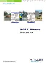
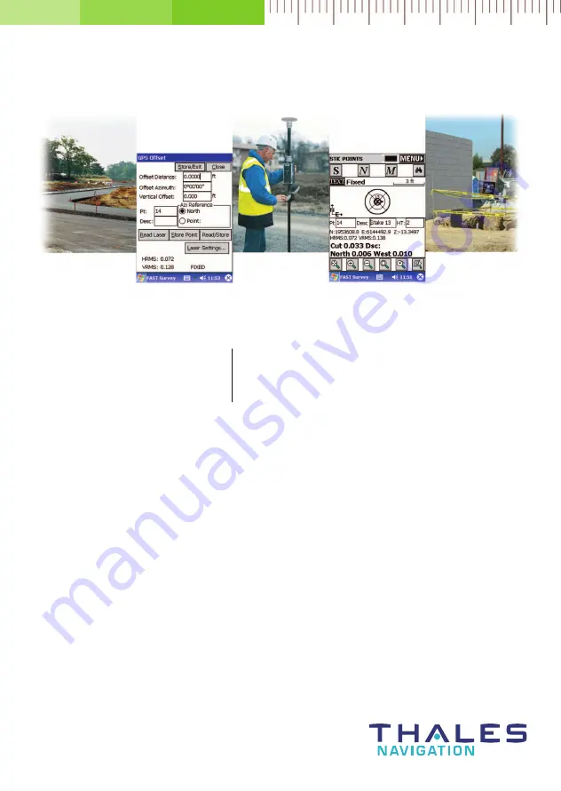
Page 1: ...FAST Survey Getting Started Guide www thalesnavigation com THALES NAVIGATION...

Page 2: ...igation Your rights with regard to this publication and the computer programs are subject to the restrictions and limitations imposed by the copyright laws of the United States of America U S A and or...

Page 3: ...K Surveying 8 Opening a New Job 8 Connection to the Receiver 9 Getting the Z Max Base Started 12 Getting the Z Max Rover Started 15 Logging Points 20 Staking Out Points 21 Logging Points in Continuous...

Page 4: ...ii...

Page 5: ...either For more information on this proce dure please refer to the GNSS Studio Office Software User Manual provided on GNSS Studio Office Software CD ROM If you need information to help you install th...

Page 6: ...e crd Configure Reading Allows you to select settings and preferences that apply to ob servations taken in the field Feature Code List Used to define feature code lists Data Transfer Prepares FAST Sur...

Page 7: ...at it is a rover Receiver Utilities Resets and or troubleshoots the GPS receiver Sets radio GSM parameters Localization Allows you to align on a local coordinate system Monitor Skyplot Allows you to r...

Page 8: ...out up to 2 user defined horizontal offsets to a center line at any station as well as an unlimited number of offsets per station if you are using a predefined Cutsheet Station and Offset List Elevat...

Page 9: ...oint Projection Allows you to calculate the station and offset of any entered or surveyed point relative to a known centerline or baseline Station Store A pure calculation routine that will create poi...

Page 10: ...mplates for roads levees ditches and other such earthwork Draw Template Draws the selected template on the screen Slope Staking Used to calculate and stake out the location of the catch point where fi...

Page 11: ...one Clicking on the Cur rent tab allows you inden tify the survey equipement Type firmware version etc MAP Screen This screen provides a graphic representation of your job It also shows the points you...

Page 12: ...A message is displayed asking you whether you wish to continue the last open job select an existing job or create a new job 3 Choose Select New Existing Job A new screen is now displayed 4 In the Nam...

Page 13: ...no receiver is connected to the field terminal or if you are using bad communication settings FAST Survey will return the following mes sage In this case you will have to check that you are using the...

Page 14: ...rvey then starts searching for the devices located in the vicinity of the handheld computer that are equipped with a Bluetooth communication system see figure 5 FAST Survey then lists all these device...

Page 15: ...345 If the PIN has been changed you can read it from the Z Max by sending the PASHQ BTH command to the Z Max receiver via a serial data cable The command can be sent from GNSS Studio s WinComm utility...

Page 16: ...ng the Z Max antenna directly connected to the receiver 5 Click on the Ports tab Assuming the Thales Navigation radio is used check the following parameters see figure 9 Data Port A if you are using a...

Page 17: ...making the transformation to WGS84 if necessary 8 Click the Yes button FAST Survey then asks you to enter a point ID 4 charac ters max 9 Enter a Point ID and click Yes Then FAST Survey asks you whethe...

Page 18: ...00 If the GSM band is not the right one click the Turn Off button to turn off the GSM module Select the right band depending on the GSM network in your country and enter the pin code if necessary Then...

Page 19: ...ld type in 1 226 m and check the Vertical option figure 15 5 Click on the Receiver tab and check that the receiver used is the Z Max Also select the Z Max GPS UHF Thales Navigation antenna in the Ante...

Page 20: ...he new station name will then be displayed in the Base Config pull down menu Note that the GSM parameters cannot be modified after selecting a predefined GSM base station You have to select Manual in...

Page 21: ...to set up as a rover from the list displayed in the Bluetooth connection window see figure 18 and then click on the Connect button After initializing the Z Max s GPS section FAST Survey prompts you t...

Page 22: ...at the GSM status reading is READY and the GSM signal strength is at a sufficient level see figure 21 Click on the Dial button to call the base After the connection to the base is established the GSM...

Page 23: ...from the handheld computer using FAST Survey s Equip tab Monitor Skyplot function see figure below Radio link quality Current position Computation uncertainties Number of satellites received GPS const...

Page 24: ...available from that screen Logging point with offset WHAT IS THIS GPS antenna height Current position and related quality figures These 2 fields to enter the point name and de scription Graphic Displ...

Page 25: ...its coordinates in the Northing Easting and Elevation fields or select a pre defined point from the points list see page 2 You can also define graphically this point by clicking on the point on the gr...

Page 26: ...current position and direction Provides access to monitor screen Takes you back to the point selection screen Point to be staked out target Provides access to the detailed stakeout screen below Stake...

Page 27: ...position The number of measurements will depend on the value entered earlier through the File tab Configure Readings function Once the position has been determined FAST Survey displays the results of...

Page 28: ...th a figure FAST Survey will place one anyway when incrementing this field Press OK to switch to the graphic screen see figure below and to start logging the first point The S button lets you instantl...

Page 29: ...ertical calibration as this will guarantee the consistency of your control points Click on the Equip tab and select Localization The screen that now appears is de scribed below Control coordinates can...

Page 30: ...es They can be loaded from the results of a point that was logged earlier during the same job If you choose to use the coordinates computed by the rover receiver then FAST Sur vey will ask you to indi...

Page 31: ...n or removed from the calibration process using the On Off but ton Warning At least 3 points are required to compute residuals in a horizontal system and at least 4 points in a horizontal vertical sys...

Page 32: ...therwise you should first stop the data logging sequence in progress by clicking on the Close File button Select Start File and then enter the logging parameters elevation mask default 5 data logging...

Page 33: ...If you have previously checked Manually as the Stop Logging option select Stop Point Logging before moving away from the point FAST Survey will then ask you to val idate the data logged on that point...

Page 34: ...utton on the Log Static Data menu Surv tab to list and manage the files stored on the receiver s SD card See figure below Files list Number of files on SD card Deletes the selected file Used to format...

Page 35: ......

Page 36: ...10 6566 0246 European Headquarters Carquefou France 33 2 28 09 38 00 Fax 33 2 28 09 39 39 Email professionalsalesemea thalesnavigation com In Germany 49 81 6564 7930 Fax 49 81 6564 7950 In Russia 7 09...

Reviews: