background image

User manual

Version:3.0

Summary of Contents for Flymaster NAV SD

Page 1: ...User manual Version 3 0...

Page 2: ...onics reserves the right to change or improve its products and to make changes in the content without obliga tion to notify any person or organisation of such changes or improvements Visit the Flymast...

Page 3: ...1 Battery 8 3 1 2 Sound 8 3 1 3 GPS 9 3 1 4 Vario 9 3 1 5 Navigation Circle 11 3 1 6 Airspaces Map 13 3 1 7 Altitude graph 14 3 1 8 Wind Arrow 15 3 1 9 Map Page 15 3 1 10 Compass 16 3 2 Data eld Elem...

Page 4: ...4 9 13 Polar 48 4 9 14 Data elds 49 4 9 15 FS Keys 49 4 9 16 Navigation Settings 50 4 9 17 Airspace settings 51 4 9 18 GPS status 52 5 TaskDe nition 54 6 McCready Functions 57 7 Flying a FAI Triangle...

Page 5: ...information is shown on both the power up screen and the Shutdown menu When the Flymaster NAV SD is connected to a power supply wall charger or via USB cable even with the unit o the instrument will...

Page 6: ...1 key takes you back When accessing data elds the associated menu option becomes grayed and the respective eld data item is highlighted Using the UP and DOWN keys changes the value on each eld Pushing...

Page 7: ...de ned FS Key will scroll up the sound level until the maximum value Pressing more will mute the sound before start scrolling again starting from the minimum value Note Changing the volume using an FS...

Page 8: ...odel Screen layout can be con gured by the user using a free application called Flymaster Designer which can be downloaded from the Flymaster website www ymaster net This intuitive tool allows the use...

Page 9: ...raphical indication of the current battery level In Table 3 1 it is possible to see the relationship between what is shown and the actual battery level in percentage This element has xed dimensions Ta...

Page 10: ...PS update rate most of others only provide 1Hz which allows the NAV SD pilot to see very small speed and position changes Furthermore the movement of the direction arrow is smoother and any position c...

Page 11: ...he Double Bar Analog Vario element shows not only the instantaneous vertical speed but also the Average Thermal and Next Expected Thermal McCready Indicator see Figure 3 3 This element can be resized...

Page 12: ...ement Navigation information is shown within the inner most circles The external circle contains the cardinal points and the Wind Flag The current traveling direction bearing corresponds to the point...

Page 13: ...se is perfect i e less than 1 o the NAV SD indicates this by showing a large arrow forward Figure 3 7 Figure 3 7 Perfect Heading Note that a start is automatically validated when a pilot correctly com...

Page 14: ...GPS position the NAV SD has in its memory The map is re centred once the ight starts i e when a valid gps signal exists and the start speed see Section 4 9 5 is reached Note After new Airspace data i...

Page 15: ...ent Figure 3 11 corresponds to a graph of barometric altitude versus time Altitude is shown in the vertical axis graduated in meters with time shown on the horizontal axis graduated in seconds Figure...

Page 16: ...ng the wind speed in Km h Figure 3 14 In the example of Figure 3 14 the wind is blowing from East Both the wind speed and direction value can be seen in a data elds Figure 3 14 Wind Arrow Note that bo...

Page 17: ...the trace for the last approximately 4 mins of the ight is shown Traces older than 4 mins are erased to reduce clutter on the screen Figure 3 17 Compass Element 3 1 10 Compass The Compass element Figu...

Page 18: ...independently to the main altimeter Arrival Goal Estimated arrival height above Goal The height is calculated considering the average glide ratio that has being made This means that wind day quality a...

Page 19: ...xed QNH of 1013 25hPa Floor Shows the lower altitude of the airspace causing the warning i e airspace that you are violating or close to violating Fuel Fuel level in liters available when connected w...

Page 20: ...adding the Wind over the current course to the Optimal Speed To Cone OptSpdCone The True Air Speed that you should y in order to minimize the time to reach the Conical End of Speed Section This value...

Page 21: ...di erence from the highest point reached If the altitude is equal or higher than the maximum reached then a positive number will show the altitude gained since entering the thermal The Gain indicator...

Page 22: ...task see Section 4 2 TaskNavigator Allows manual override of navigation see Section 4 3 Critical Airspaces This page constantly shows the airspaces which are closer than the thresholds de ned in the...

Page 23: ...nstrument1 The rst waypoint on the list appears highlighted and the corresponding data of the selected waypoint is shown in the DO area As the cursor is moved to a di erent waypoint so the data change...

Page 24: ...Task select the waypoint that is to be added by pressing either the UP or DOWN buttons until the desired waypoint is highlighted Pressing the ENTER button will add the point onto the TL on the right...

Page 25: ...ENTER button the instrument will jump to the ight screen automatically and navigate to that point When returning to the Waypoints Taskwill cancel the active Go To The Go To function will override the...

Page 26: ...art line after the start time Note that the sequence in which this waypoint appears in the task list in very important Start Out Enter Start Out is the most commonly used start gate sometimes also kno...

Page 27: ...The start is only validated when the pilot crosses the perimeter line at a time later than the de ned time The TTG time to go will show how much time remains to the opening of the start i e the di ere...

Page 28: ...distance it will be less than the distance shown in the Task List Figure 4 5 Task View 4 2 Task Delay During competitions it is common that the tasks gets postponed or delayed Usually the take o the s...

Page 29: ...ch is the closest point on the cylinder to where the pilot is This is not necessarily the optimum point on the cylinder The Start waypoint will be grayed since it is not possible to navigate to a star...

Page 30: ...itude of the airspace The list also shows the airspace status speci city if the pilot is violating airspace or the violation is imminent or if it is out of airspace In the example of Figure 4 9 the pi...

Page 31: ...cult we decide to let the pilot manually decide on the rst and second vertex rather than have this automated since this may lead to invalid triangles The Triangle Assistant page allows the pilot to ma...

Page 32: ...glide ratio are also shown The list is sorted by glide ratio in ascending order see Figure 4 12 On the example of Figure 4 12 the closest air eld is 12 48 Km from our present location and the necessar...

Page 33: ...tion of the task Pushing the ENTER key will display the Flight Log Action List with options Delete ight Delete all ights Each of the options is explained in the following sections Also if you use a ig...

Page 34: ...hout data from Flymaster accessories like HEART G or TASProbe which equates to over 36 hours with a 1 second recording interval obviously if you set it to a 10 second recording interval you get 360 ho...

Page 35: ...You can select di erent pages by selecting either the UP or DOWN keys If you press ENTER for a certain page 2 options become available as shown in Figure 4 17 Figure 4 17 Page Options Selecting the Go...

Page 36: ...will be on the Enable Page Pressing ENTER will re enable the page 4 9 Settings Menu The Settings Menu is used to con gure the NAV SD s many features The menu screen is divided into two sections On th...

Page 37: ...ltimeter can be achieved by entering the know altitude of the location Entering an altitude automatically calculates the QNH which is the local barometric pressure adjusted to sea level Alternatively...

Page 38: ...ction 1 7 However when a task is active the NAV SD will store a track log point immediately as it enters a turn point cylinder Goal or Start See Section 4 7 about track log memory capacity UTC o set U...

Page 39: ...onds to the climb threshold by default 0 1 m s Later as the climb rate increases a bip bip sound is produced for which the cadence and frequency also increase The Base Frq can be set from 500 to 1500...

Page 40: ...successfully cross a turnpoint see Turnpoint valida tion Start Open A siren type sound is produced when the start time elapses This tone does not indicate that a successful start has been made just t...

Page 41: ...the beeps increases as the climb rate increases This increase in rate is not linear The cadence parameter speci es which cadence curve should be used Current there are 2 possibilities represented in t...

Page 42: ...t 0 9 m s In the second zone of the thermal the air is rising at 0 8 m s and so pilots are descending at 0 2 m s At this stage the orange pilot starts to hear the Buzzer brrrrr sound of his NAV SD whi...

Page 43: ...he thermal Grey lines Set Yes the trace lines in lift will be drawn in black while the sink will be drawn in grey Set to No and all the trace lines will be drawn in black Track up Track up allows the...

Page 44: ...e 4 29 Track Up O Figure 4 30 Track Up On 4 9 7 Screen The screen menu option allows the user to set the Screen contrast to Enable Disable the pages triggers and to colour invert the titles Figure 4 3...

Page 45: ...n 0 5m s and the rate of turn is greater than 10 Transition This event occurs when the pilot enters leaves a thermal and starts a transition A transition is detected when the integrated vario is less...

Page 46: ...ith inverse titles set to Yes 4 9 8 Language Units The Language and Units menu option allows the user to change the NAV SD interface language and units A short description o the available options for...

Page 47: ...If set to Yes the NAV SD turns o if the GPS speed is less than 5 km h and integrated vario less than 1 5 m s for more than 30 seconds 4 9 10 RF Probes The RF Probes menu option allows the user to pai...

Page 48: ...o pair that device becomes available 4 9 11 Probe Alerts Figure 4 34 Probe Alerts The NAV SD allows relating alerts with some probes values see Figure 4 34 A short description of each alert is sown in...

Page 49: ...et or when a rmware update is done The magnetometer calibration process is described in Section 8 2 The NAV SD magnetic compass is very sensible to external magnetic elds In order to get good readings...

Page 50: ...By pressing either the UP or DOWN keys the user can select which data eld is displayed Pressing ENTER will toggle to the next UDF When all six UDFs have been set pressing ENTER will save the settings...

Page 51: ...on can be found on the folowing sections Safety Margin The pilot can chose the safety margin they wish to use for any of the horizontal distances Using a setting of 5m as shown in Figure 4 38 would me...

Page 52: ...space which are explained in Table 4 12 Table 4 12 Airspace Menu Settings Function Description CTR dist Th Minimum horizontal distance that a pilot can be from an airspace without triggering an airspa...

Page 53: ...sition dilution of precision pdop shown gives an indication of how reliable the GPS data is at the moment The lower the pdop value the more accurate the position x Values bellow 2 5 are fairly accurat...

Page 54: ...Figure 4 42 GPS Reset 53...
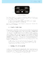
Page 55: ...Start Out set the distance to 2 000km and the start time to 13 00 Note that all times are in the 24 hour clock Beware that it is very important that the rst occurrence of WHALEB be set as Start otherw...

Page 56: ...he ESS is conical This information is provided through 5 additional data elds which can be included in a Layout page Each of the data elds is explained in Section 3 2 but for a better understanding co...

Page 57: ...ESS considering the expected average GR trough the remaining path see Figure 5 2 Note The expected GR is calculated considering historical data and also the wind compo nent at that direction If a pil...

Page 58: ...he average thermal speed used to calculate the Speed to Fly is manually set by the pilot McCready Ring On the NAV SD this value is calculated by averaging the last thermals climbed Conversely for each...

Page 59: ...riangle assistant module becomes active once vertex 1 of the triangle is manually de ned Alternatively the pilot can activate the module by de ning the directly vertex 2 In this case vertex 1 is de ne...

Page 60: ...um and maximum possible triangle distances are respectively 9 053 Km and 14 12 Km Figure 7 4 Triangle 4 In the example of gure Figure 7 4 the pilot has just de ned vertex 2 which is indicated by a cir...

Page 61: ...vertex 3 which is represent by a circle in the task map Navigation is changed to vertex 1 in order to close the triangle and a line is draw between vertex 3 and vertex 1 In addition the colors of the...

Page 62: ...ay facing up 3 Press ENTER key avoiding moving the NAV SD 4 The message Calibrating appears on the display for a while and until the calibration is done 5 At the end of the calibration process message...

Page 63: ...hile the left and right circles are associated with the Roll angle When the calibration is initiated all the circles are empty no color If the instrument is rotated so that the pitch angle gets close...

Page 64: ...t similar to the one used to calibrate the iphone 3 If the movement is correctly made the all the 4 circles will become black and the calibration process automatically stop 4 The end of the calibratio...

Page 65: ...re is no need to install further software Figure 9 1 Firmware Menu Option Once the Designer is correctly installed do the following procedure 1 Open the Designer 2 Select Tools Firmware see Figure 9 1...

Page 66: ...Figure 9 2 Firmware Update Done 65...

Page 67: ...alled on the computer and that GPSDump has been installed 10 1 Con guring GPSDump Before you can start interfacing your Flymaster GPS unit with your computer you must rst make sure that you have set t...

Page 68: ...at are currently interfacing with the instrument Flymaster instruments typically populate with high COM port numbers such as COM 11 in the example below Figure 10 3 Figure 10 3 COM port options Once t...

Page 69: ...gure 10 4 Waypoint list Once the le has been opened select alll of the waypoints COMMAND A in MAC and CONTROL A for PC In the drop down menu for WPTS you should see the following options Figure 10 5 6...

Page 70: ...ending the waypoint ID or the waypoint name or both Once you select the type of waypoints to send you should see the the waypoints being sent to the instrument 10 3 Downloading tracklogs To download a...

Page 71: ...on the instrument Figure 10 7 Figure 10 7 Tracklog list Simply clicking on the desired ight will download the tracklog to the computer Once the tracklog has been downloaded it is possible to save the...

Page 72: ...51 Alerts 39 Base Frequency 38 Climb Threshold 38 Delete All Flights 33 Delete Flight 32 Increments 38 Memory capacity 33 Sink Alarm 38 Sink Threshold 38 Sound Alerts 39 Volume 38 Time Setting 37 Volu...

Reviews: