DRS Firmware Manual v2.6-EN (2022-07-19)
©2022 Drone Rescue Systems GmbH
10/19
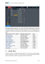
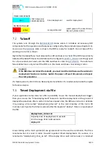
To set the system time, place a file (ASCII text) named "set_time.txt" in the root directory of
the micro SD memory card and specify the new date and time formatted like YYYY-MM-DD,
HH:MM:SS. Lines beginning with a hash symbol (#) are ignored and can be used as comments.
The following example sets the date to June 21st in 2020 and the time to 3pm.
#YYYY-MM-DD, HH:MM:SS
2020-06-21, 15:00:00
The firmware will find and parse this file at startup, and if a valid entry is found, it sets the
system time accordingly. The file will then be renamed to "set_time_ok.txt" on success or
"set_time_fail.txt" if the entry cannot be parsed. This way, the user does not need to manually
remove the file after setting the time.
If the MAVLink-
is used, then the FW attempts to read the current time and time
shift (parameter SDLOG_UTC_OFFSET in PX4) from the flight controller and sets the system
time to it if it could be received. The logfile, however, is always created before the read
attempt and is therefore named using the system time at startup or the time taken from the
file as described above.
4.3.1
Time Zone
Usually, the flight controller reads and adopts the current UTC time from a GNSS module. If
you want to have the DRS system time set to your local time instead of UTC time in a Pixhawk
environment, just set the parameter SDLOG_UTC_OFFSET to the time difference given in
minutes. The DRS adds this value to the time received from the flight controller. See the PX4
user guide for details on SDLOG_UTC_OFFSET.
Geofence
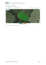
The geofencing feature is activated according to the parameter
. You can use the
geofence to limit the area of flight. If the UAV leaves this area for two seconds or if the GNSS
signal is lost for the time specified by
, the parachute will be
deployed. If the system is already outside of the geofence corridor during powering up the
DRS system, the LED and buzzer will indicate an error. Do not take off in this case, otherwise
the parachute will get deployed immediately.
Please note that only the GNSS variant of the DRS system supports GNSS and thus geofencing.
The standard variant does not have a GNSS receiver installed.
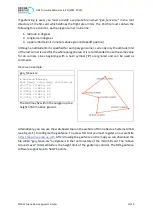
The area of flight is polygon-shaped and has a constant height over the whole polygon area.
The polygon is specified with the corner coordinates (latitude, longitude) having the allowed
flight area between the corners, i.e. from the lower lat/long value to the higher one. This
results in the following restrictions:
•
The polygon may not be wrapped around 180° longitude (e.g. from 179° longitude to
-179° longitude).
•
The polygon may neither include the north pole nor the south pole.


