GeoCOM Reference Manual
Theodolite Measurement and Calculation – TMC
Leica TPS1200 – Version 1.50
184
17.8.6
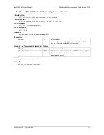
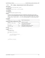
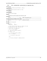
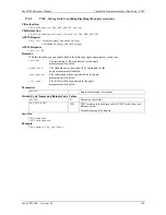
TMC_GetSimpleCoord - getting cartesian coordinates
TMC_GetSimpleCoord..............................................................................................................................................................................................................................................................................
eCoord
........................................................................................................................................................................................................................................................................................................................................................................................................................................................................................................................................................................................................................................................................................ 2116
2116 ................................................................................................................................................................................................................................................................TMC_GetSimpl
C-Declaration
TMC_GetSimpleCoord( SYSTIME WaitTime,
double &dCoordE,
double& dCoordN,
double& dCoordH,
TMC_INCLINE_PRG eProg)
VB-Declaration
VB_TMC_GetSimpleCoord( ByVal WaitTime As Long,
dCoordE As Double,
dCoordN As Double,
dCoordH As Double,
ByVal eProg As Long)
ASCII-Request
%R1Q,2116:
WaitTime[long],eProg[long]
ASCII-Response
%R1P,0,0:
RC,dCoordE[double], dCoordN[double], dCoordH[double]
Remarks
This function gets the cartesian co-ordinates if a valid distance exists. The parameter
WaitTime
defined the
max wait time in order to get a valid distance. If after the wait time a valid distance does not exist, the function
initialises the parameter for the co-ordinates (
E,N,H
) with 0 and returns an error. For the co-ordinate calculate
will require incline results. With the parameter
eProg
you have the possibility to either measure an inclination,
use the pre-determined plane to calculate an inclination, or use the automatic mode wherein the system decides
which method is appropriate (see 15.1.1).
Parameters
WaitTime
In
Max. wait time to get a valid distance [ms].
eProg
In
Inclination sensor measurement mode.
dCoordE
Out Easting.
dcoordN
Out Northing.
dcoordH
Out Orthometric
height.
Return-Code Names and Return-Code Values
GRC_OK
0 Execution
successful.
GRC_TMC_ACCURACY_GUARANTEE
1284
Accuracy is not guaranteed, because the result are consist of
measuring data which accuracy could not be verified by the
system. Co-ordinates are available.
GRC_TMC_NO_FULL_CORRECTION
1283
The results are not corrected by all active sensors. Co-
ordinates are available.
In order to secure which correction is missing use the both
functions
TMC_IfDataAzeCorrError
and
TMC_IfDataIncCorrError
GRC_TMC_ANGLE_OK
1285
Angle values okay, but no valid distance. Co-ordinates are
not available.
GRC_TMC_ANGLE_NO_ACC_
GUARANTY
1289
Only the angle measurement is valid but its accuracy cannot
be guaranteed (the tilt measurement is not available).
GRC_TMC_ANGLE_NO_FULL_
CORRECTION
1288
No distance data available but angle data are valid. The return
code is equivalent to the
GRC_TMC_NO_FULL_CORRECTION
and relates to the angle data. Co-ordinates are not available.
Perform a distance measurement first before you call this
function.
GRC_TMC_DIST_ERROR
1292
No measuring, because of missing target point, co-ordinates
are not available.
Aim target point and try it again
GRC_TMC_DIST_PPM
1291
No distance measurement respectively no distance data
because of wrong EDM settings. Co-ordinates are not

